BHAIRAVGAD-MOROSHI
TYPE : HILL FORT
DISTRICT : THANE
HEIGHT : 2313 FEET
GRADE : VERY HARD
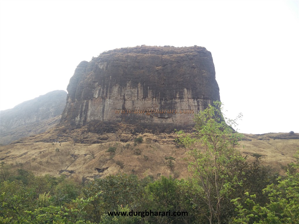
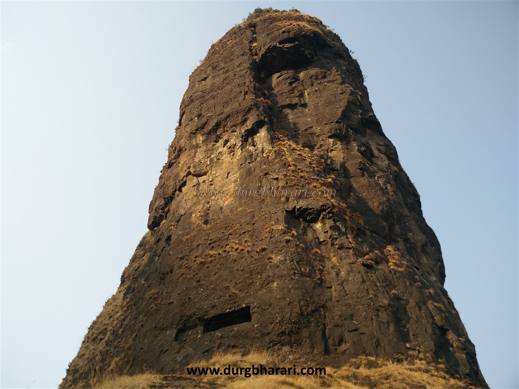
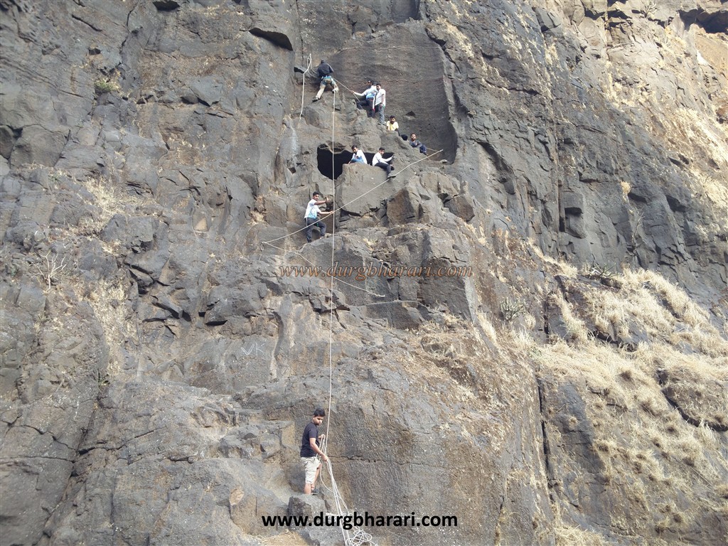
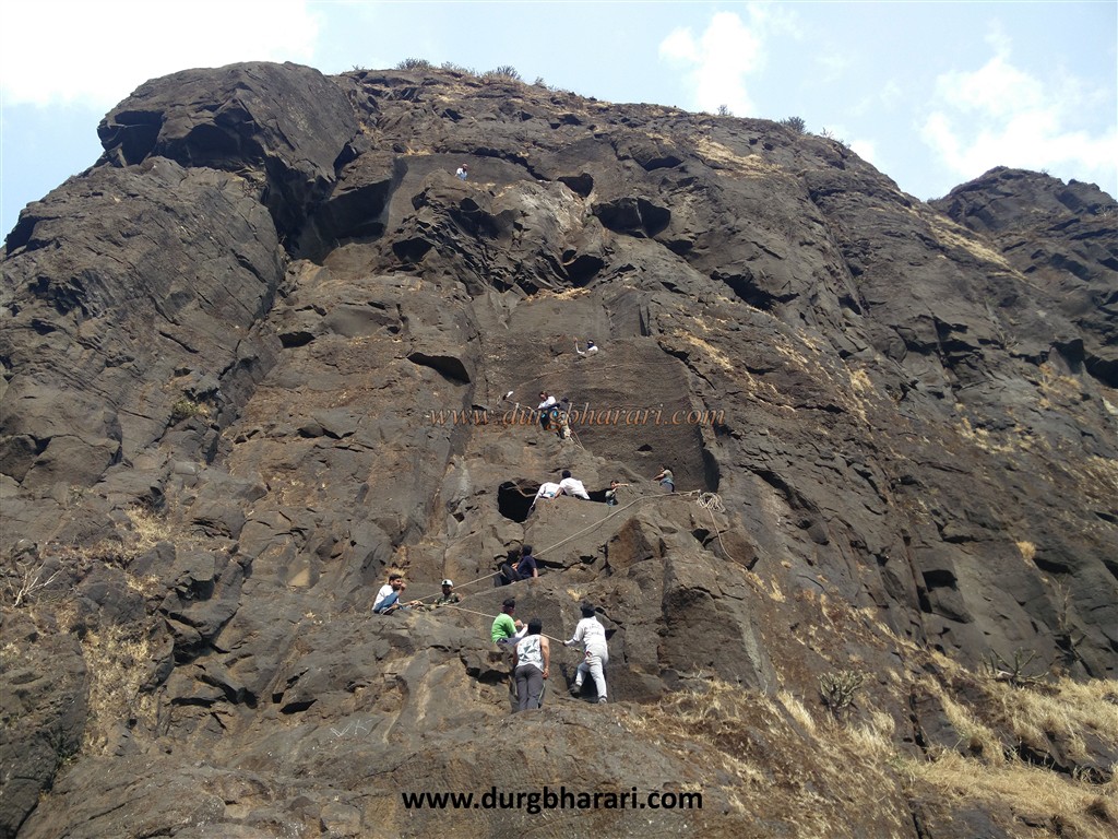
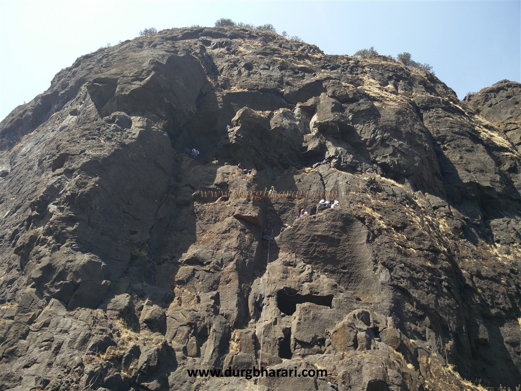
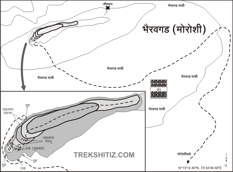
The Sahyadri is formed by lava due to volcanic eruptions. The specific accumulation of this lava results in the formation of many different structures and sizes of basalt rock. In geological terms, such a structure is called a dyke. We can see this structure on Bhairavgad. The citadel of Bhairavgad is built on a similar dyke, a 400 feet high straight wall of basalt rock. We are amazed looking at the design of the fort. Moroshi is a village near Malshej Ghat in Murbad taluka of Thane district. Behind this village is Bhairavgad fort on the hill which rises from the main mountain range of Malshej. It is easy to reach till the Machi of the fort, but it is difficult to climb up to the citadel. You need to have the climbing equipment and you also need to know the climbing techniques to reach the citadel. To reach Bhairavgad, one has to reach Moroshi village before Malshej Ghat via Mumbai-Kalyan-Murbad.
...
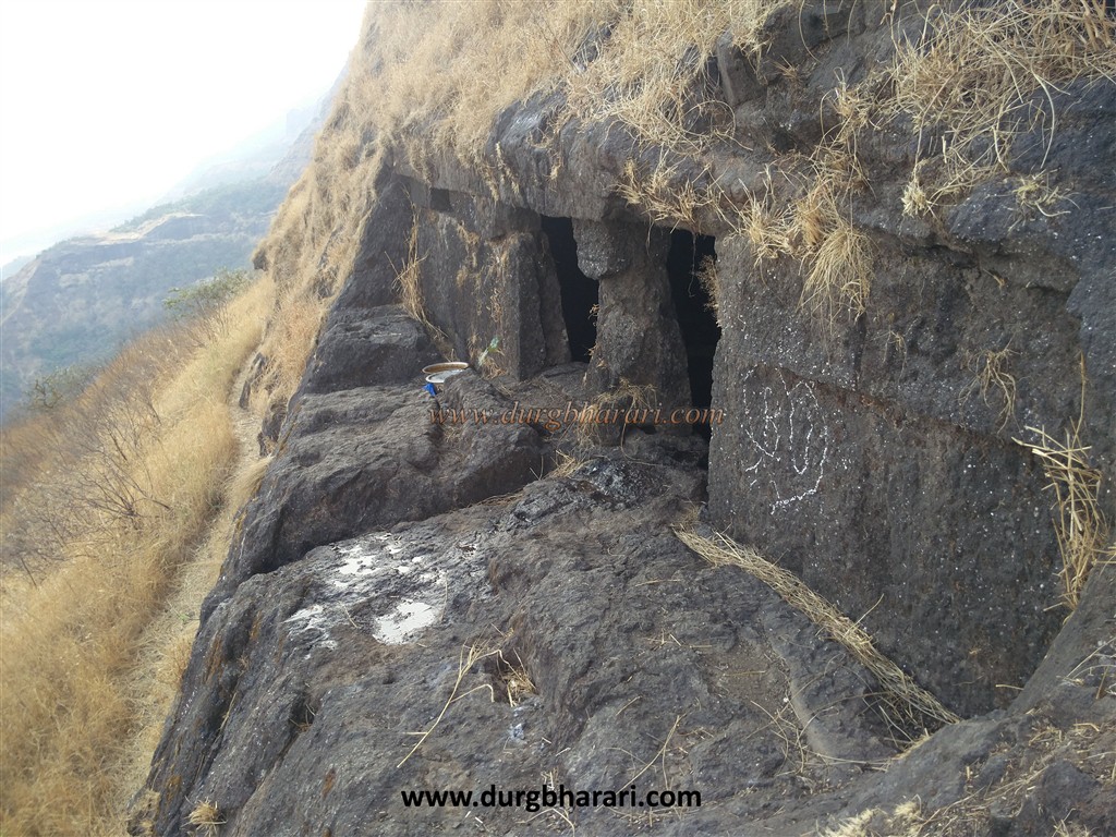
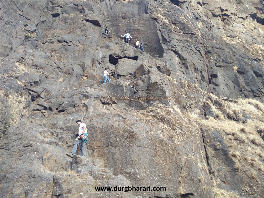
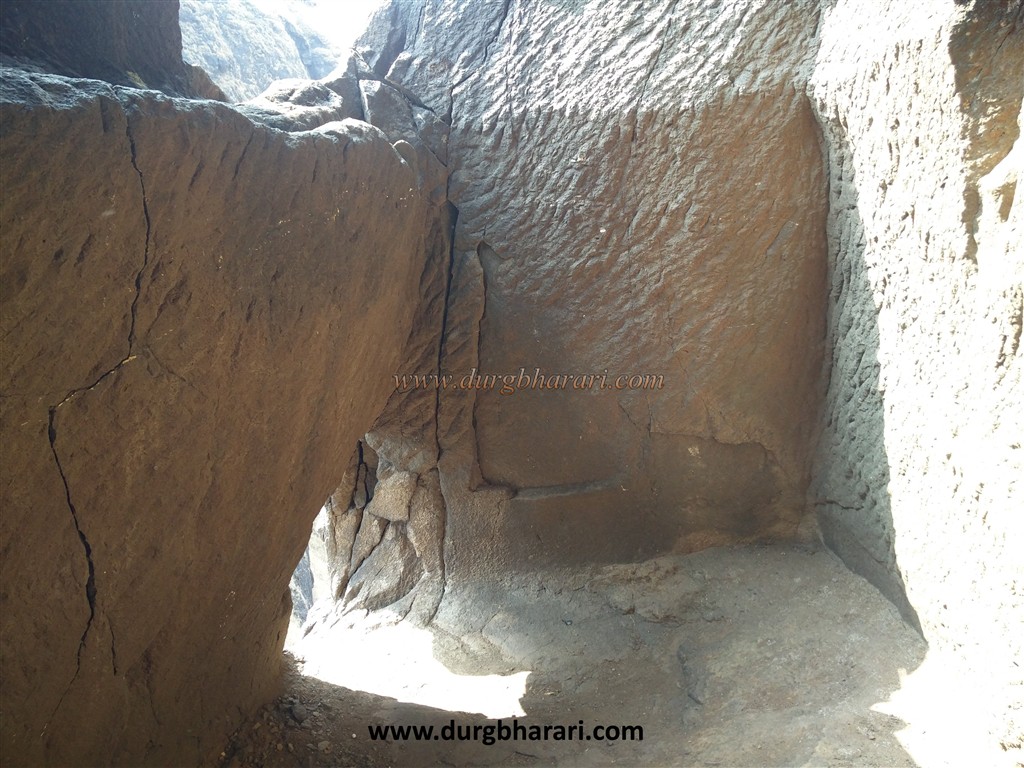
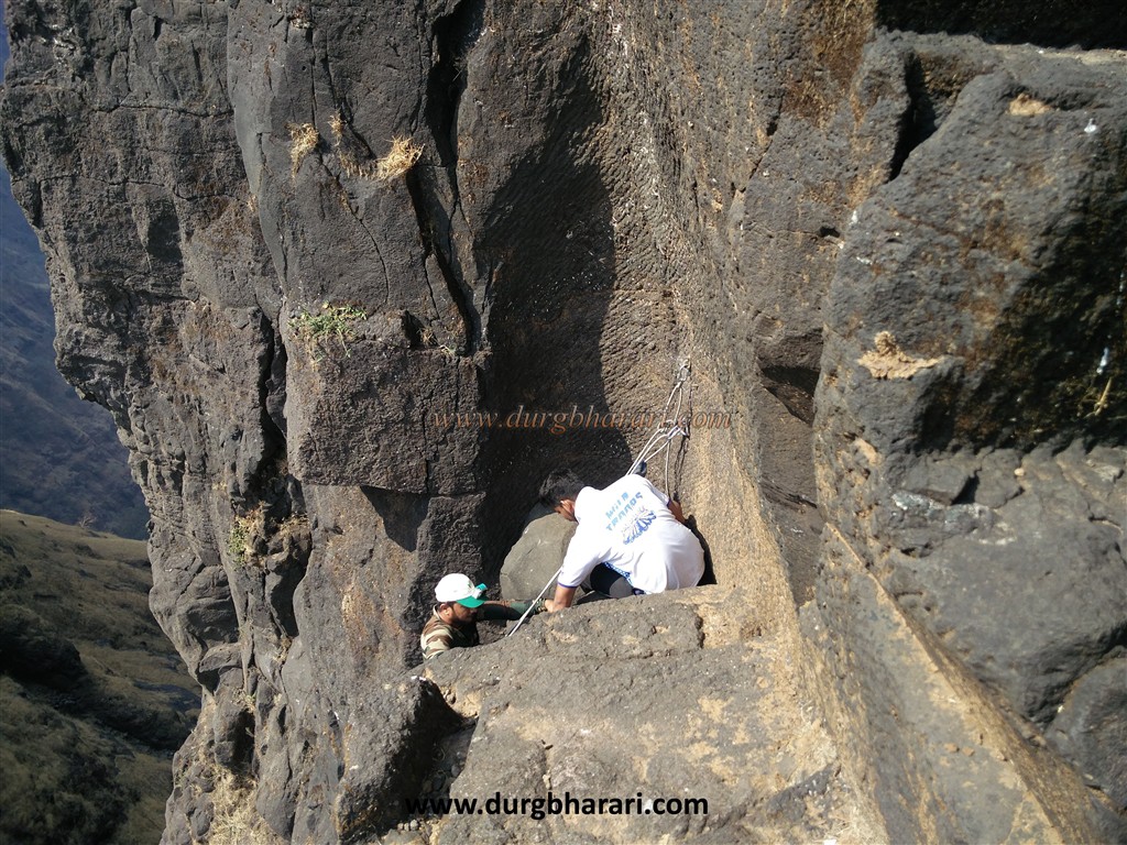
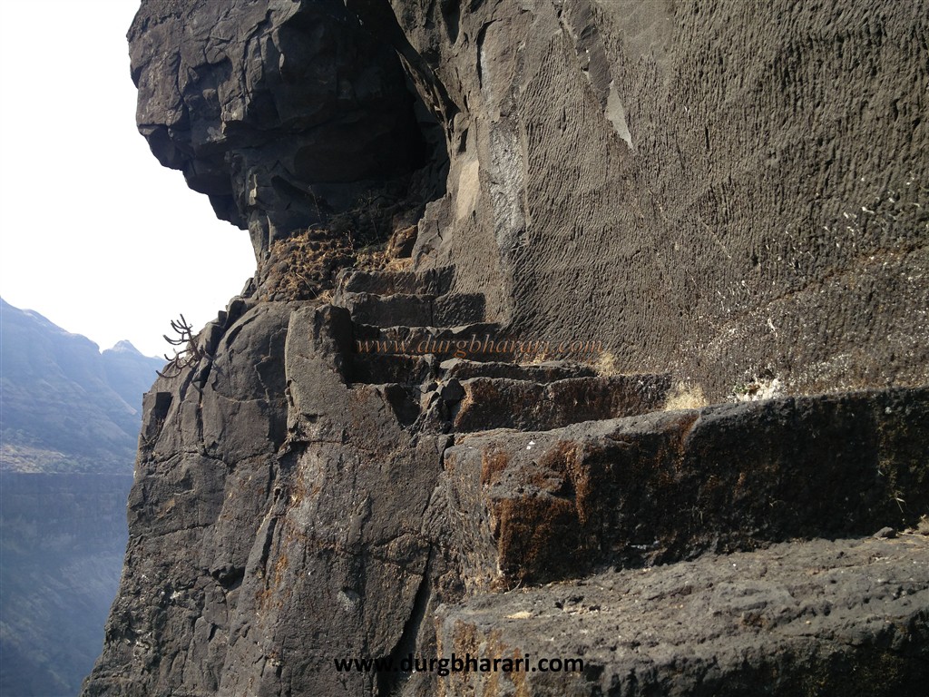
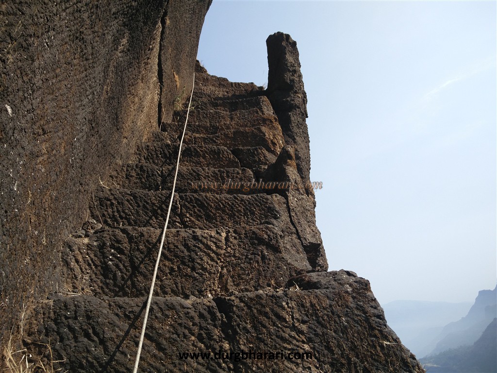
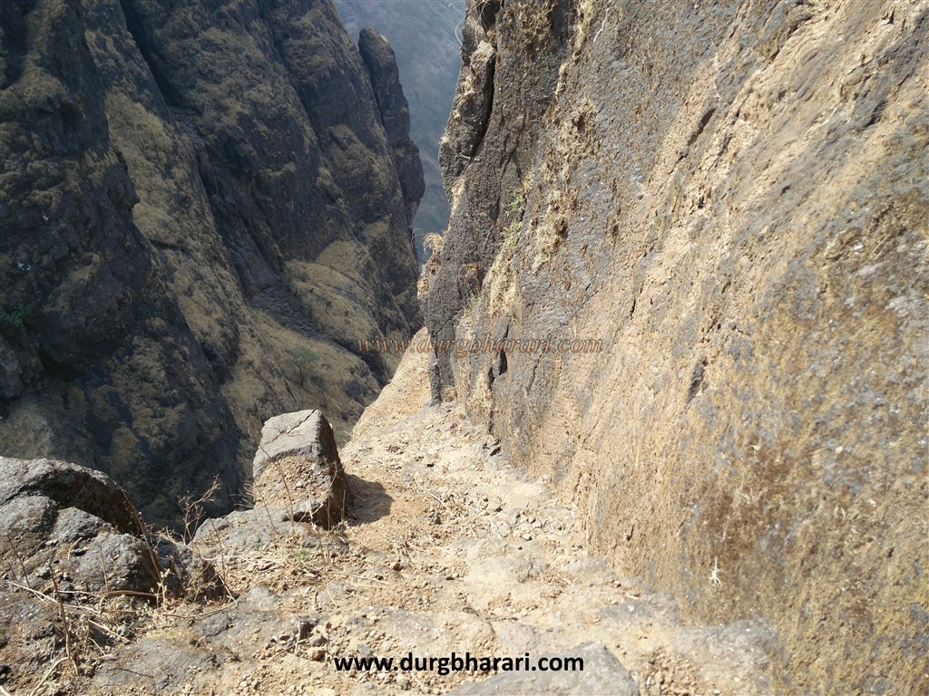
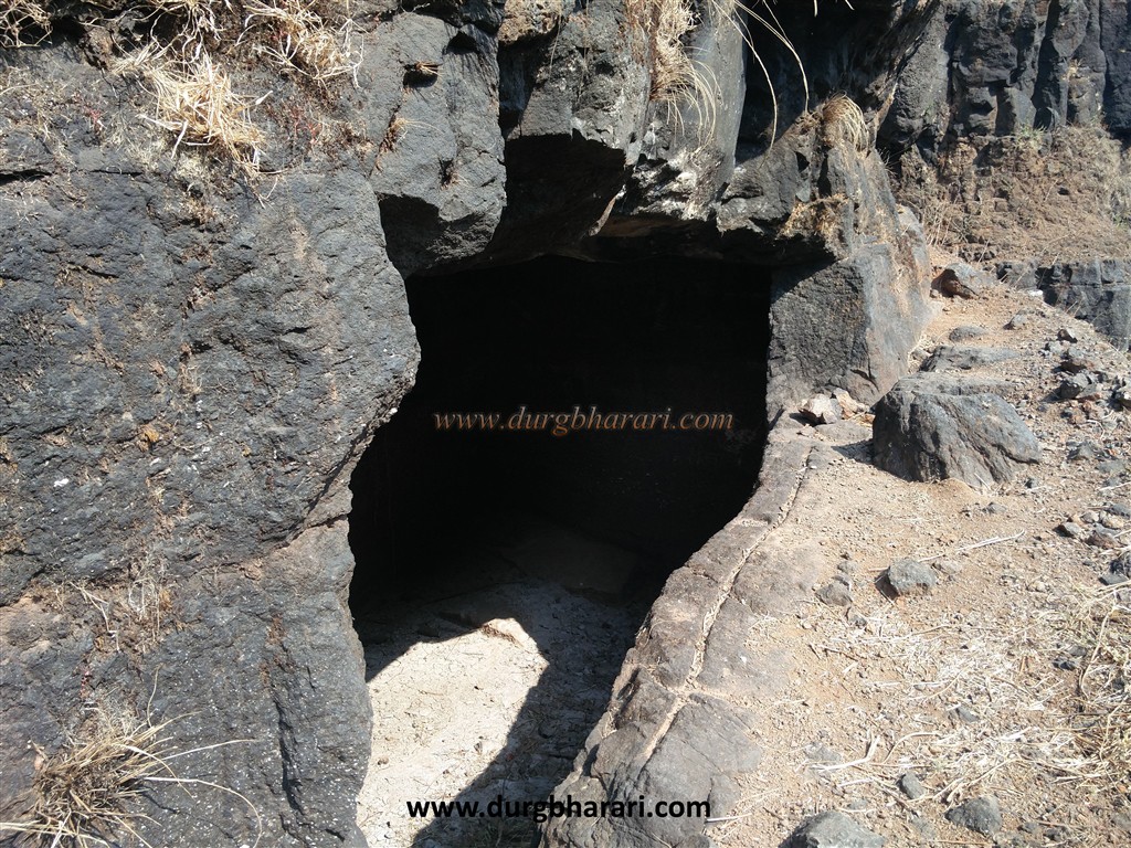
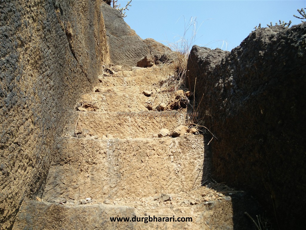
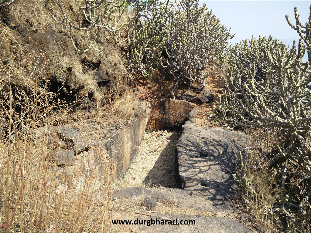
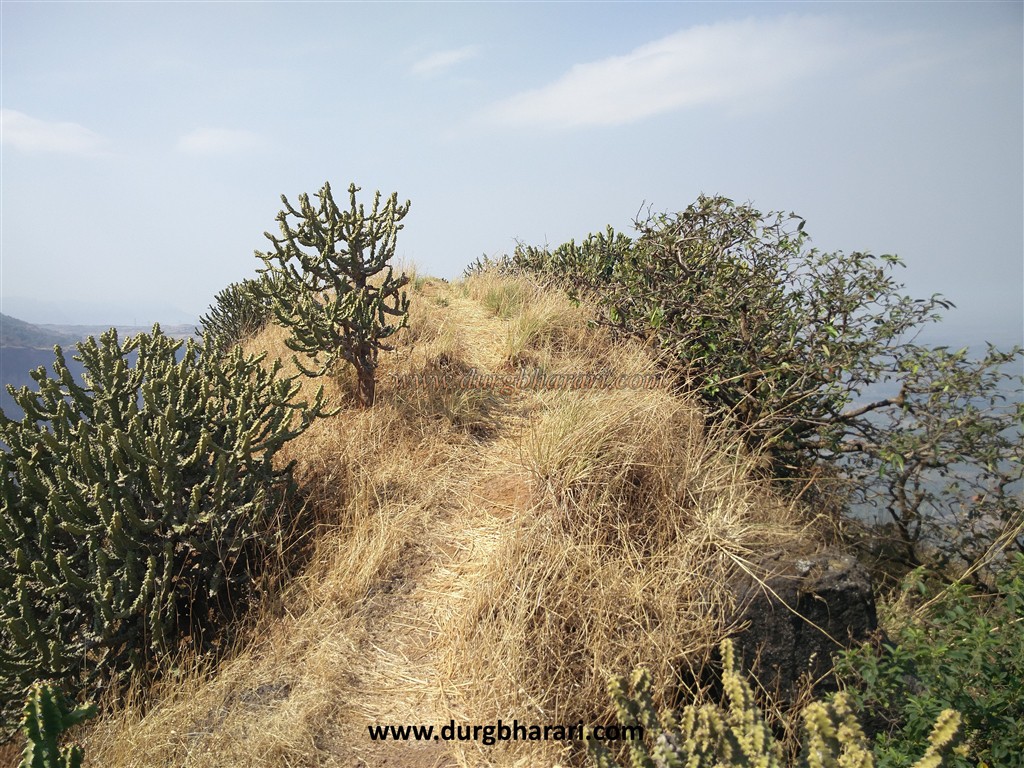
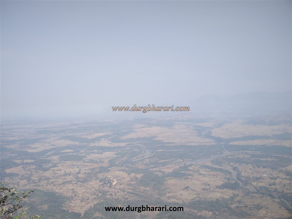
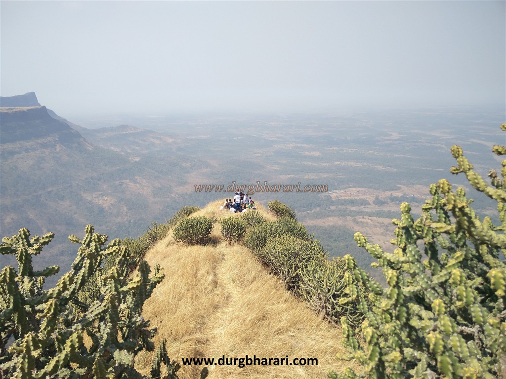
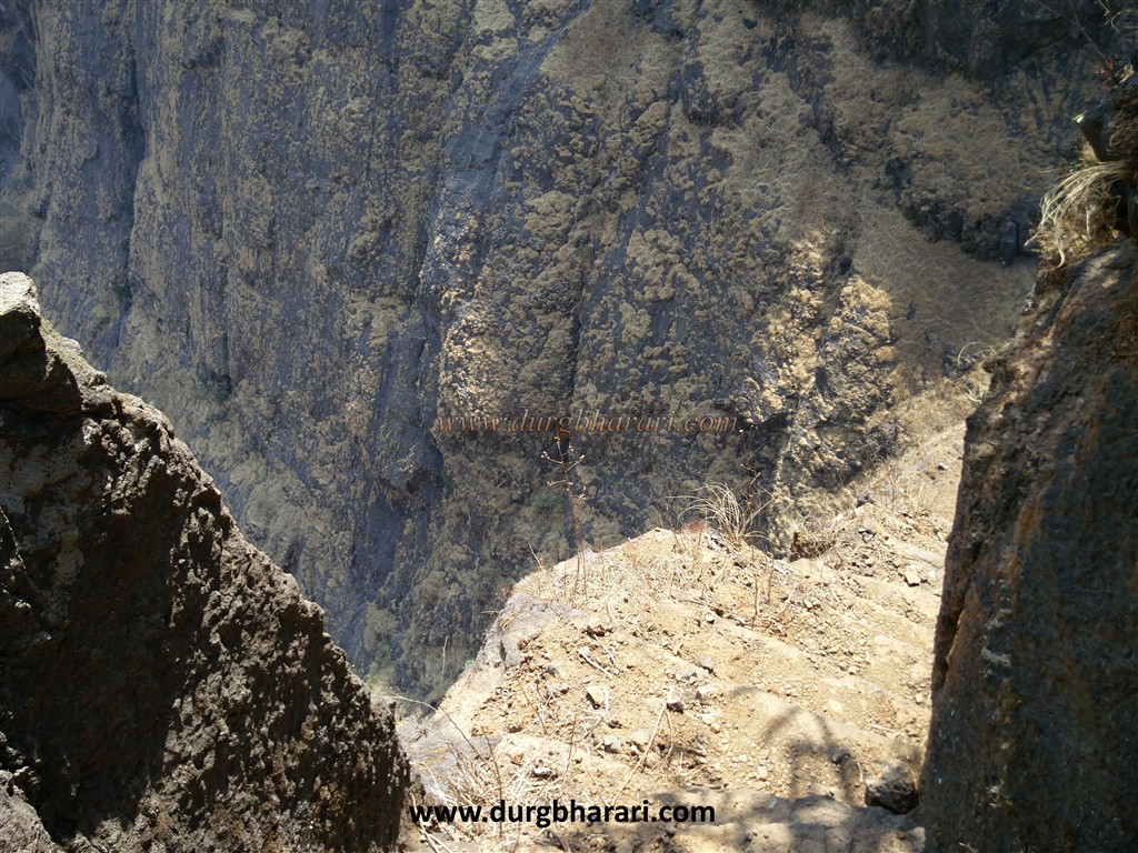
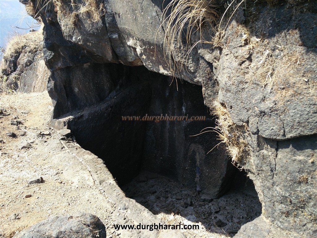
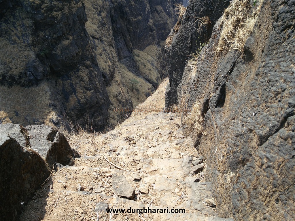
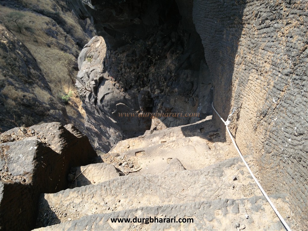
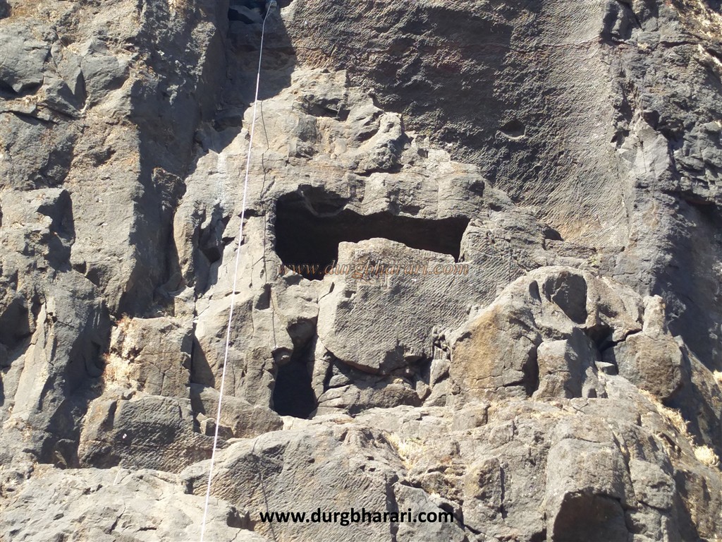
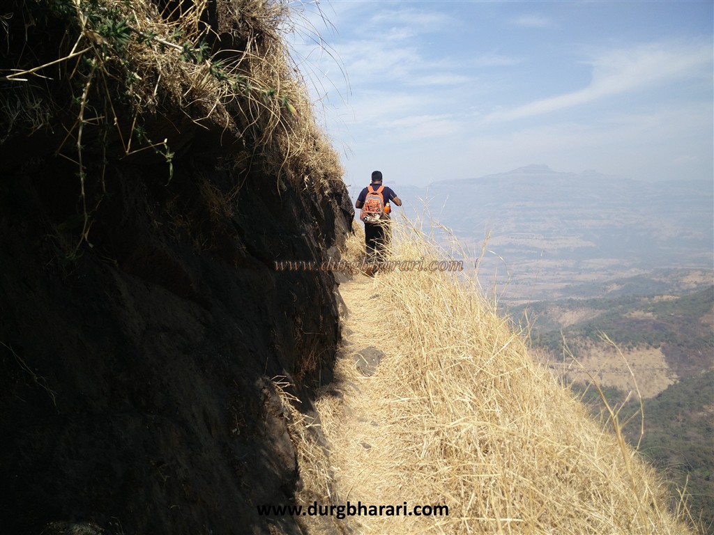
On the way from Moroshi village to Malshej on the highway, about 100 meters ahead from the police check post, on the left side, there is another road leading to Moroshi village. On this path On the right-hand side, you can see a is an iron arch inscribed by the Forest Department as Fort Bhairamgad Cave Road Forest Department Thane. The path under this arch leads from the hillside fields to the hill in front. from here you have to start climbing this hill. After crossing two hills, we reach a small plateau and after crossing the next stage, we reach the Machi of the fort. The road leading to the Machi is somewhat paved, so there is less chance of getting lost. It takes 1.5 to 2 hours to reach Machi from the foothills. Upon entering Machi, you can see the fort gate and the ramparts carved into the rock, as well as the remains of some structures on the right side. On the way from Machi to the citadel, you can see a quadrangle structure of houses built out of cement. The fort was inhabited by eight to ten houses till 2005 but later shifted to the foothills of the fort. Further along the way, there are dense forests up to the base of the dyke. If you want to stay at the fort, you set up a tent here. Other remnants of the fort and water sources are lost in this dense forest. It takes 15 minutes to reach the base of the dyke from Machi. There is a rectangular cave carved in the rock on the right side of the path, but you have to use climbing equipment to get to this cave. There is a water cistern at the top of the sidewalk. It is the only source of drinking water on the fort. Following this path, we reach the eastern end of the citadel. There is a rectangular cave partially carved in the rock at a height of about 15 feet. To get to this cave, you again have to use climbing equipment. We take a detour to the eastern end of the citadel and reach the gorge between Bhairavgad and the adjoining hills. Since all these roads are steep and slippery, it takes 45 minutes to reach this pass from Machi. The only way to reach the fort from this side of the gorge is carved with stone steps but in many places, these steps are broken. The way to the fort has become dangerous due to the steep climb of about 80 degrees and broken steps. After climbing about 40 steps, we come to a cistern carved in the rock. When the Britishers destroyed the steps of this fort by planting a mine, the bottom part of this cistern broke and a hole has been formed through which you can crawl and move ahead. The back wall of this 8 x 4 x 8 feet wide cistern has a niche for wooden blocks. Since the cistern was in the open belly of the bridge, the roof was covered with a shed to prevent water evaporation. Since the steps at the front of the cave are destroyed, you have to climb here with a rope to reach the next part. After crossing this section of about 100 feet, there are steps carved in the rock. There is a cliff on one side and a deep ravine on the other side of the stairs also slippery soil has accumulated on these steps, so utmost care is to be taken here. While climbing these steps, you can see the remains of the bottom part of a door. After climbing a few steps, you can see another dry cistern of 20 x 10 x 15 feet in length on the right side. At the end of the steps, we reach a small hummock. This is the circular western end of the dyke, i.e. the citadel. Here you can also see the remains of a small outpost and a flagpole. After seeing this, start climbing the path on the left. On the way, there is another dry water cistern. On the way to the front of the cistern, you can see the remains of another structure. The next path leads to the highest point of the fort through a bunch of cactus trees. There is a large amount of dry slippery grass on the top of the fort and care should be taken while exploring the fort. It takes 1 hour to reach here through the gorge. The head of the fort is very narrow measuring 450 x 60 feet and is spread over about half an acre from east to west. There are no remains on the head of the fort except a water cistern and two quadrangle structures. From the top of the fort, you can see Harishchandragad in the west and Naneghat in the east. Considering the size and structure of the fort, it should be used for surveillance and observation of the surrounding area. Although Bhairavgad is mentioned in history, it is difficult to refer to Bhairavgad as it is the name of many forts. In the year 1672, this fort was in the possession of the Marathas but in the eighteenth century, it was in the possession of Jawaharkar. In 1818, Captain Dickinson, a British officer, wrote a letter dated 6 January 1818 stating that they have damaged the steps of Bhairavgad. This thrilling beauty and challenge of Bhairavgad should be experienced at least once.
© Suresh Nimbalkar
GALLERY