BEED
TYPE : CITYFORT
DISTRICT : BEED
HEIGHT : 0
GRADE : EASY
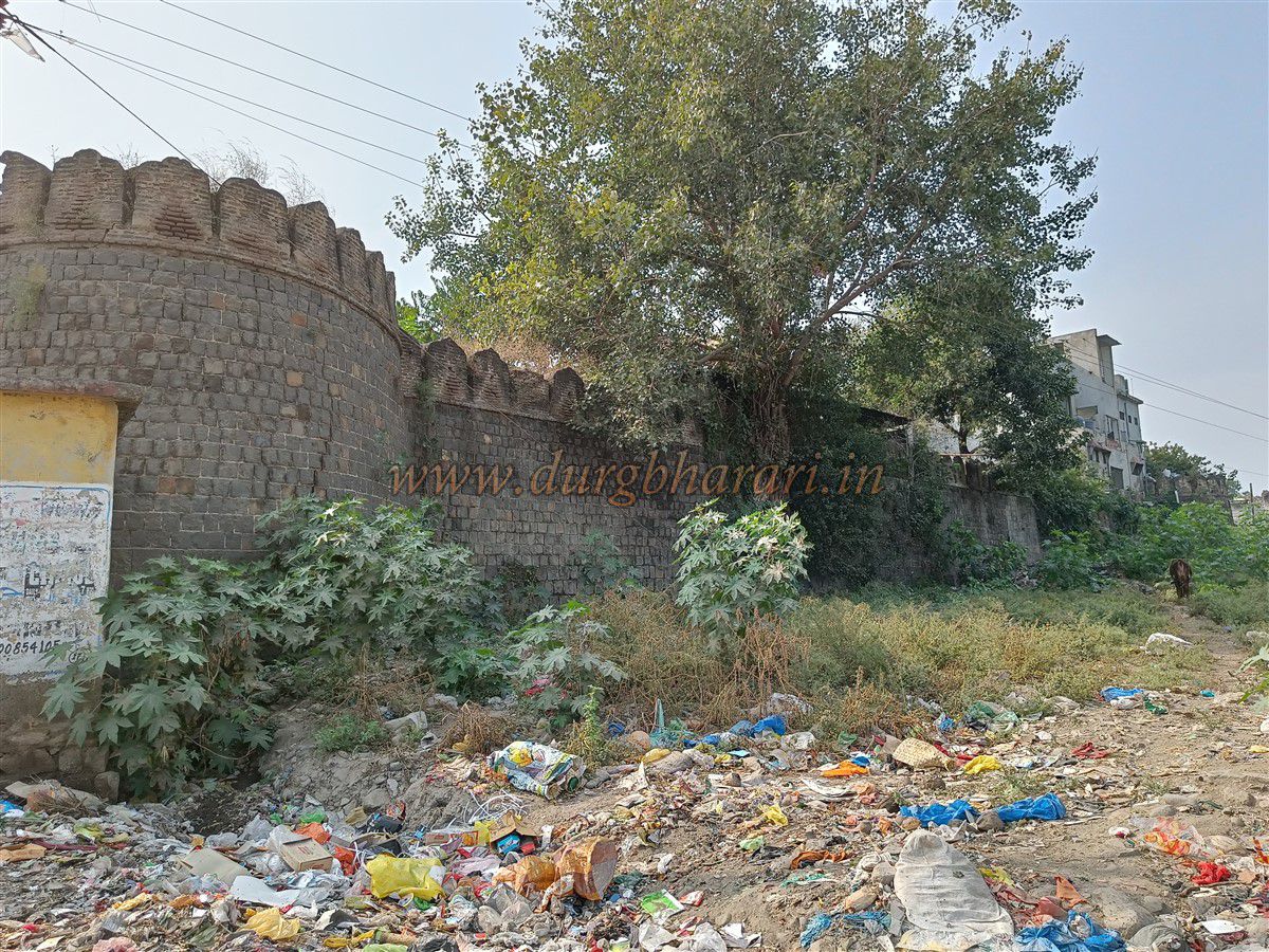
It is often said that there are only two forts in Beed district—Dharur and Dharmapuri. However, those who say this tend to forget that at one time, the city of Beed itself was situated within a fort. Located on the banks of the Bindusara River, the entire city was once enclosed by fortification walls, and in some places, a protective moat was also dug for defence. Though the moat has since been filled in and replaced by a road, that road is still known today as “Khandak Road.”
Due to urban expansion, the entire fortification has been encroached upon, and with time, most of the original walls and structures have either vanished or been destroyed. As a result, one cannot view the fort as a continuous structure. To see what remains, one must visit specific locations where remnants of the fort still stand.
...
The fort once had six gates. Four of these gates were part of the main fortification, while the other two were situated either within the interior of the fort (Kazi Gate) or across the river in the Hiralaal Chowk area (Ganj Gate). This area, known today as Hiralaal Chowk, was once a marketplace (Peth), and the fort wall was extended around it, including the construction of a gate. The neighbourhood was established in 1882 by a commander named Sheikh Daud Mehbubdaullah and named after him. A Persian inscription on the Ganj Gate records this, indicating that the original name of this locality and gate was “Mehbubganj.”
Now, looking at the main fortification gates, there were four principal ones: Mali Ves Gate, Rajuri Gate, Dhondipura Gate, and Kotwali Gate.
The Mali Ves Gate has been completely destroyed, with no visible remains. Near this gate stood the residence of Sultaanji Nimbalkar, known as Baradari. Later, this structure was converted into a courthouse, and it was this very court that, in 1890, sentenced seven revolutionaries from Beed to death during the uprising of that year. In the Mali Ves area lies the Shinde family's orchard and the Satwai Devi temple, the village deity of Beed. Historian Dr. Satish Salunkhe references an inscription from this gate in his book Ancient and Medieval History of Beed District.
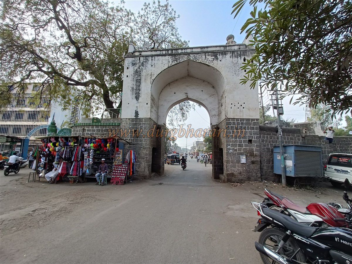
The second gate is the Rajuri Gate. When one turns from Shivaji Maharaj Chowk toward Karanja Road, they enter the city through this gate. The gate and its adjacent bastions are still well-preserved, although 100 feet of the left-side wall are missing. On both sides inside the gate are guard chambers, and stairways lead to the bastions above. Each bastion has a platform where cannons could be mounted; on one of them, the platform has been turned into a shrine. The Karanja Road continues from Rajuri Gate across the city and exits at the Kotwali Gate near the Bindusara River.
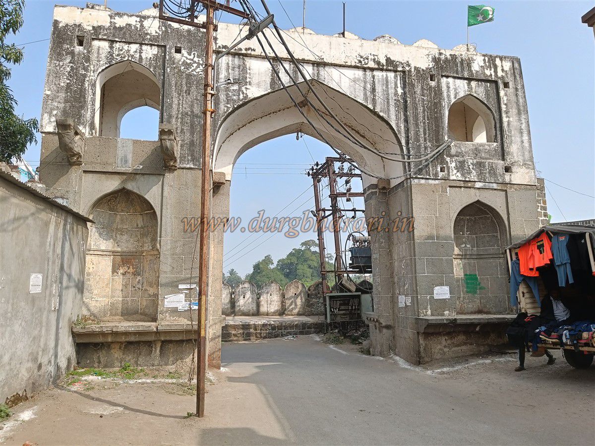
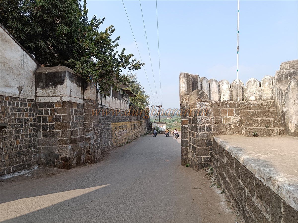
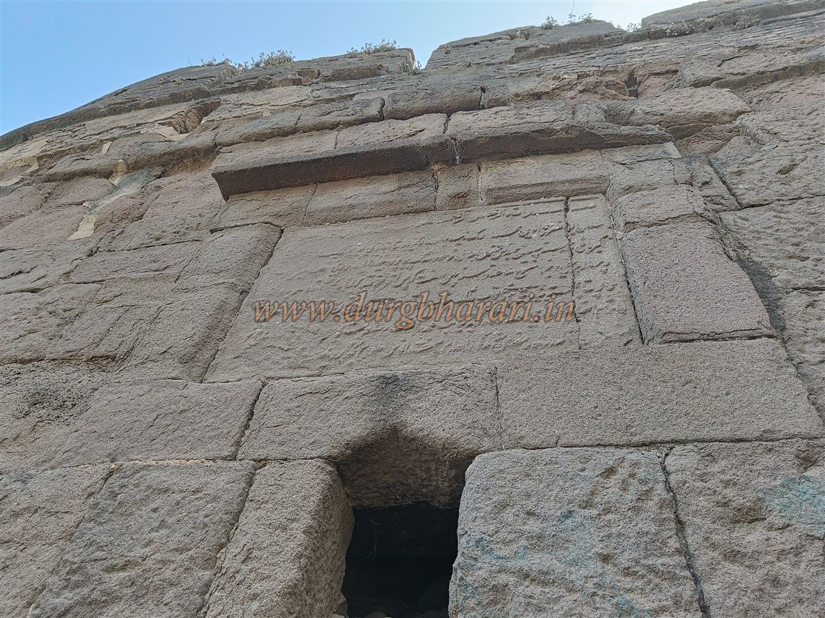
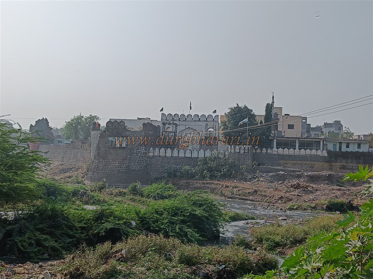
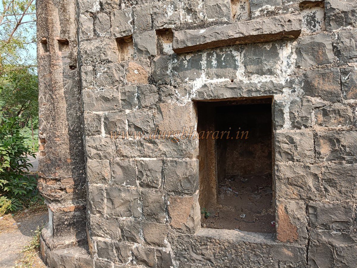
The Kotwali Gate and the riverbank walls with their bastions remain in place today. One bastion to the right of the gate contains a beautiful three-arched balcony, with a shrine built along the adjoining wall. There is access to the top of the gate. A secondary wall and bastion are built in front of the gate as a further line of defence. An Arabic inscription is carved on the bastion to the left of the main gate (near an electric pole), and another inscription is found on the right bastion of the outer wall. From across the Bindusara River, one can still see the structure of the gate, the walls and six to seven bastions. However, from inside the city, the wall has been almost entirely encroached upon, making it difficult and unpleasant to access or observe.
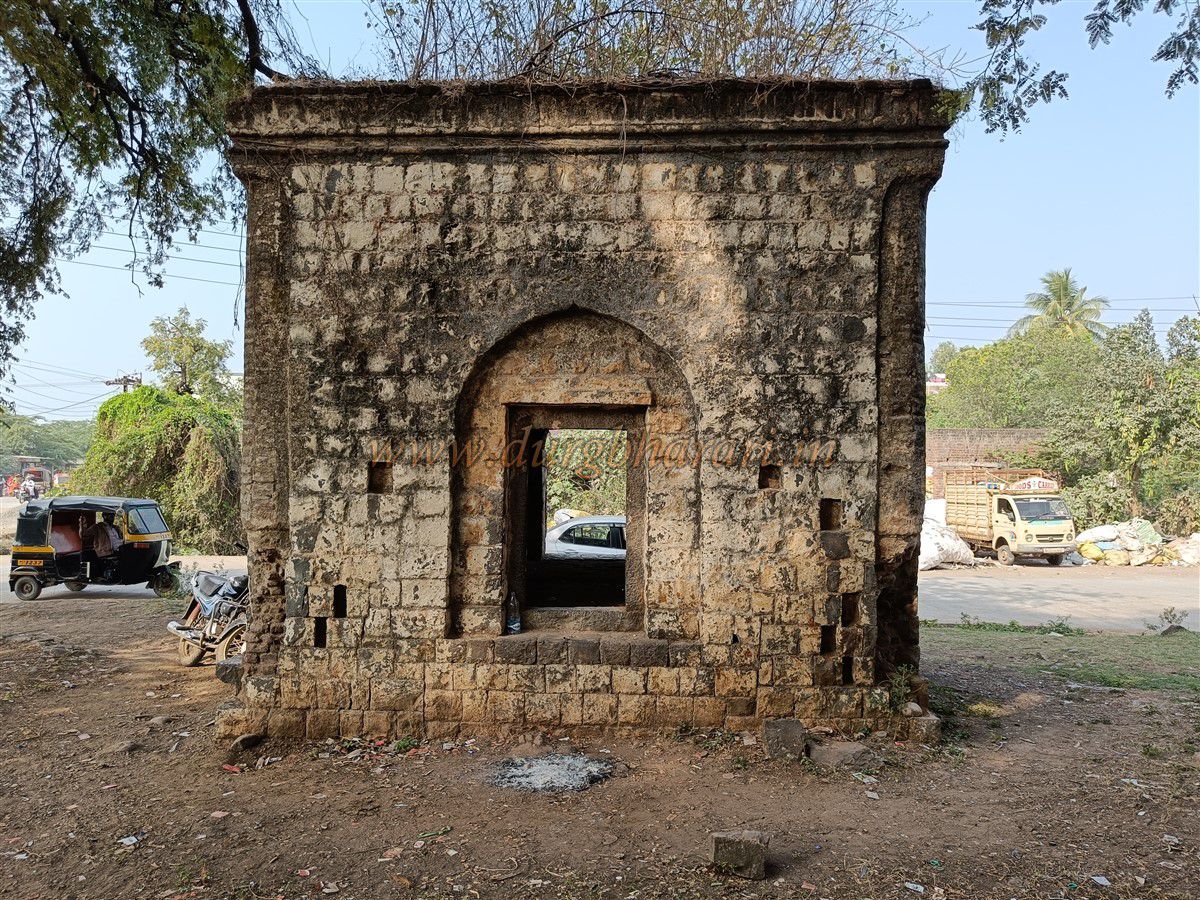
Within the old market near the Kotwali Gate is another gate known as the Kazi Gate. The lower portion of this gate is constructed from dressed stone, while the upper part is made of bricks. A Persian inscription is carved on the arch of the gate. The road near this gate is known as Khandak Road. It is likely that this was the site of Beed original fort. The outer fort walls seen around the city today may have been constructed later, during the Nizam’s era, in response to the city’s growth.
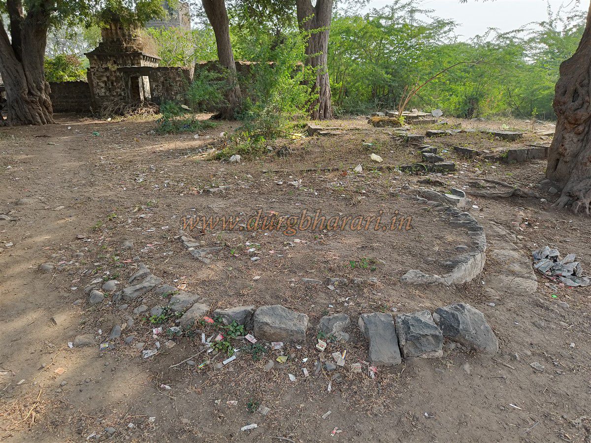
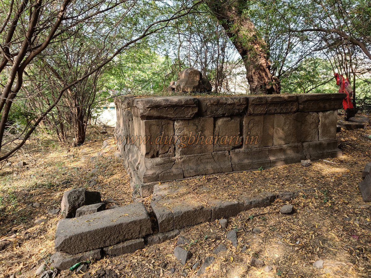
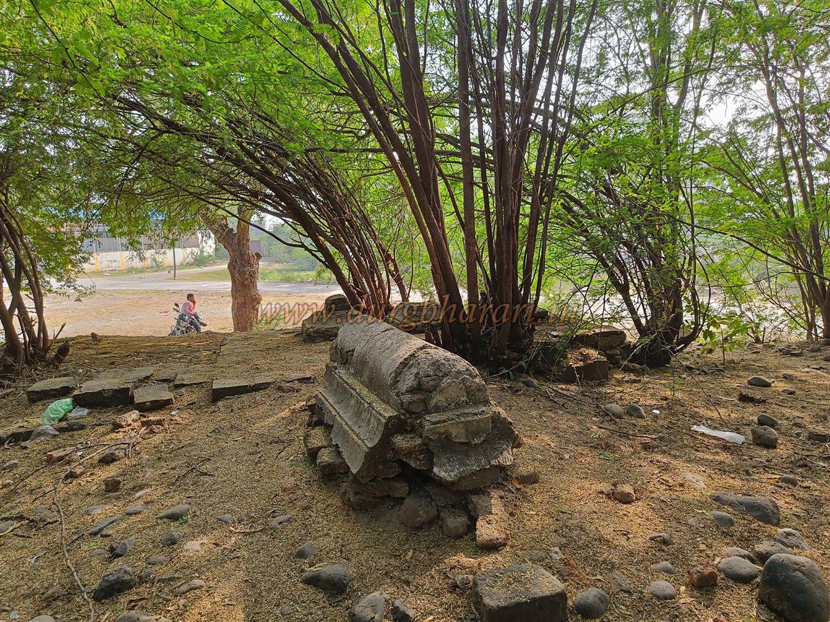
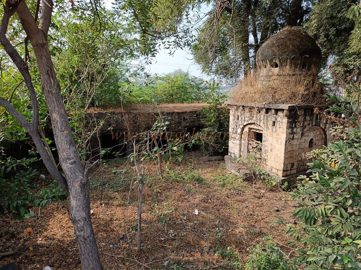
The next gate is Dhondipura Gate, located at the end of Saraf Road on the banks of the Bindusara River. As it was a market day during the visit, close access wasn’t possible, and photographs had to be taken from a distance. This area contains important heritage structures such as the Saat Chowk Wada, Soudattikar, Thigale and Deshmukh family residences, and Kanhoji haveli. On the opposite side of the Kotwali Gate, along the river, there are remains from the medieval period. Near the road, there are several Samadhi (memorial) platforms, and within the precincts, a number of memorial structures survive.
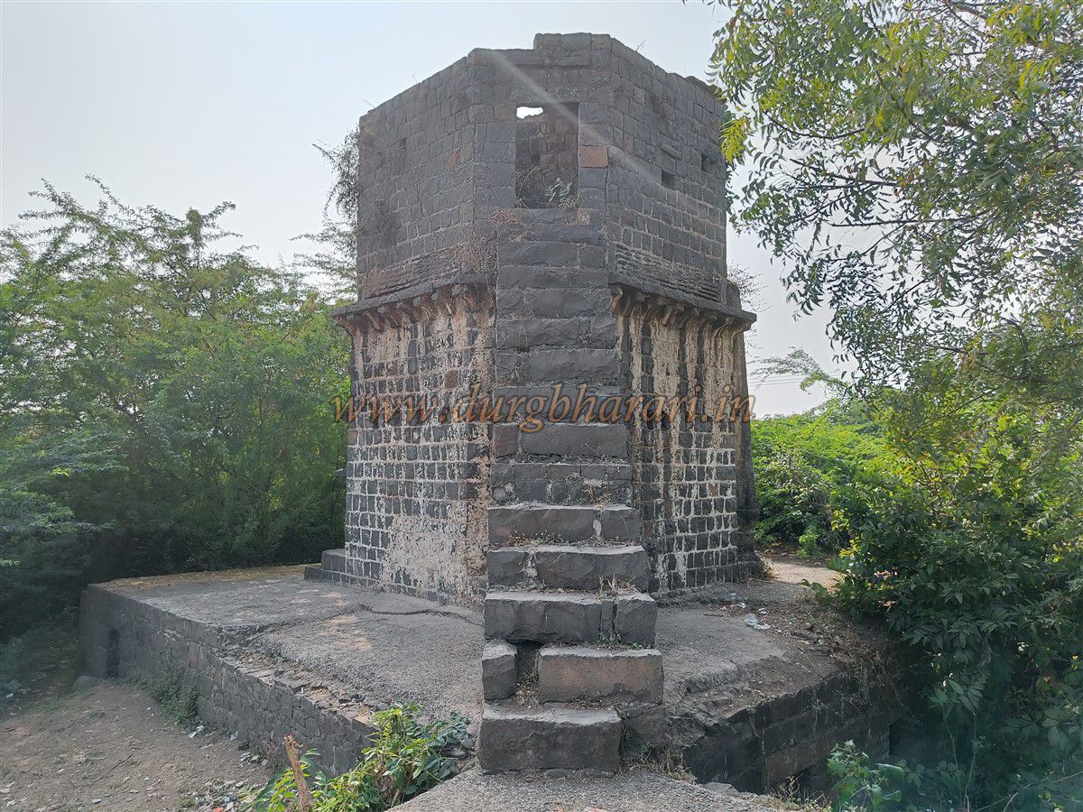
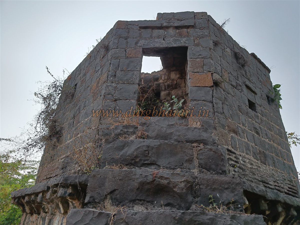
Among these is a three-story tower, one floor of which is below ground. This underground floor is quite large and includes several chambers. There are stairs leading to the upper levels, where one finds a flagpole and a small reservoir. Near the tower are ruins of a large mansion, now overgrown with thorny bushes.
It takes about three hours to fully explore the fort and its surrounding remains. The city of Beed is situated in a hollow or depression along the Bindusara River at the foot of the Balaghat hills. It is believed that the name "Beed" evolved from the word Beel (meaning a hollow or cavity). During the time of the Pandavas, it was known as Durgavati Nagar, and during the Chalukya period, it was referred to as Champavati Nagar.
The recorded history of Beed dates back to the 4th century CE. It was ruled at various times by the Satavahana, Chalukya, Kalchuri, Vakatakas, and Kadambas. Later, it came under the Yadav dynasty of Devgiri. Aladdin Khilji conquered this region from the Yadav’s between 1296–1316, and it eventually came under the rule of Muhammad bin Tughlaq (1325–1351). With the rise of the Bahamani Sultanate, Beed became part of their domain. After the division of the Bahamani kingdom, it became part of the Nizamshahi dynasty.
Though it is commonly said that the fort was built by the Nizam of Hyderabad, records show that Beed was a Subha (province) under the Nizamshahi rule. During the reign of Murtaza Nizam Shah, his commander Salabat Khan constructed the Khadzina Well to provide water for the city and its agricultural lands. The Gazetteer also mentions that the fort may have originally been constructed during the Bahamani period.
During the Peshwa era, major battles between the Marathas and the Nizam took place at Rakshasabhuvan and Kharda. Following treaties, this region came under Maratha control but was reclaimed by the Nizam after the fall of the Maratha Empire. Beed remained under Nizam rule until 18 September 1948, when the Hyderabad State was officially merged into the Indian Union. Until 1956, this region remained part of the Hyderabad State before being integrated into Maharashtra after linguistic reorganization.
© Suresh Nimbalkar
GALLERY