BASGAD / BHASKARGAD
TYPE : HILL FORT
DISTRICT : NASHIK
HEIGHT : 3573 FEET
GRADE : MEDIUM
Selbari-Dolbari, Ajanta-Satmal, and Trimbak are the mountain ranges in the Nashik district. Bhaskargad, Harshgad, Trimbakgad, Anjaneri, Ranjangiri, Gadgad, Bahula, and many other forts can be seen in the Trimbak mountain range spread to the east of Nashik and south of Igatpuri. Bhaskargad or Basgad in the same Trimbak range is adjacent to Harihar fort. Harihar Fort is famous for its steep steps. Due to these steps, this fort is always bustling with trekkers. But despite Bhaskargad being very close to this fort, very few trekkers visit Bhaskargad. Nashik has been known as a market for a long time. To protect the ancient Dahanu-Jawahar-Gondaghat-Amboli Ghat-Trimbak-Nashik trade route from Sopara Dahanu port to Nashik, two forts Harihar and Bhaskargad were built to guard the Gonda Ghat.
...
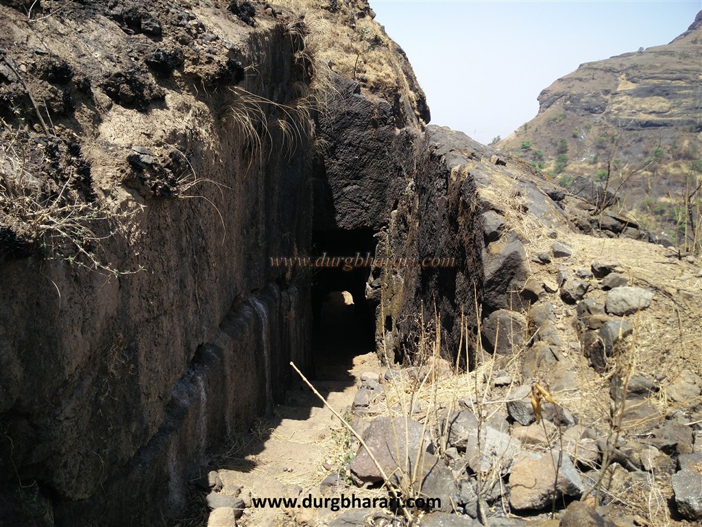
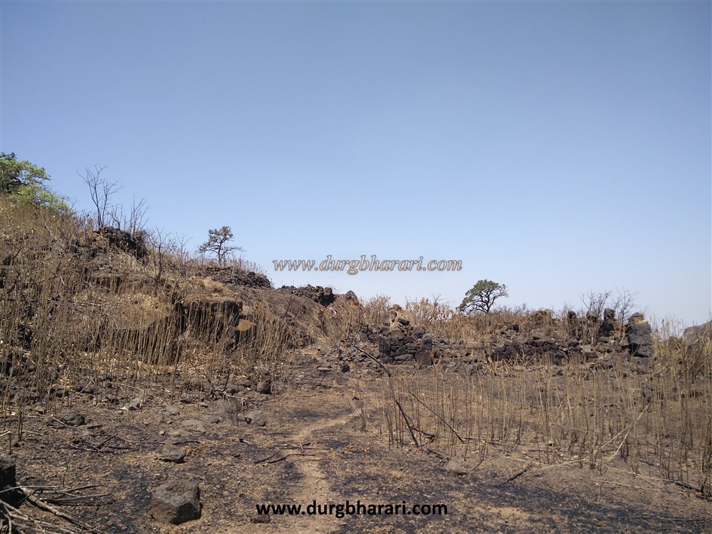
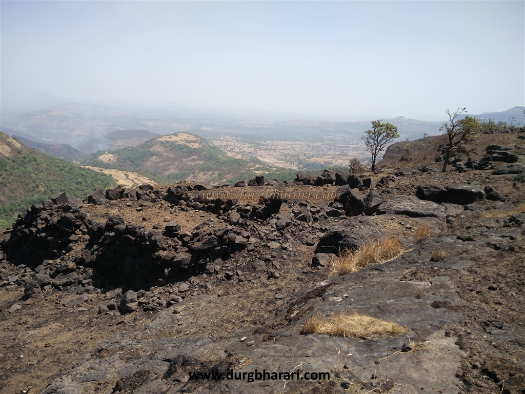
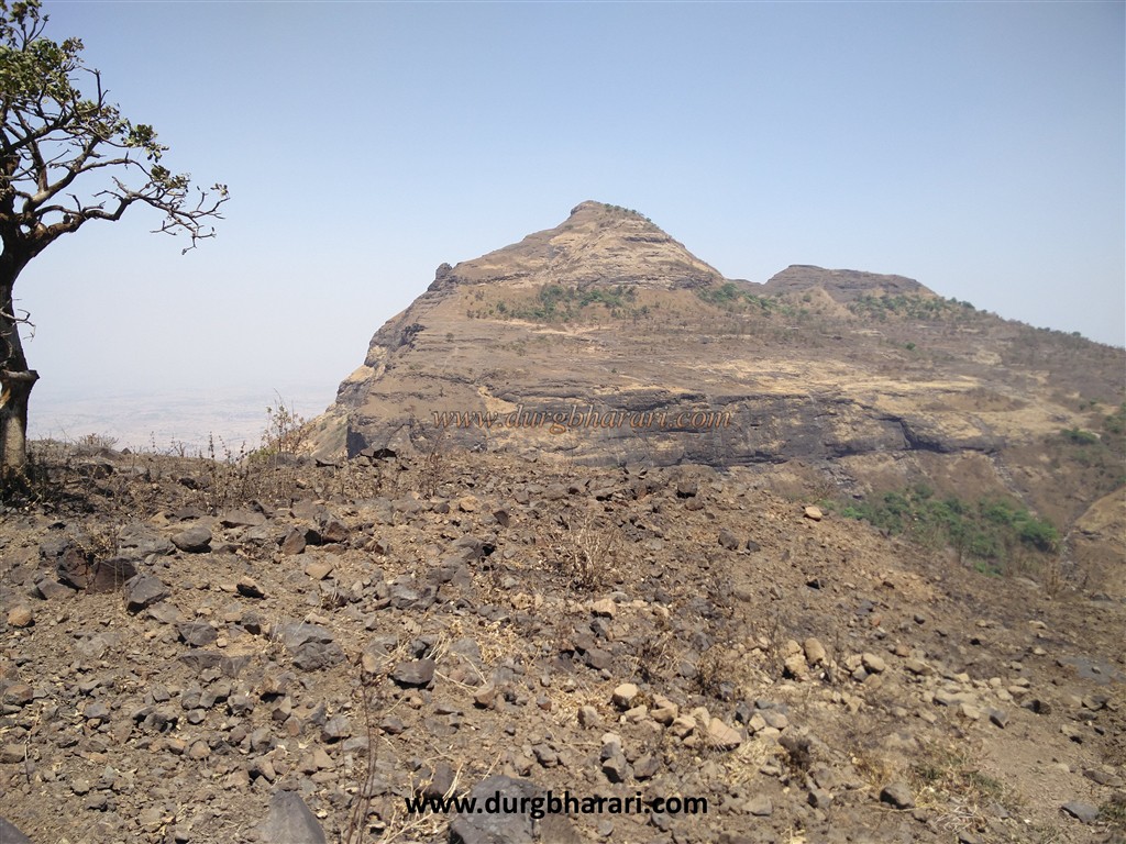
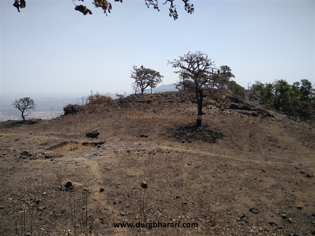
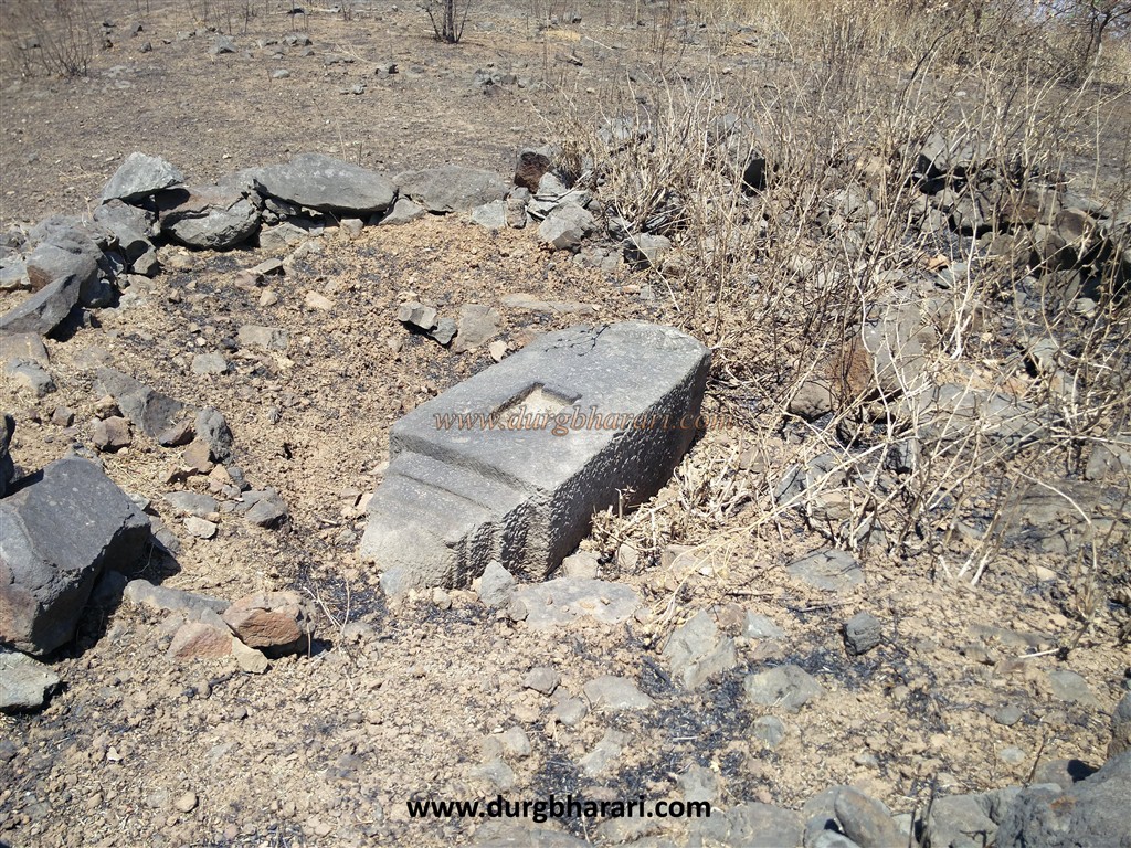
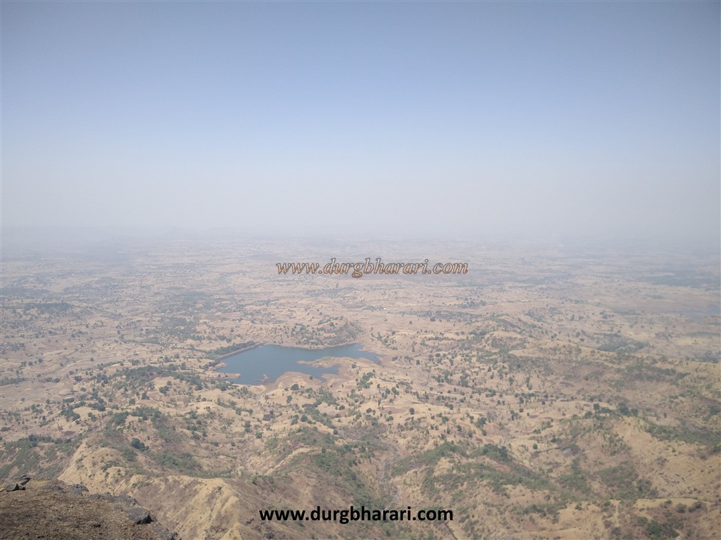
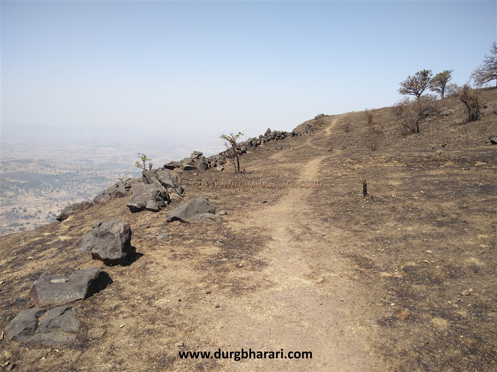
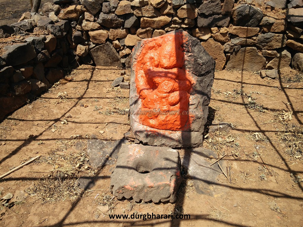
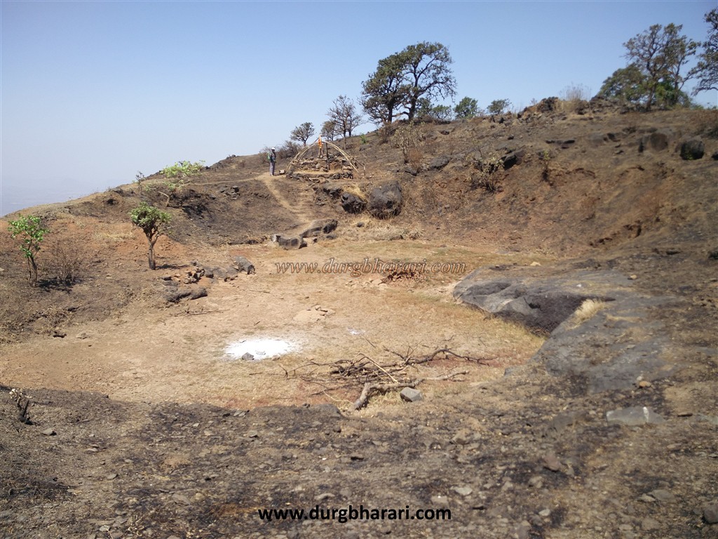
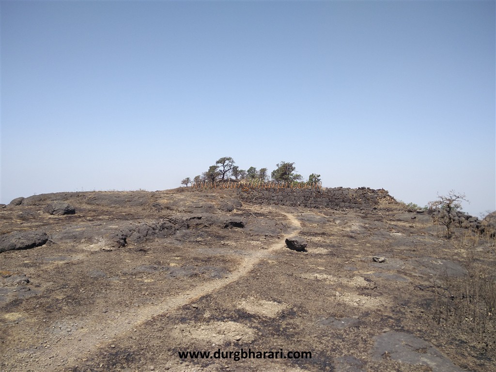
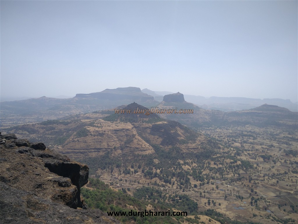
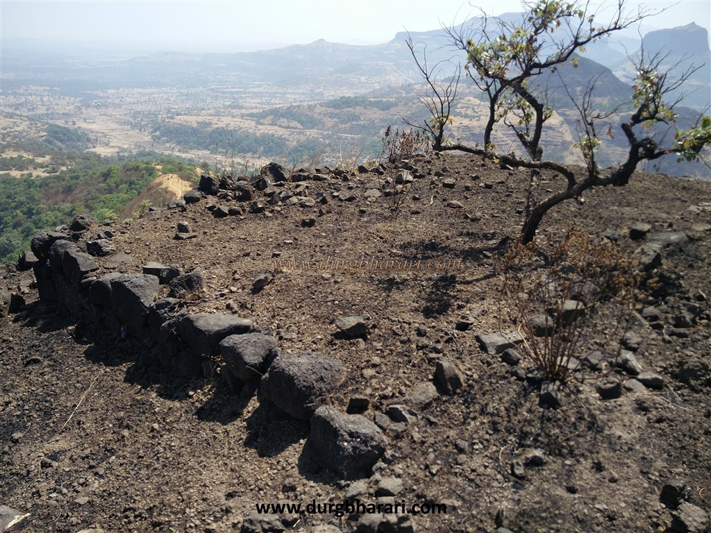
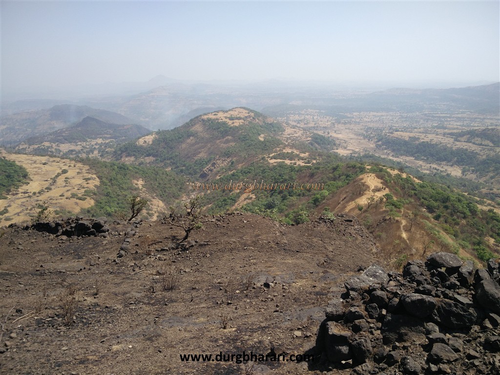
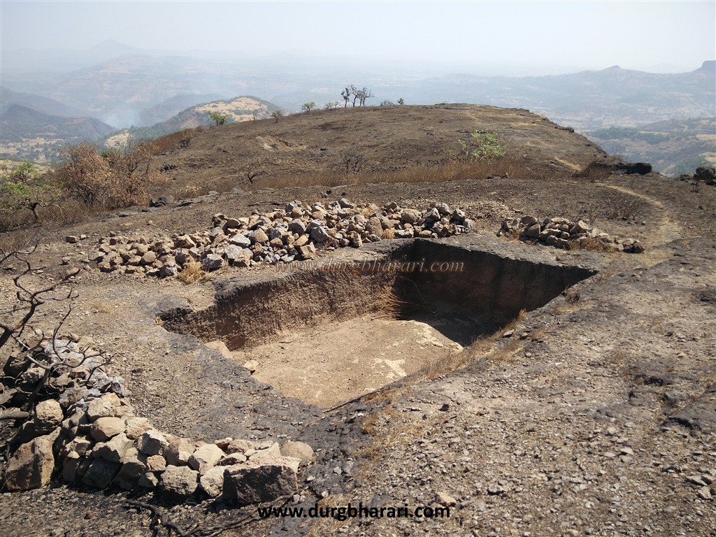
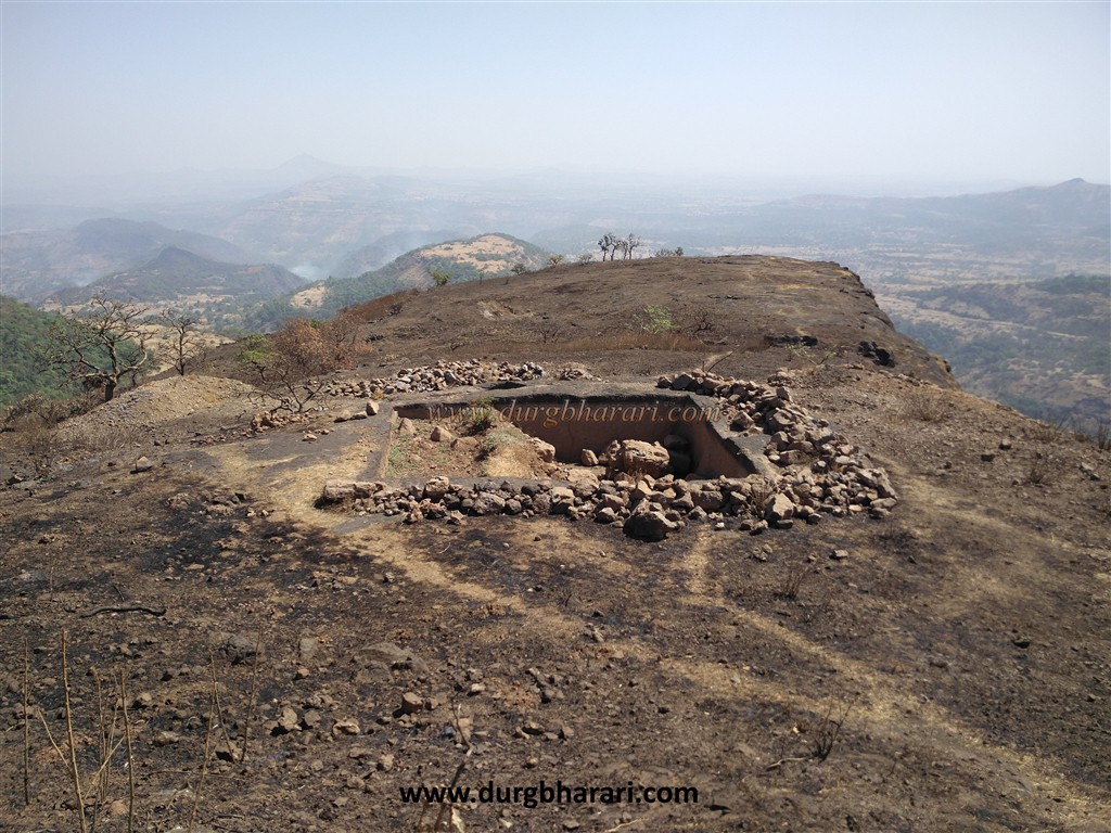
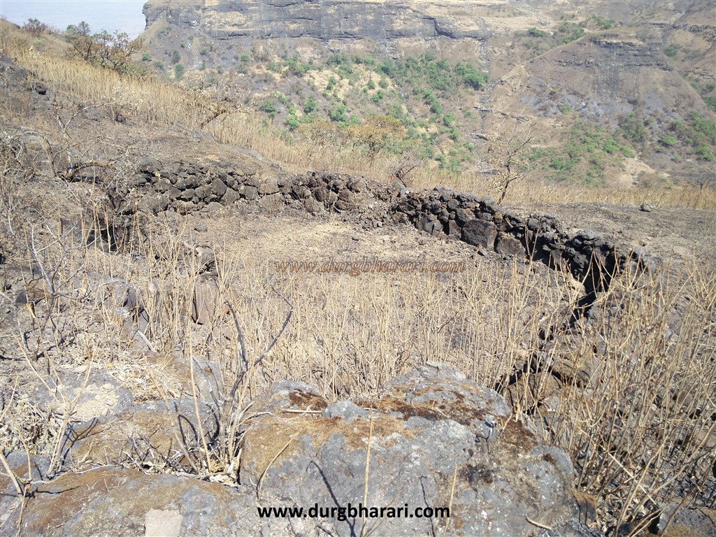
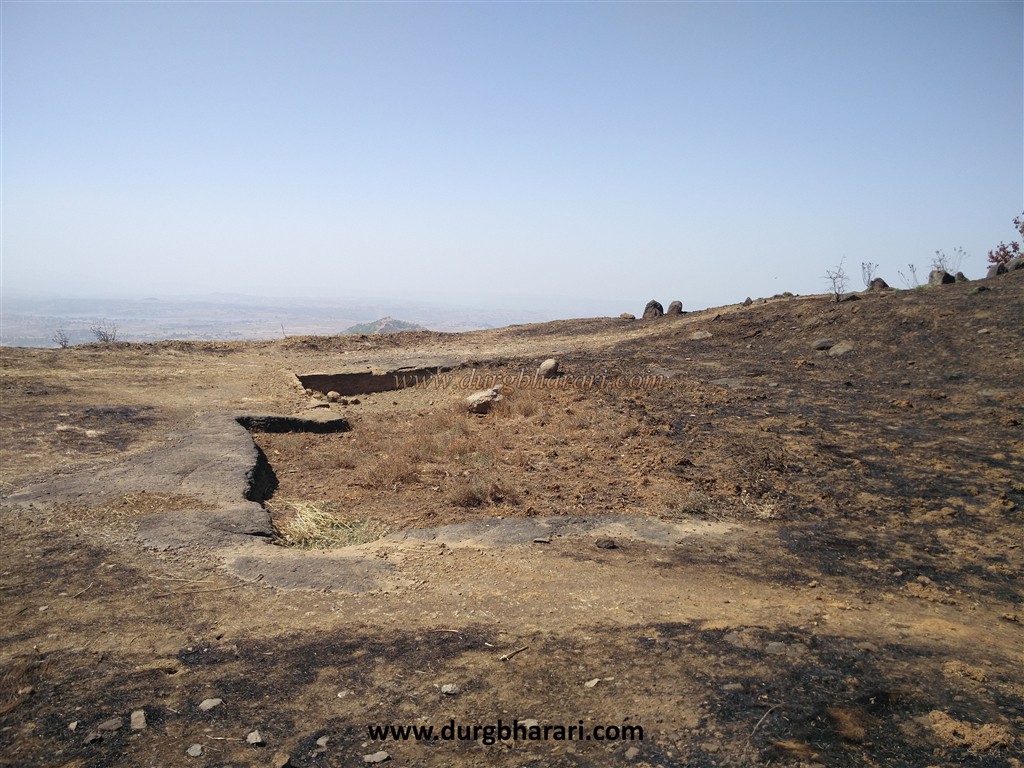
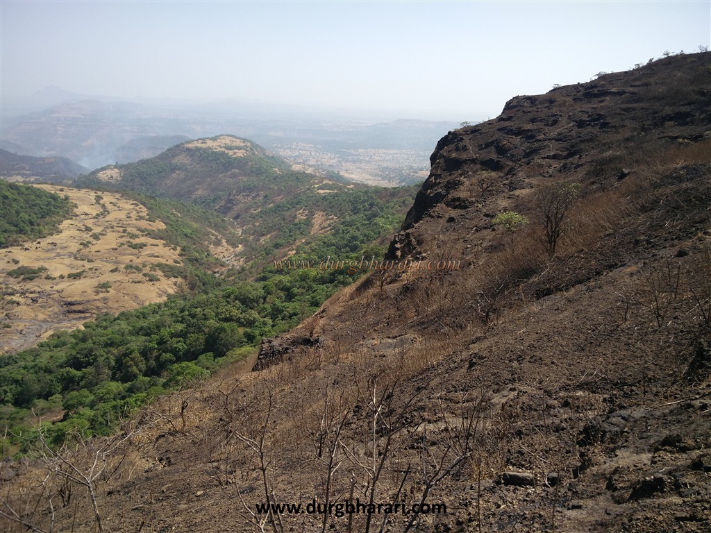
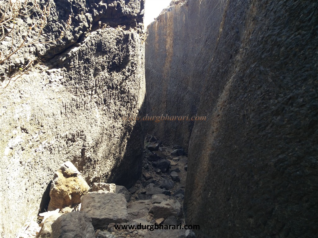
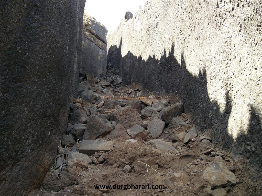
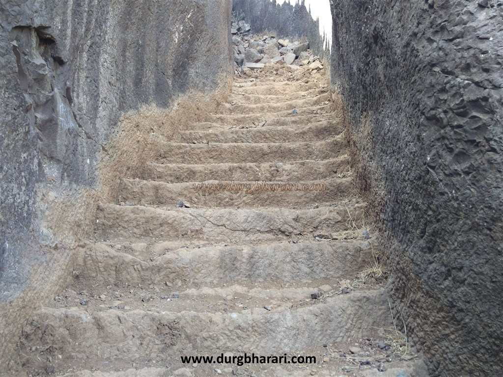
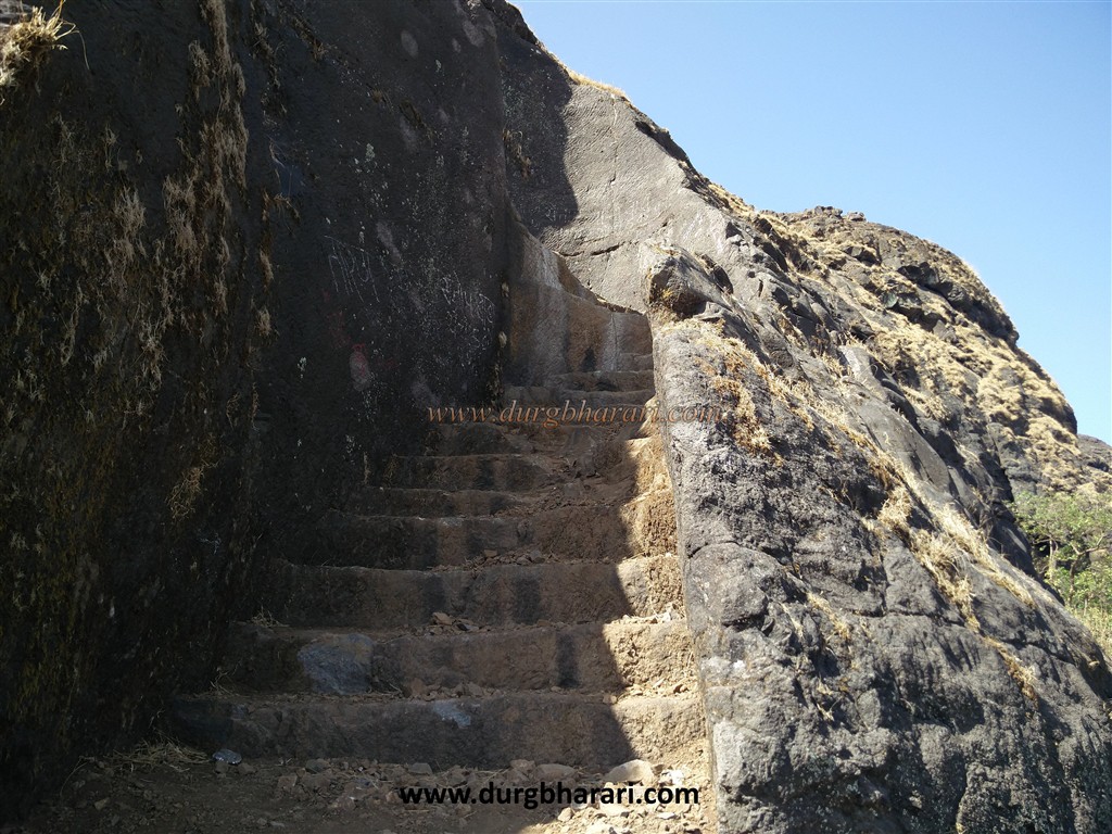
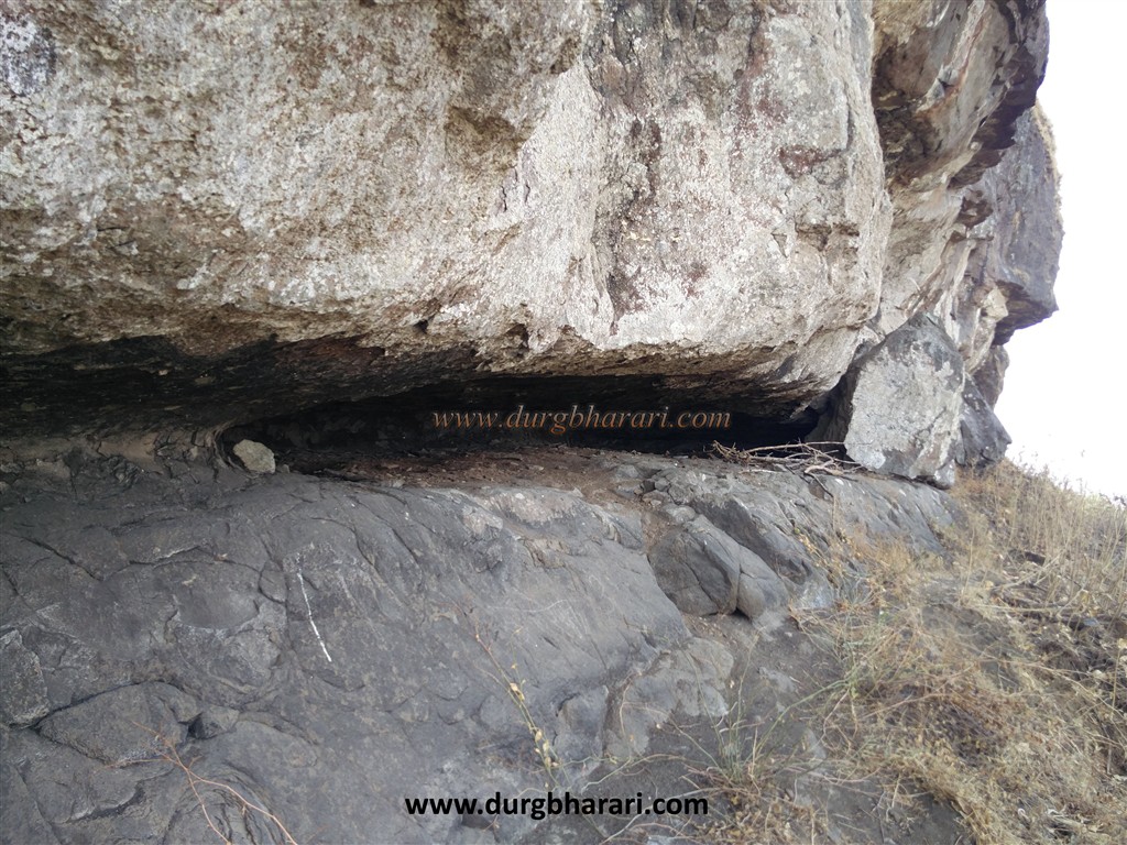
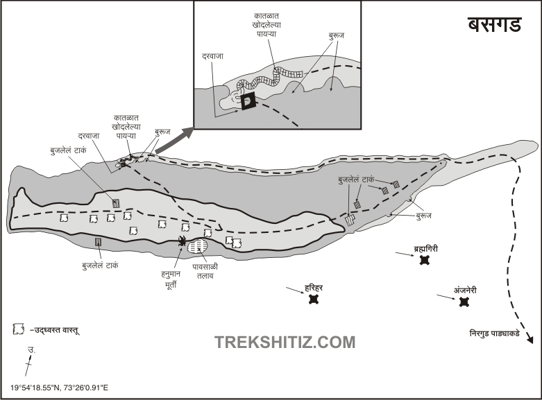
Nirgudpada is a common village at the foothills of forts Harihar and Bhaskargad. The distance from Mumbai-Nashik highway via Ghoti to Nirgudpada is about 170 km and from Nashik-Nirgudpada via Trimbak is 41 km. However, this route is convenient for Nashik and Pune residents. On the Nashik-Trimbak road, a path directly leads to Ghoti village from the Prayagtirtha lake near Trimbakeshwar. From this road distance of Nirgudpada is 20 km. As Nirgudpada is a small village, it is convenient to have a meal and stay at school if the villagers told in advance. In front of Nirgudpada is Harihar fort and on the left side of the village is Basgad fort which looks like a hat. Between these two forts is a mountain with a serpent shape called Fani mountain. Harihar, Basgad, and Fani mountain can be reached from Nirgudpada. Although the fort is visible from the village, to reach it, one has to take a detour across the hill and go to the opposite end. It takes one and a half hours to reach the foothills of the fort from the village and two and a half hours to reach the top of the fort. A short distance from Nirgudpada village towards Ghoti, an unpaved road leads to the gorge between Fani mountain and Bhaskargad. A trunk with Bhaskargad and Utwad hills descends into this gorge. Leaving the unpaved road here, one can see a footpath on the left. This road takes many turns and goes to Bhaskargad. Due to the dense forest at the foot of the fort, it is not difficult to climb the fort even in summer. As very few trekkers visit this fort, the path is not that much clear. It is not a difficult task to find a way for regular trekkers but the novices should take an informed person from the village. When you reach the first plateau from the trunk in the gorge, you should constantly take the path towards Bhaskargad on the left. Utvad hill in front of Bhaskargad is the highest peak in the Trimbak range. It is also taller than Bhaskargad. Adjacent to the road leading to Bhaskargad, a road leads to Utvad hill. If you wander a little, you are likely to reach the foot of Utwad mountain. After climbing for about an hour through the gorge, we reach a small plateau in front of the trunk in Bhaskargad. From this plateau, the ruined bastion on the trunk of Bhaskargad can be seen in front. From this plateau, the fort takes a detour to the left side and a valley leads to the fort. After walking for about 20 minutes, we reach the steps of Bhaskargad. There are steps carved out of the rock to reach the fort. On both sides of this road, there are gravel walls about 10-12 feet high. The ramparts on the upper side of the wall have been heavily demolished and debris of these ramparts have fallen onto the steps. As a result, the steps have been buried up to some extent. The first few steps have been cleaned by the Hindavi Swarajya Mavla Pratishthan. Climb these steps and reach the west-facing gate carved in the rock which is half-buried into the ground. Although the gate of the fort is half-buried, the lotus flowers carved on both sides of the gate are still in good condition. You have to enter the fort by bending a little through this door. Inside the door, there is a porch for the guard on the right side and from here we climb 10-12 steps in front of the door. From here, on the way to the plateau of the fort, there are two divisions one goes in the front and the other goes on the right side. After walking for 10 minutes on the right footpath, you reach the plateau of the fort. With a steep but wide plateau, the fort is at a height of 3340 feet above sea level and is spread from east to west. The area of the fort is about 32 acres. You can see stones scattered everywhere across the head of Bhaskargad. On the way to the plateau, on the right side, there are the remains of a structure and some carved stones can be seen in it. This structure should be a temple. When we reach the plateau, there is a water cistern and the remains of a large structure can be seen in front of this cistern. Looking at a large number of architectural ruins on the fort, it seems that the fort should have a large population in the past. From this plateau, you can see two dry water cisterns on the way to the bastion which you can see while descending the fort. At present, Hindavi Swarajya Mavla Pratishthan, an organization from Nashik, has undertaken the work of fort conservation here and even in the scorching heat of May, these congregations are working here. One of the cisterns has been completely cleaned and the other cistern has been partially cleaned. The cleaned tank will collect water during this monsoon season and will provide some water to the fort later. Many thanks and salutations to the work of these Mavals of Hindavi Swarajya Mavla Pratishthan who are fighting for the fort. The bastion at the bottom of the cistern is fortified to some extent and the door leading to the bastion has been demolished. The fort has some fortified ramparts in this area. Seeing this, you should come to the cistern you saw at the beginning and start the fort round from here. In the beginning, you see the remains of the walls of a large mansion. This should probably be the fort keeper’s mansion. Going further from this mansion, you can see a rainwater harvesting lake. A pond is carved in the rock in the lake itself. Inside the four crumbling walls on the edge of the lake is an idol of Hanuman with Shendur applied on it. In this part of the fort, a large stone wall can be seen on the edge of the plateau. On the right-hand side, there are cisterns under a tree and another set of cisterns on the way which are filled with soil. Ten minutes walk from here we see the ruins and reach the other end of the fort. The bastion at this end and the remains are completely buried under the ground. From here, on the other side of the plateau, you can see the carved stone of a Samadhi at the beginning and a cistern carved in the rock next to it. Remains of 3-4 structures can be seen on the front side of this cistern. On the left side of the road and the lower part of the plateau, the ruins of a settlement can be seen. A large number of architectural remains can be seen on the fort. From the top of the fort, you can see the nearby Utvad and Fani hills, Harihar, Bramhadongar, Trimbakgad, and Anjaneri. When you reach the gate of the fort, your fort round is complete. The entire fort round takes two hours. Even though there are 7-8 cisterns on the fort, there is no drinking water facility so keep enough water with yourself while visiting the fort. There is not much mention of this fort in history but many monarchs like Devagiri, Bahamani, Nizamshahi, Mughals, Marathas, Koli, Peshwa, and British have ruled over this fort. Looking at the footpath carved in the rock and the water cistern carved in the rock on the fort, it seems that the fort was built during the Satvahana period or the contemporary monarchy. From 1271 to 1308, the fort was under the rule of Devgiri and later under the control of Bahamani and Nizamshahi. When Shahaji Raja defeated the Nizamshahi in 1636, he took over the neighboring Trimbakgad and Harihar and the area came under his control. Later, however, it was passed to the Mughals. The fort was conquered by Moropant Pingale in 1670-71 while capturing Nashik province. In 1688, the Mughals conquered Bhaskargad. In 1730, the Koil revolted and took it over. Later, it came under the control of the Peshwas. After the conquest of Harihargad by the British in 1818, Basgad also came under their control.
© Suresh Nimbalkar
GALLERY