BALAPUR
TYPE : GROUND FORT
DISTRICT : AKOLA
HEIGHT : 0
GRADE : EASY
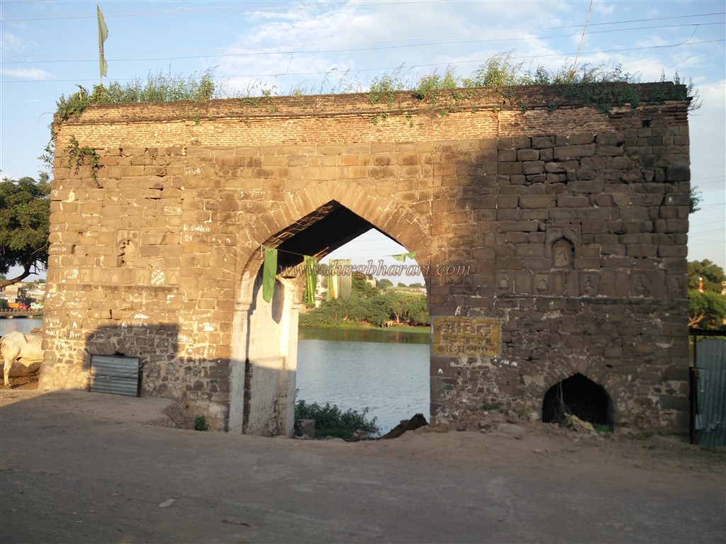
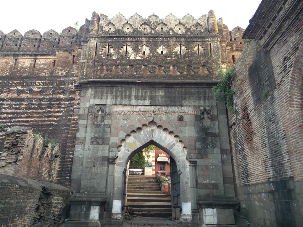
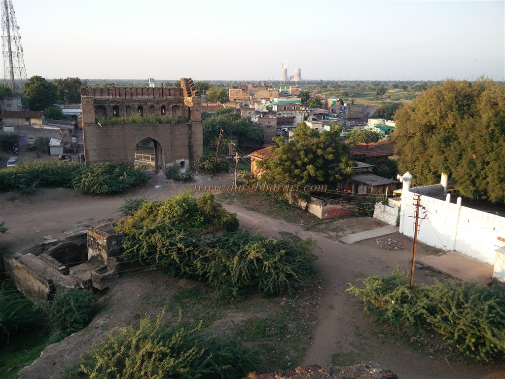
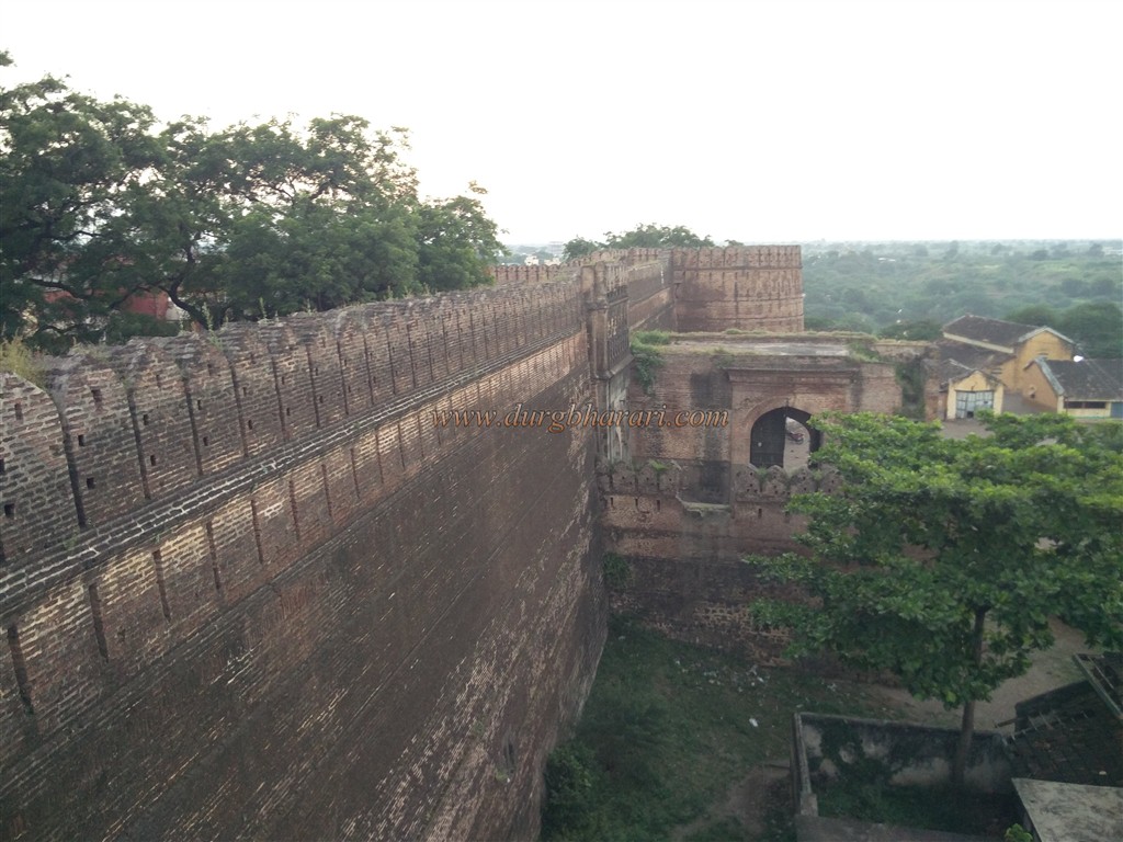
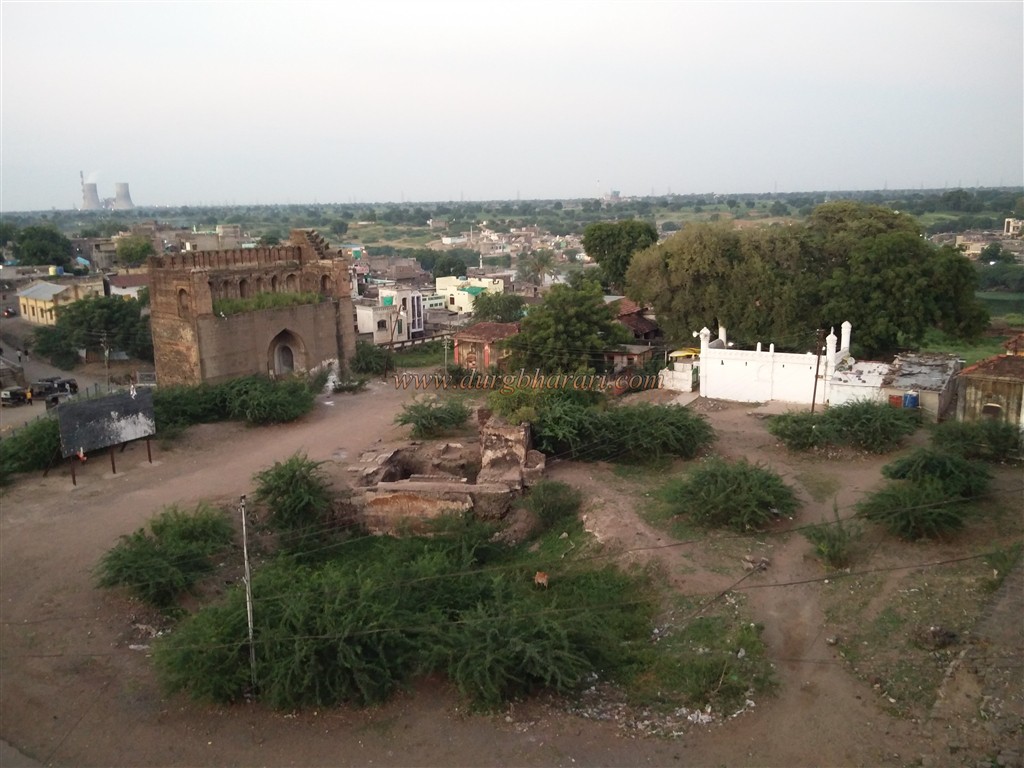
Forts in Akola district are so less that one can count them on fingers. But the ones that do exist are very beautiful and spacious. Narnala and Balapur are one of these forts. Although the fort of Balapur is geographically located in Akola district, it is convenient to visit the fort from Shegaon in Buldhana district. Balapur is a taluka located at a distance of 19 km from Shegaon. There are good facilities for S.T. and rickshaws to reach Balapur from Shegaon. The original city of Balapur and the fort are situated on the banks of the river Man and Mahish. It is said that the city got its name from the temple of Baladevi on the recent hill of Balapur fort. Entering the city of Balapur, one can see the fort from a far wide distance. After getting off at the bus stand and walking along the banks of the River Man, keeping the double ramparts of the fort on the left-hand side and the river on the right-hand side, in 10 minutes we reach the Gulzar gate of Balapur fort.
...
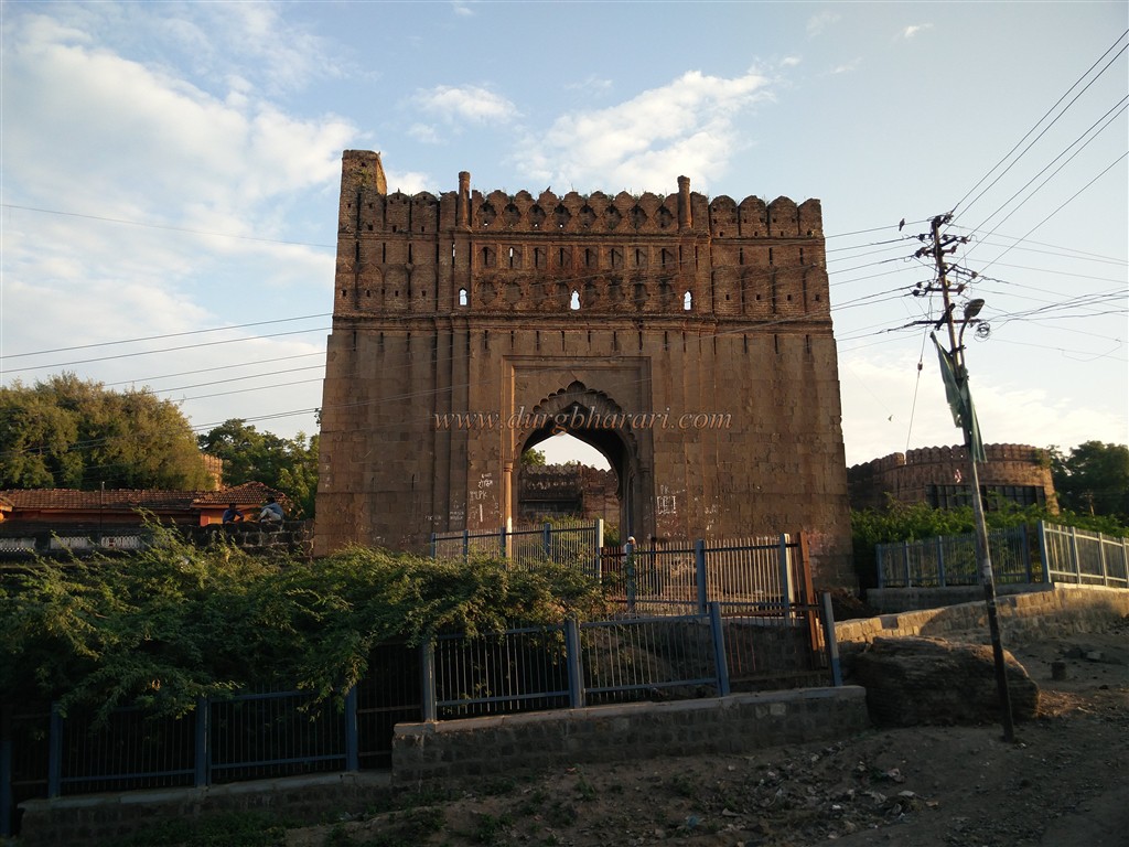
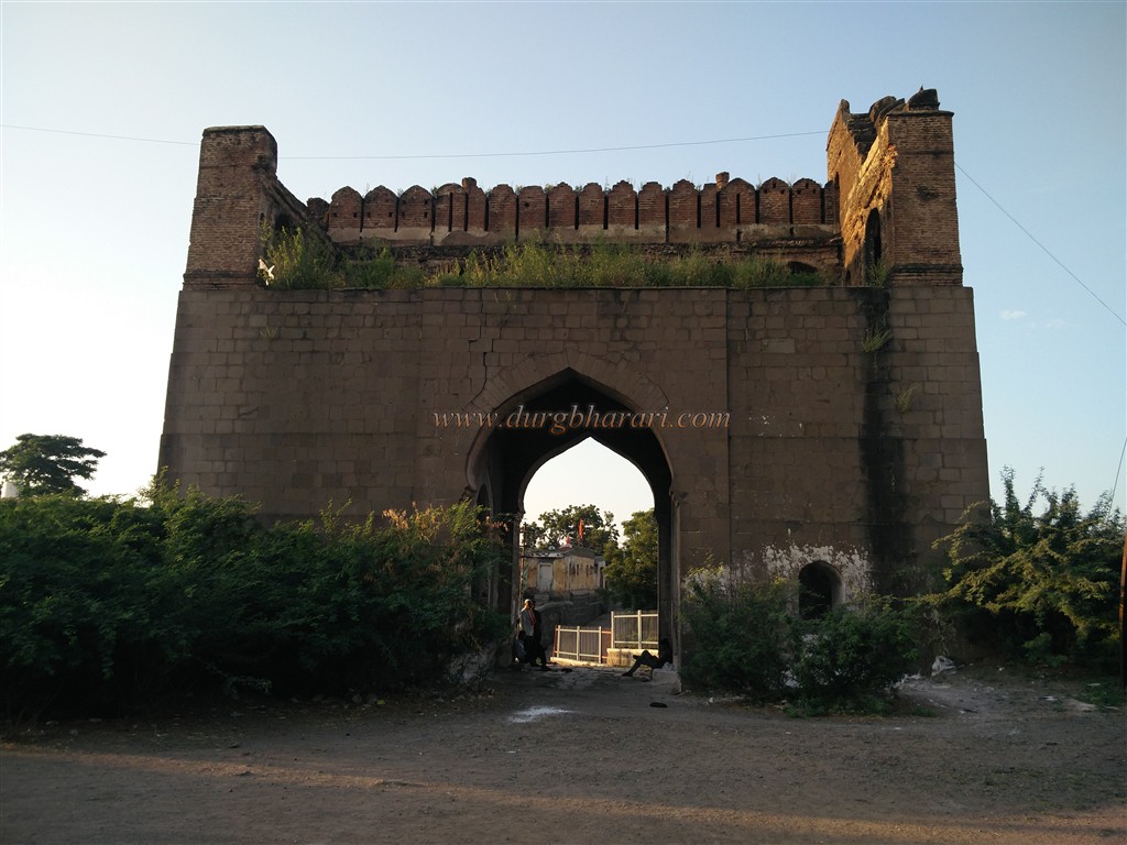
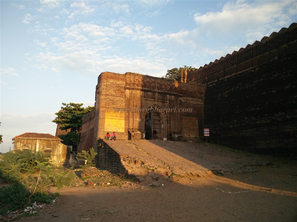
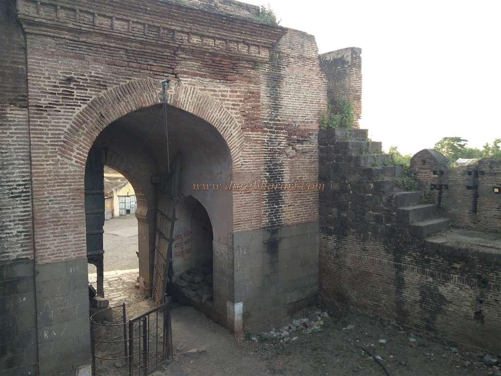
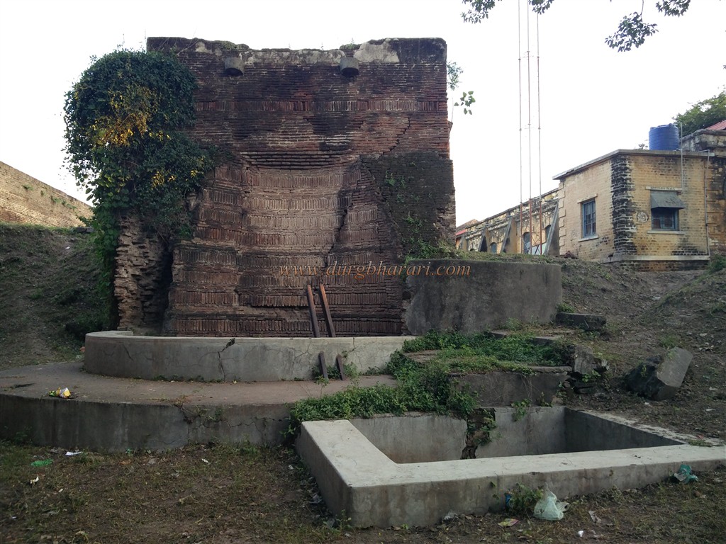
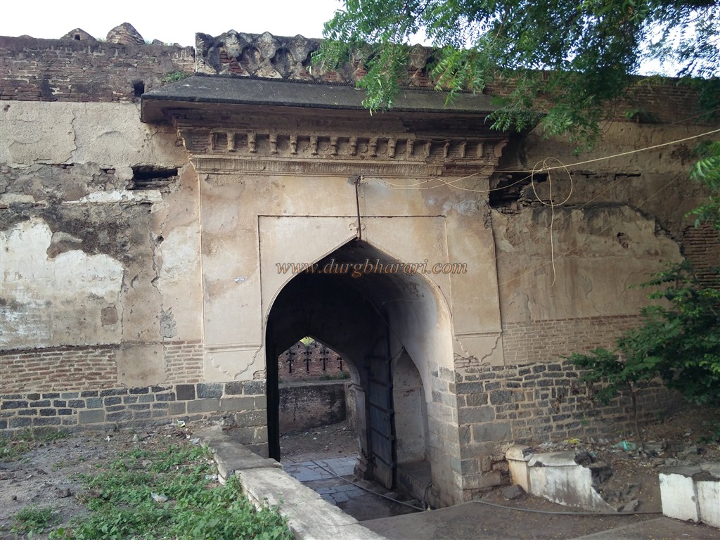
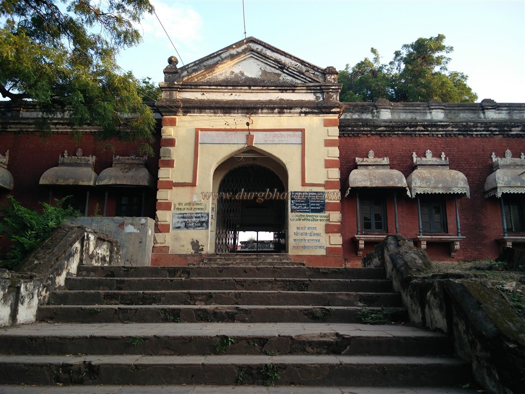
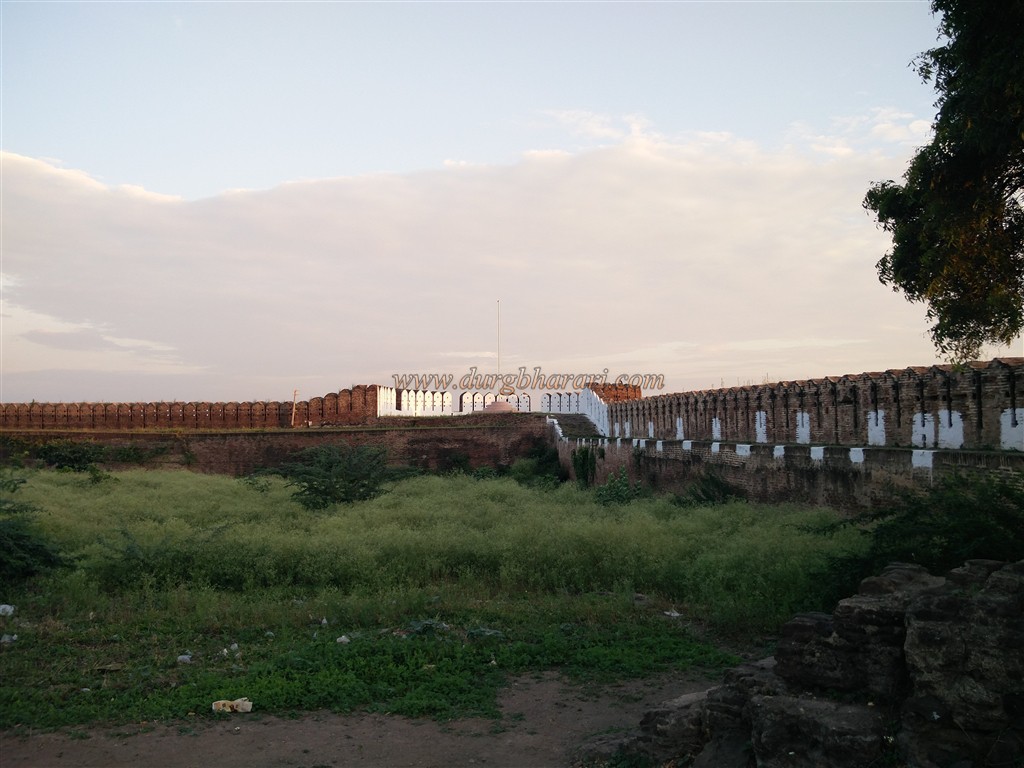
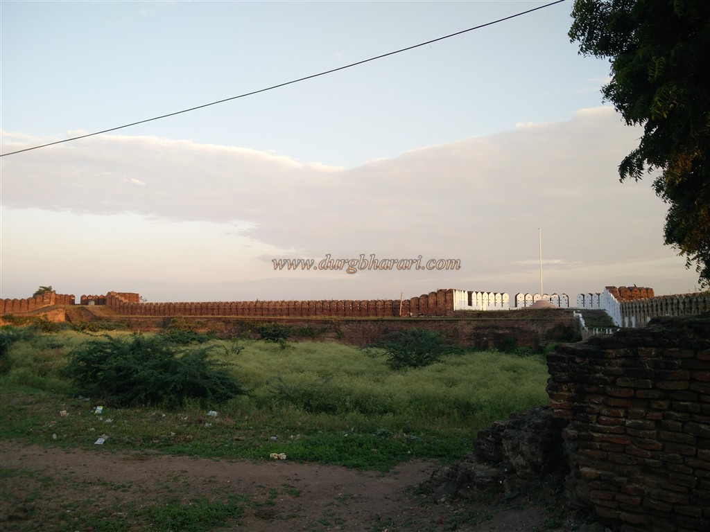
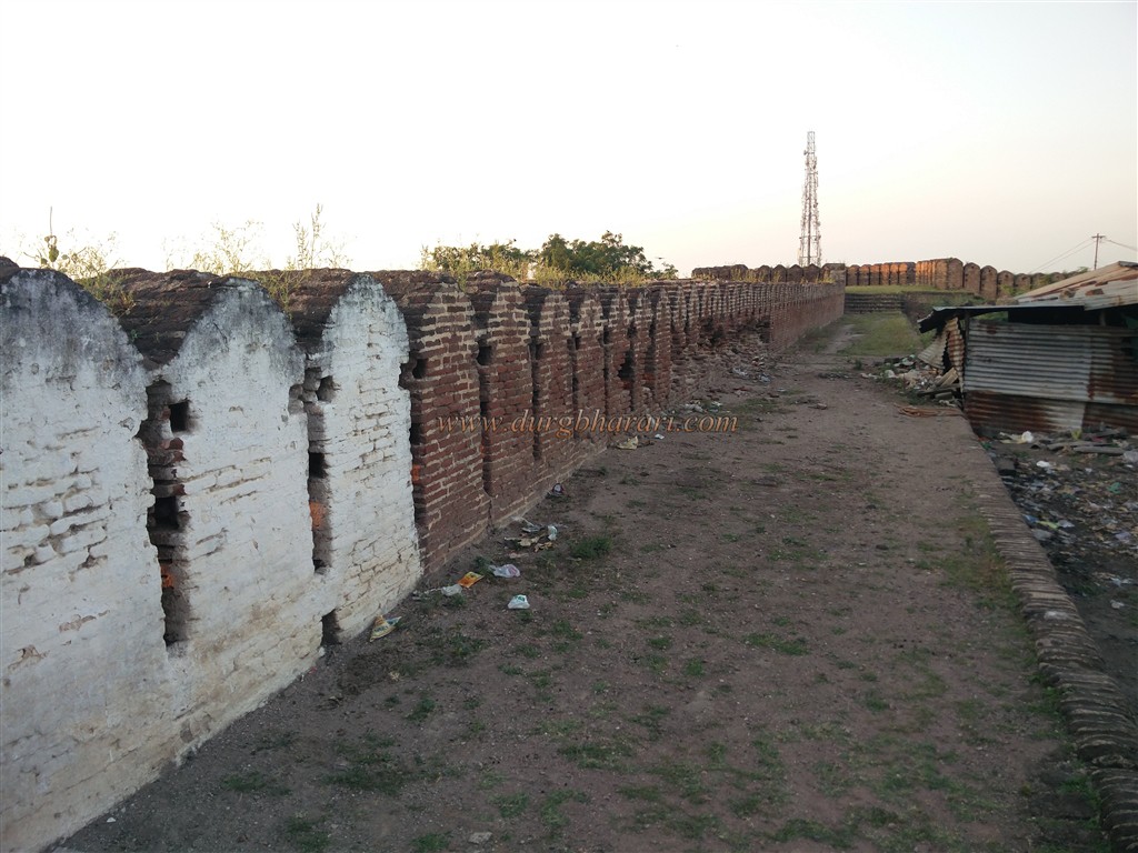
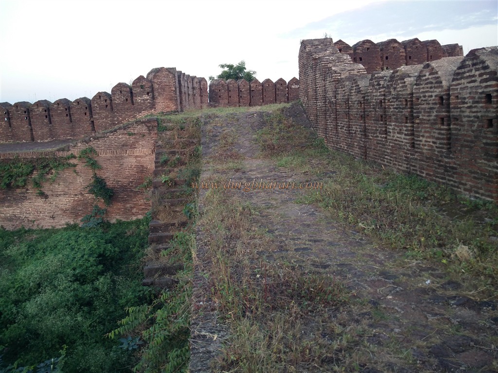
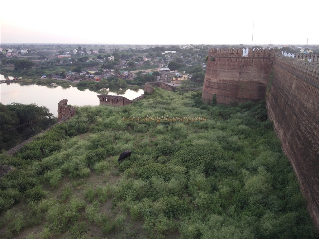
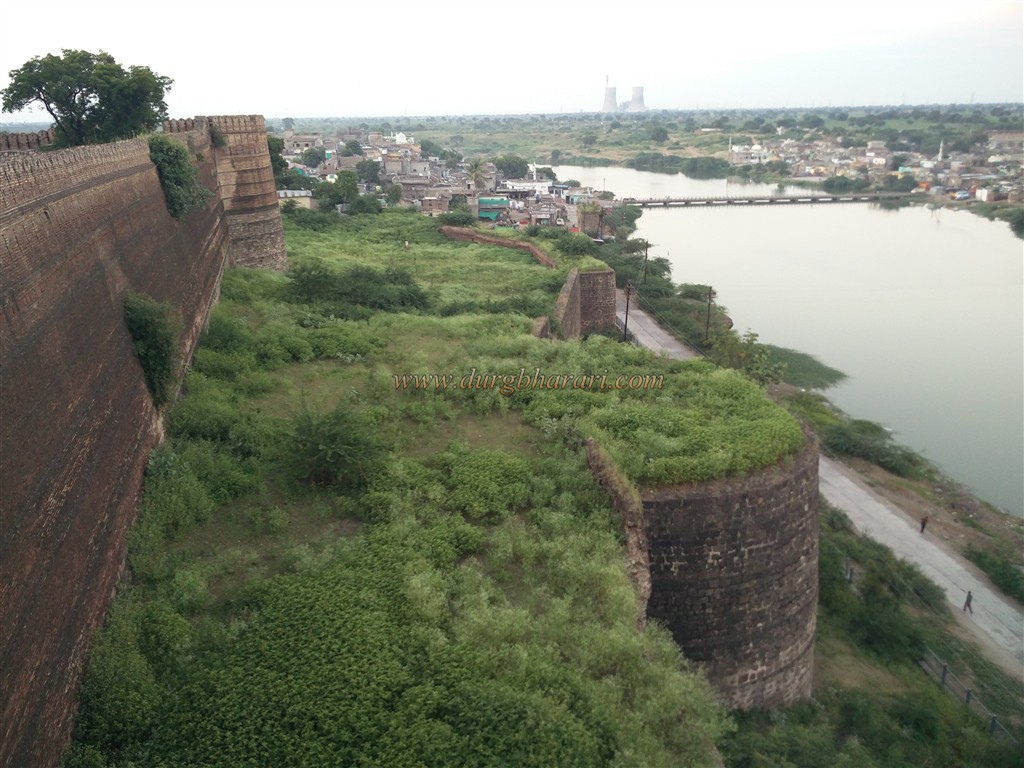
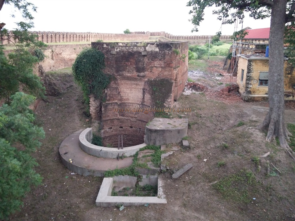
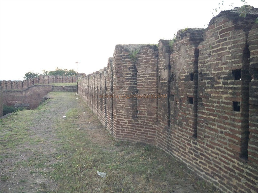
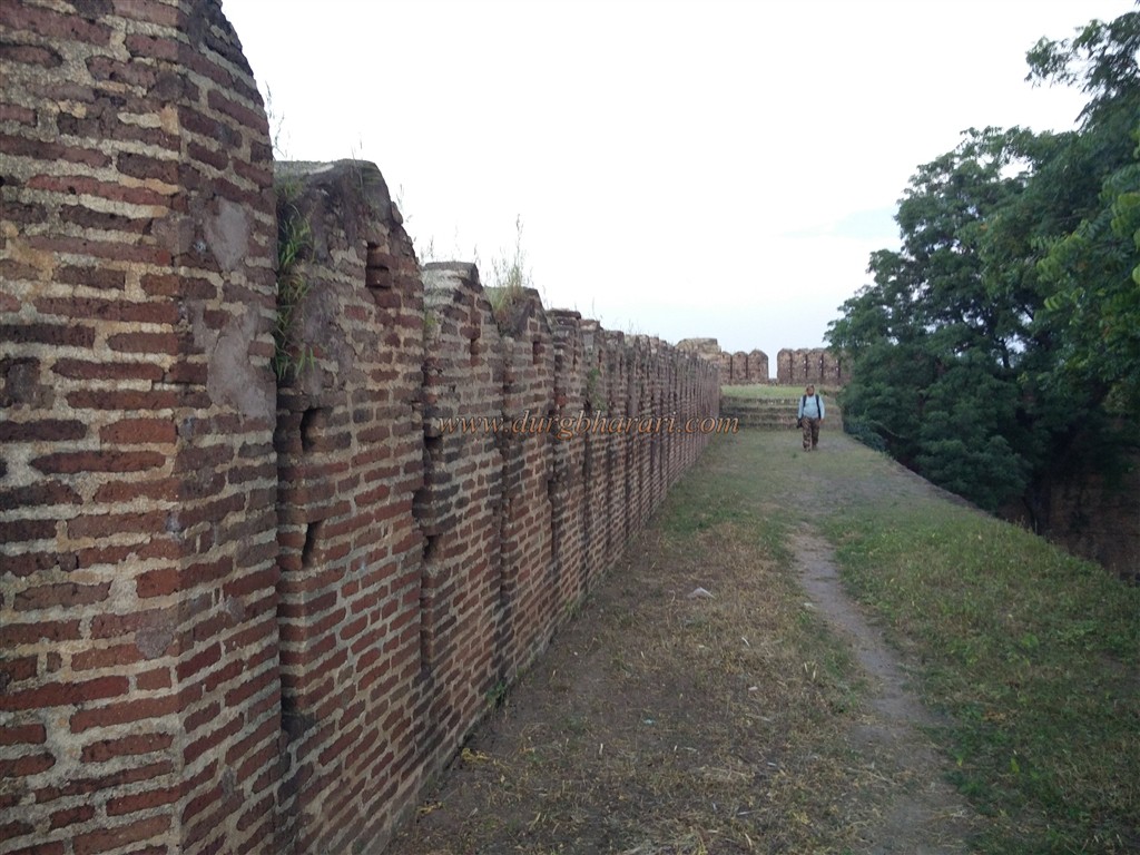
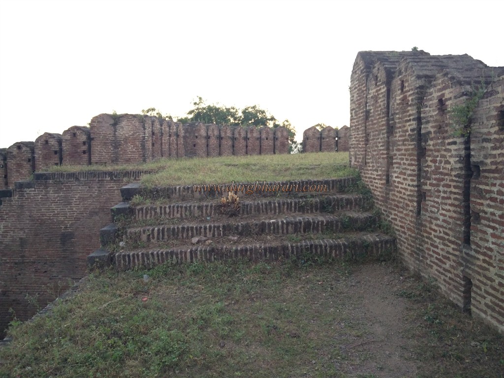
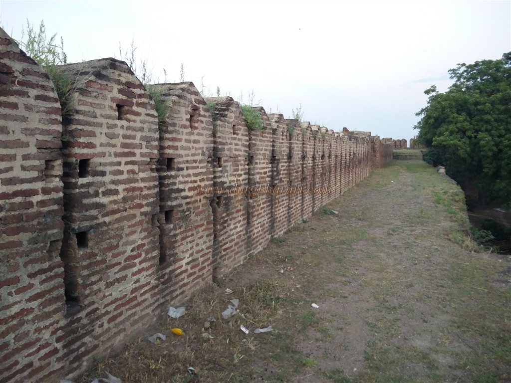
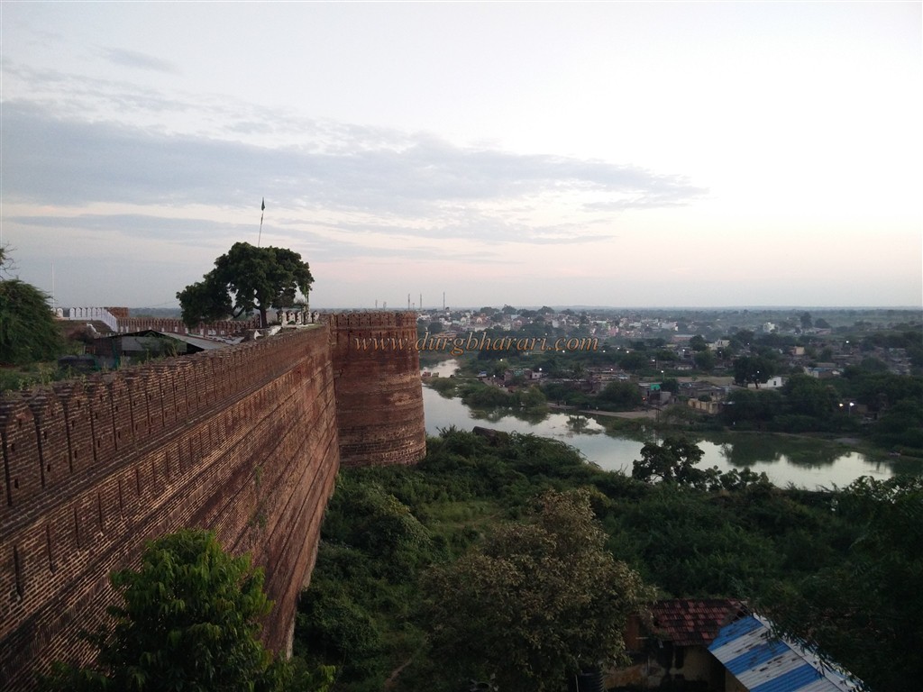
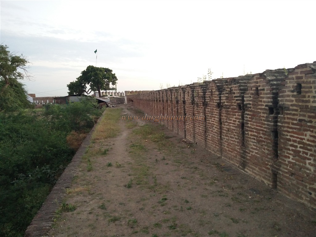
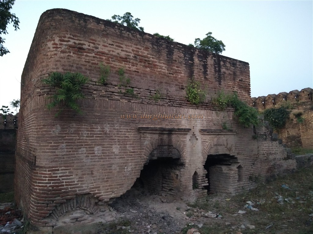
The Man and Mahish river basins are a natural moat for the city and the fort and are connected to the outskirts of the fort and the old city of Balapur in a very narrow way. The fort consists of ramparts and gates around the original city, a citadel on a hummock at the edge of the city, and fortifications around it, this is the security pattern of the fort. The construction of the fort is in good condition even today. Near the Gulzar Darwaza of Nagarkot, you can see the ruins of the fort and the remains of the bastions on the left side. Ascending this path, we reach the front of the magnificent north-facing gate at the top of the fort. There is a Persian inscription on the arch of the door which mentions that it was built in 1757 by Ismail Khan, the Nawab of Ilichpur. The lower part of the door is made of stone and the upper part is made of bricks. There are guard porches on either side of the door. The steps leading to the fort have been destroyed due to the demolition of the ramparts adjacent to the gate and the road leading to the fort. Upon entering through the door, there is a mosque on the left side and a square-shaped dry well made of bricks on the right side. There are some government offices in the area outside the main fort and between the ramparts. When visiting the fort, first look at the area between the citadel and the outer ramparts and then enter the citadel. The base of the citadel is made of stone and the top is made of bricks. In the stone construction at the bottom, you can see some carved stones and a flower-carved temple. While walking around the citadel, you can see the Man river on one side of the fort while Mahish river on the other. There are 10 bastions in the outer ramparts of the citadel and 5 in the inner ramparts. While exploring the citadel, you can see water storage tanks at four places along the way. At the end of the tour, we enter the fort through the east-facing door in front of the well. The citadel, which is about the size of a square, covers an area of three acres. The citadel has two gates at a right angle behind each other. The wooden part of these doors, the nails on them, and the small door of this big gate are still in firm condition. Both of these doors have porches for guards on either side. Upon entering through the first door, there are ramparts and steps. On the second north-facing gate of the citadel, various stone sculptures like horse, elephant, lotus are carved and the upper part of this gate is made out of limestone. Upon entering the fort through this gate, a British-era building can be seen in front. The building currently houses government offices. To the left of this building is a large well in front of the ramparts. Adjacent to this well is a carved bathroom of 15 feet high bricks and the remains of a mansion can be seen next to it. The water supply scheme for the bathroom, as well as the stoves for heating the water and its ventilation scheme, are all feasible. From here you can reach the rampart by the steps in front. The curtain wall of the fort is about four feet wide and the ramparts on this wall and the petal-shaped charya on it are six feet high. The ramparts and bastions, built entirely of bricks, are lined with barrage for cannons. You can walk around the entire fort from the curtain wall. There are steps in two places to climb the ramparts. The ramparts of the fort, surrounded by strong bastions on the outside, give a sense of the grandeur of the fort. In this fort, a newly built flagpole is seen on one bastion and a tomb is seen on the other bastion. There is a round barn in front of the bastion with a tomb. There is a small enclosed temple built of stone on a quadrangle structure in the courtyard of the fort. As the fort is on a hill, a distant plain can be seen from the fort. During monsoons, part of the rampart of the fort has collapsed due to the flooding of the river on three sides of the fort. When you reach the gate of the fort, your journey is complete. Two hours is enough to see the whole fort. To the south of Balapur village, on a 25 feet square platform on the river bank, there is a five-domed canopy built by Mirza Raje Jaisingh with a height of 33 feet and 20 pillars. This domed canopy is worth seeing while exploring the fort of Balapur. In Ain-e-Akbari it is mentioned that Balapur is a rich regime in the county of Varhad. During the Mughal period, Balapur was an important military post after Elichpur on the way from Delhi to Hyderabad. During the Mughal period, Akbar’s son built a palace for himself at Shahapur near Balapur, the headquarters of Berar in 1596. Before coming to the throne, Jahangir, Shah Jahan, and Aurangzeb lived for some time in Shahapur, 15 km from Balapur, as Subhedars of the South. This fort was built by Aurangzeb's son Mirza Azam in 1717 and completed in 1757 by Ismail Khan, the first Nawab of Elichpur.
© Suresh Nimbalkar
GALLERY