BAHULA
TYPE : HILL FORT
DISTRICT : NASHIK
HEIGHT : 2980 FEET
GRADE : VERY HARD
The forts situated on the peaks of the Sahyadri have become inaccessible for many reasons. Some forts are famous for their inaccessibility due to its difficult terrain, some forts have become inaccessible due to British encroachment, but some forts have become inaccessible for nomads as they are under the control of the army. Bahula is one such fort under the control of the army. The fort is an arena for Army's artillery training. As the practice is closed on Sundays, some fort lovers visit the fort, but it is somewhat dangerous to go there as live cannon balls are scattered in the area. It is said that artillery training is off during Sundays, although sometimes the training starts on Sunday too, so you should decide to go to the fort with full information.
...
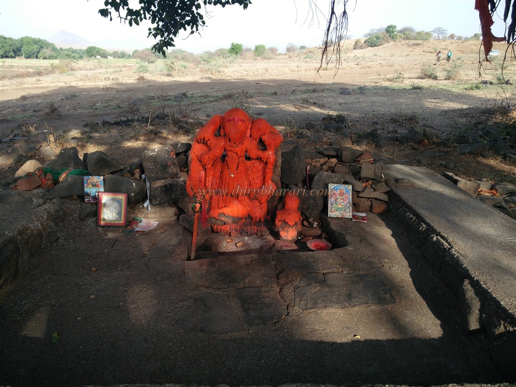
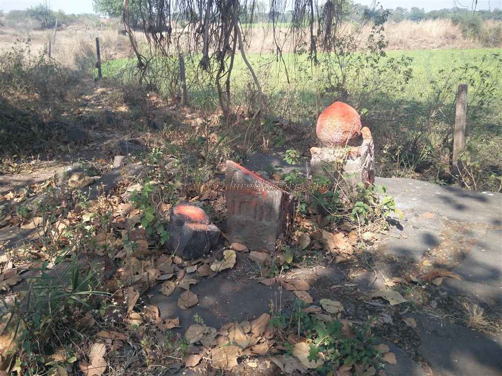
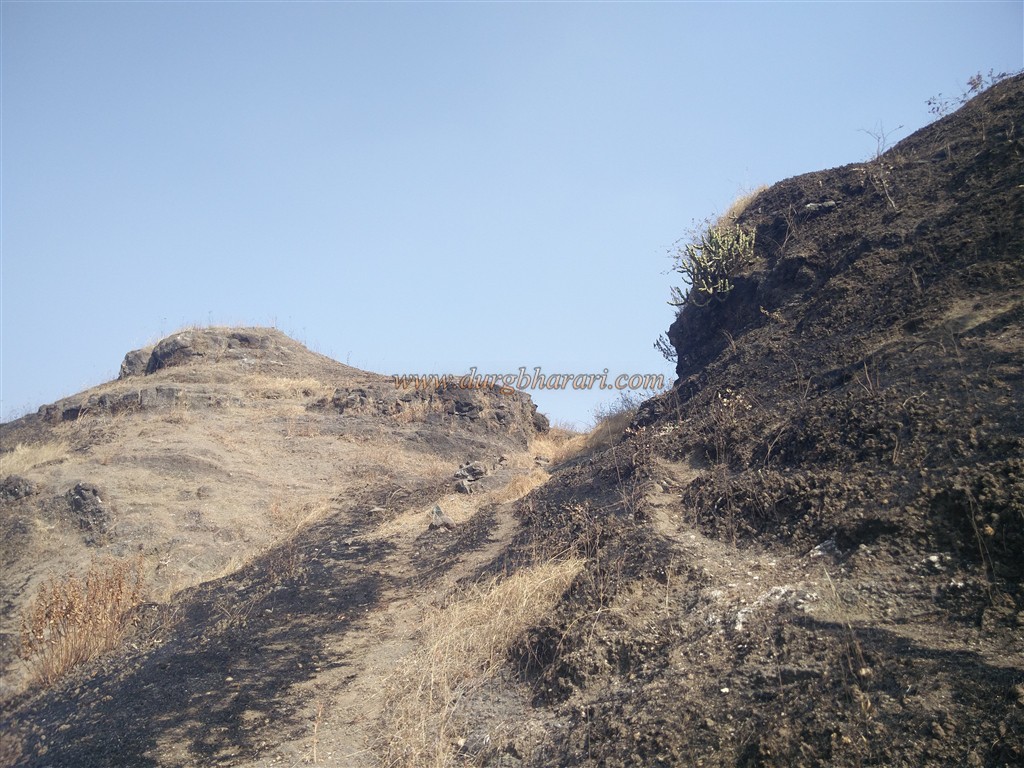
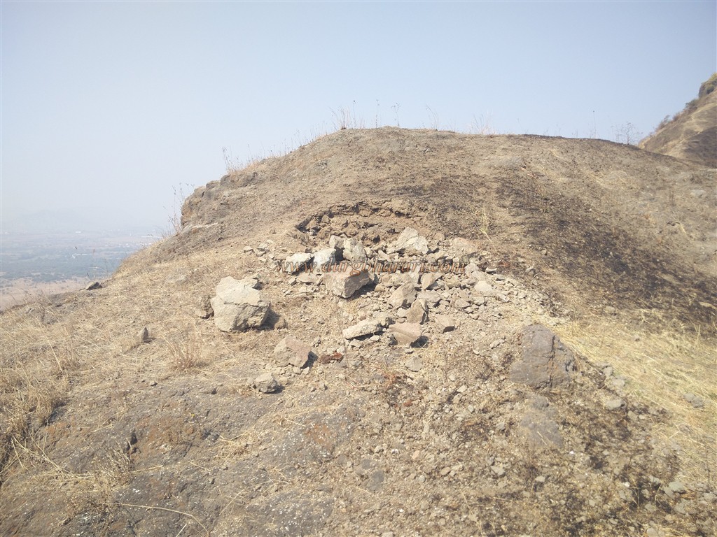
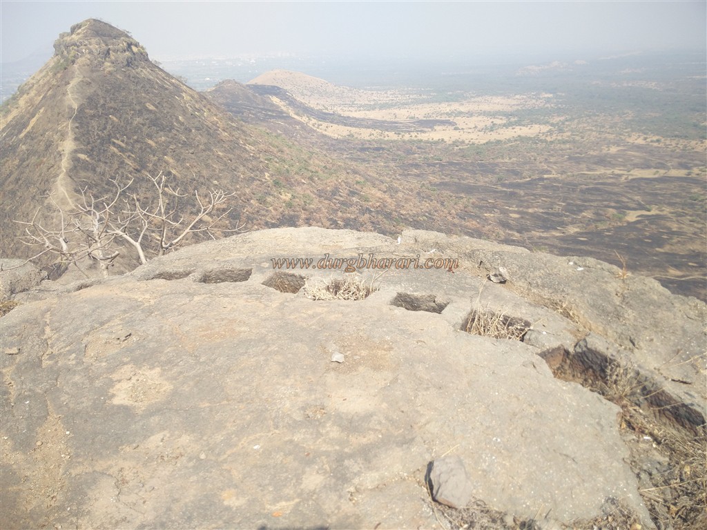
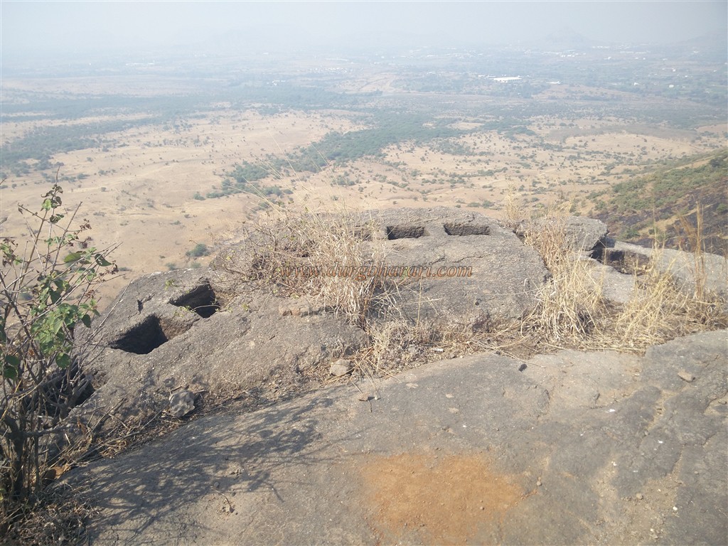
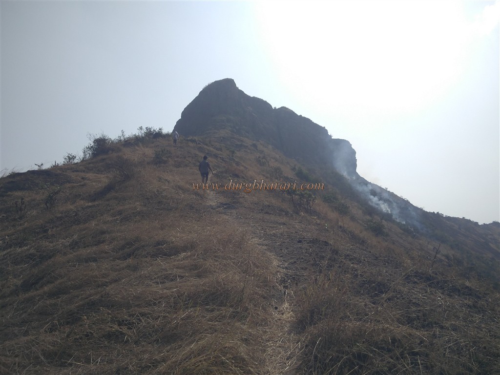
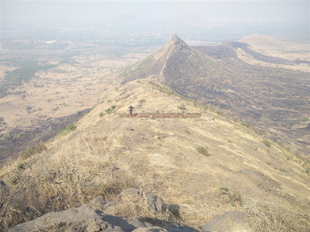
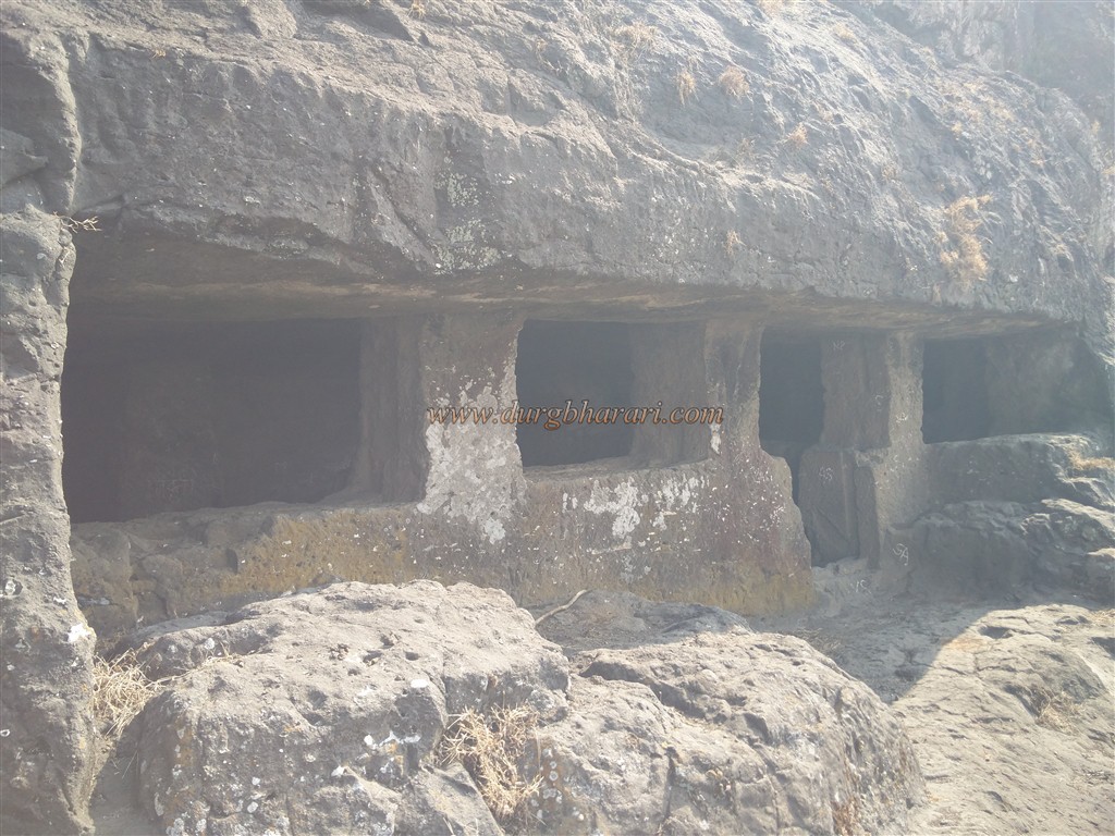
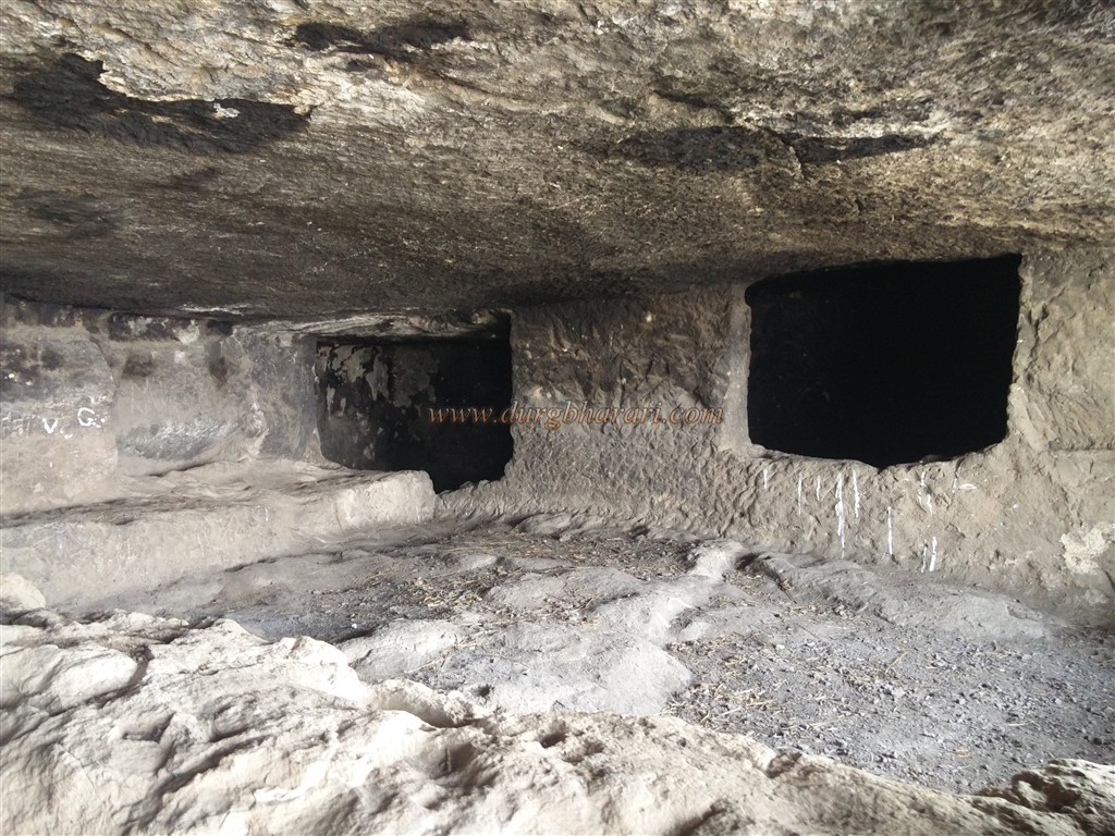
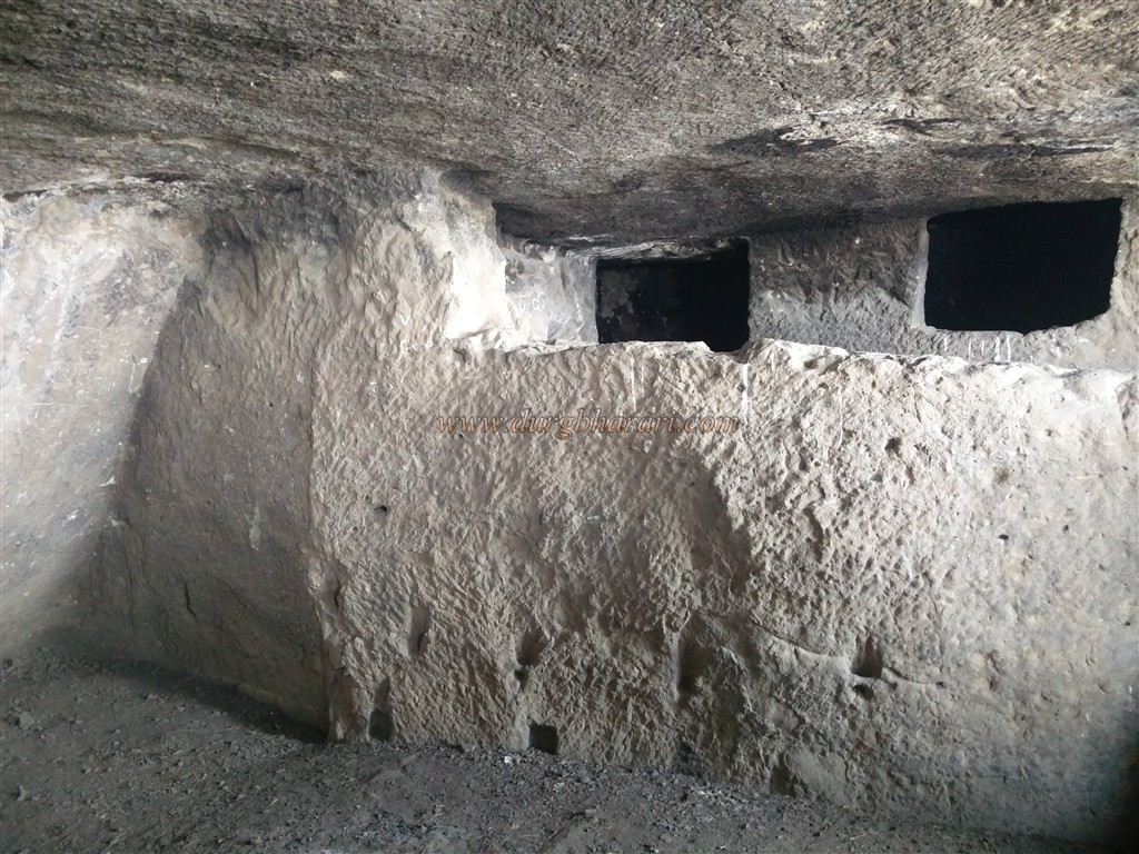
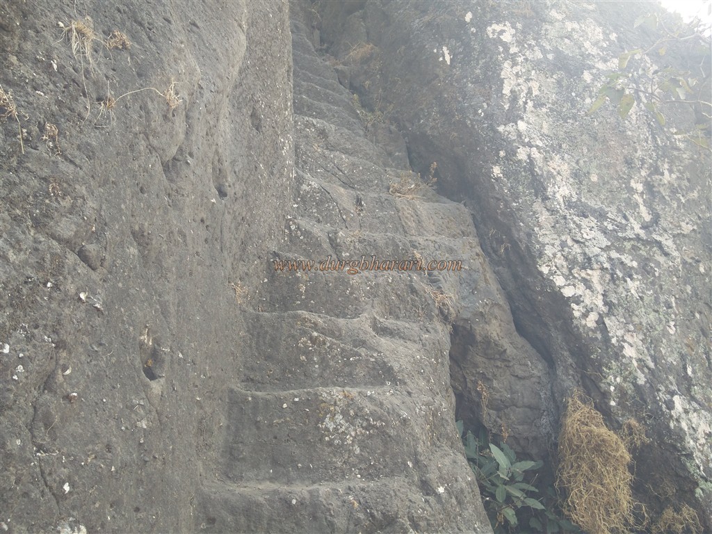
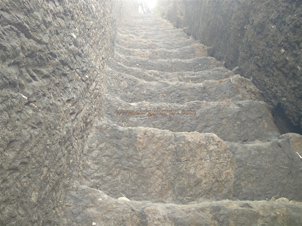
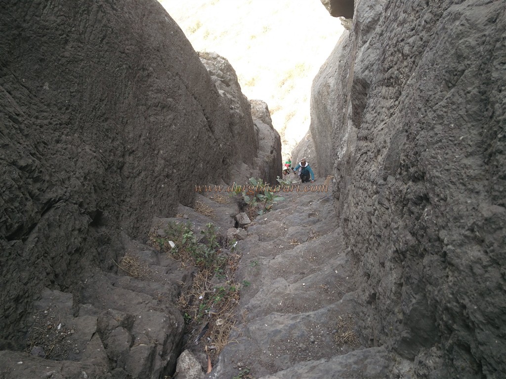
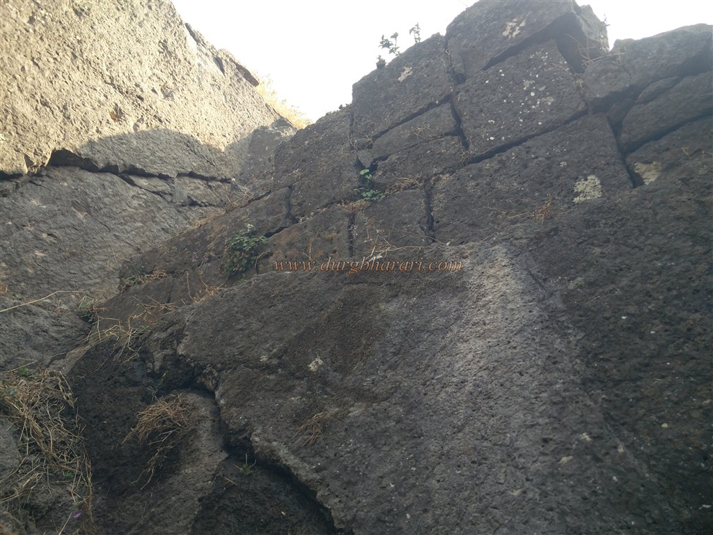
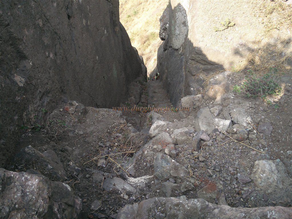
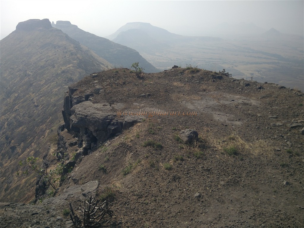
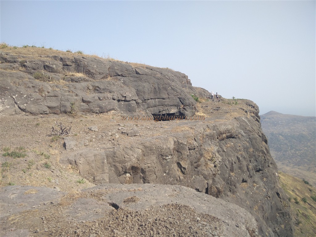
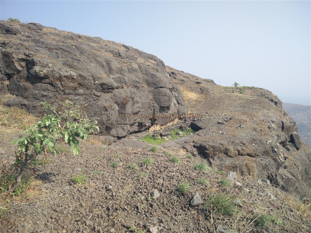
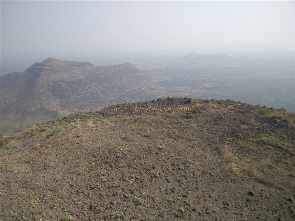
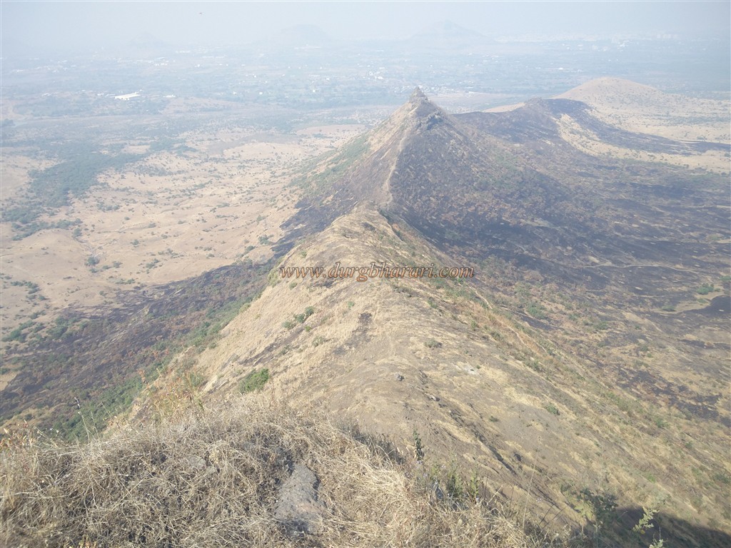
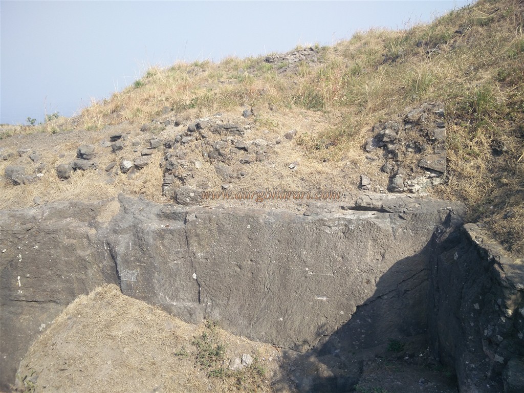
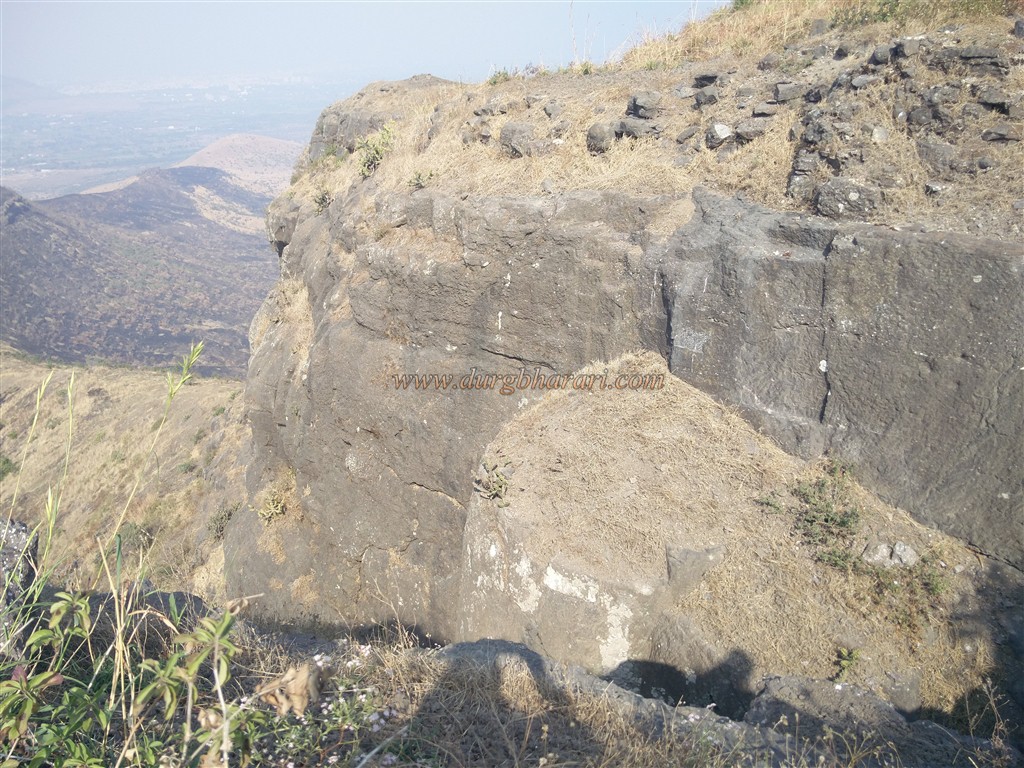
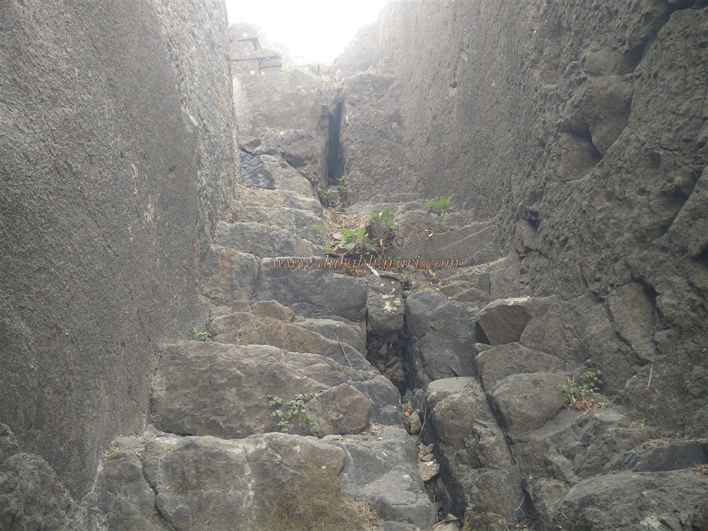
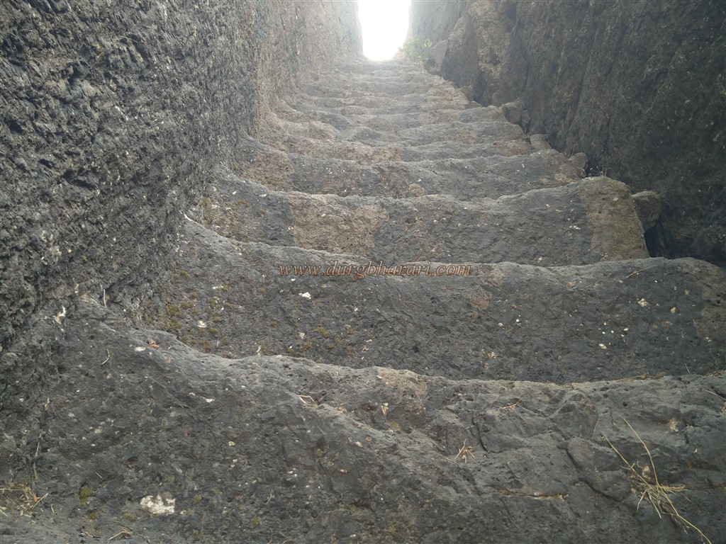
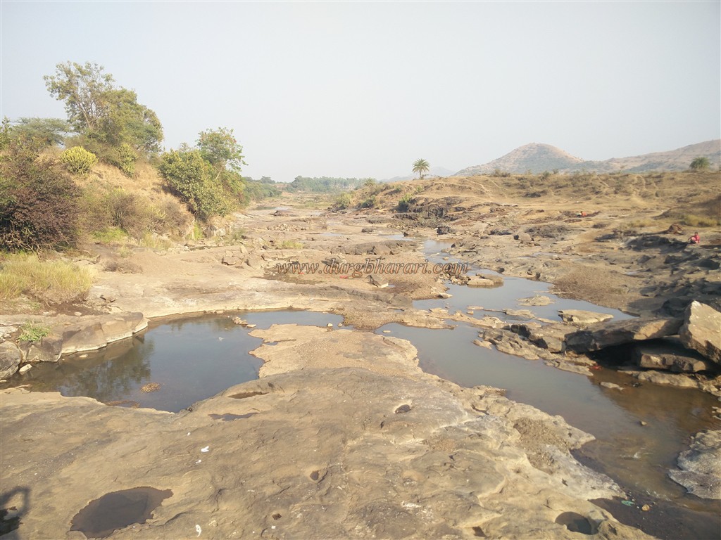
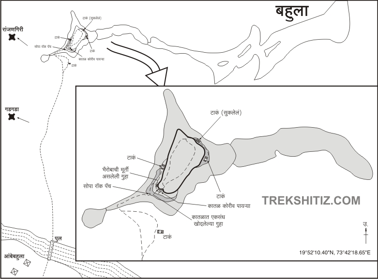
Ambebahula is a village near the fort, to reach Bahula fort. some of the villagers go to the fort on Sundays to collect debris so you should seek their help to see the fort at your own risk. To reach Bahula fort, after crossing the Ghoti fork on the Mumbai-Nashik highway, you need to drive 24 km. At a distance of 14 km from Nashik on the left, there is a fork leading to Viholi village. This road takes you to the village of Ambebahula in 2 km. The original Bahula village was situated at the foot of the fort, but during 1944, when the army set up the Deolali camp, it took over a large area for the firing range, including the original village of Bahula. Therefore, Ambebhula village which was at the foot of Bahula fort across the Valdevi river is currently situated across the river. A dirt road passes through the village towards the embankment at a distance of 1 km outside the village. This is the way to cross the dam and reach the fort. The fort cannot be reached during monsoons as the dam goes underwater. From here you have to walk 4 km to reach the base of the fort. Looking towards the fort from this road, you can see the Raigad fort on the right and the hill on the left is Bahula fort. There is a path leading to the fort through the gorge between the trunk of the hill on the left. We reach the base of the fort after an hour's walk from the thorny bushes, then through the acacia forest and then through the grassy meadows. This place has a big cistern carved in the rock. This cistern is overgrown with seaweeds and potable water is available throughout the year. After this, as there is no potable water anywhere on the fort, you should take enough water from here. From here we climb for half an hour and reach the bastion of the hill on the left. After a five-minute walk up the right path, you come to a small hummock. When you climb this hummock, which looks like a bastion, you can see many square-shaped holes carved in the rock at the top. These holes may have been carved to break the rock or to build the base of the bastion at this place. From here the footpath to the fort starts from the trunk. Along the way, you can see some used cannonballs. Avoid touching and photographing objects lying here. After walking for 10 minutes on this path, we reach the edge of the fort. A small cave appears at the top of this cliff. The locals have established God Bhairav in this cave but the way to reach the cave is somewhat difficult. After walking a few steps from here, we reach another cave. The cave is weighed on a stone pillar and two more caves are carved on the right side. Occasionally you can stay in this cave but there is no water facility. After crossing some distance from this cave by the road adjoining the fort, we reach the footpath carved in the rock leading to the fort. This beautiful footpath is carved at an angle of 65 degrees on the water path coming down from the hill and it has 90 steps one to one and each step is about one or one and a half feet high. At the beginning of this ladder-like footpath, holes are created in the rock for taking support while climbing on these steps. When you reach the top of this staircase, which is completely carved in the rock, you can see the collapsed west-facing gate of the fort at the end and the collapsed ramparts next to it. Through this door, you enter the fort. The head of the triangular fort is spread over 3.5 acres from south to north and is 2980 feet above sea level. When you reach inside the fort, start your fort round in the southern direction. You can see some plain surface at the south end of the fort. There are some steps carved in the rock to descend to this surface. The water cisterns are carved next to these steps and the water in them is not potable as it's not in use. There is a deep hole carved in the rock on the surface and this should probably be the place for the flag. This part, which looks like a bastion, has been made difficult to climb. As you proceed forward from the tank in the direction of the valley, you come across another cistern. A large amount of silt has accumulated in this cistern. When you return to the top of the fort, you can see another soil-filled tank. Apart from this, while walking around the fort, one can see many architectural quadrangle structures of some large mansions built with the help of wrought stones. Walking along the ramparts of the fort, one can see many ramparts. Your fort round is complete when you reach back to the door walking from the edge of the valley. Half an hour is enough for the whole fort round. Considering the size of the fort and its remnants, this fort must have been used for observation. Aundha, Patta, Bitangad, Alang, Madan, and Kulang to the west, Gadgada to the northwest, Anjaneri, and Ranjangiri to the north can be seen from the top of this fort. While going from the cave to the fort, you can see two cisterns carved in the rock on the right side of the fort. An hour is enough to reach Ambebhula village from the cave. The caves on the fort and the footpaths carved in the rock show that the fort was built in ancient times. Considering the power of Marathas in this area during Shivaji Maharaj’s period, it can be guessed that this fort should also be a part of Swarajya. After the fall of Peshwa in 1818, Captain John Briggs, an English officer, took possession of Bahula fort and damaged it. This news is reported in the Nashik Gazetteer.
© Suresh Nimbalkar
GALLERY