BARADGAD
TYPE : HILL FORT
DISTRICT : PALGHAR
HEIGHT : 1710 FEET
GRADE : MEDIUM
In Maharashtra, many lesser-known forts seem to be under a curse of neglect. Some of these forts came to light years ago but never reached fort enthusiasts, and hence remain overlooked to this day. One such fort, lost in the Portuguese-controlled regions near Mumbai, is Bardgad Fort.
Senior mountaineer Hamida Khan had noted two decades ago that the hill known locally as "Bardya Dongar" was, in fact, Bardgad Fort. However, at the time, the lack of widespread social media meant the information never reached the broader community of fort lovers. Despite visibly carrying remnants of fortification, Bardgad was often met with sceptical questions like, "Where is the documentary proof?" As a result, it remained in obscurity for years.
In recent times, Devendra Kadam and the organization "Chinchani Hikers" reignited interest in Bardgad.
...
They were joined by Jagdish Gajanan Dhanmeher of "Sahyaspandan," and with this collaboration, the once-silent fort began to speak again. A letter from Chimaji Appa, dating back to the Vasai campaign, surfaced and put an end to the anonymity of Bardgad.
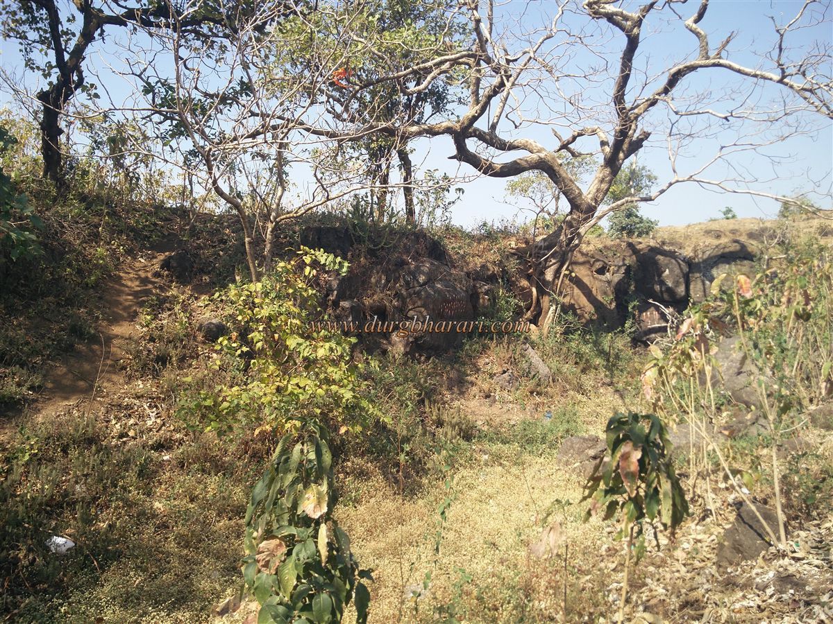
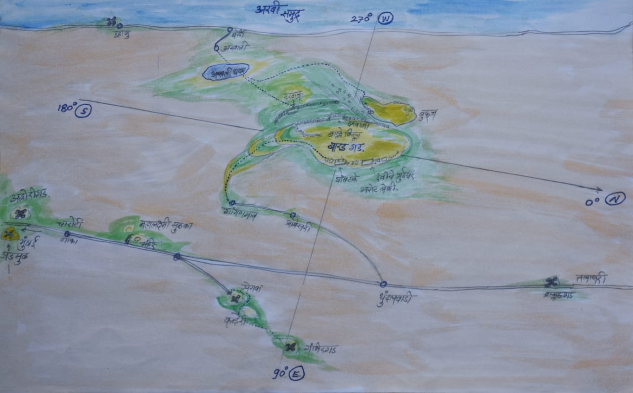
The fort holds numerous remnants such as moats, caves, rock-cut cisterns, ruined gates, ramparts, bastions, and a flag pedestal — all waiting to be preserved. Bardgad can be approached from three surrounding villages: Aswali, Gangangaon, and Karjgaon. The trails from Aswali and Gangangaon are primarily in use.
Bardgad is 138 km from Mumbai via the Mumbai-Ahmedabad highway. From the Dhundalwadi Phata, the route continues through Ambesari to Gangangaon. If traveling by private vehicle, this is the most convenient and quickest route, taking about two hours to reach the fort. For those using public transport, approaching from Aswali is more suitable. The nearest railway stations are Gholvad and Bordi Road on the Western Railway line. Both are about 9 km from Aswali, and local rickshaws are available.
From Aswali, the trail to the fort crosses a dam embankment and takes around 2.5 hours. Although there is water on the fort, it's not potable, so one should carry sufficient drinking water. As there are local deities on the fort, the main trail is well-trodden. However, the plateau below the fort is crisscrossed with cattle paths, so it is advisable to take a local guide.
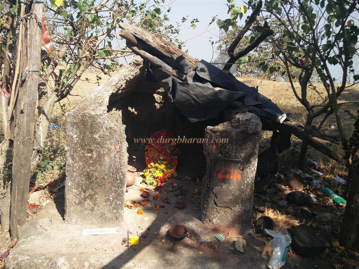
From Gangangaon, a one-hour climb through dense forest brings you to the Bori-cha-Mal plateau, situated on the southern side of the fort. From here begins the proper trail to the fort. Passing through a karvi thicket, one encounters several small shrines to forest deities. Despite being an uphill trek, the shade of the forest prevents exhaustion.
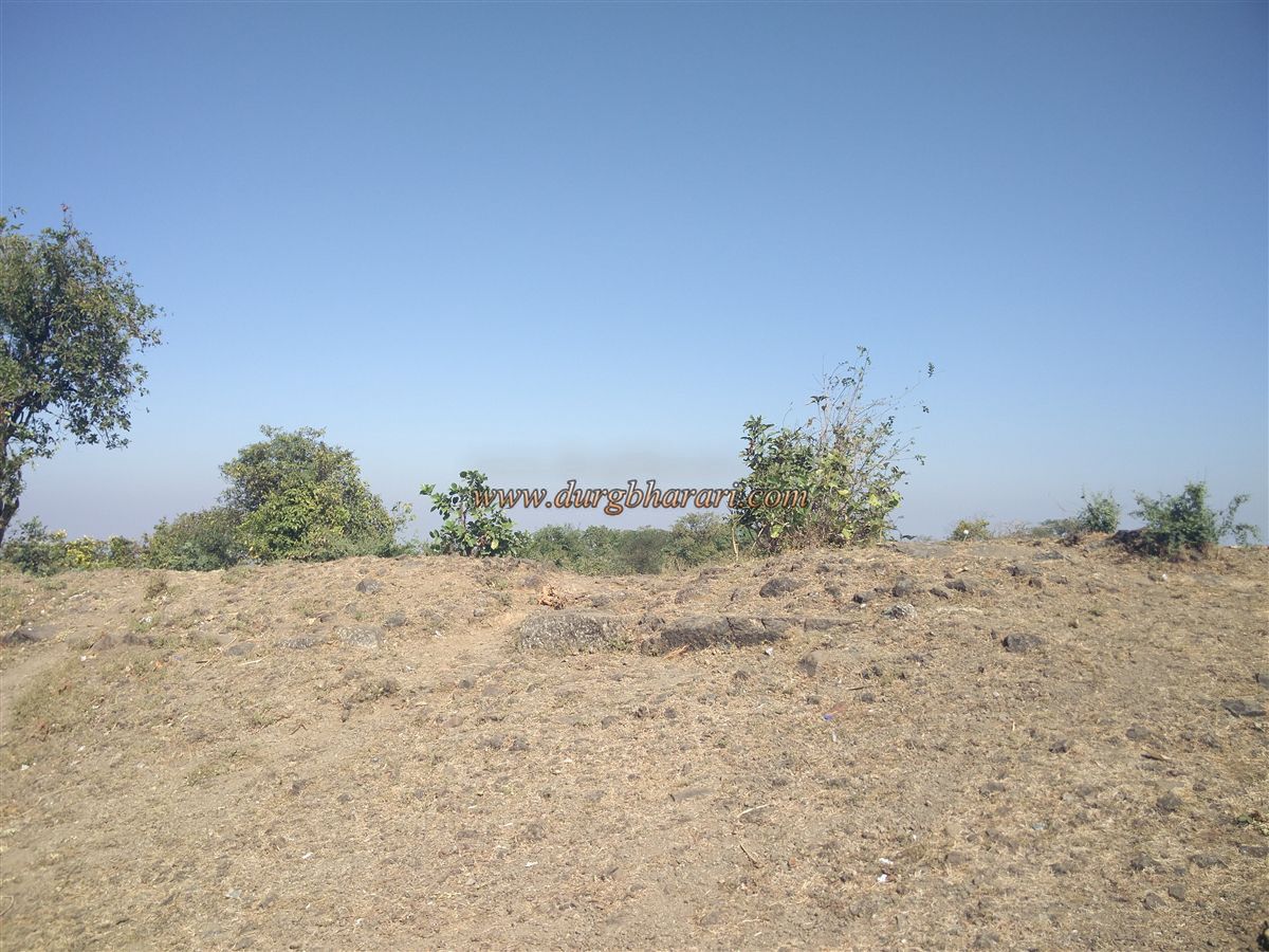
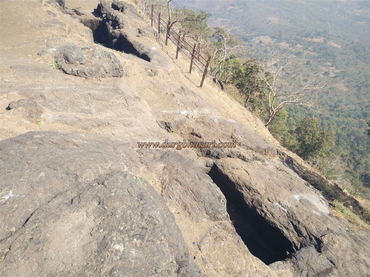
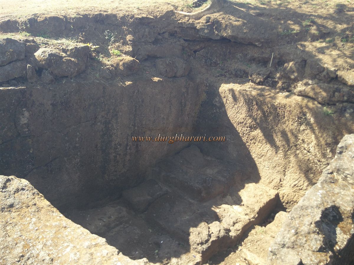
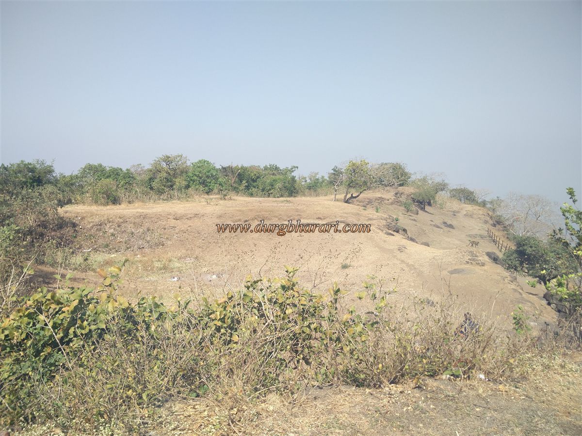
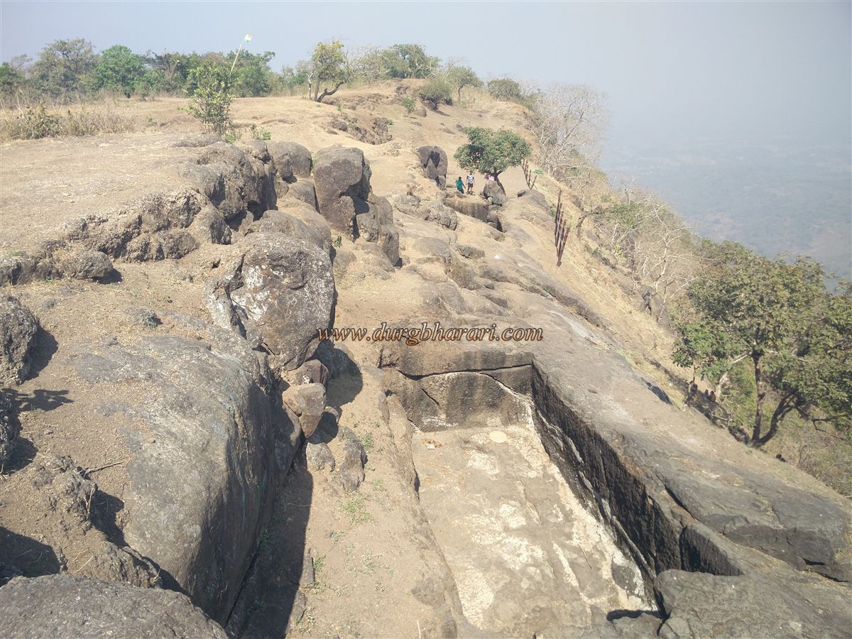
After around 45 minutes, you reach the moat in front of the ruined rampart. Since the moat was never completed, this section partially connects to the main fort. In the moat stands a domed temple, but the carvings have eroded beyond recognition. The fort's rampart above the moat is reduced to a buried base. This is the highest part of the fort, offering views of the flat expanse that makes up the forts interior.
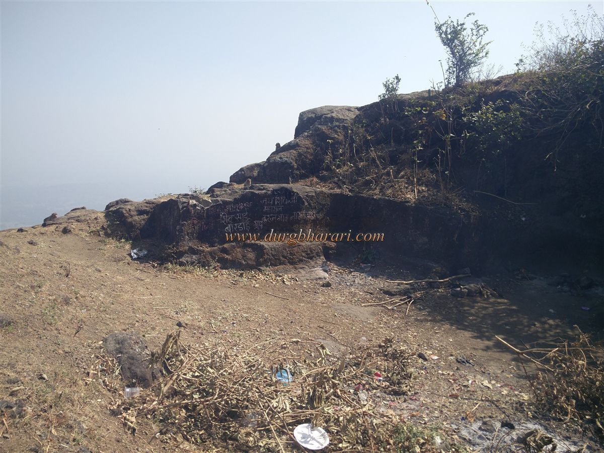
The fort sits at an elevation of 1,710 feet above sea level and covers a 10-acre area in a north–south alignment. A deep valley provides natural defence on the eastern side, and so no construction is visible there. On the remaining three sides, ruined ramparts from 2 to 5 feet high are visible.
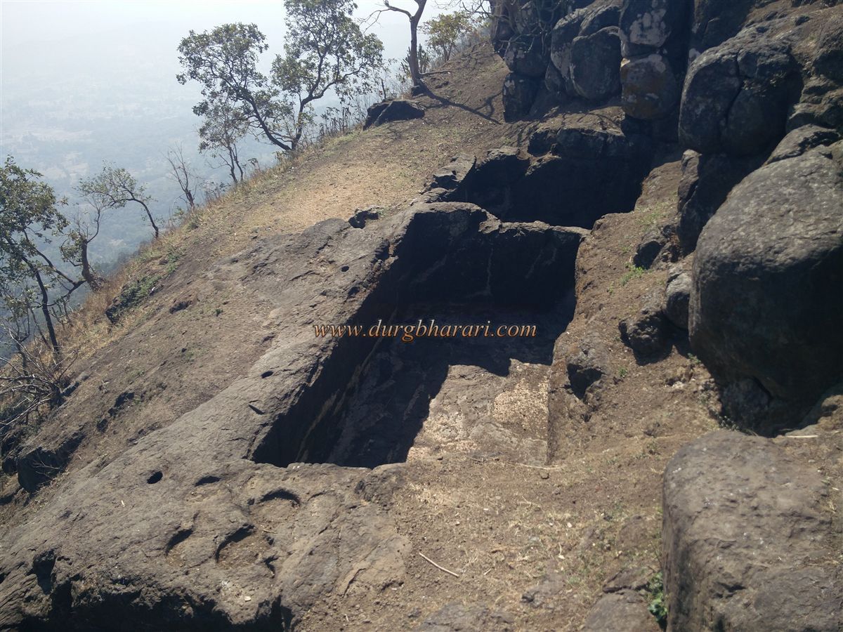
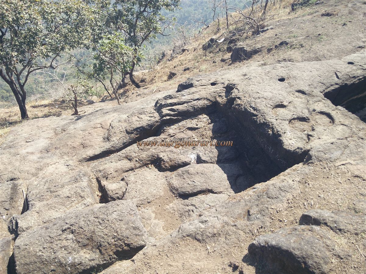
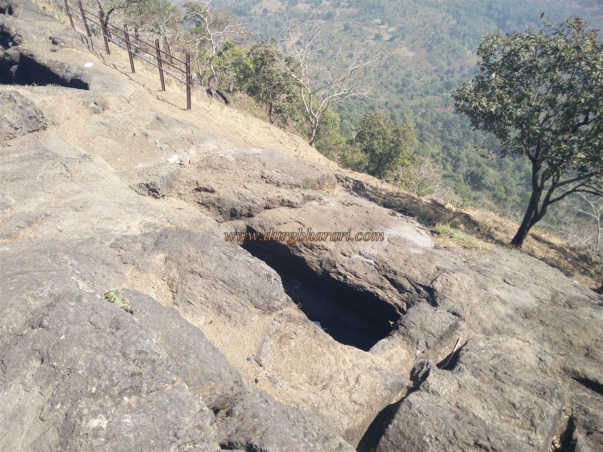
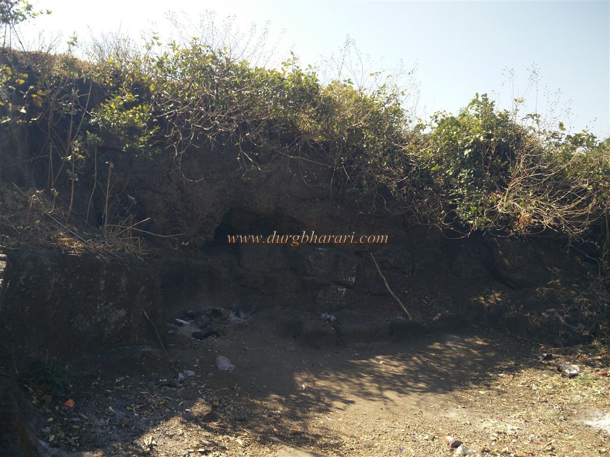
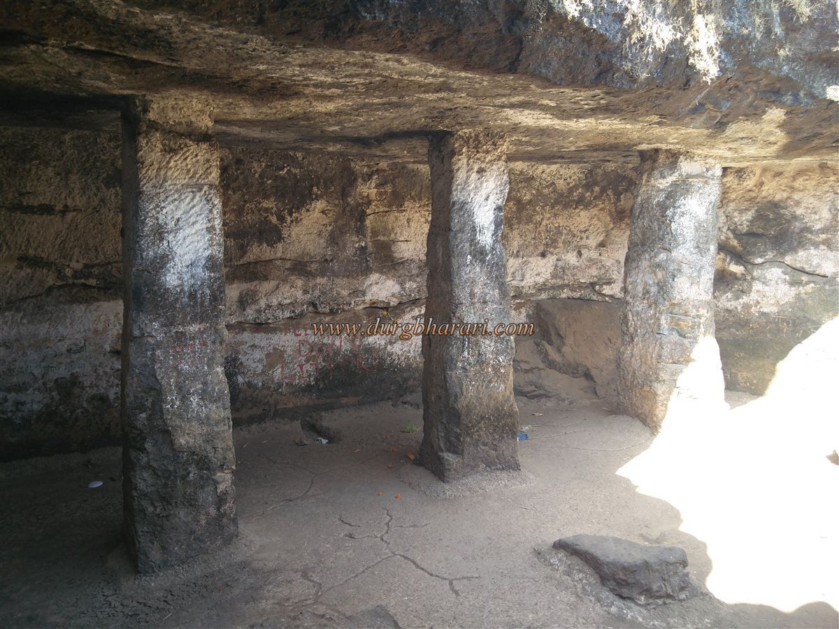
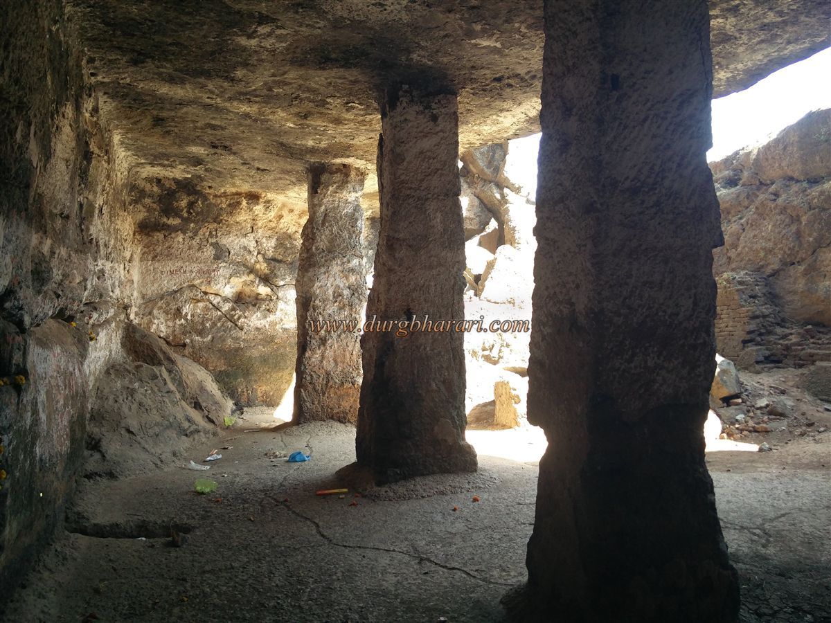
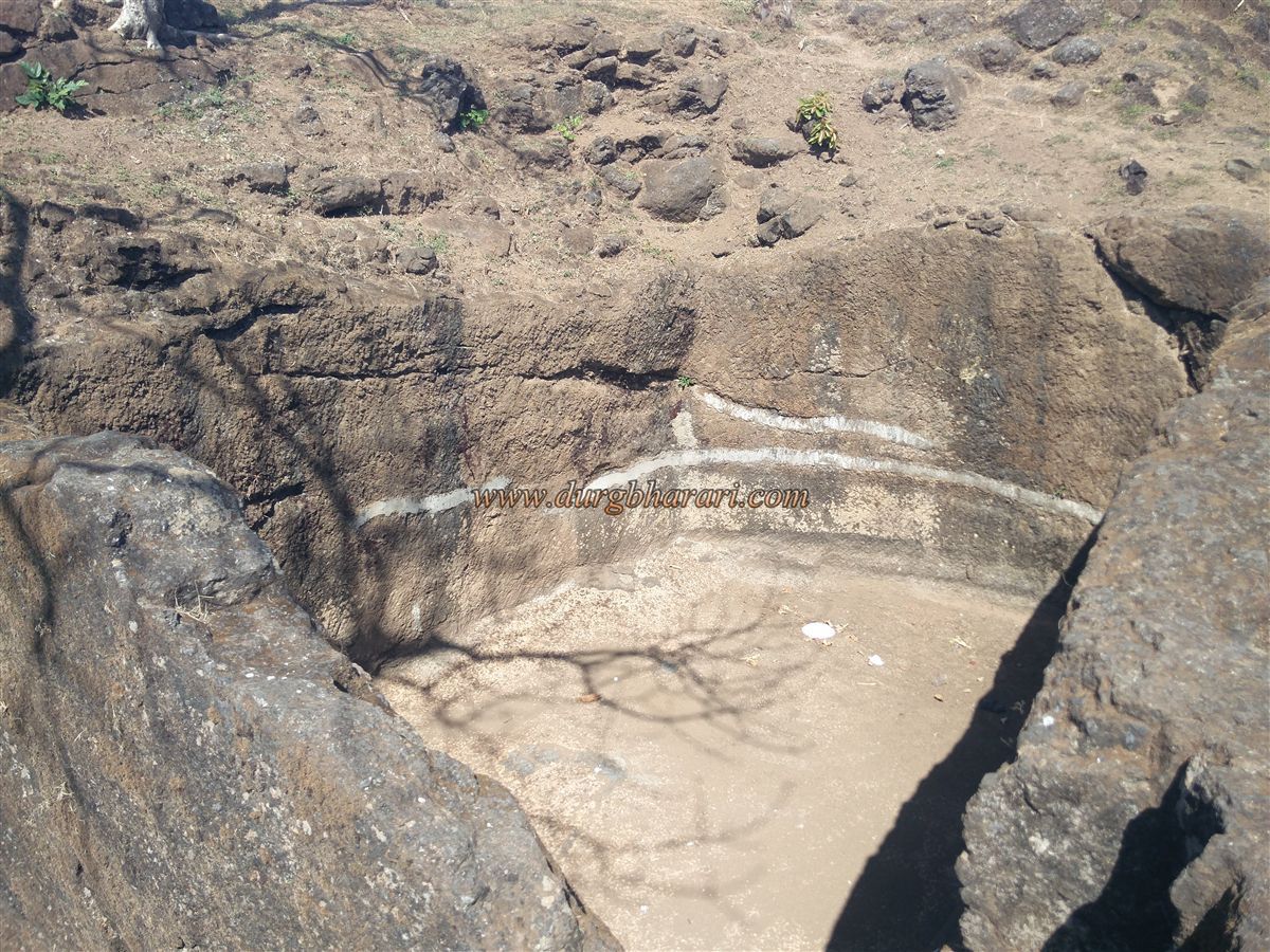
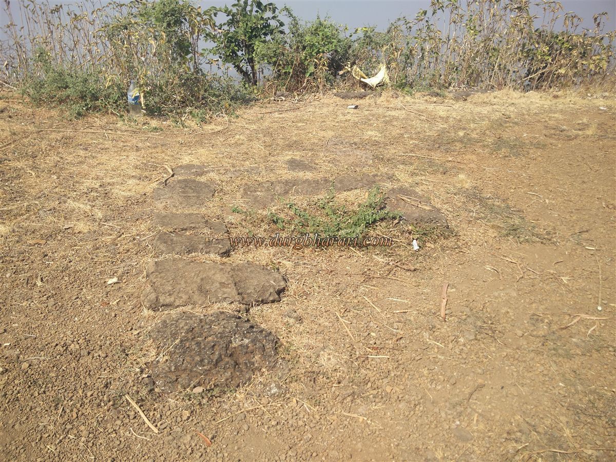
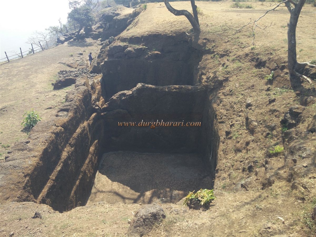
At the entry point, there are two rock-cut cisterns, now filled with silt. On the right edge, near the cliff, are 5–6 more cisterns carved into the rock, along with two stone-pillared caves. Some cisterns are incomplete, and chiselled stones used for construction are clearly visible nearby. All cisterns are currently dry, except one with water unfit for drinking due to algae, though it may be usable after boiling and filtering.
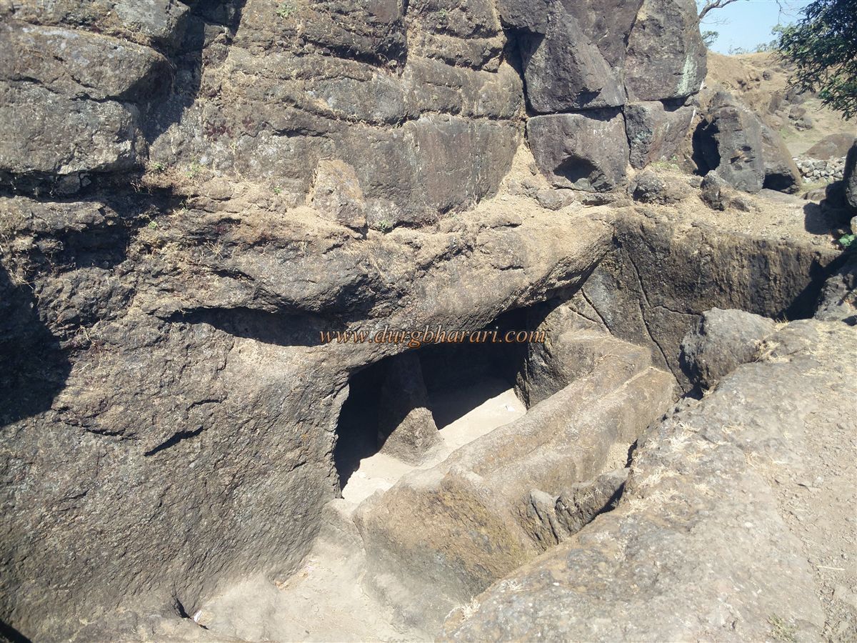
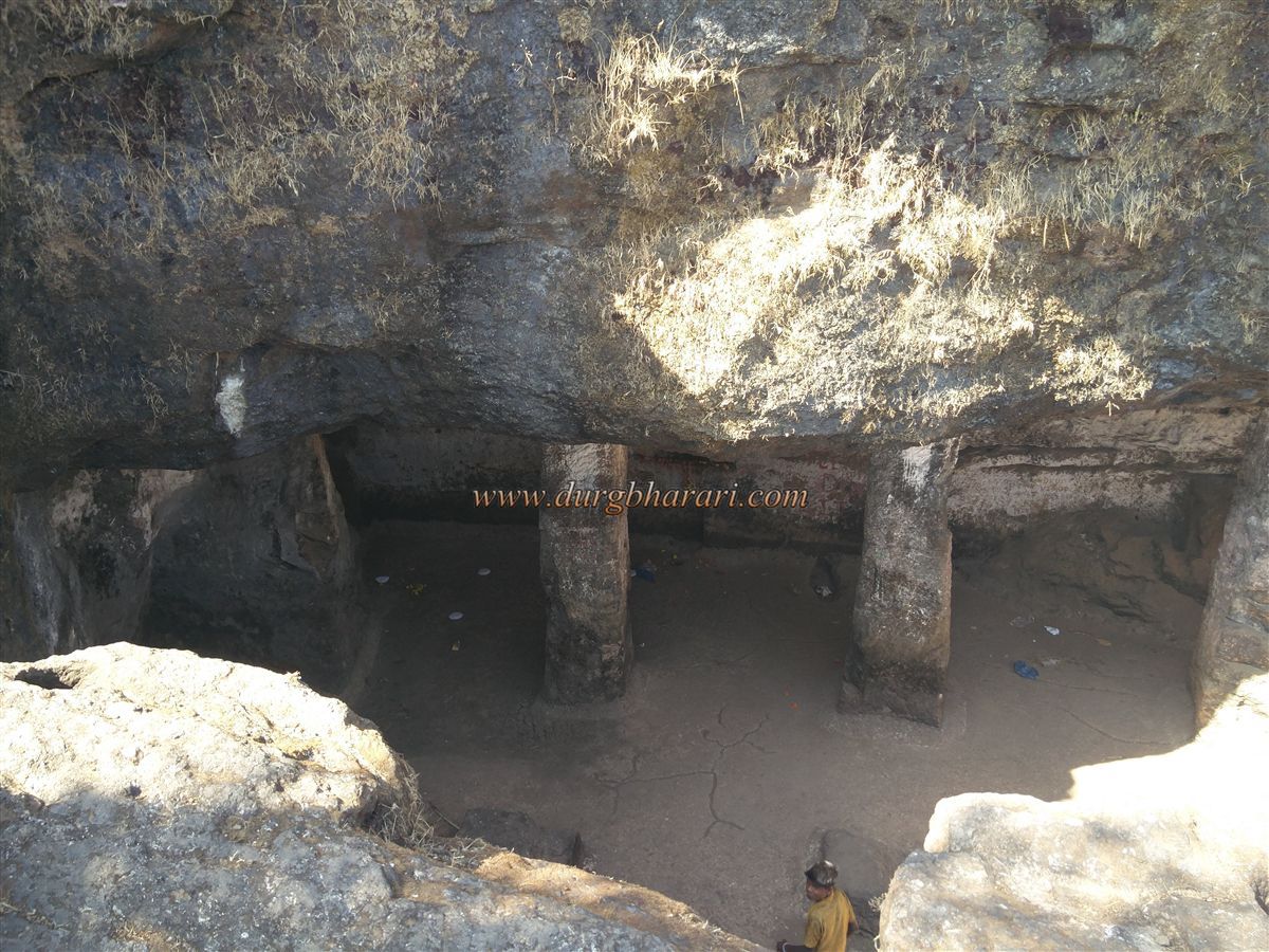
Among the caves, the larger one with five supporting pillars is known locally as “Devi's Bhuighar.” Two of the pillars have collapsed. Inside, remains of ancient brickwork are visible. There's also a small water tank inside the cave, but its water is also undrinkable. The second cave lies deeper within the rock-cut structure and is supported by a single pillar. Due to the fort’s obscurity, only a handful of trekkers visit these caves.
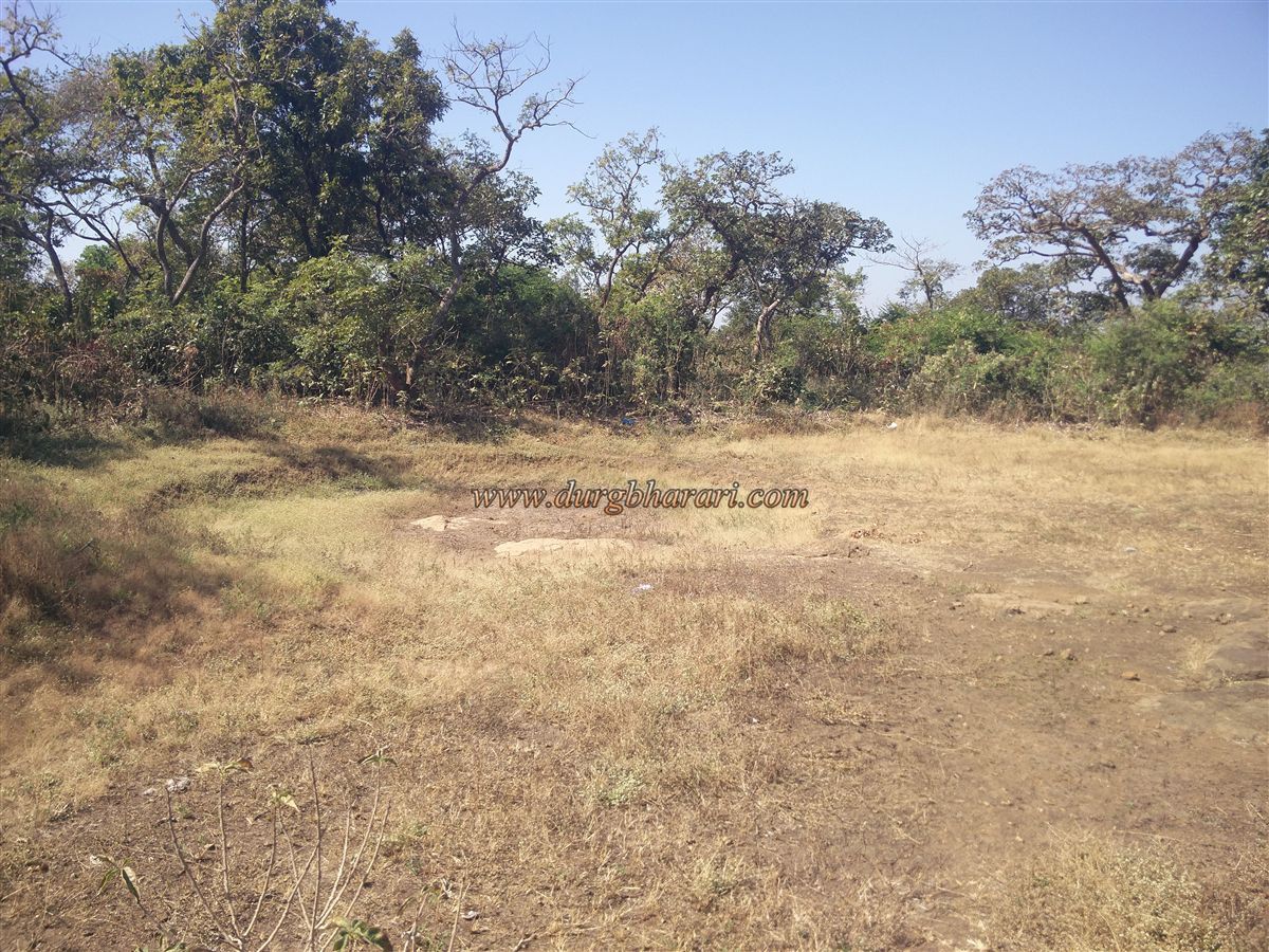
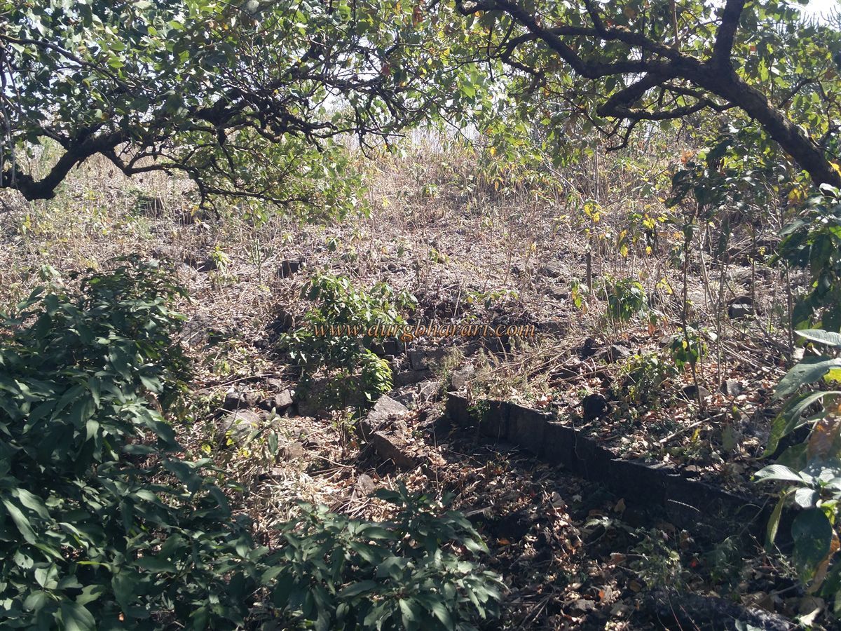
Official records label these as "Barad Caves" and basic iron railings have been installed for protection, but further conservation has been left to nature. After exploring this area, the trek continues northward. To the left, there’s a dried-up lake, now filled with silt. Moving on, two paths diverge — one going downhill and the other continuing straight. Take the straight path to see more of the fort.
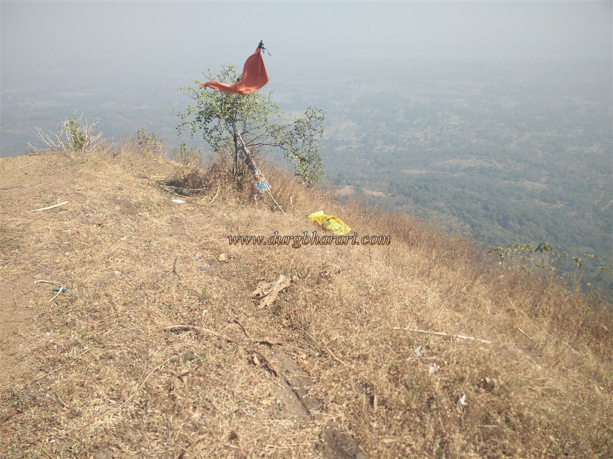
The northern tip of the fort features two narrow spurs. On the northeast spur, a square bastion houses a flag pedestal. The third access route to the fort, from Karjgaon, enters through this bastion. After exploring this section, descend back along the earlier path. Between the two spurs lies a ruined, north-facing gate — once the main entrance from Karjgaon. That path is now defunct, and the new route enters from the bastion instead.
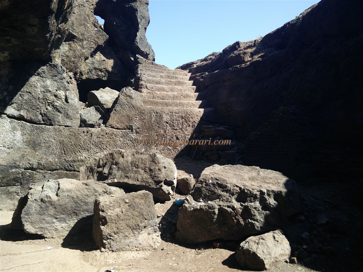
Descending through thorny vegetation, a few intact stone steps are visible. This route from the second spur was once the main Aswali access. Where the rampart descending from the main gate joins the upward rampart from below, a stone foundation suggests the presence of a small gate.
A bit further, more constructed steps appear outside the ramparts, hinting at yet another possible gate. Walking along the rampart is difficult due to thick vegetation, but it eventually leads back to the entry point. The rampart is built from 5–6 layers of dressed stone, and scattered stones and remnants can be seen all around.
Instead of circling the rampart, you can descend via the steps to find another section of cross-ramparts. From the Aswali spur, the fort’s entry was once heavily fortified with twin ramparts and two gates. Though fort enthusiasts rarely visit, local alcoholics frequently use the site, polluting the area.
Both the fort and the plateau below are surrounded by dense forest. Two hours is sufficient to explore the entire fort.
After the Sultan of Gujarat defeated King Bimba of Mahikavati (Mahim), Bimba's dynasty settled in Mumbai. Later, European trading powers took control of the region. The Portuguese defeated the Gujarat Sultanate and captured North Konkan, making Vasai their capital. Their reign ended in 1739 due to Chimaji Appa’s Vasai campaign.
During this campaign, letters exchanged between Chimaji Appa and his commanders reveal important insights. To capture Badlapardi Fort, Chimaji Appa sent Satyavaji Jadhav, son of Pilaji Jadhav, and, due to strong defences at Daman, dispatched a knowledgeable aide, Raiji Shankar.
In a letter dated January 5, 1739 (Shaka 1660, Paush Shukla 5), Chimaji Appa writes:
“Shri Rajshri Satvoji Jadhav Gosavi — adorned with eternal prosperity and royal honour, blessings from Chimaji Ballal. We have called upon Ramnagarkar Rajya for a meeting. If you are engaged in capturing Badlapardi, then also keep Ramnagarkar with you and complete the task. If Raiji Shankar is assigned a duty, let him remain. If no action has been initiated, then do not detain Masharnil. Send him instead. A hill near Dahanu must be fortified — he will build it. In summary, whether or not the Badlapardi operation is underway, please inform us of the situation.”
This confirms that Satyavaji Jadhav captured Badlapardi Fort on January 5, 1739, and Chimaji Appa had decided to build a fort near Dahanu, assigning Raiji Shankar for the job.
Geographically, Bardgad near Dahanu is a strategically advantageous hill — offering a panoramic view of the vast sea and inland areas. The attempts to fortify this hill seem clear and purposeful.
Note: Special thanks to Jagdish Gajanan Dhanmeher of Sahyaspandan for his valuable support during the Bardgad exploration.
© Suresh Nimbalkar
GALLERY