AVCHITGAD
TYPE : HILL FORT
DISTRICT : RAIGAD
HEIGHT : 974 FEET
GRADE : MEDIUM
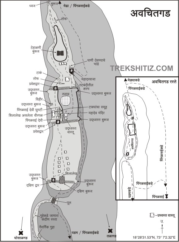
Avchitgad is a fort located in the hills near Roha village on the banks of the Kundalika river in Konkan. This fort is surrounded by dense forests. In the medieval period Talgad, Ghosalgad, and Birwadi were important forts in the protective fort chain on the trade route from Nagothane port to Savashni Ghat. Avchitgad Fort, which is important for the protection of Kundalika Bay, is inaccessible due to the dense forest surrounding it. Alibag and Pen are to the north of the fort and Roha and Murud taluka’s are to the south. To reach this fort in Roha taluka, there are villages like Medha and Pingalsai at the northern and southern foothills of the fort. Later these two paths come together in the ravine below the fort. Pingalsai village is at a distance of 4 km from Roha village and Medha village is at a distance of 6 km.
...
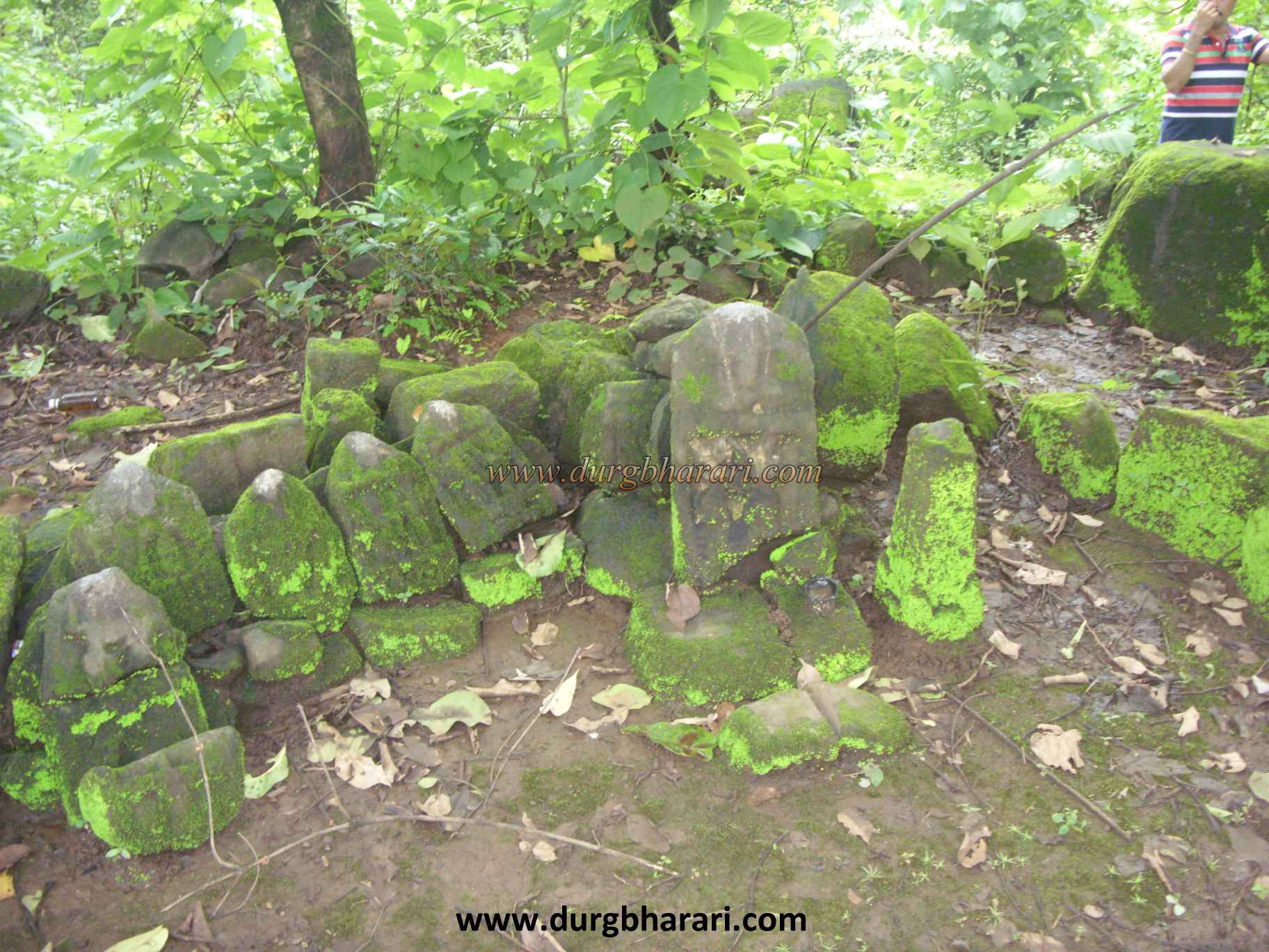
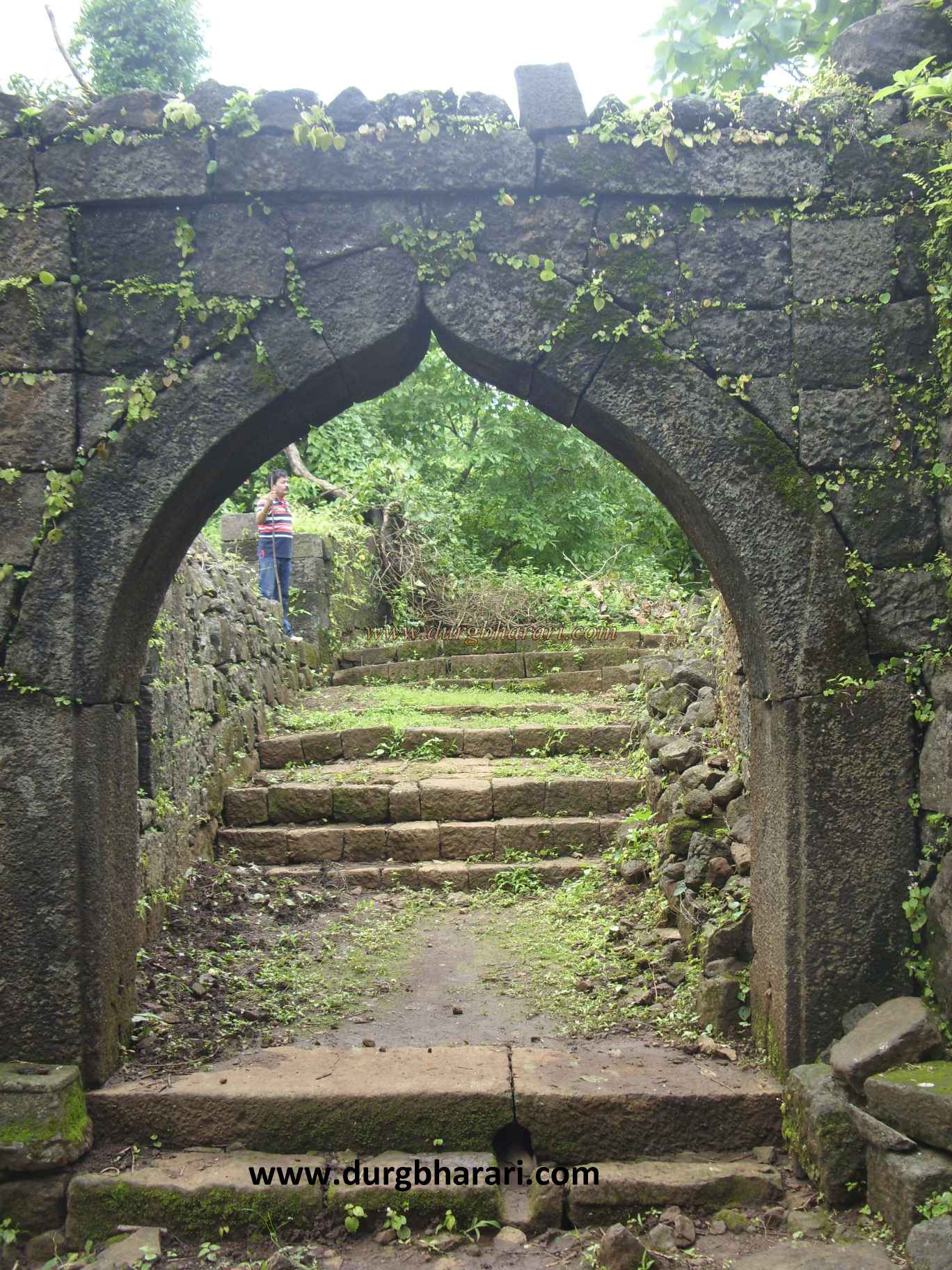
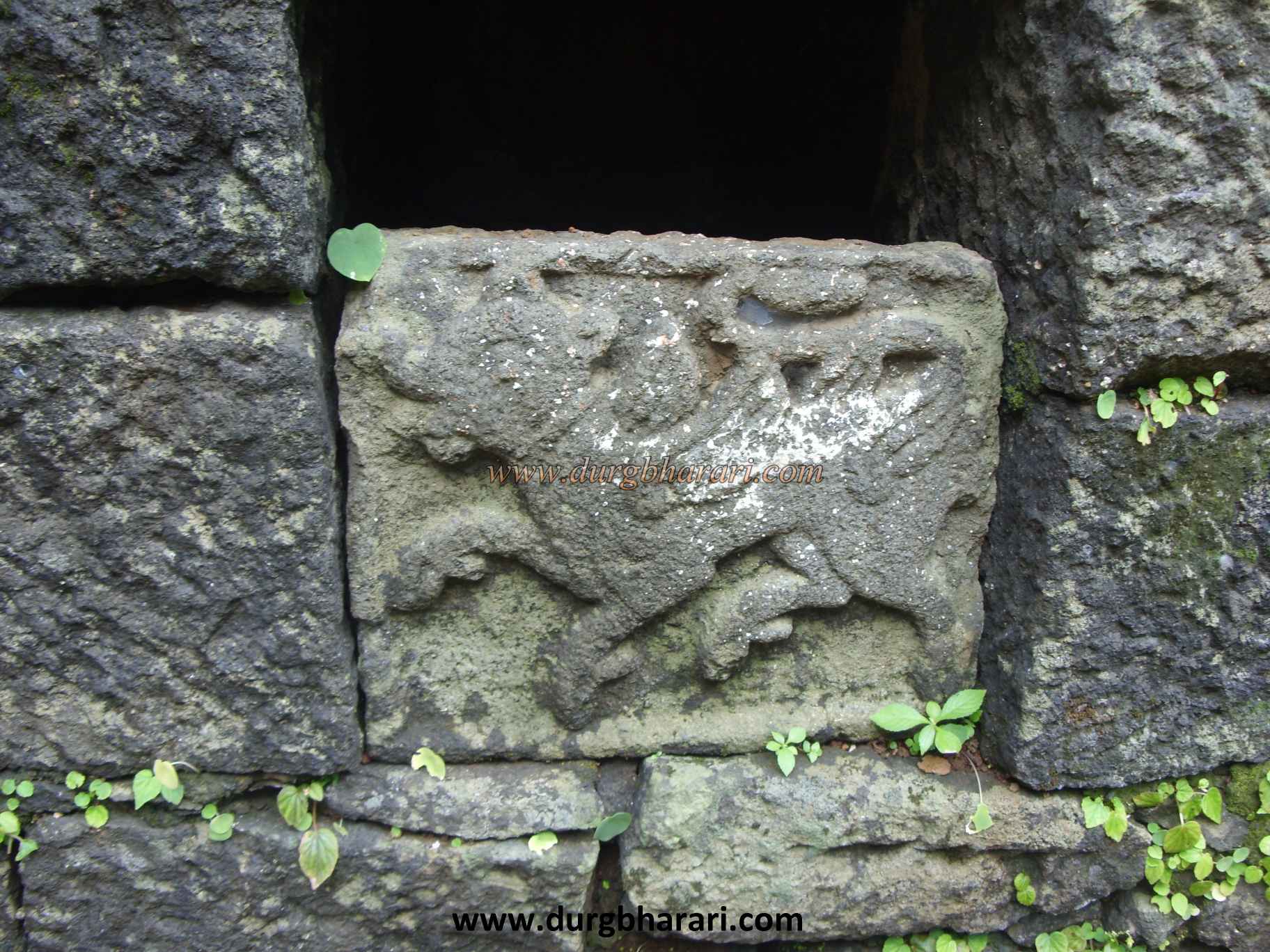
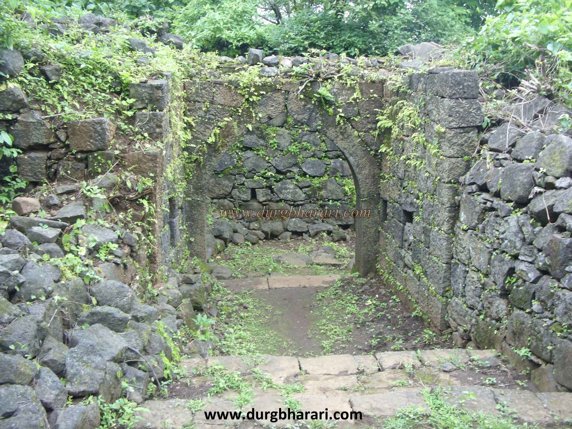
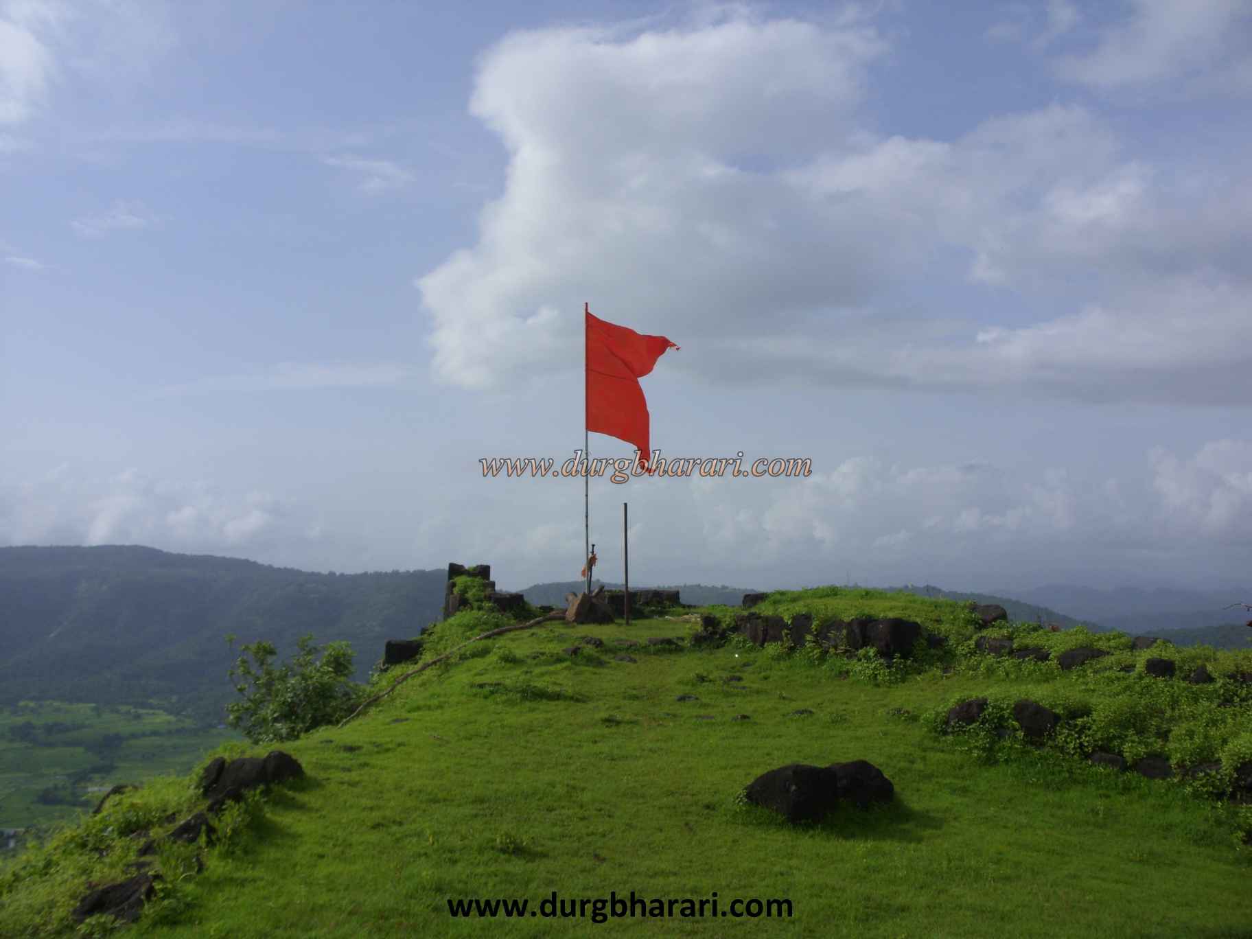
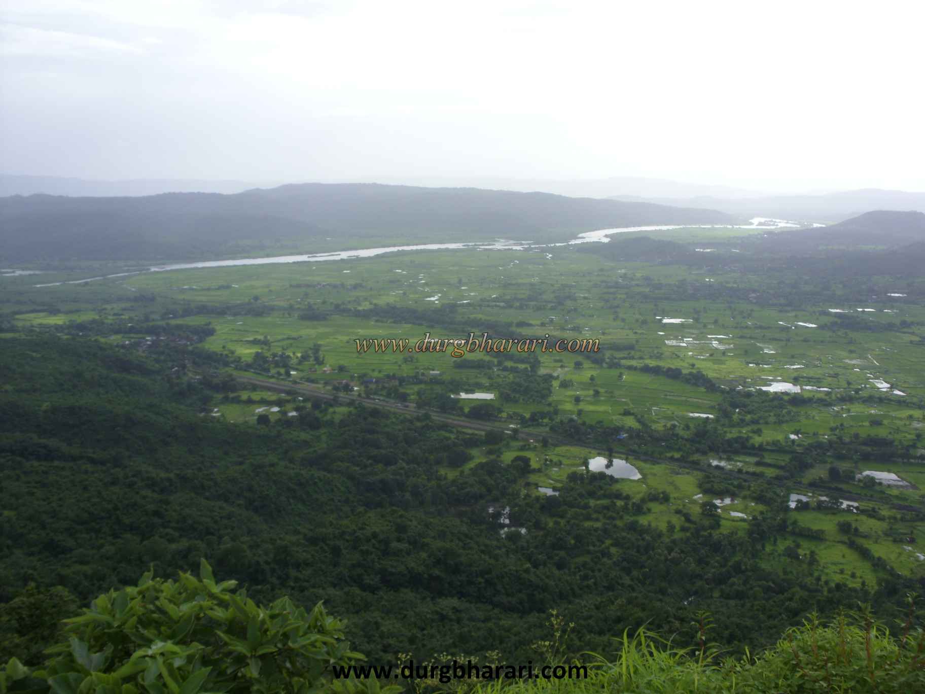
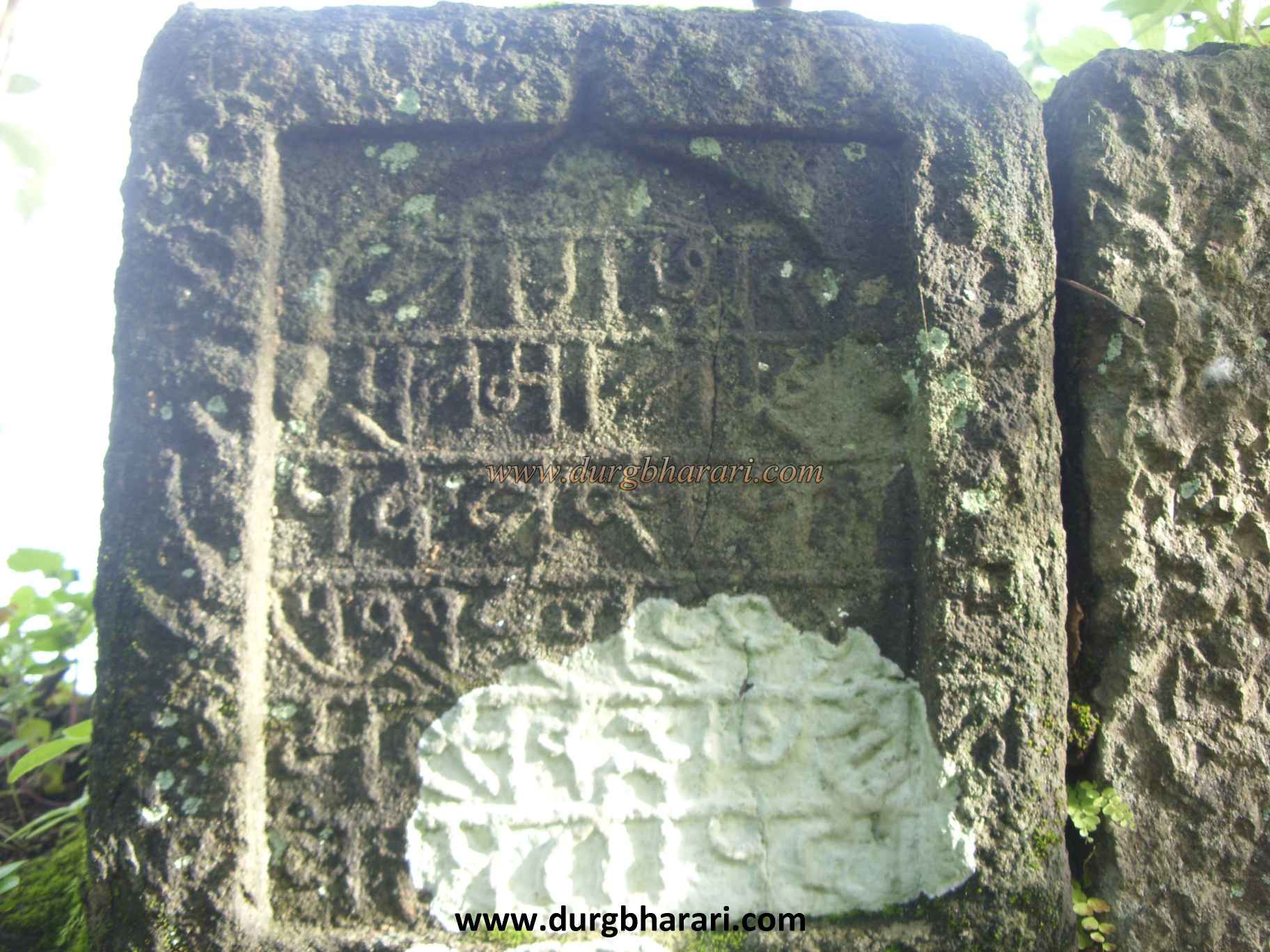
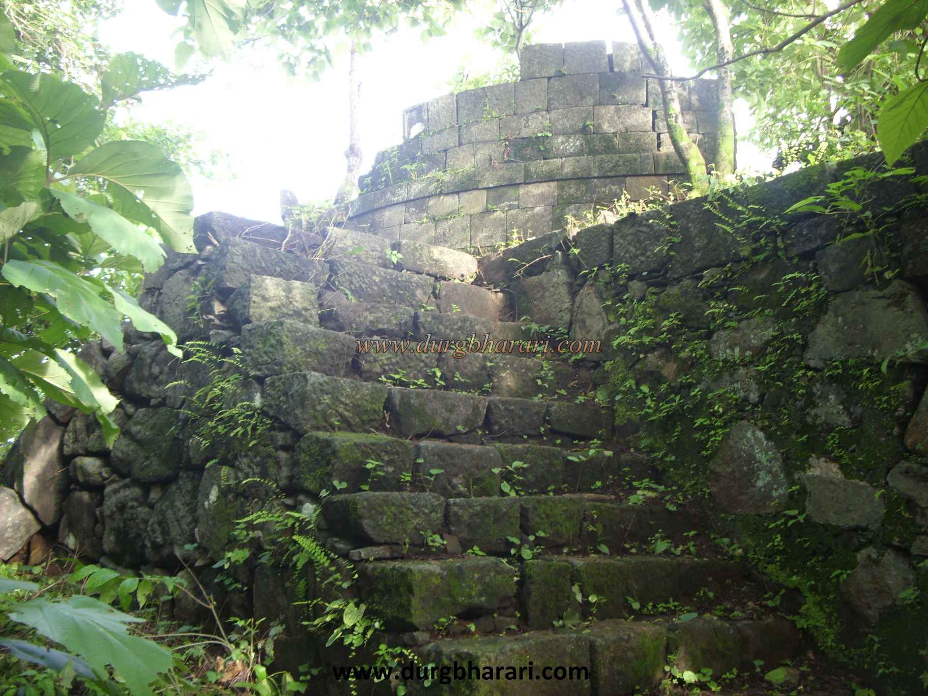
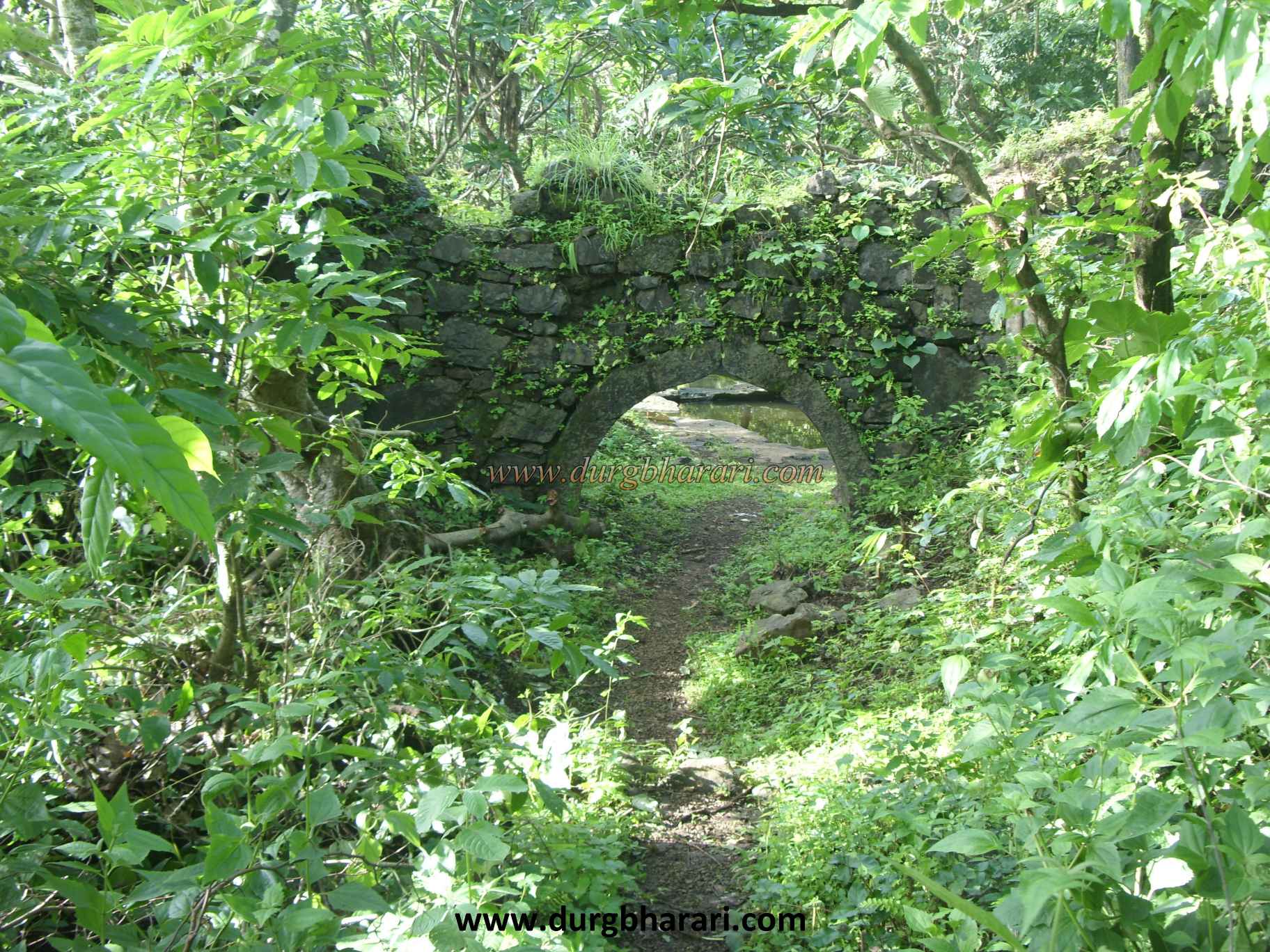
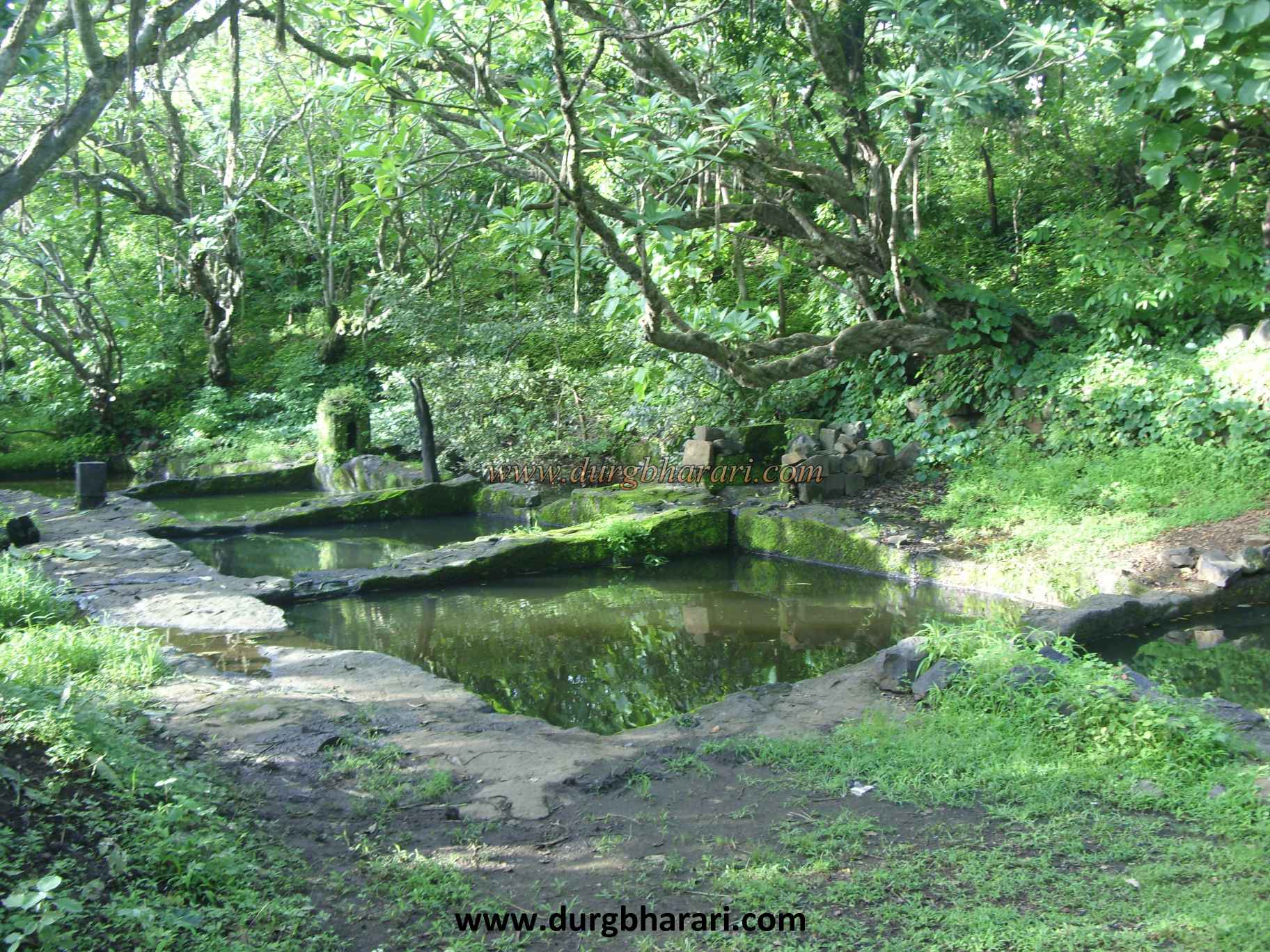
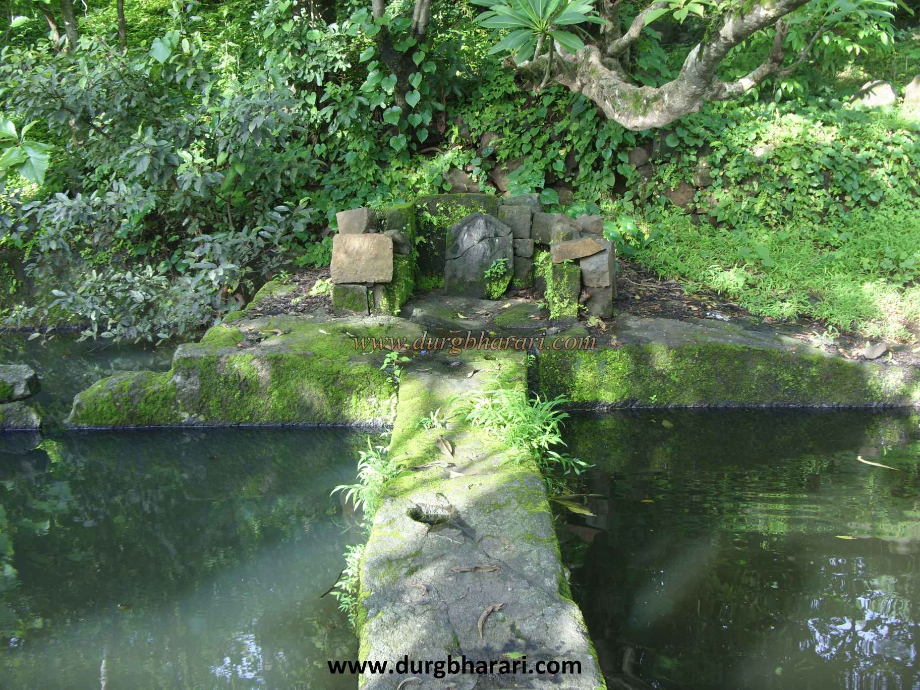
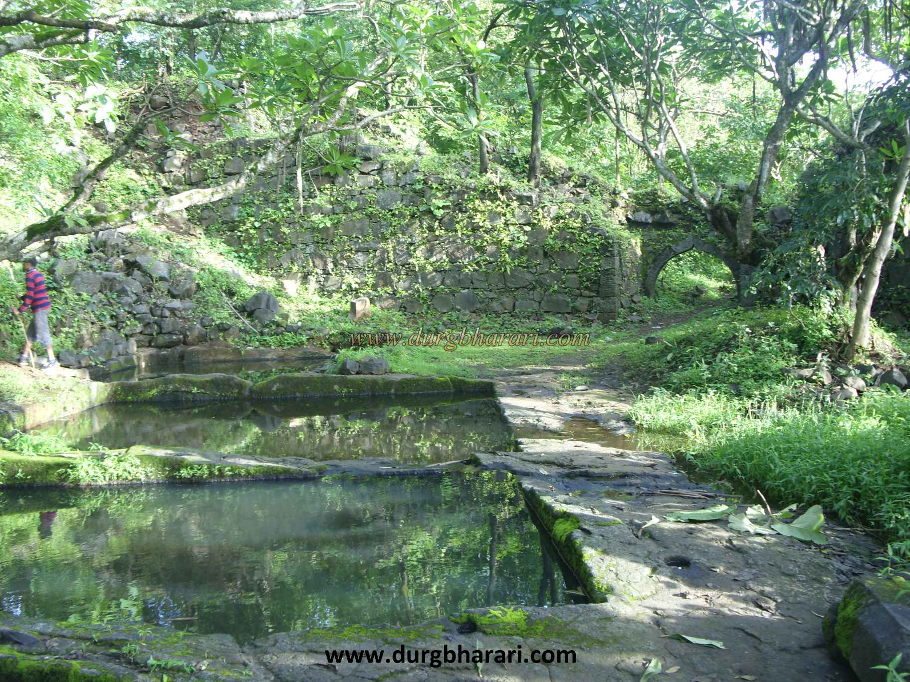
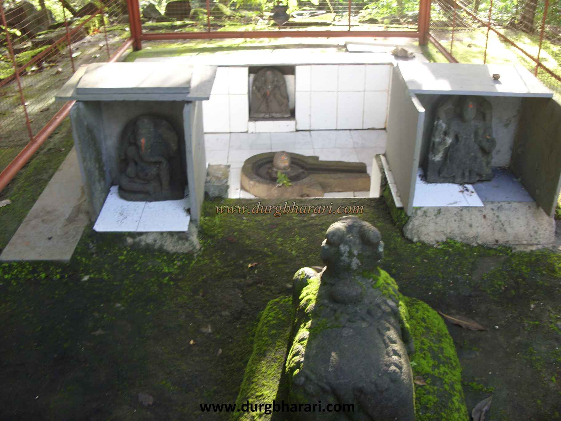
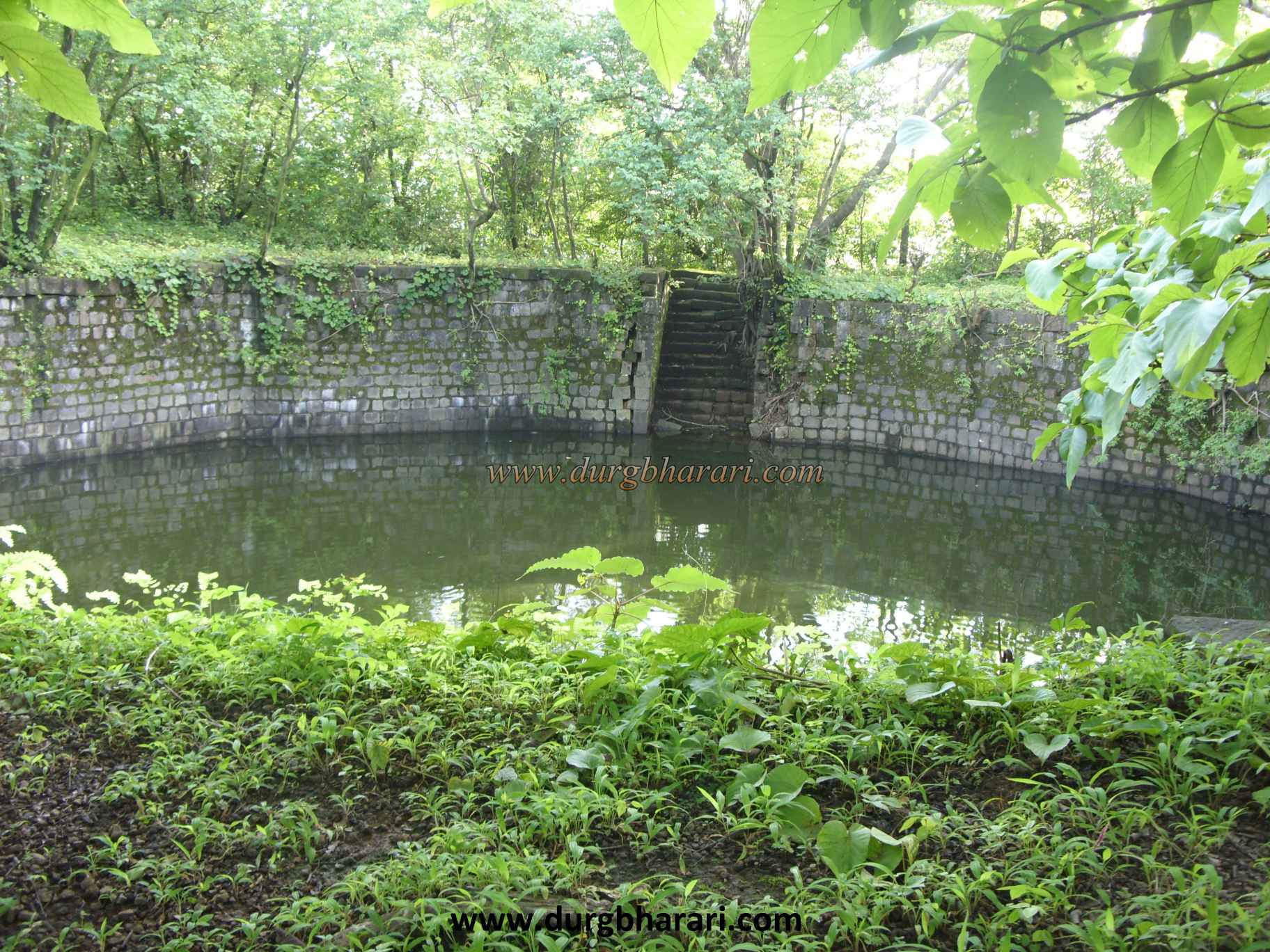
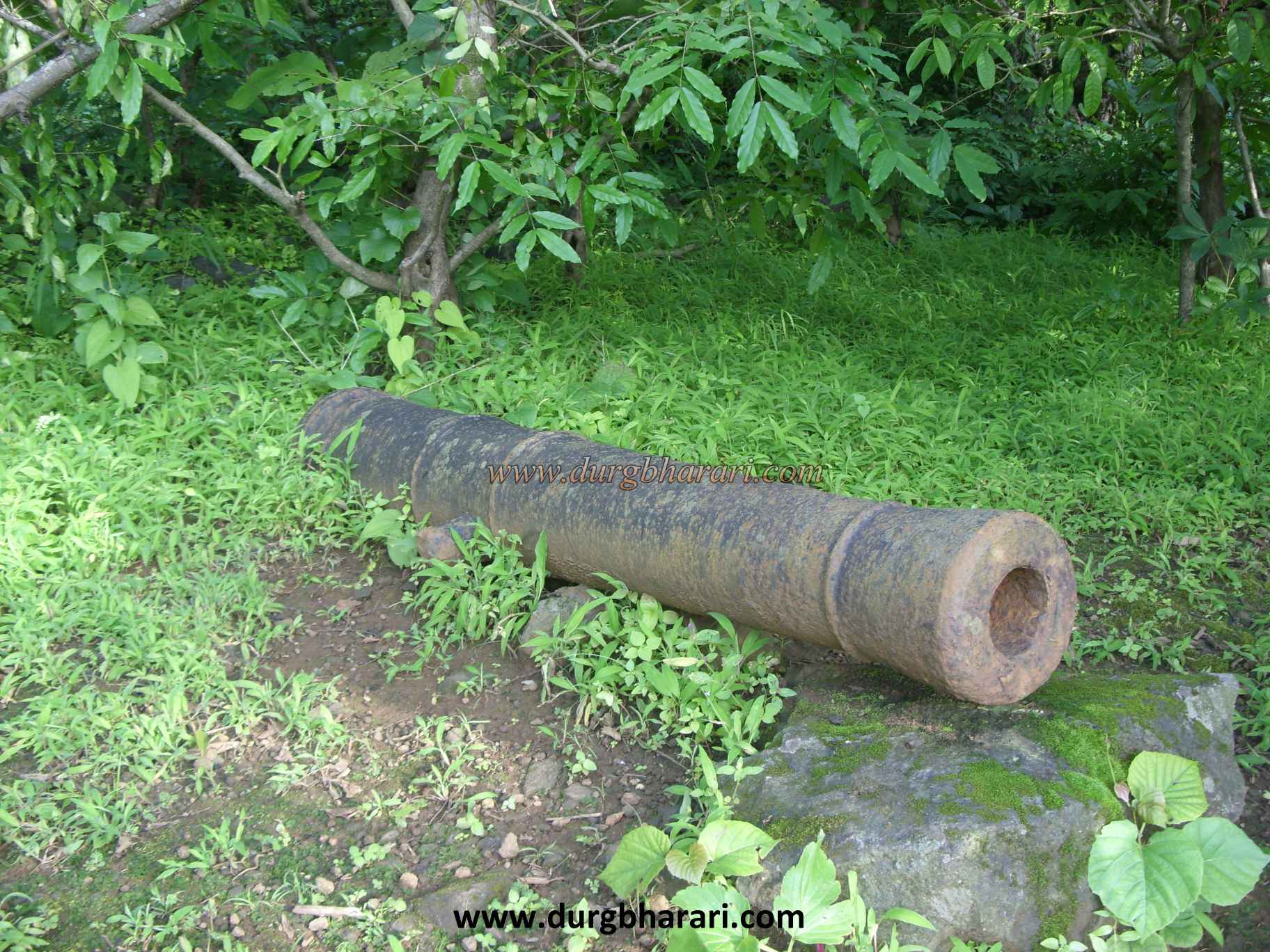
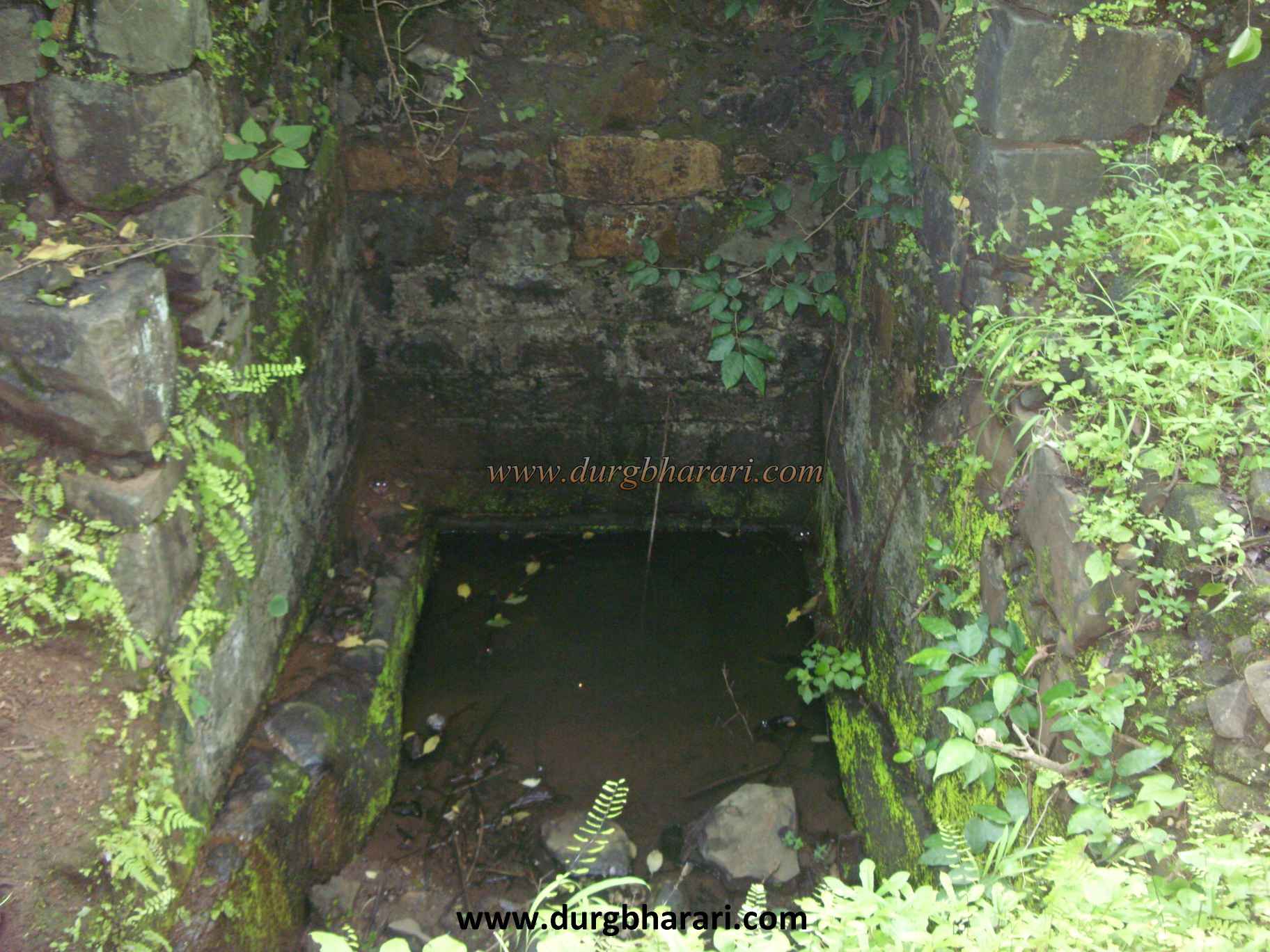
In about two hours, we reach the gorge below the fort. As there is no potable water on the fort, you should start your journey with enough water from the village. In the gorge, you can see some worn out sculptures of hero stones. After a 10 minute vertical climb through the gorge, we reach the ruined east-facing gate of the fort. The ramparts of the main gate and the bastion around it have collapsed, and only the arch of the inner gate still stands. A Sharabh sculpture can be seen among the remnants. Once you enter through this door, you enter the fort. In front of the door, there are remnants of a mansion and this should be the headquarter of the fort. The head of the fort, which is tapering on both sides, is 965 feet above sea level and is spread over 7 acres from south to north. The ends of the fort are enclosed by bastions on both sides and the hummock in the middle is fortified and converted into a citadel. After entering the fort, turn right and first look at the northern part. There are some stone structures on the hummock in this area. The construction of the bastion at the northern end of the fort is partially destroyed and a medium-sized cannon has been placed on the bastion. After seeing this part of the fort, turn back and come to the door. The straight path from here takes you to the citadel. The gate of the fort on this road has been destroyed and its remains are scattered around. Much of the citadel is covered by a large lake. Stairs are built to descend into this moss-filled lake. In the next part of the lake, there is a temple of Lord Shiva under a tin shade and in this temple Shivling, Ganapati, and idols of some other deities can be seen. Next to the temple is the remains of a building. On the lower side of the temple, there are seven small water tanks carved in the rock. The water in one of these tanks is potable after filtered. Near the tank, there is a pillar three feet high. The inscription on this column depicts it as the memorial of Baji Pasalkar. Adjacent to the wall near the tank is a broken sculpture. The path that goes under the arch of the citadel near the tank takes you to the south side of the fort. The ruins of some houses can be seen on the way. The south side of the fort is surrounded by fortifications and a bastion is built in the center. To reach this bastion, there are steps attached to the ramparts and there is a square shape inscription on this bastion. The inscription is: "Shri Ganeshay Namah Shri Jaydev Shak 1718 Nalanam Sanvatsare Chaitra Shuddha Pratipada." Shak 1718 is the year 1796 Chaitrashuddha Pratipada means Gudipadva. This means that this bastion or part of it must have been built on this day during the Peshwa period. From this bastion, Nagothane gorge, Birwadi fort, Kundalika river valley can be seen. The bastions at both ends of the ramparts have completely collapsed, and the gates in them only show their existence. After exiting through this door, we reach the south end of the fort. A moat is dug between the southern end of the fort and the hill beyond it. After seeing this part of the fort, you should turn back. A little further on from the group of seven tanks, on the left side, near the ramparts, you can see a deep well of square shape. A little further from this well is the third entrance to the citadel. Outside this door is another medium-sized cannon. Next to the cannon is a water tank carved into the rock on the edge of the valley. These tanks are usually dry except in the rainy season. Turning right from this tank, we reach the entrance to the fort. on this place your exploration completed. One hour is enough to walk around the entire fort. From the fort, you can see Tailbaila, Sudhagad, Sarasgad, Ghangad, Surgad, and the Savashni wharf area. The fort of Avchitgad seems to have been built as a military outpost during the Shilahar period, but Avchitgad has been mentioned in history since the seventeenth century. This fort was under Adilshah’s control during the reign of Shivaji Maharaj. Shivaji Maharaj's army conquered the fort from Adilshah in 1658. The fort was militarily rebuilt to keep an eye on the Portuguese of Chaul-Revdanda and the Siddi of Janjira. One of the sculptures on the fort is associated with Baji Pasalkar in the Mose valley. The fort was captured by Colonel Prorther in February 1818 during the Maratha war with the British.
© Suresh Nimbalkar
GALLERY