AUNDHA
TYPE : HILL FORT
DISTRICT : NASHIK
HEIGHT : 3993 FEET
GRADE : HARD
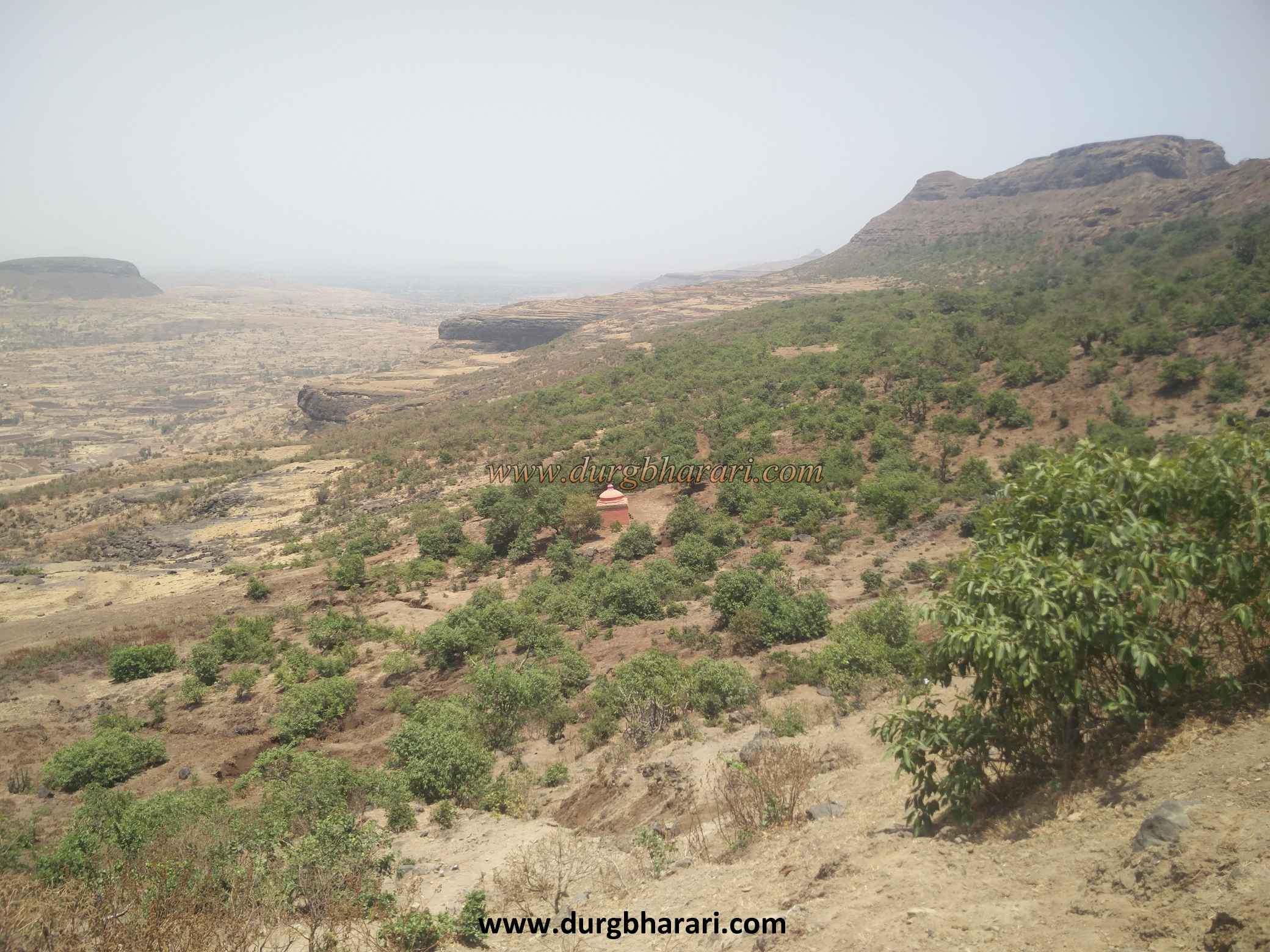
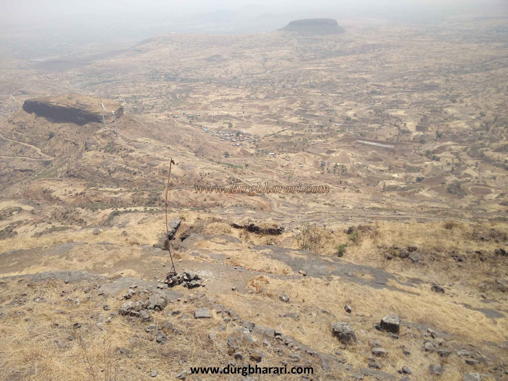
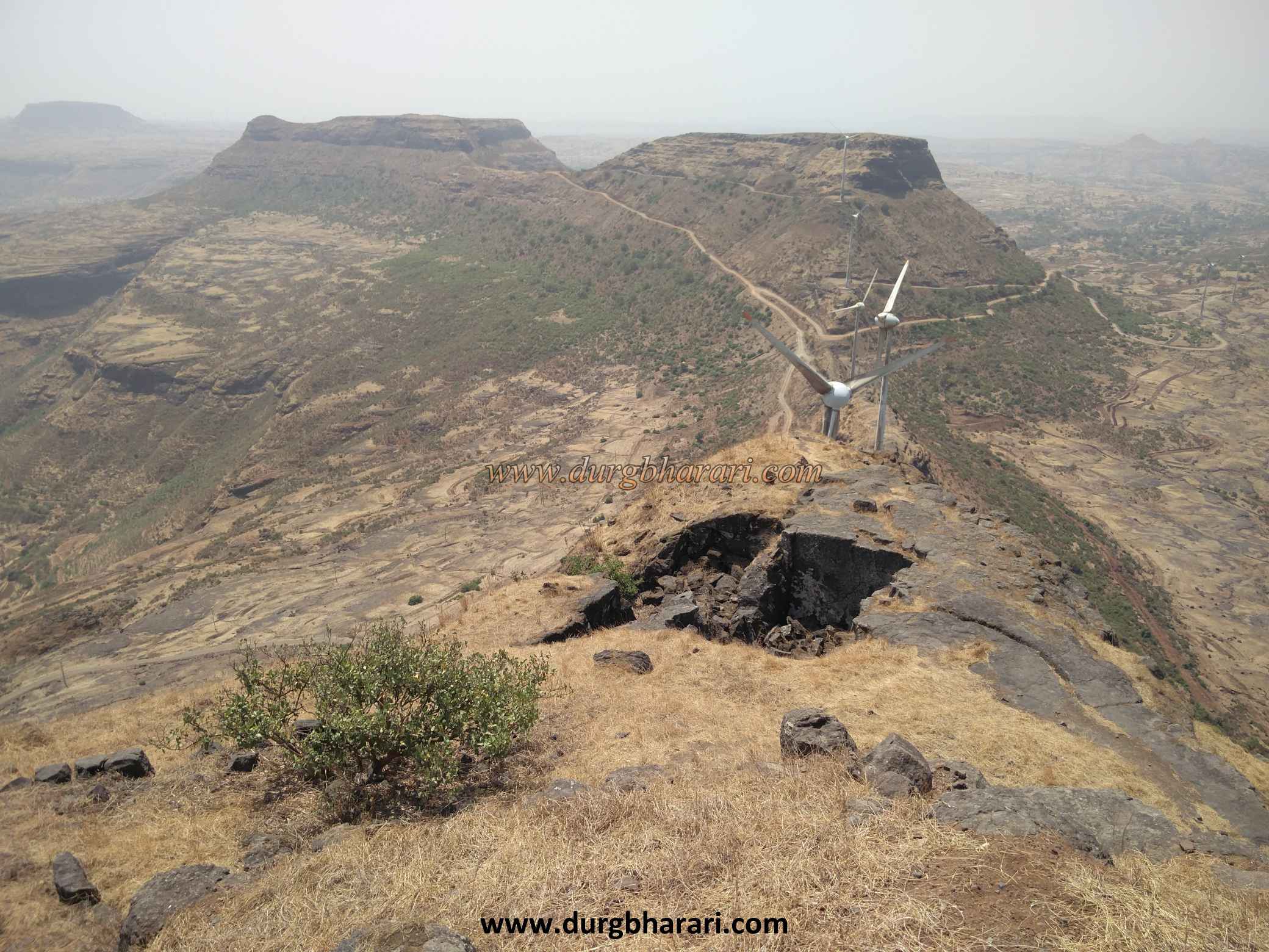
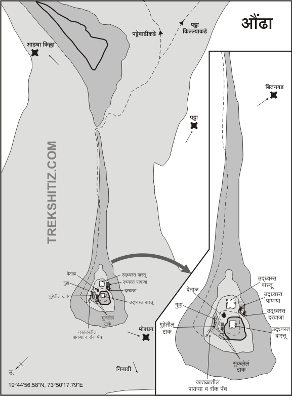
Kalsubai mountain range in Akole taluka is well known. Aundha, Patta, Aad and Bitanggad forts are situated to the east of this mountain range. In all these forts, Aundha fort is the fort that makes you feel the thrill of exploring. Situated on the border of Nagar and Nashik districts, this fort stands in the back of Pattagad with its cone piercing the sky. Of these, Pattagad is in Nagar district and Aundha fort is in Nashik district. Aundha fort is at a distance of 180 km from Mumbai via Ghoti, 200 km from Pune via Sinnar and 40 km from Nashik. There are three ways to get to the fort. The first of these is the Aundha-Patta trek. In this, the path descending from a hill trunk of Patta fort takes you to the base of Aundha fort in one and a half hours. The second path is Aundhawadi, a village at the bottom of the fort.
...
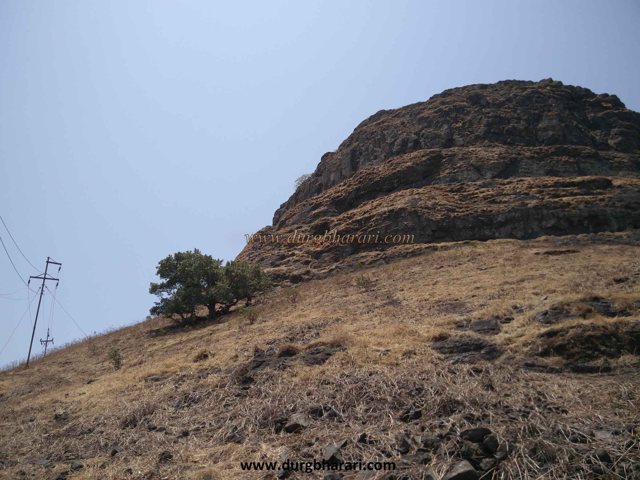
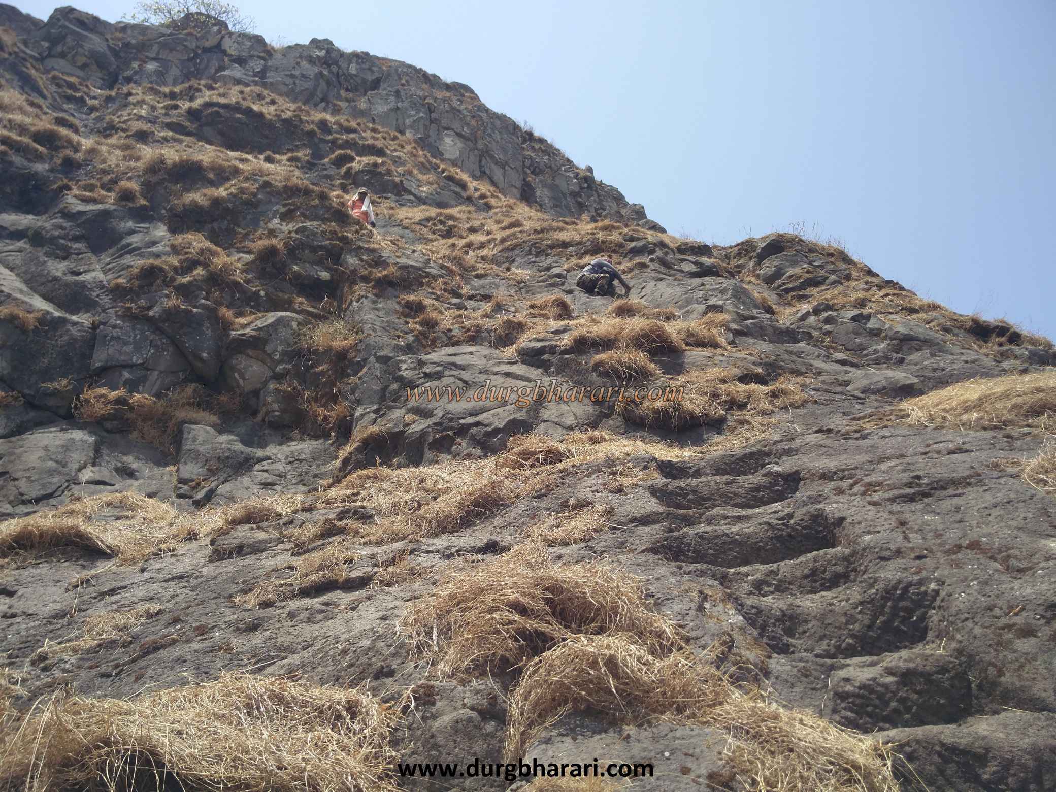
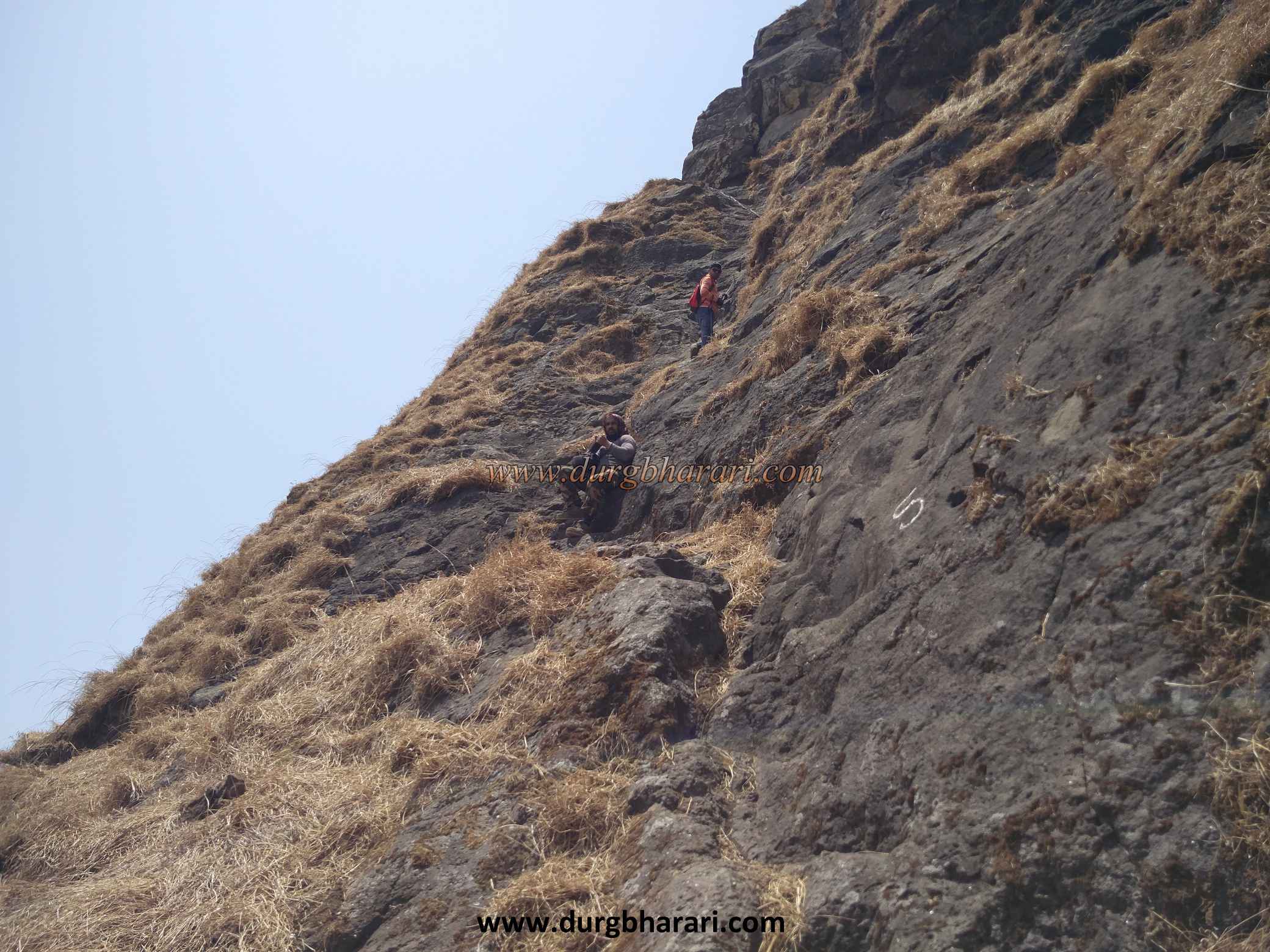
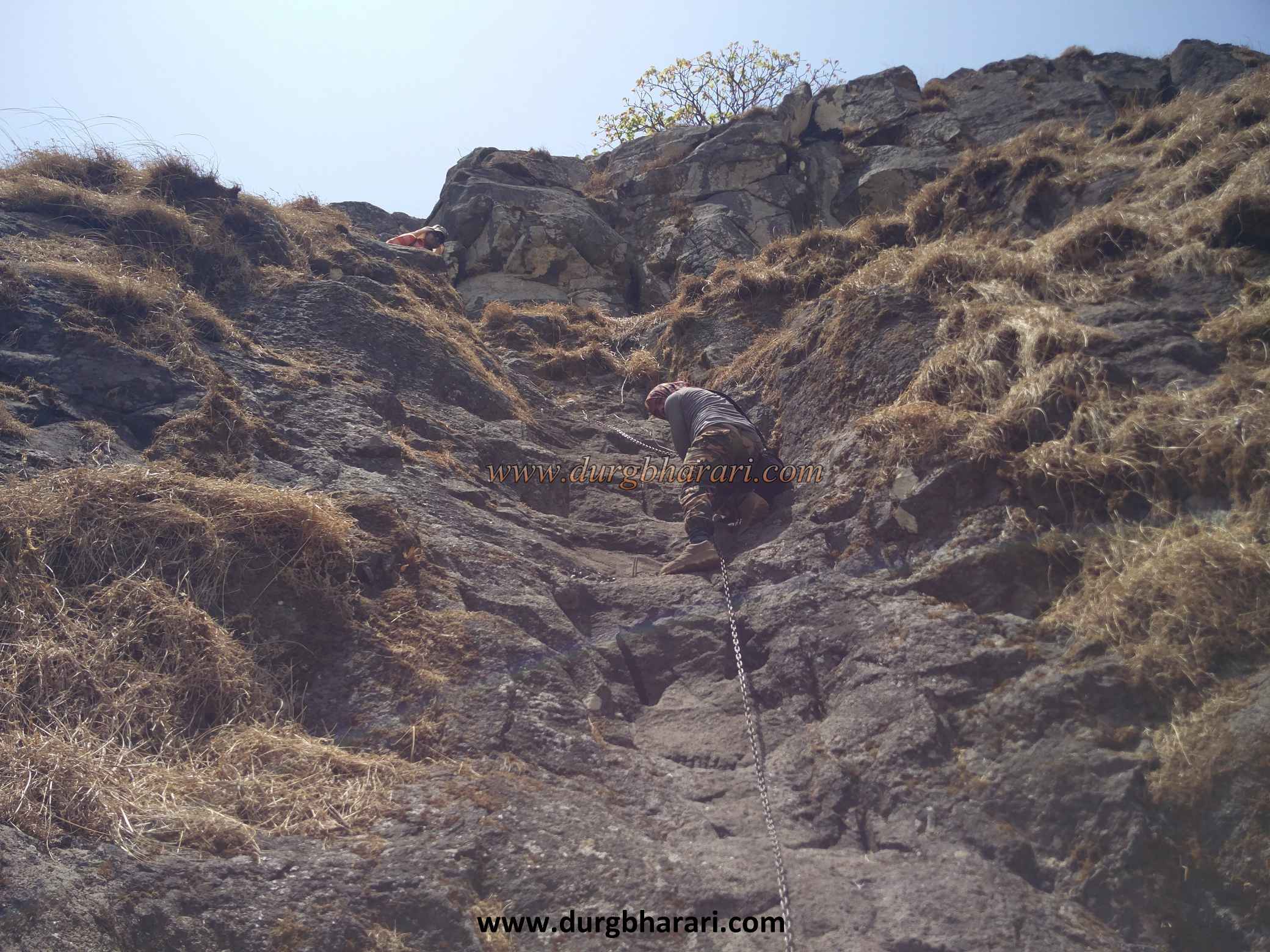
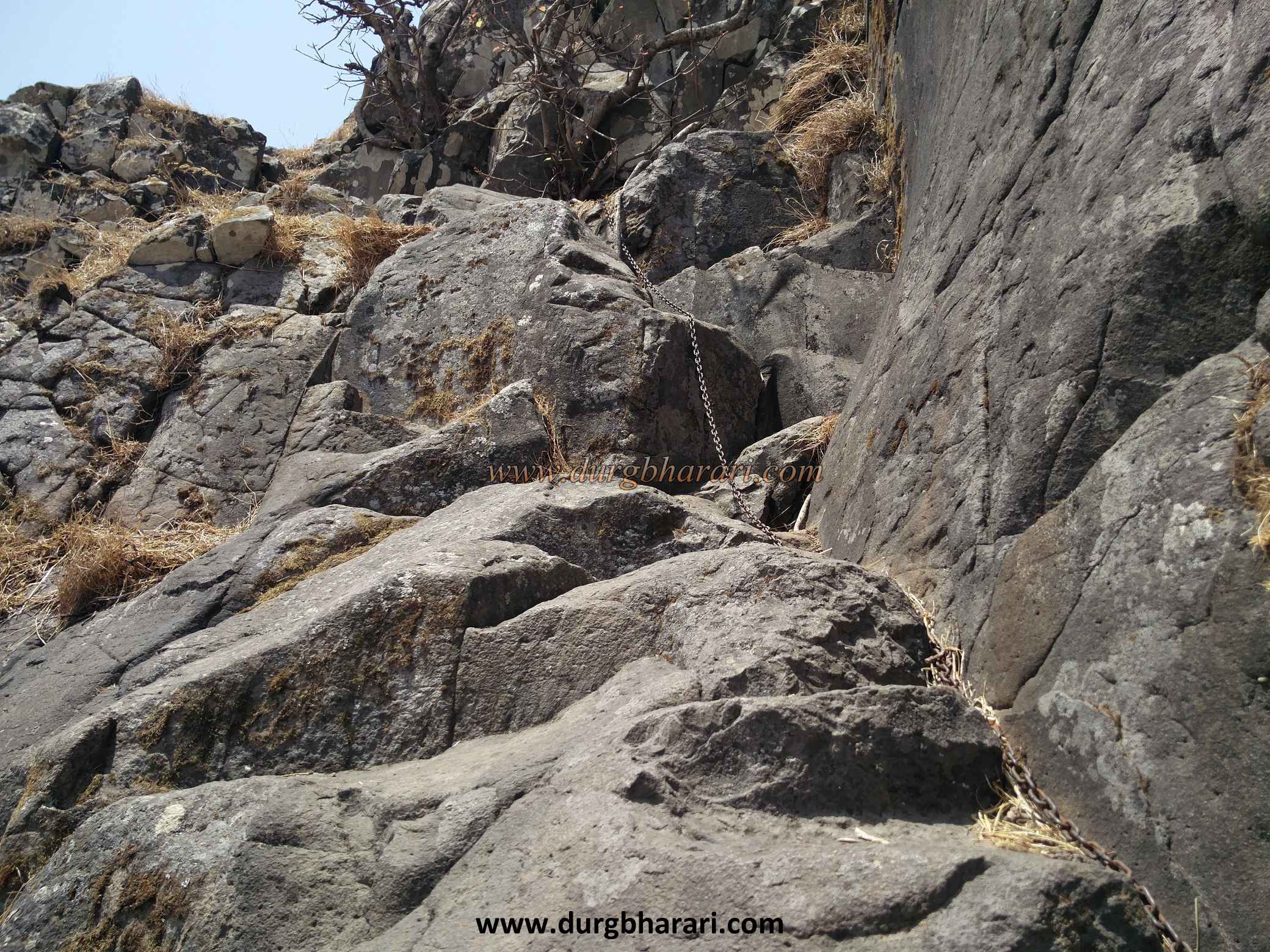
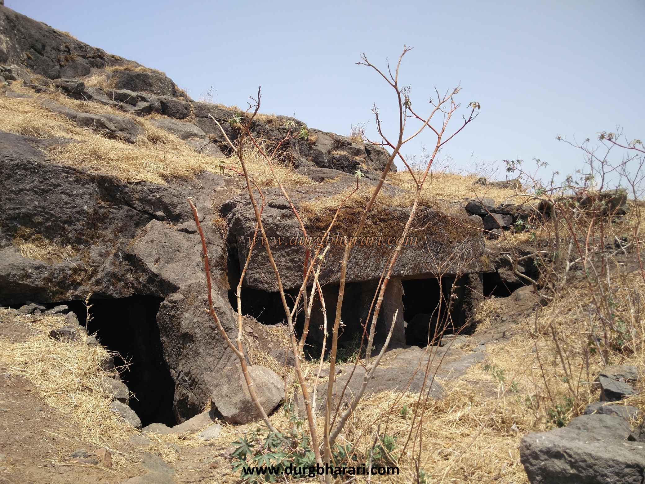
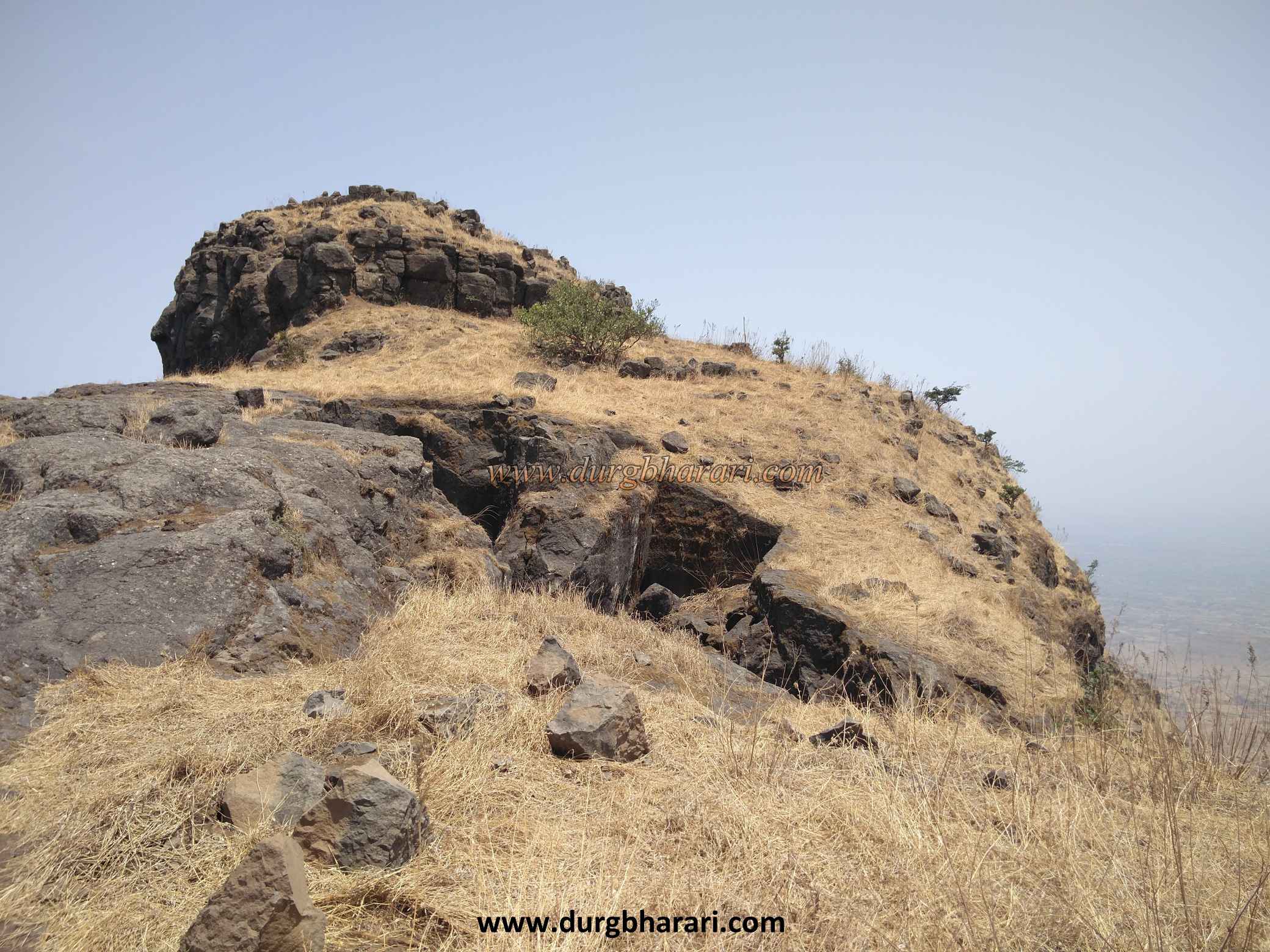
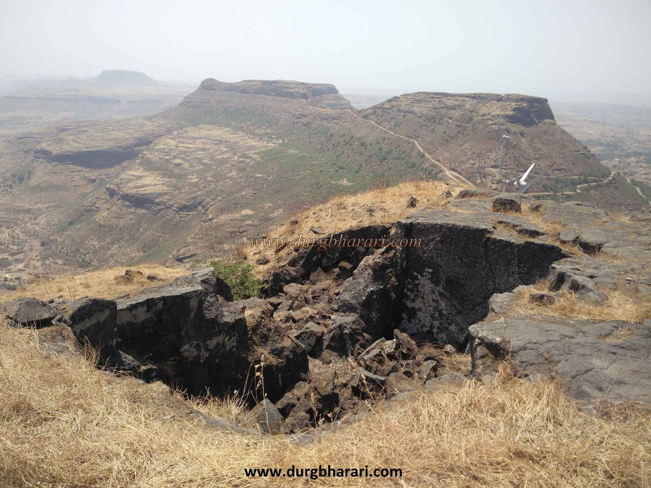
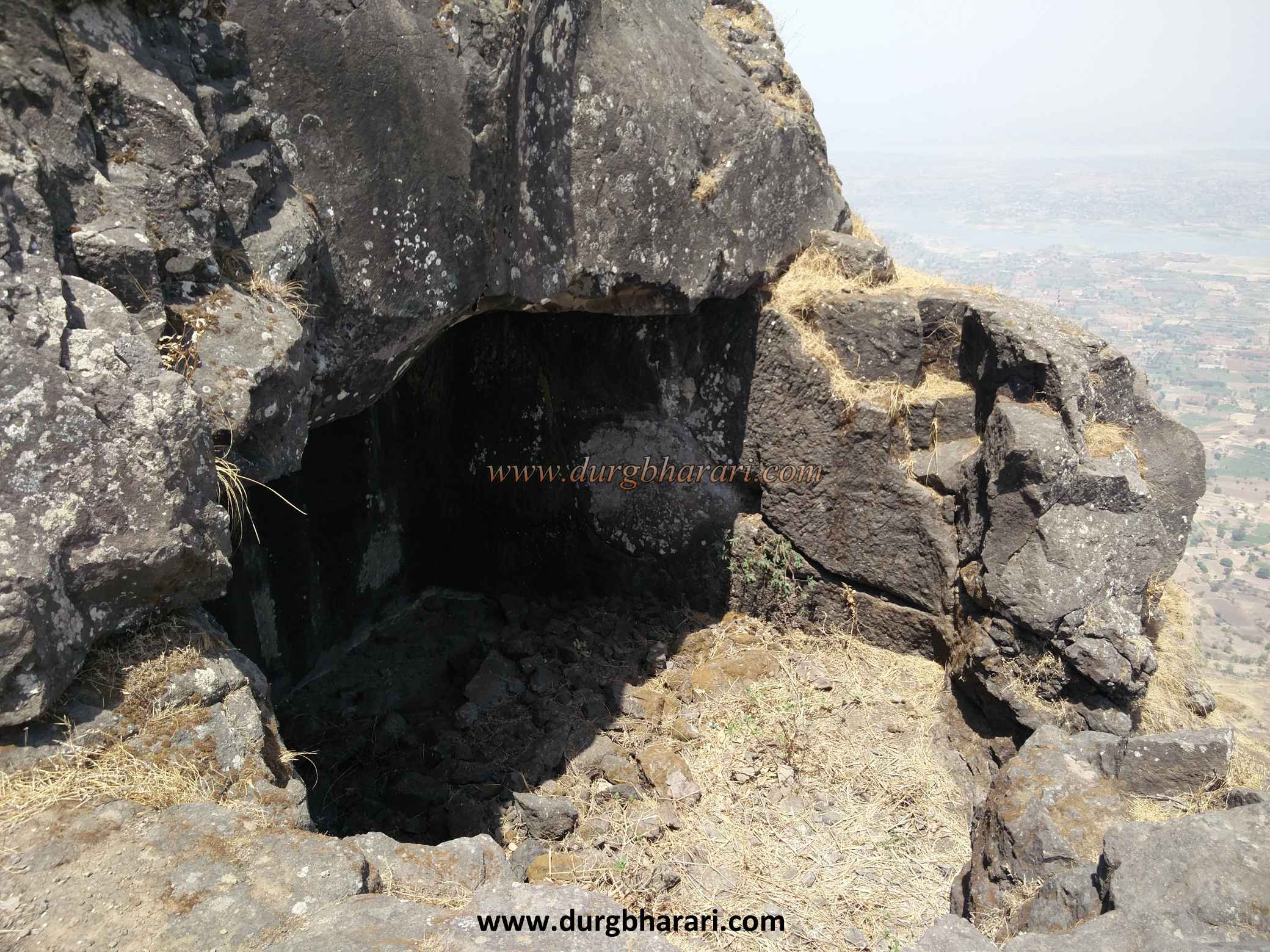
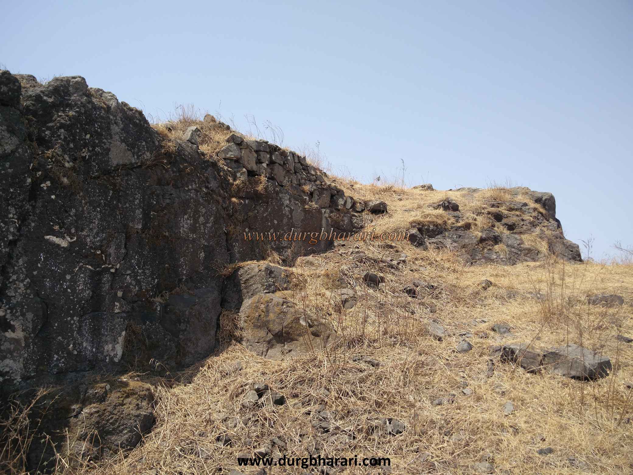
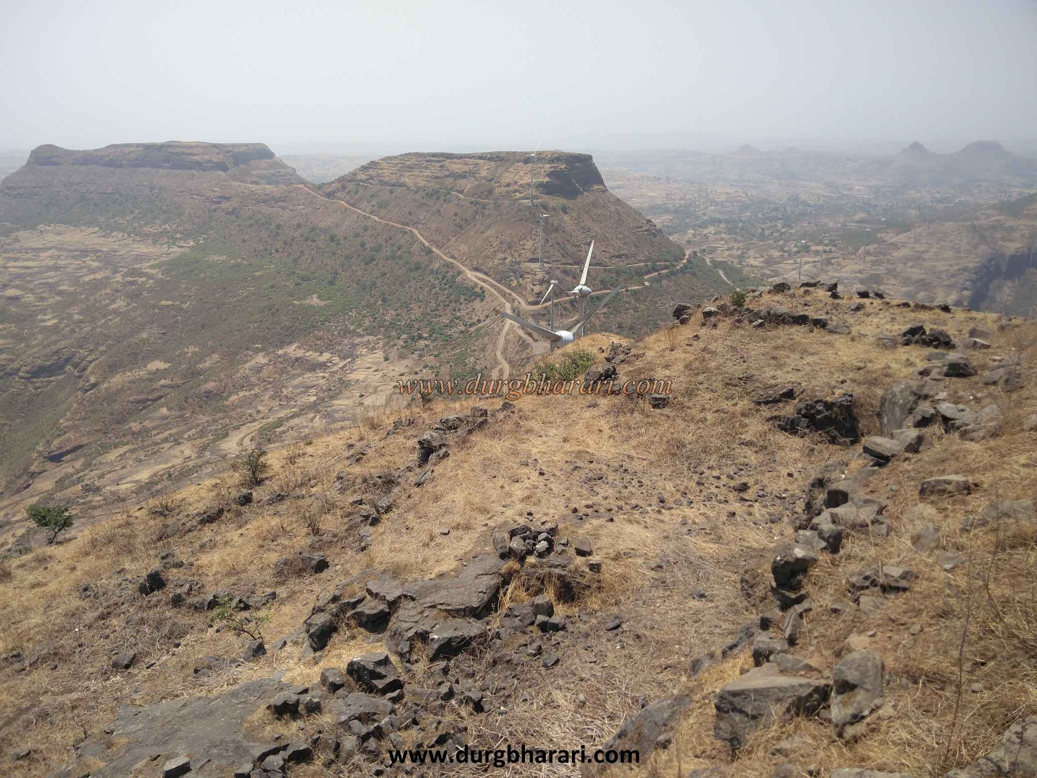
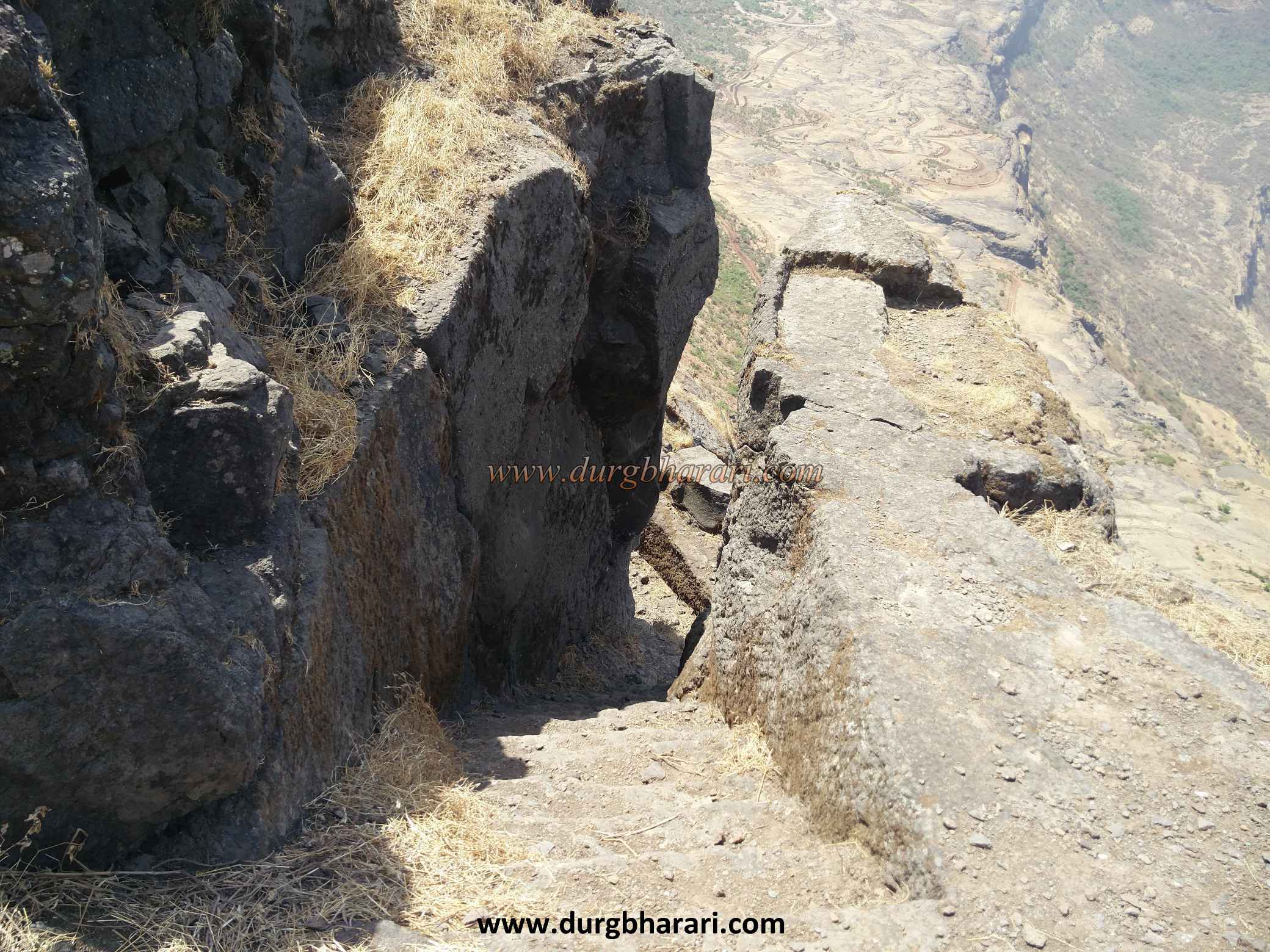
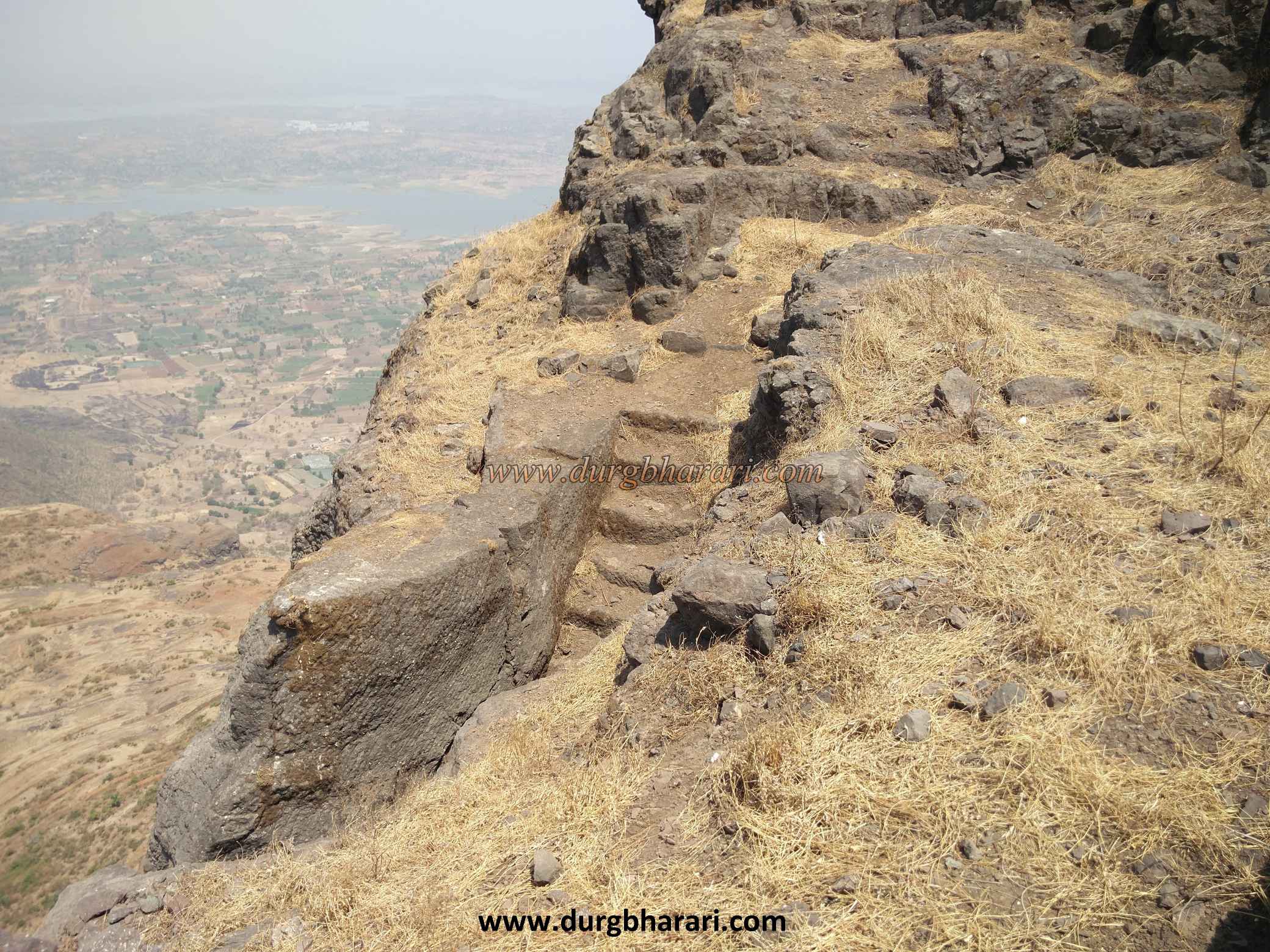
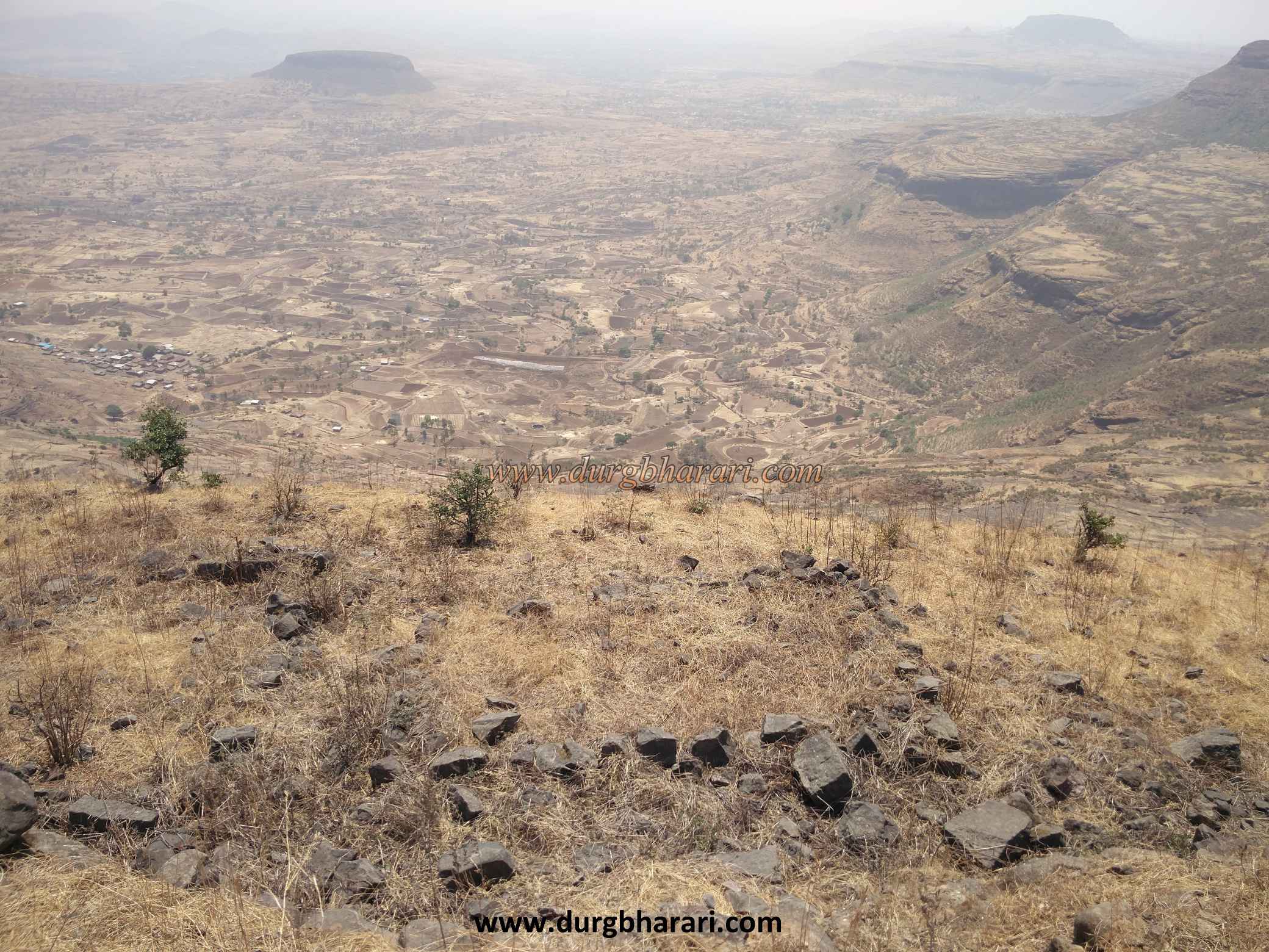
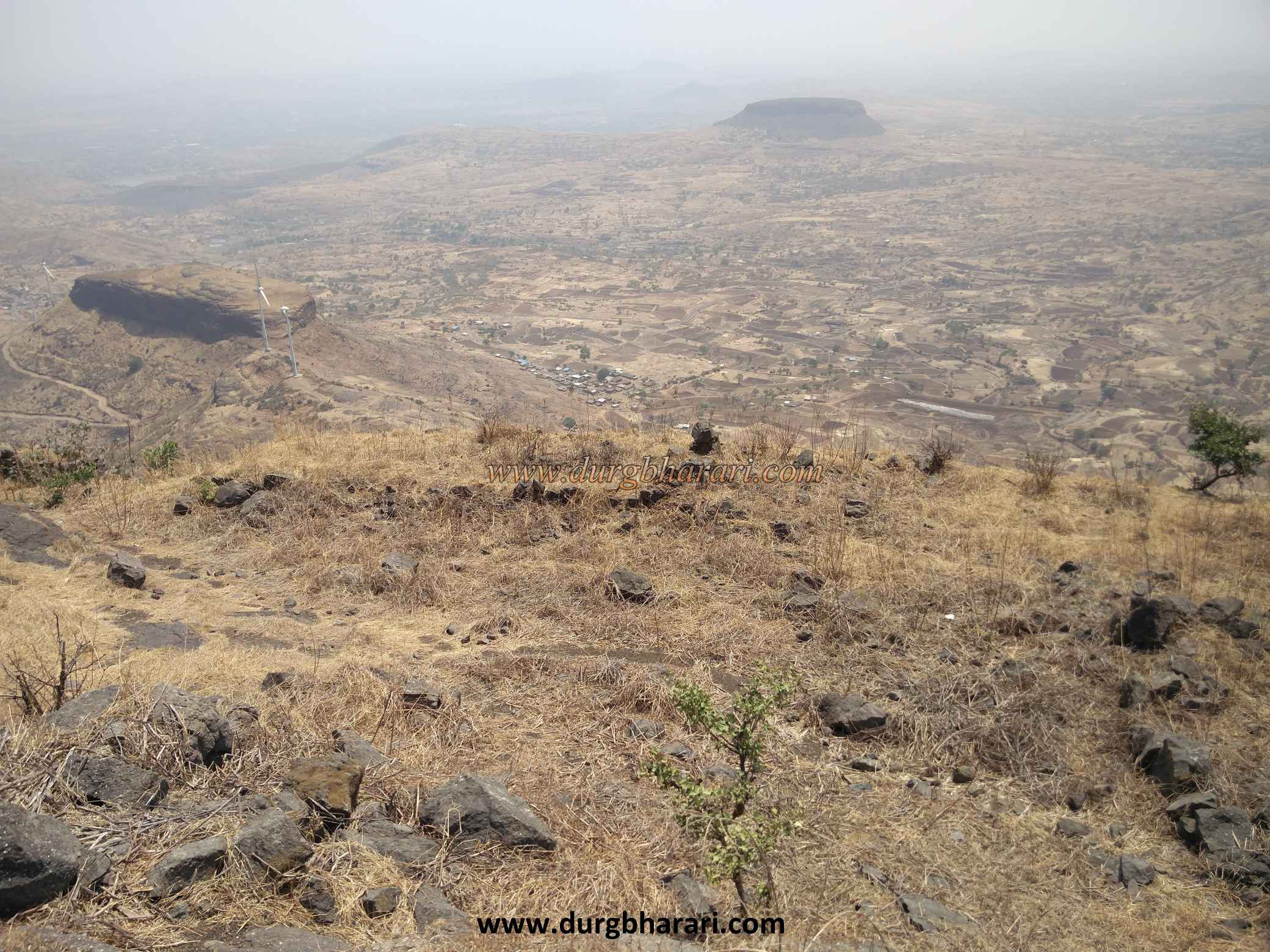
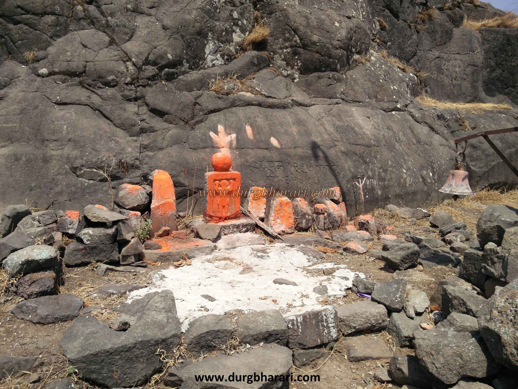
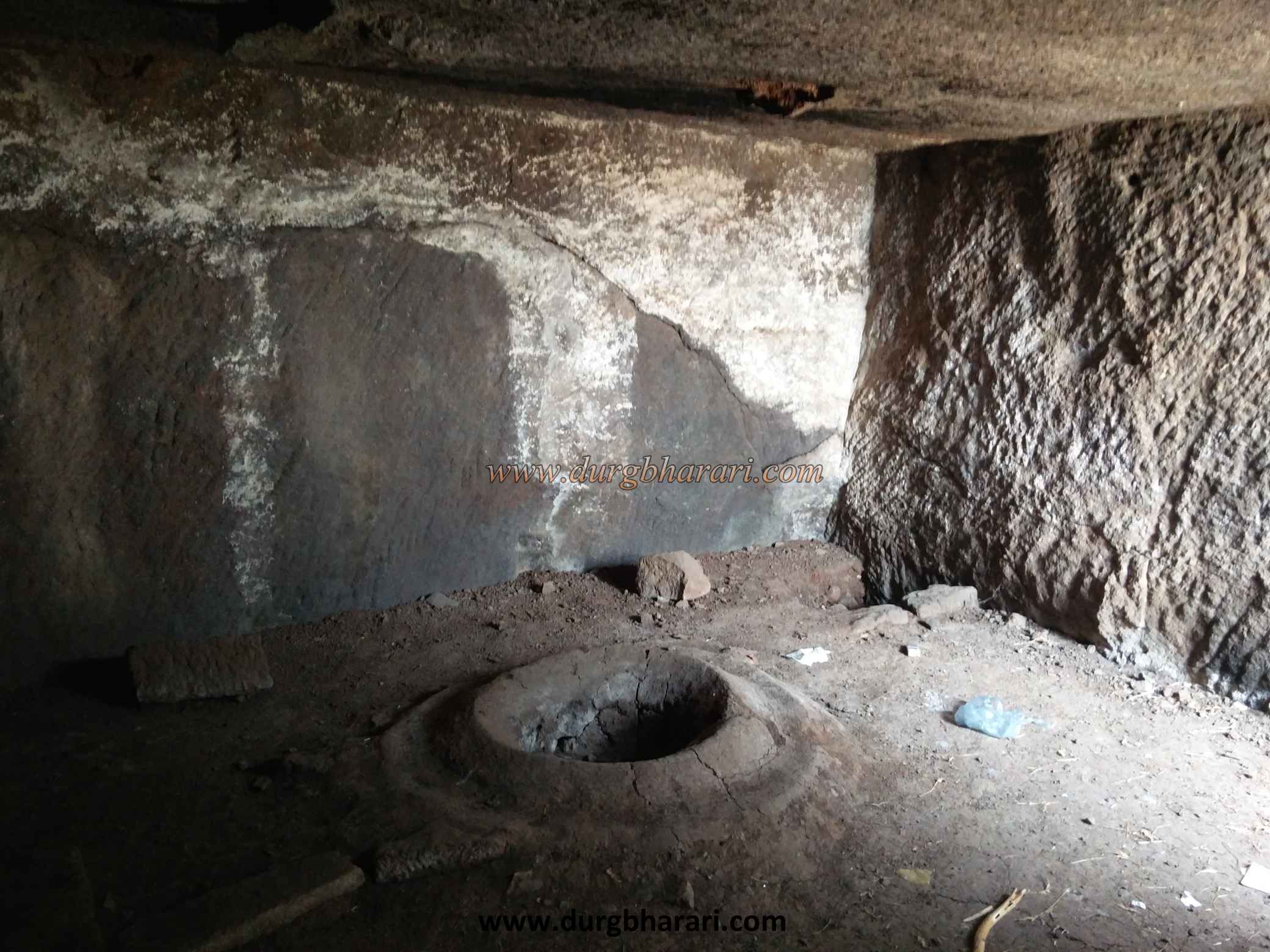
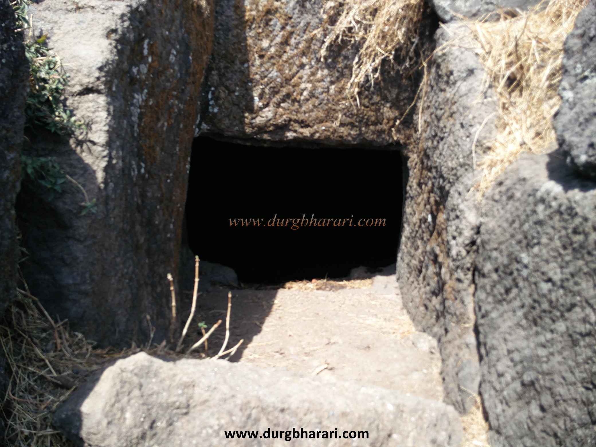
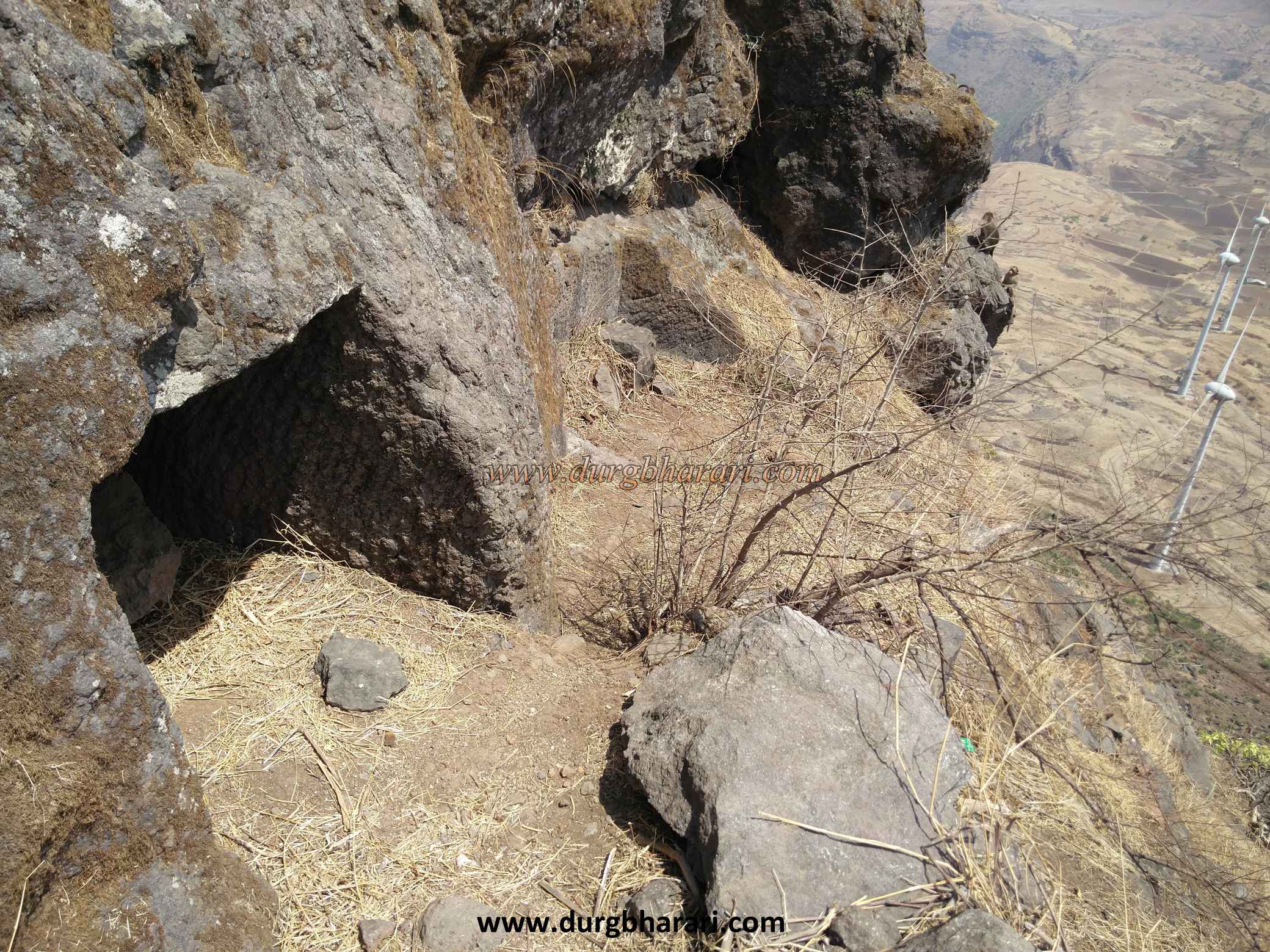
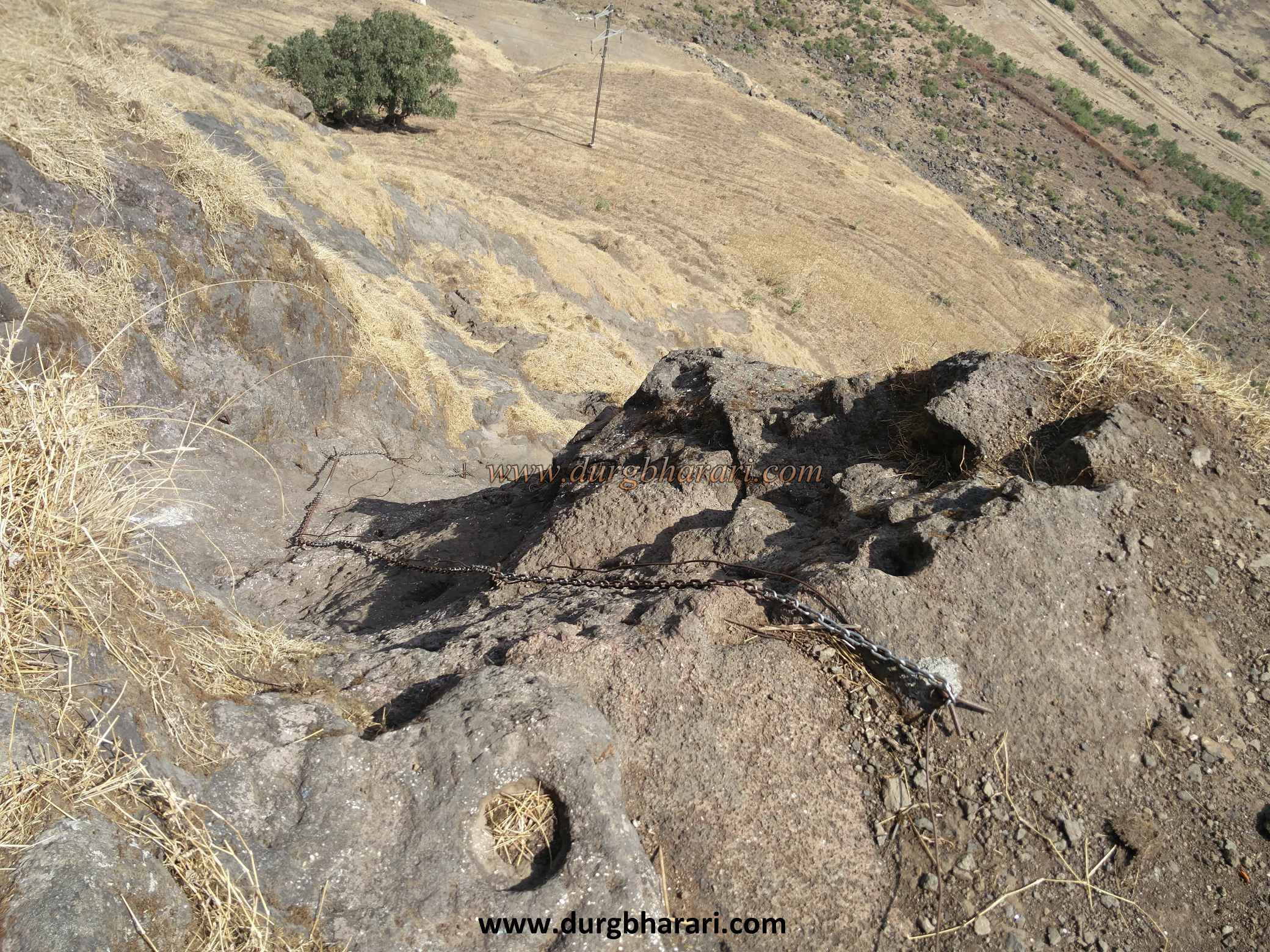
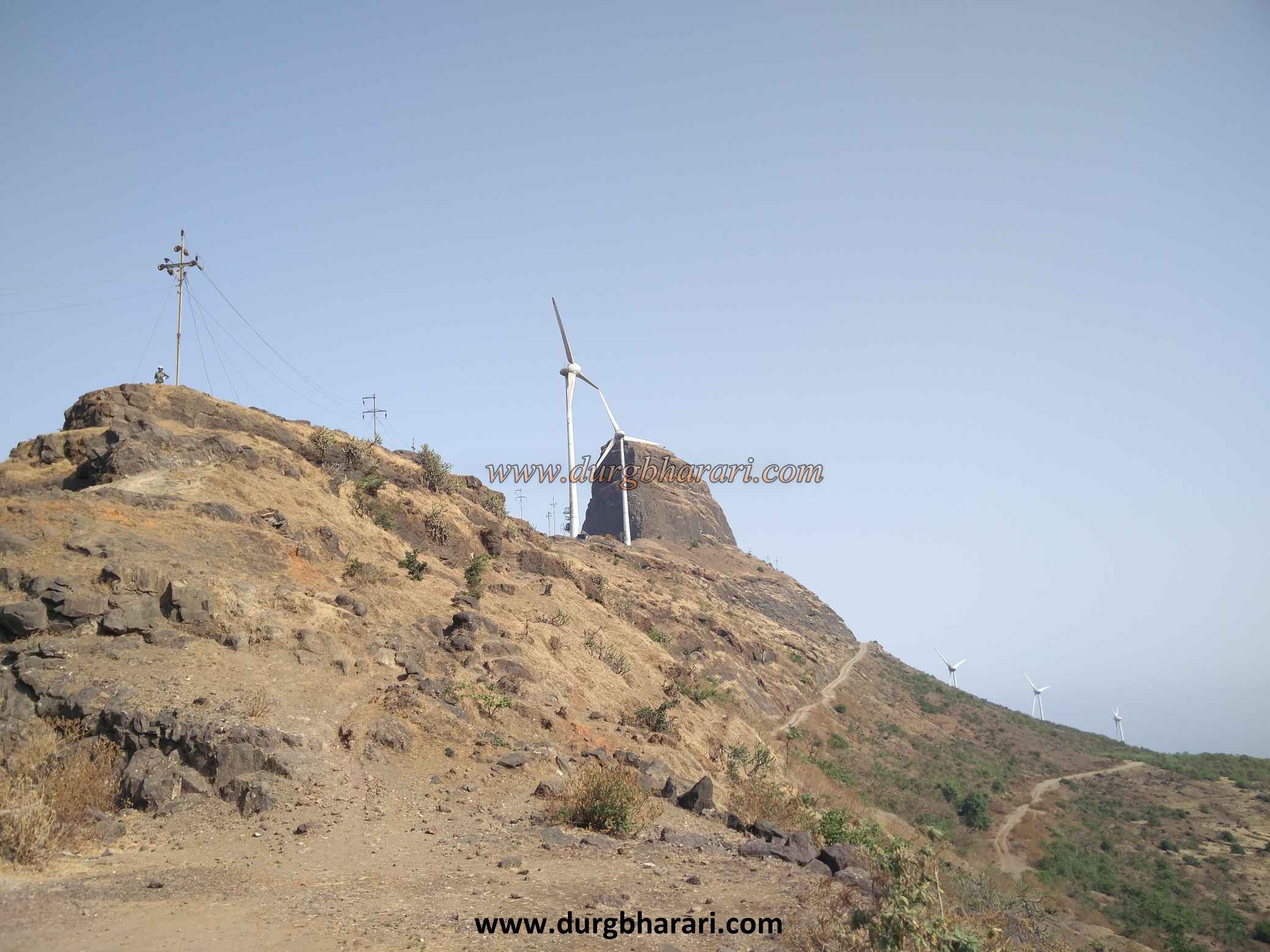
Last path saves all your detour and one and a half hour and takes you directly to the base of the fort if you have your own vehicle. To reach the fort by this road, there is a fork on the Ghoti-Bhandardara road leading to Taked village. Konkanwadi fork is 9 km from Taked village via Mahesmal wharf and Aundha fort is 9 km from Konkanwadi fork. Due to the windmills here, dense network of unpaved roads has been formed on the hill. From the recent Konkanwadi of Pattagad, this path takes a detour to Pattagad and comes to the windmill below the cone of Aundha fort but if you want to see the whole fort then park your car in gorge on the plateau below the pinacle and start climbing the fort from there. There is a stone under a tree with shendur (lead oxide) on it in the gorge and on the right side of the gorge there is a statue of a tiger in a dome and a small temple can be seen on the lower plateau. From here, as you start to climb the plateau on the left side, you can see 10-12 steps carved into the rock in two places. Ascending this path, at the beginning of the plateau, you can see the gate on this platform as well as the ruined remains of the ramparts. There are as many relics of the fort on the plateau and the some other relics may have been destroyed during the construction of the two windmills and the road. Since there is a road here for windmills, vehicles can come here. The fort looks like a small plateau and citadel on the cone. From here you can see the flagpole under the cone in front. On the right side of this pole, keep the edge to the left and the valley to the right. The path to the base of the cone is a bit difficult but the path to the cone is thrilling. Apart from this, the vehicle on the plateau can come from the opposite side of the cone on the road and from there it can reach the base of the cone, but this footpath is steep. It takes an hour to get here by car. Here you can see 20-25 steps carved in the direction of the cone. Some of these steps have collapsed. After climbing these steps, we reach the cone. There is a steep slope of about 40-50 feet and there are clear signs that the steps were broken by the British. This is where the thrilling climb begins. There is a chain hanging on this rock and you have to climb up on this chain with the support of cracks developed on it. After crossing this stage and coming up, another thirty feet steep stage takes place. Since there are no grooves in this place, you have to climb up by holding the chain and maintaining the balance of the body. After ascending this stage, you enter the fort directly through the broken door on the edge. The gate of the fort faces east and is 4270 feet above sea level. With a simple rectangular shape, the fort has an area of less than one acre. There is a 3x3 feet tunnel near the door although it isn’t accessible due to stones falling on its mouth. This area is slightly fortified and three caves can be seen in front. One of the caves is dilapidated and the other has drinking water tanks, while the third cave has a small circular tank but it is not realized. At the top of these caves, there are some rough carved stone covered with shendur (lead oxide). On the upper side of the cone there is a ruined rampart and inside this rampart there are some houses. There is a bastion in the direction of plateau on the cone and there are two big dry tanks carved in the rock recently. There is a carved door and 30-40 steps in the opposite direction to the cone. These steps seem to be an old ruined path leading to the fort. At the end of these steps is another large but dry joint tank. In addition to this, there is a large cistern carved in the rock at the back of the cave. The area of the fort is small, the five large tanks and the scattered remains of the house make the fort seem to be quite populated. The fort must have been used mainly for surveillance. From the fort, one can see Pattagad, Bitanggad, Kalsubai, Alang, Madan and Kulang. Half an hour is enough to see the fort. The forts of Awandh and Patta are mentioned in the Aranyakand of Saint Eknath Maharaj's Shri Bhavarth Ramayan. The fort, which belonged to the Bahamani Empire in the 14th century, came under Nizam rule in 1490 after the conquest of the Bahamani Empire. The fort was conquered by the Mughals in 1627. In 1675, when Moropant Pingale captured Nashik province, he brought Aundha fort under his control. Until 1688, this fort belonged to the Marathas. After this, from 1688 to 89, the Mughals took over the fort and appointed Sardar Shyamsingh as the fort keeper. The fort was captured by the British in 1818.
© Suresh Nimbalkar
Gallery