ASHERIGAD
TYPE : HILL FORT
DISTRICT : PALGHAR
HEIGHT : 1656 FEET
GRADE : MEDIUM
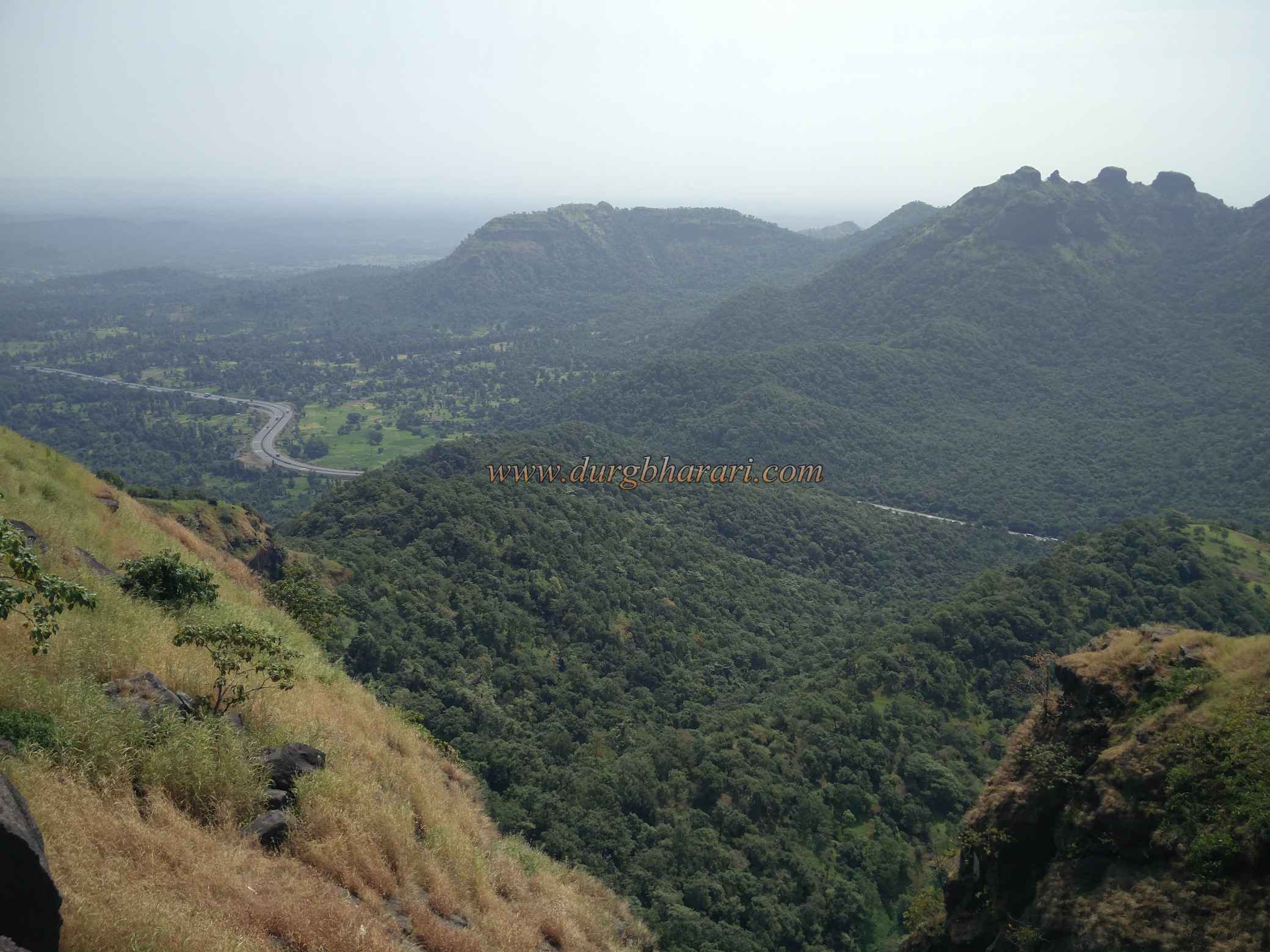
Due to Mumbai, the Konkan province is divided into North Konkan and South Konkan. South Konkan consists of Raigad, Ratnagiri and Sindhudurg districts while North Konkan consists of Thane and Palghar districts. Asherigad is surrounded by thick forest in Palghar taluka adjacent to the Mumbai-Ahmedabad highway. Asherigad can be reached in one day by train from Mumbai or by own vehicle. To visit Asherigad, one has to reach Dahanu station by Western Railway train. Khodkona is a village at the foot of the fort. This village is at a distance of 24 km from Dahanu railway station via Chilhar Fata and 11 km from Manor Naka on Mumbai-Ahmedabad Highway. The distance from Chilhar Fata to Khodkona village is 5 km. Khodkona village is on the inner side of the highway and at a distance of 10km from Charoti on the way from Mumbai to Ahemadabad.
...
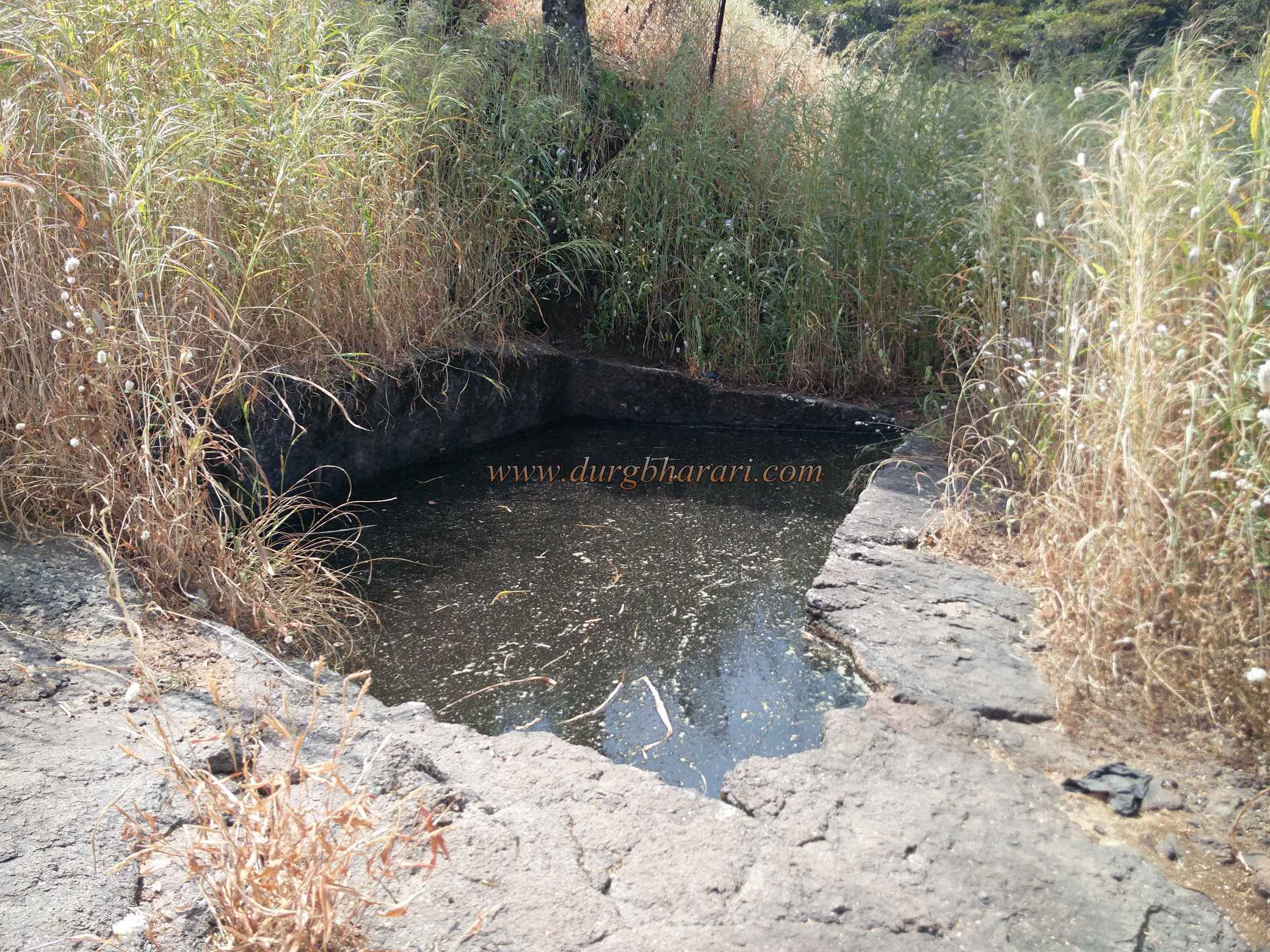
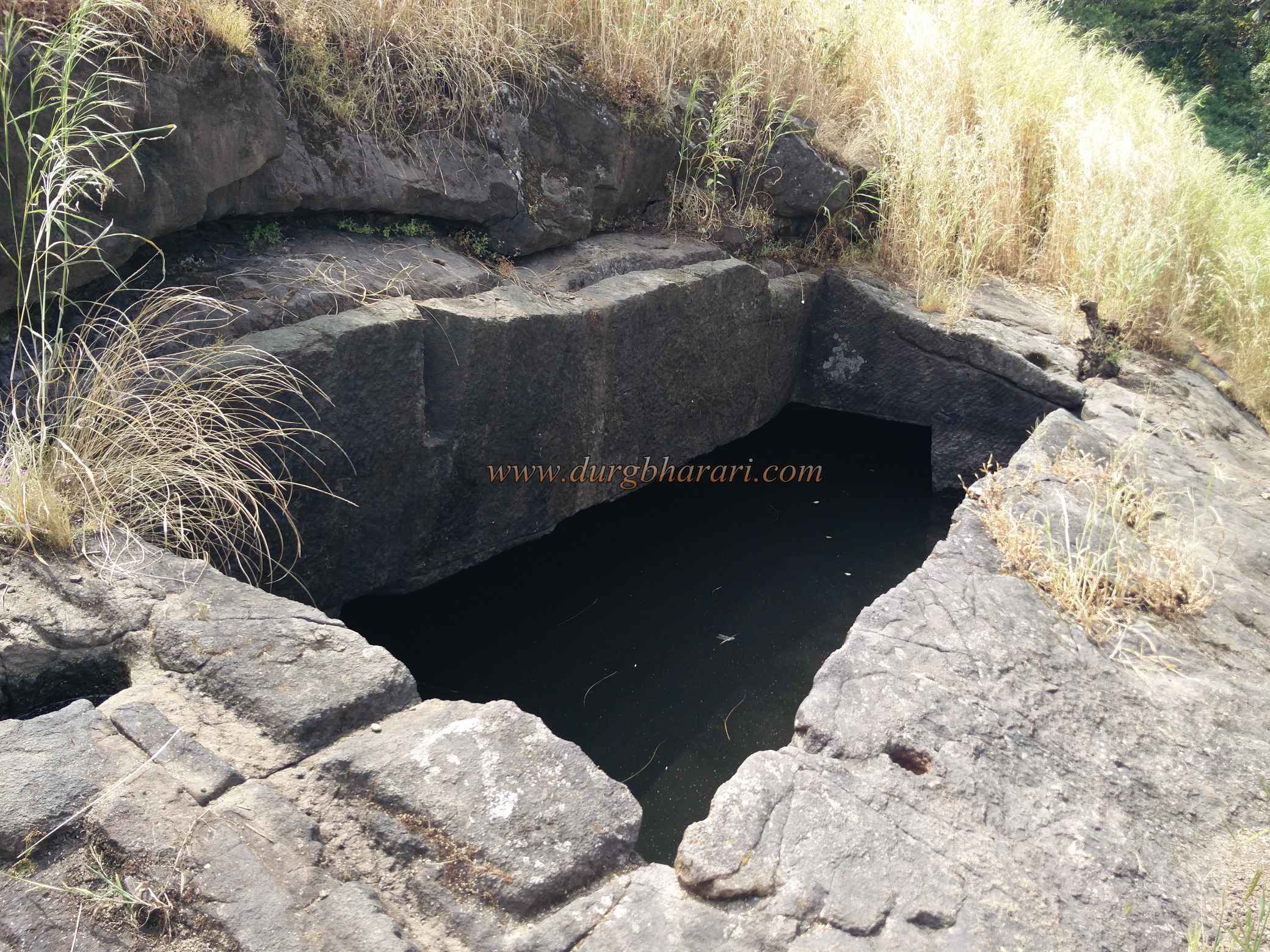
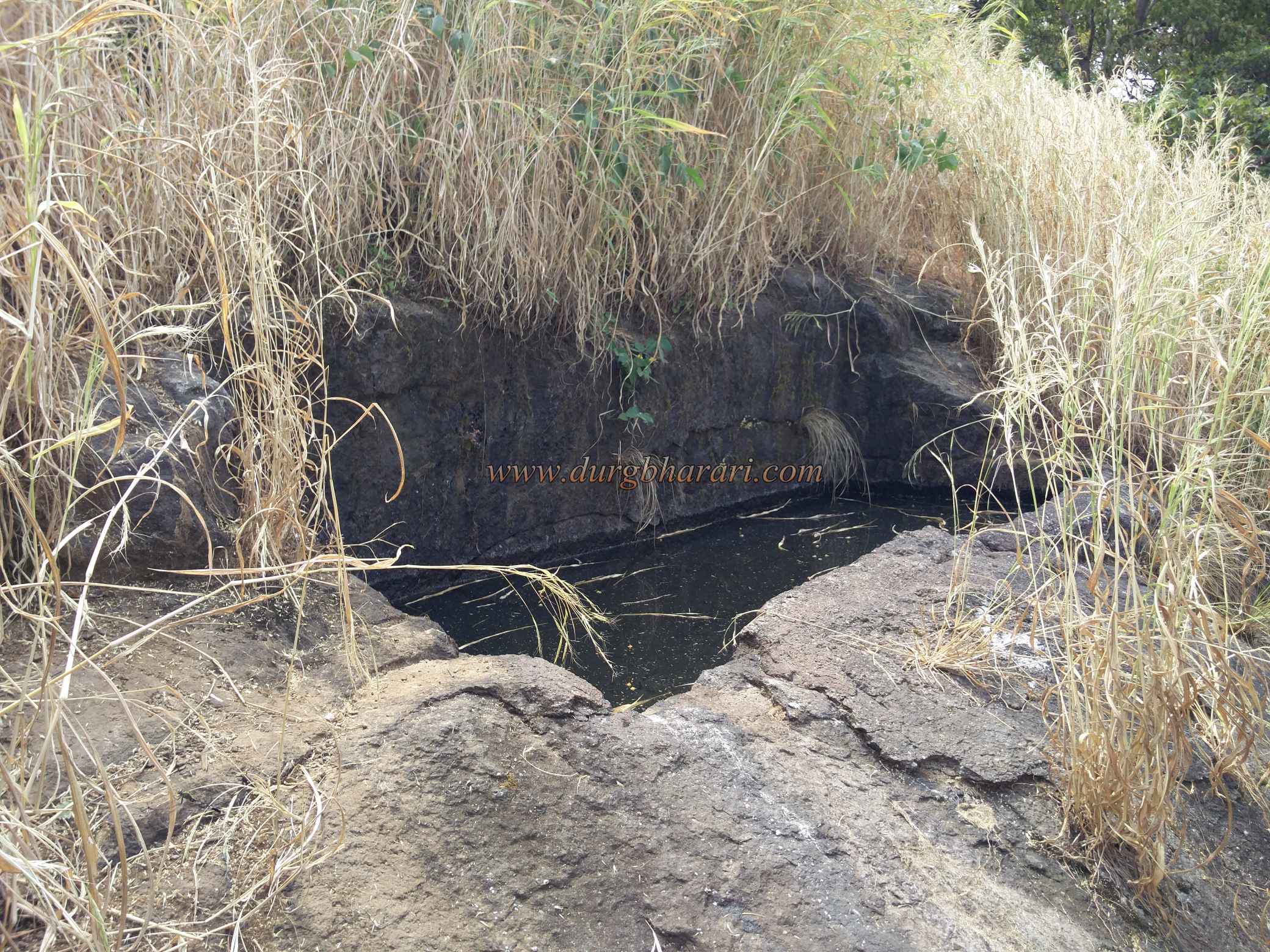
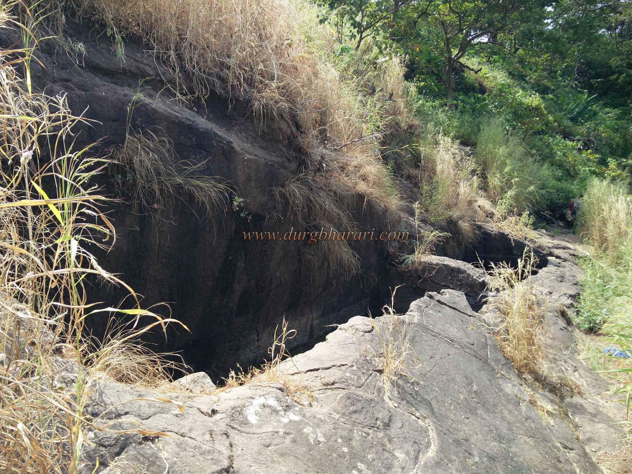
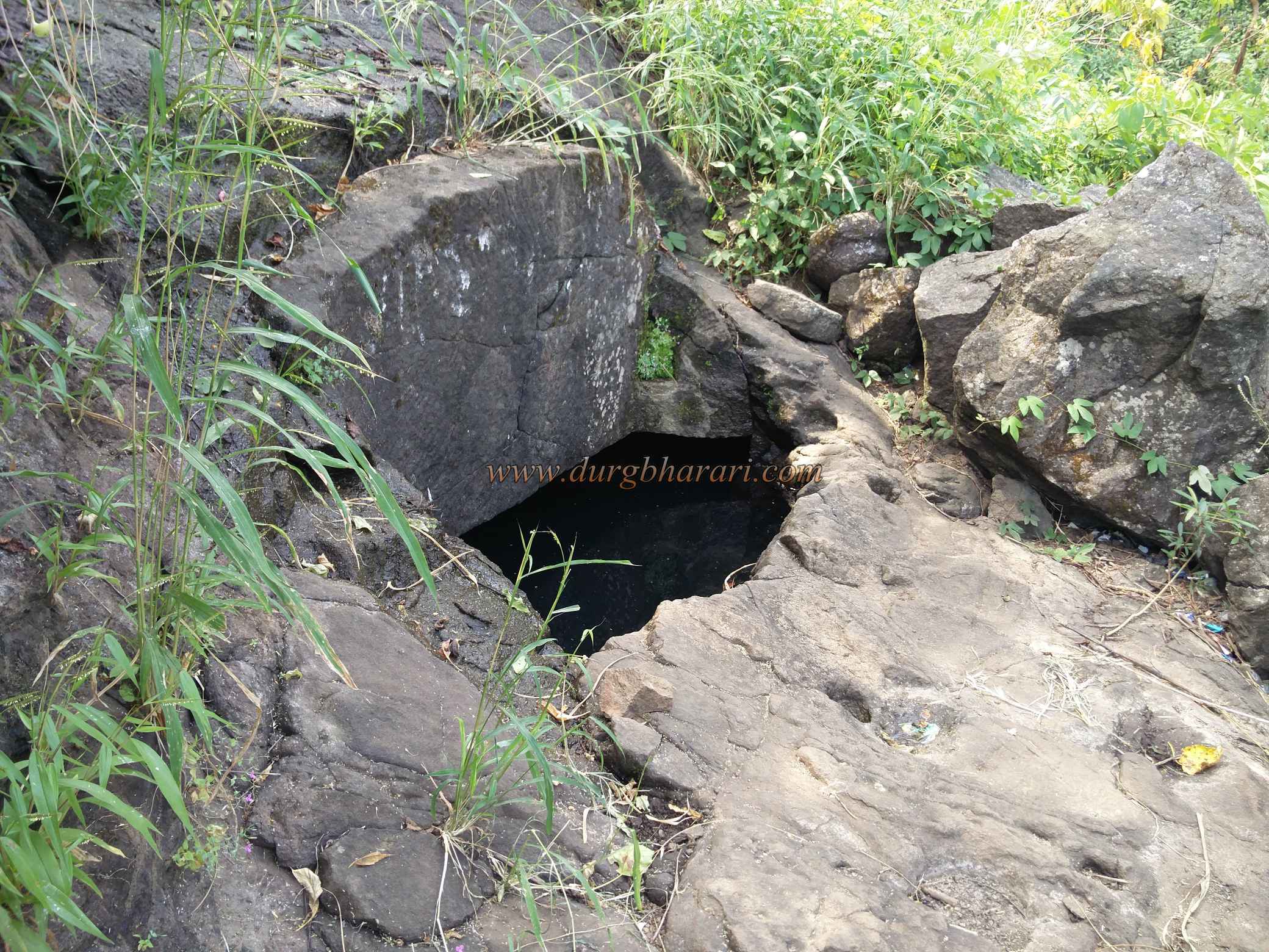
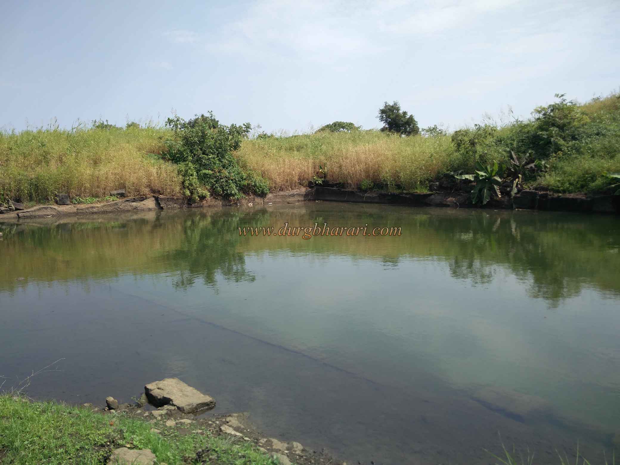
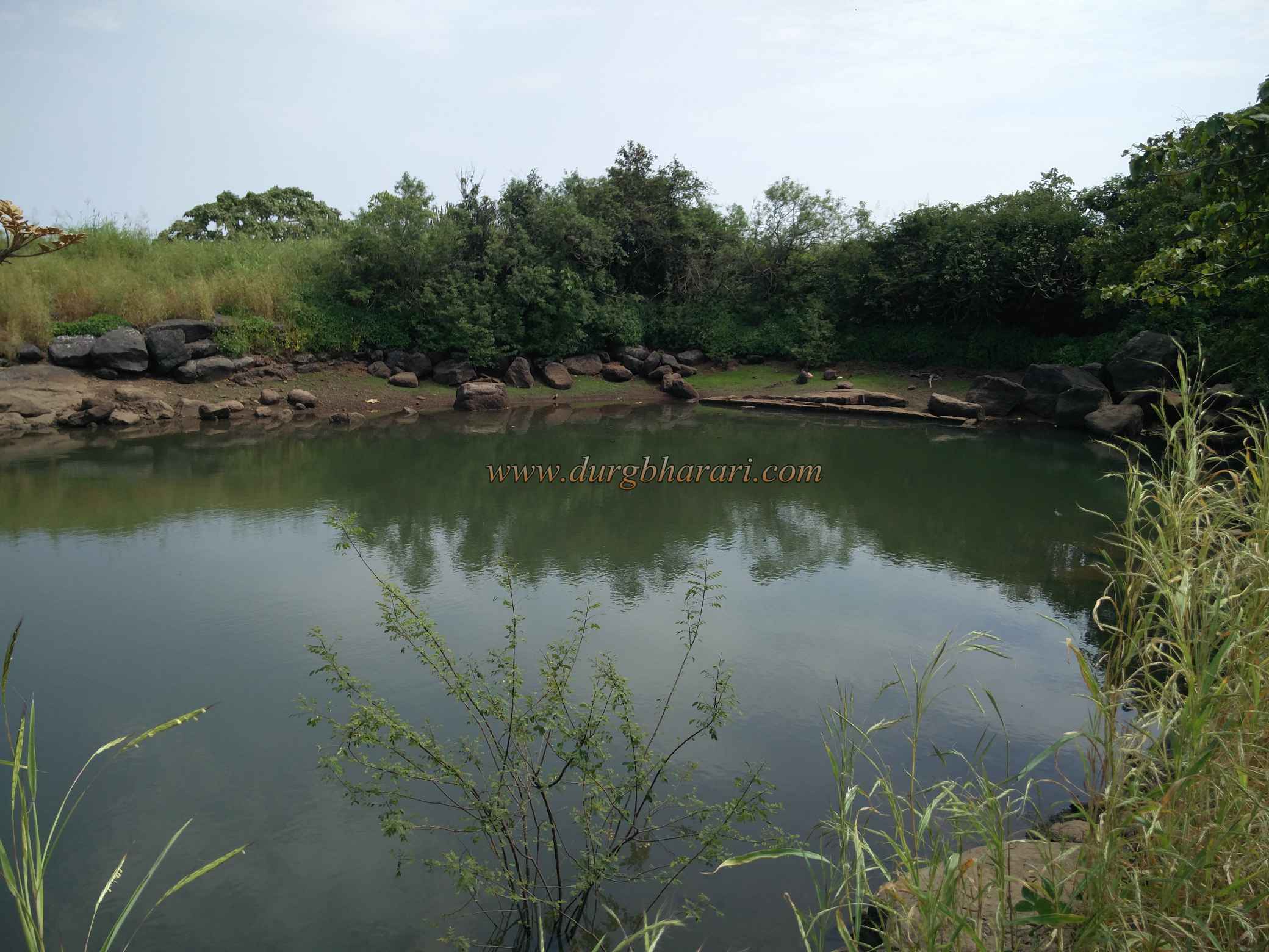
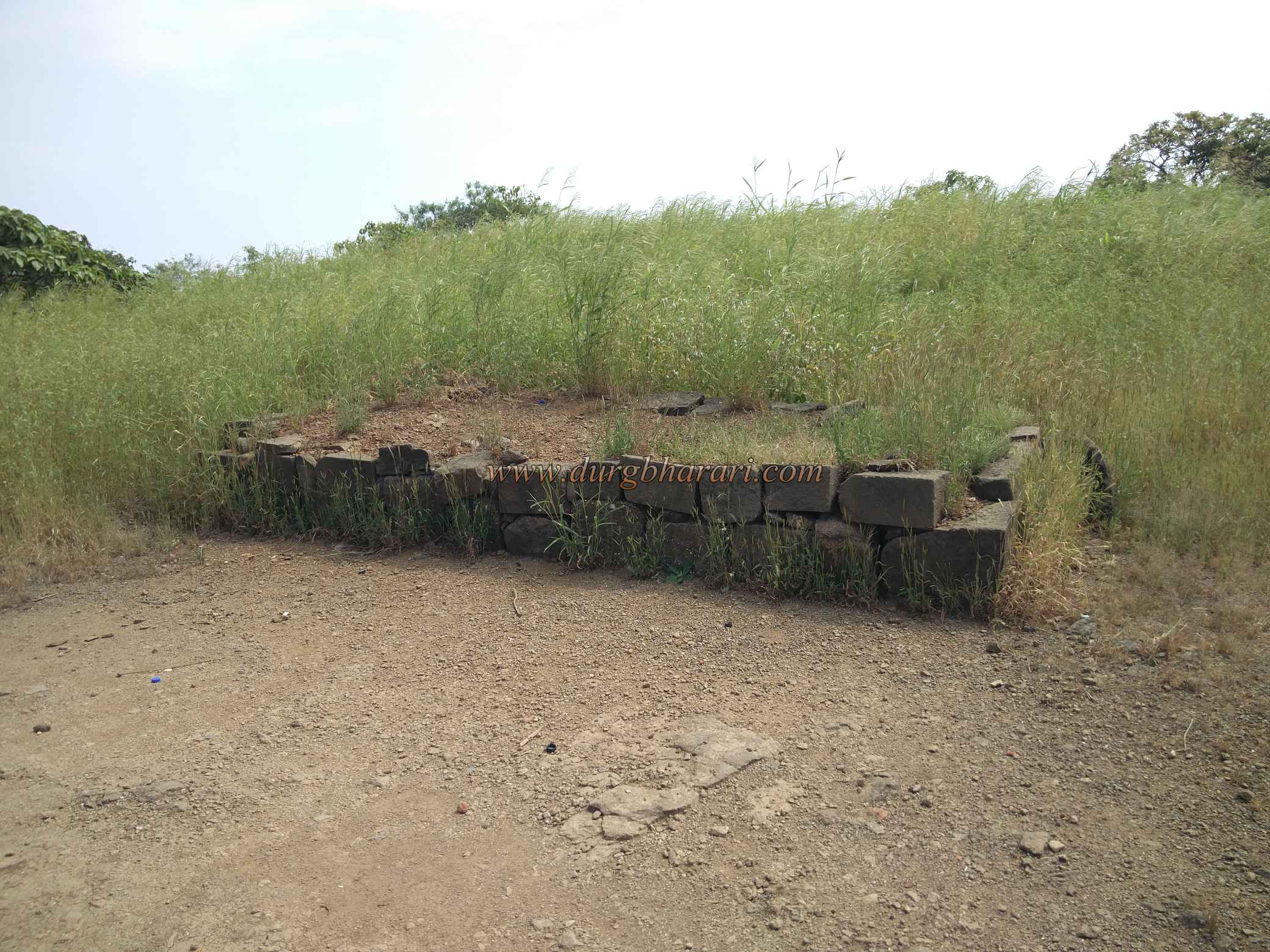
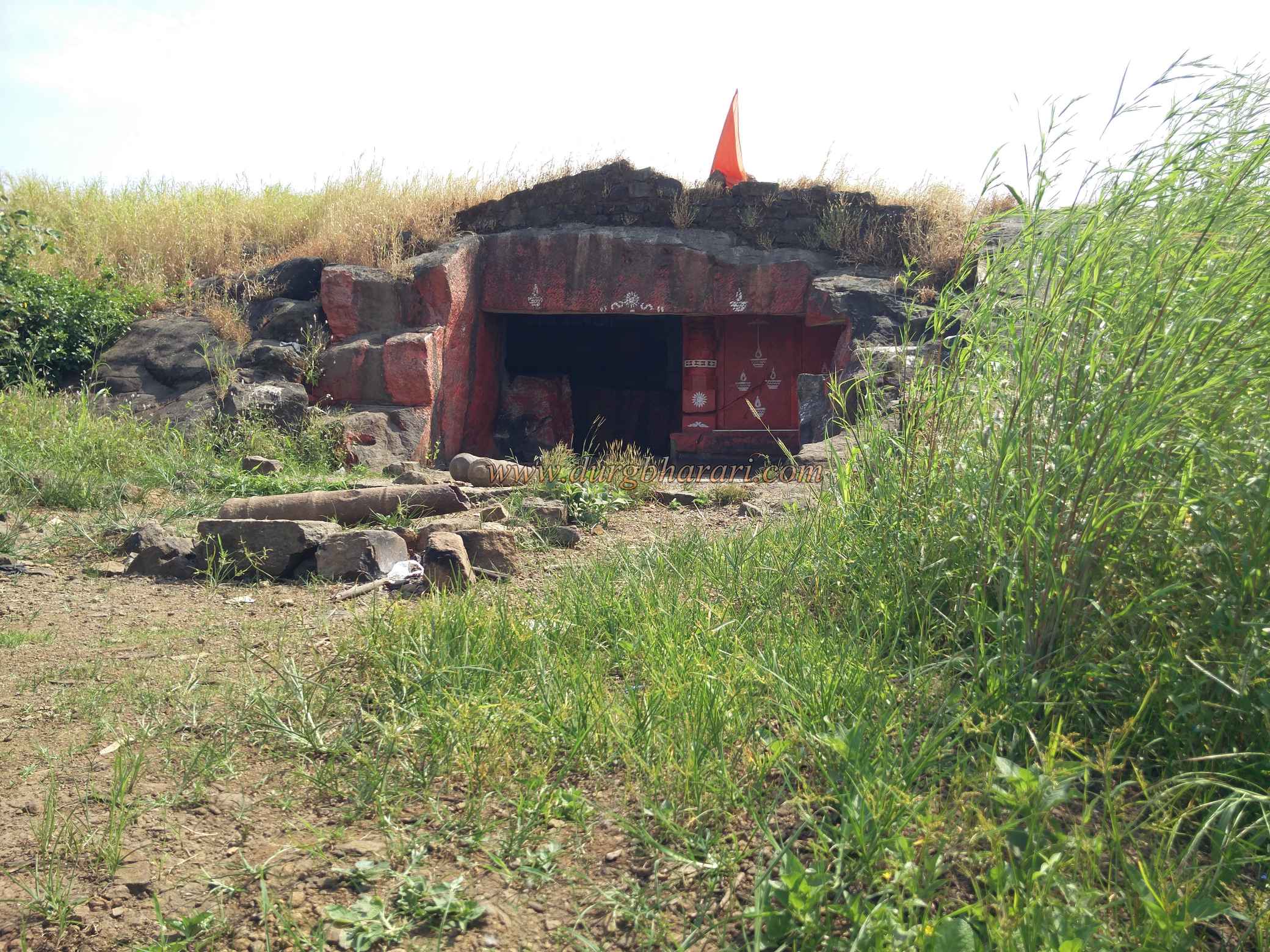
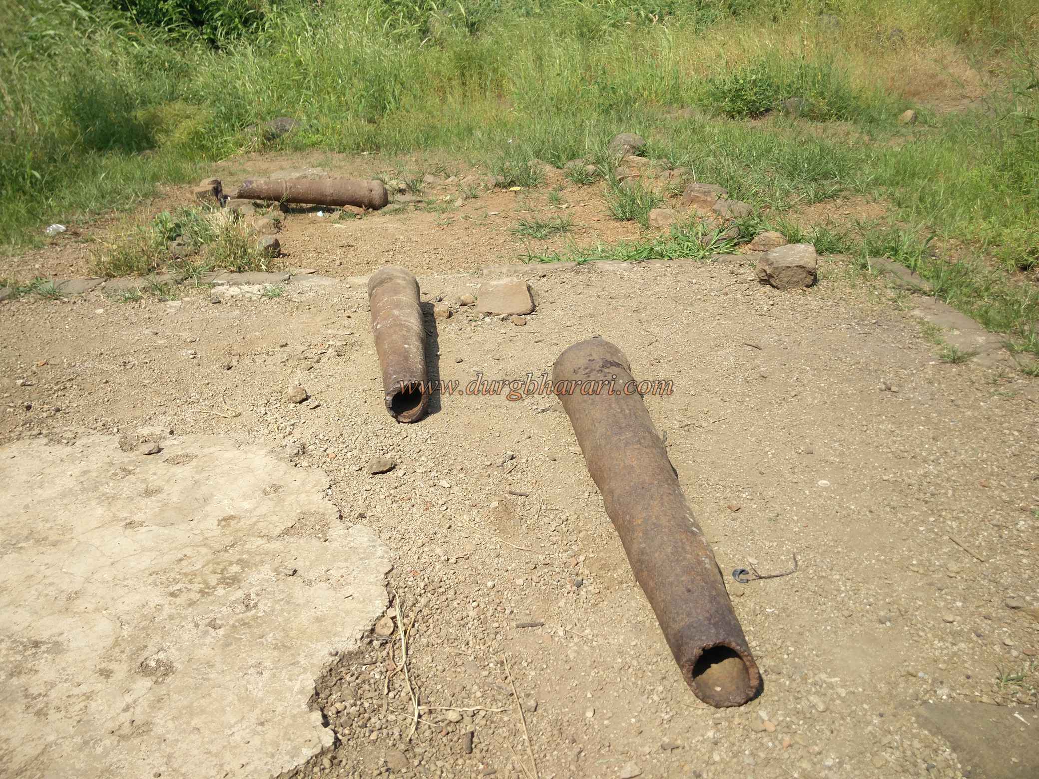
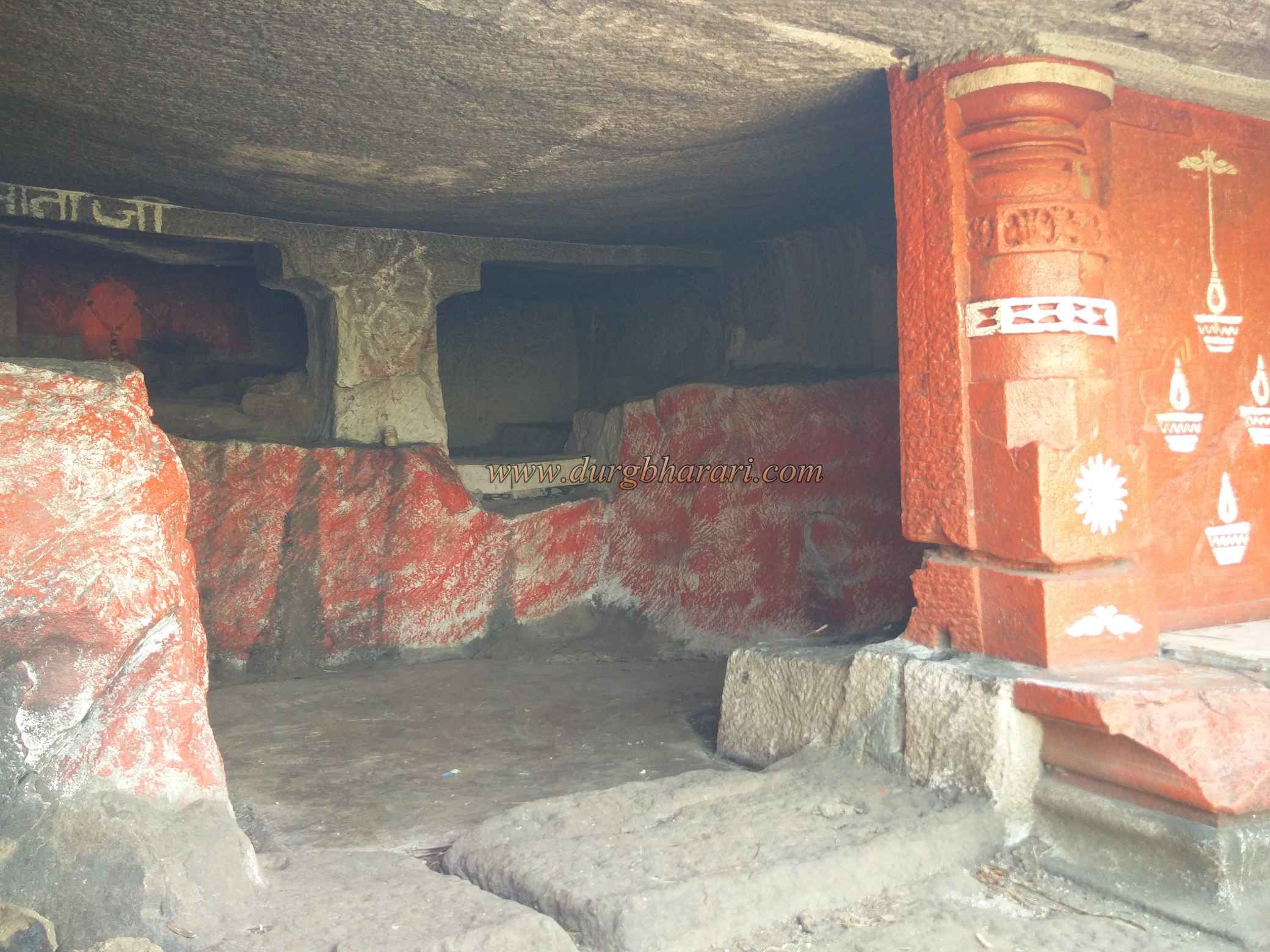
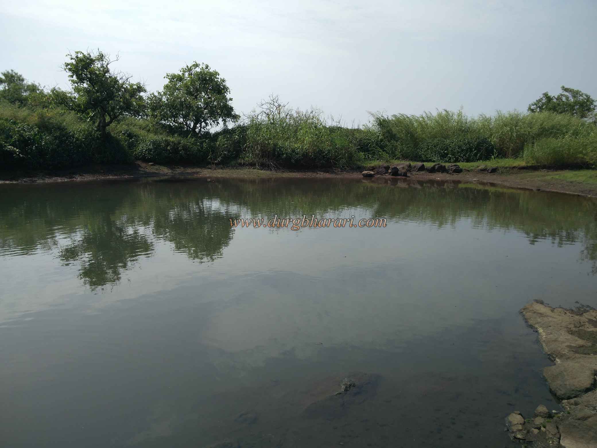
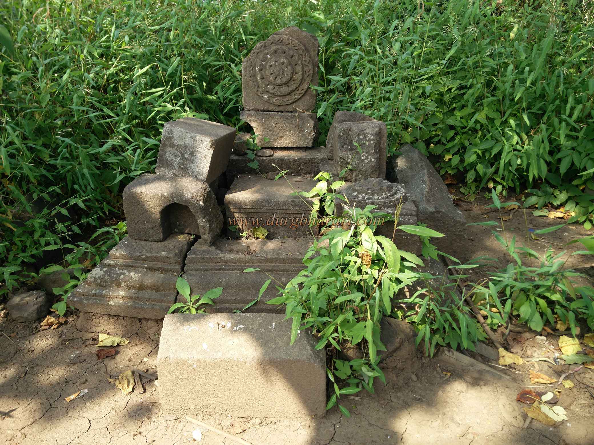
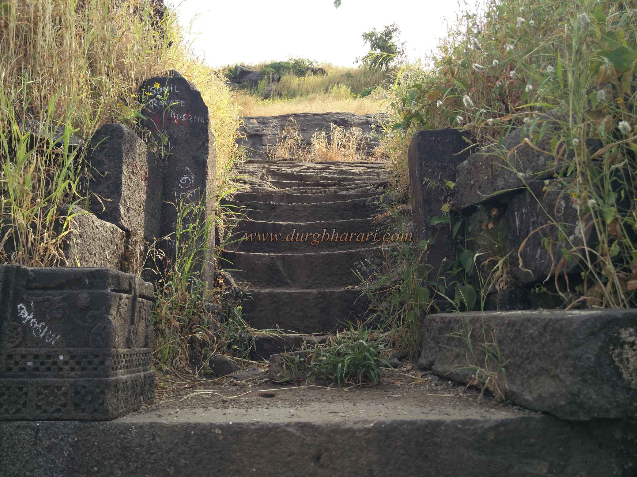
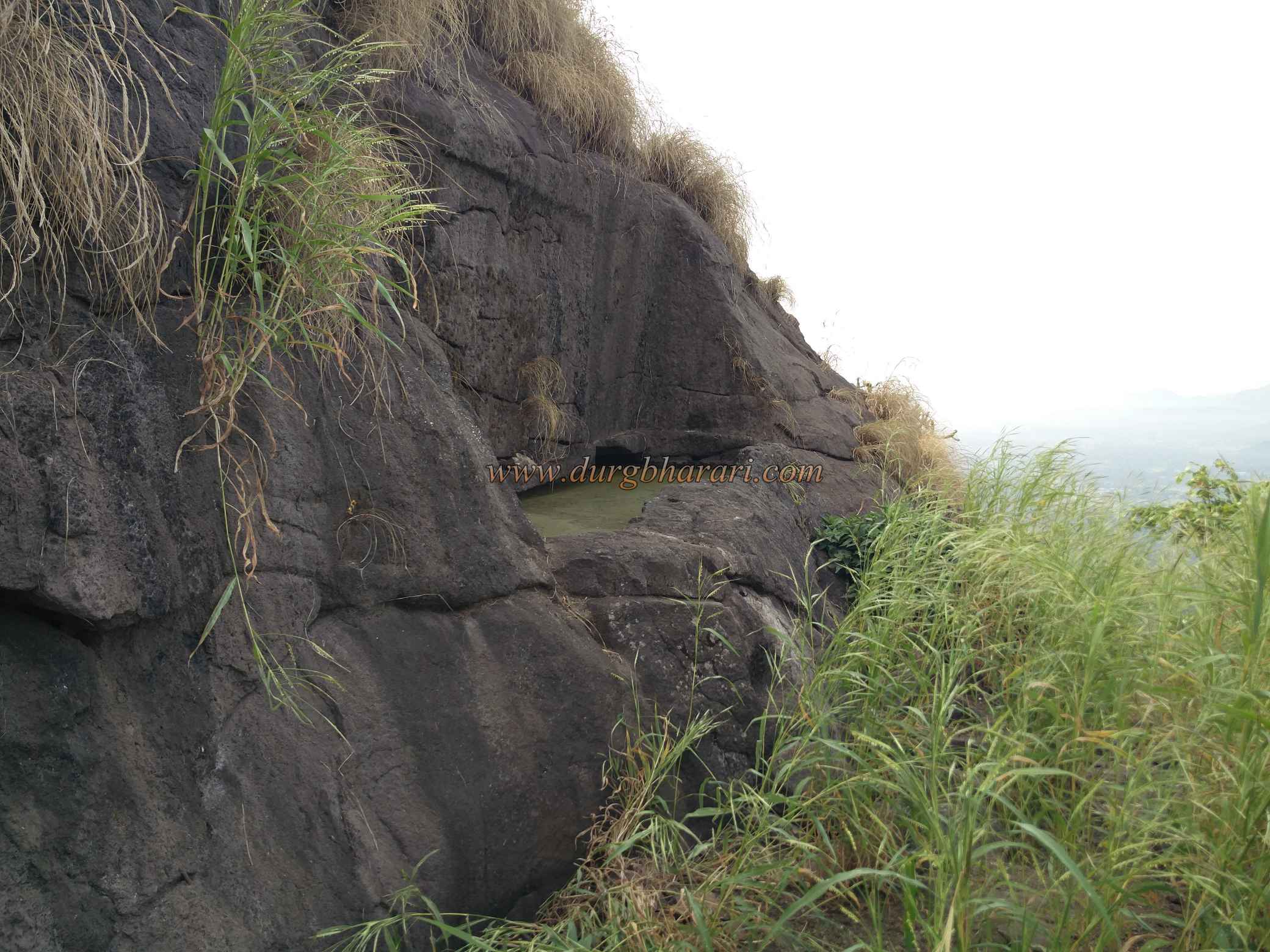
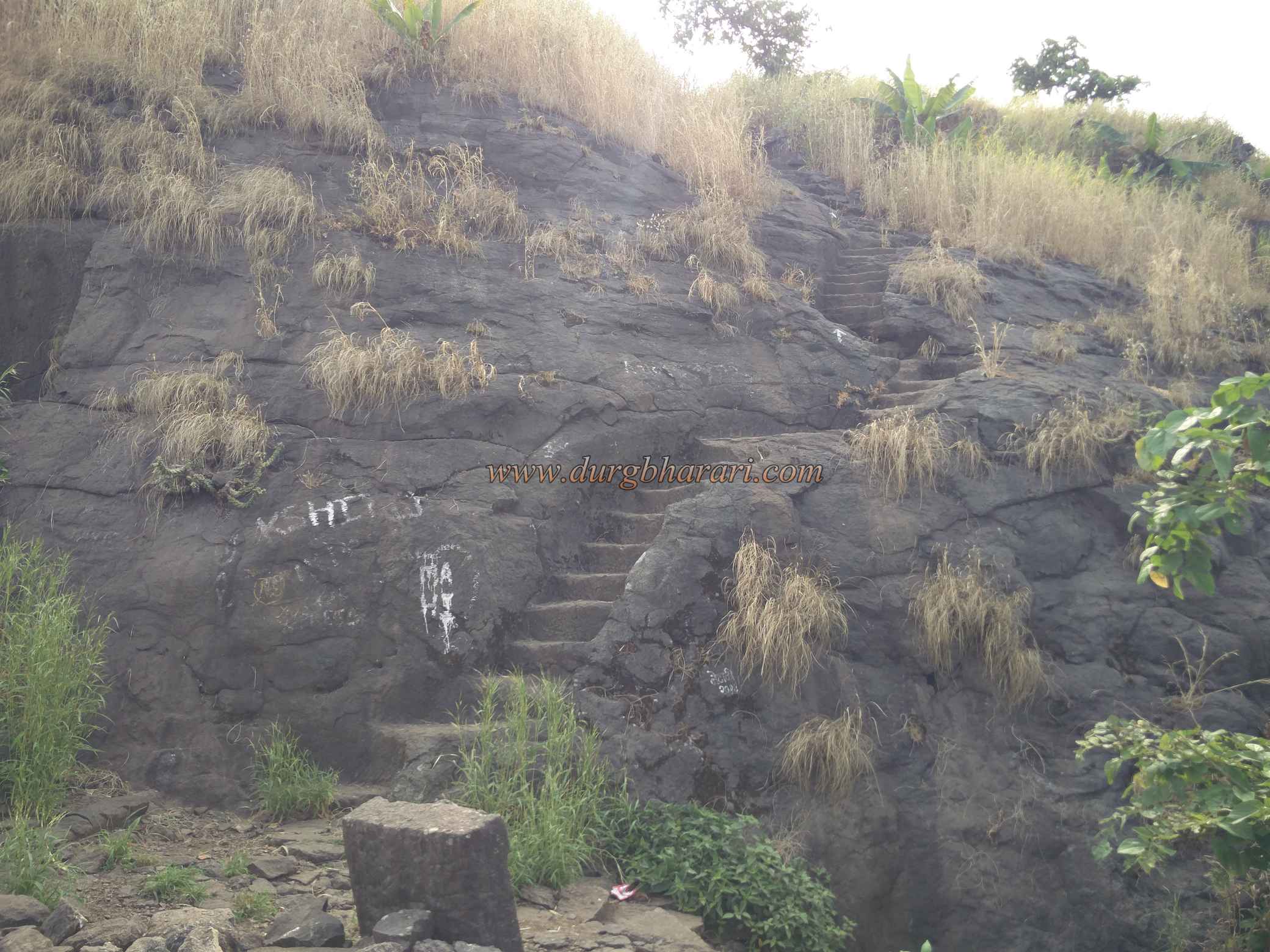
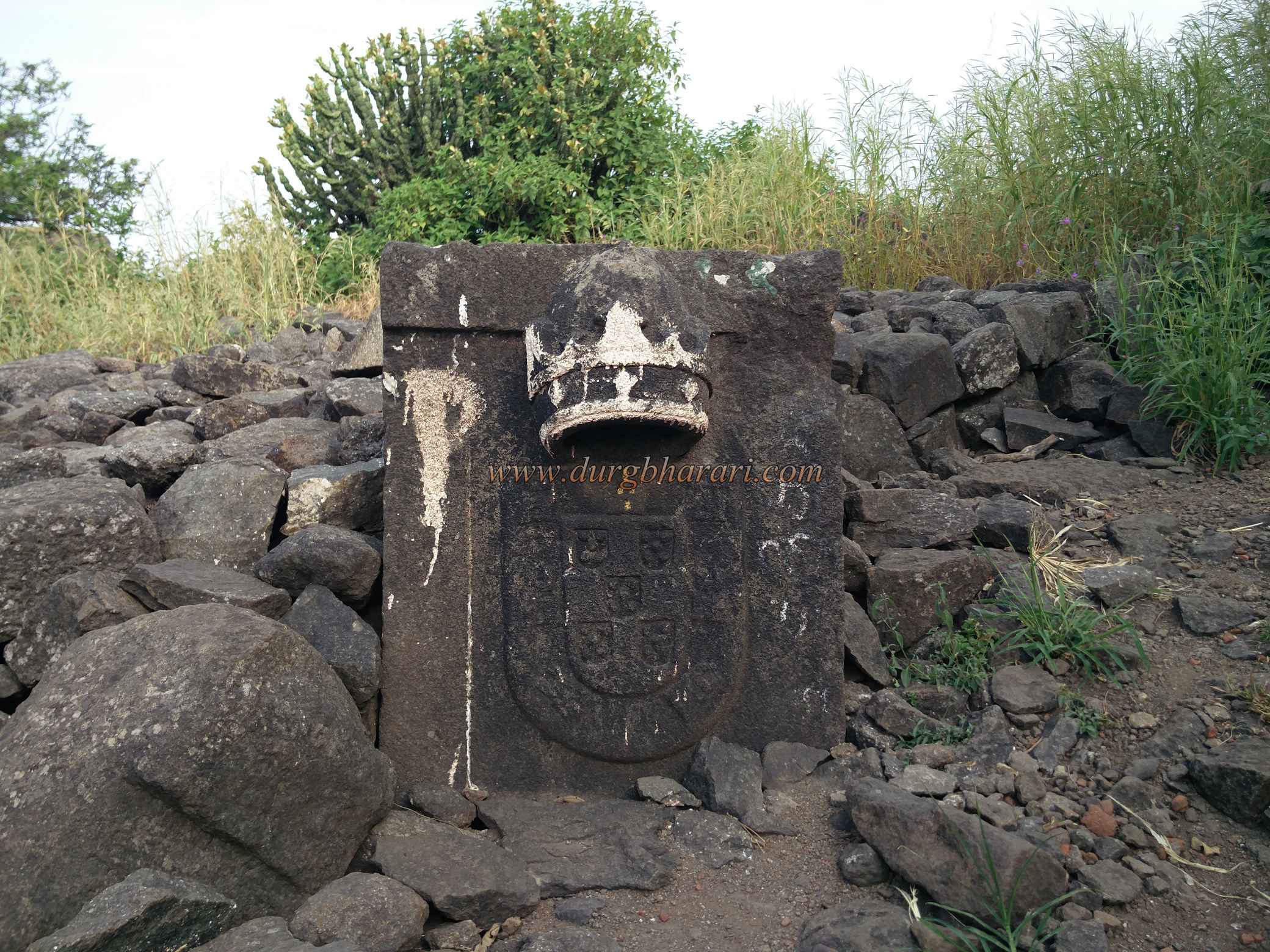
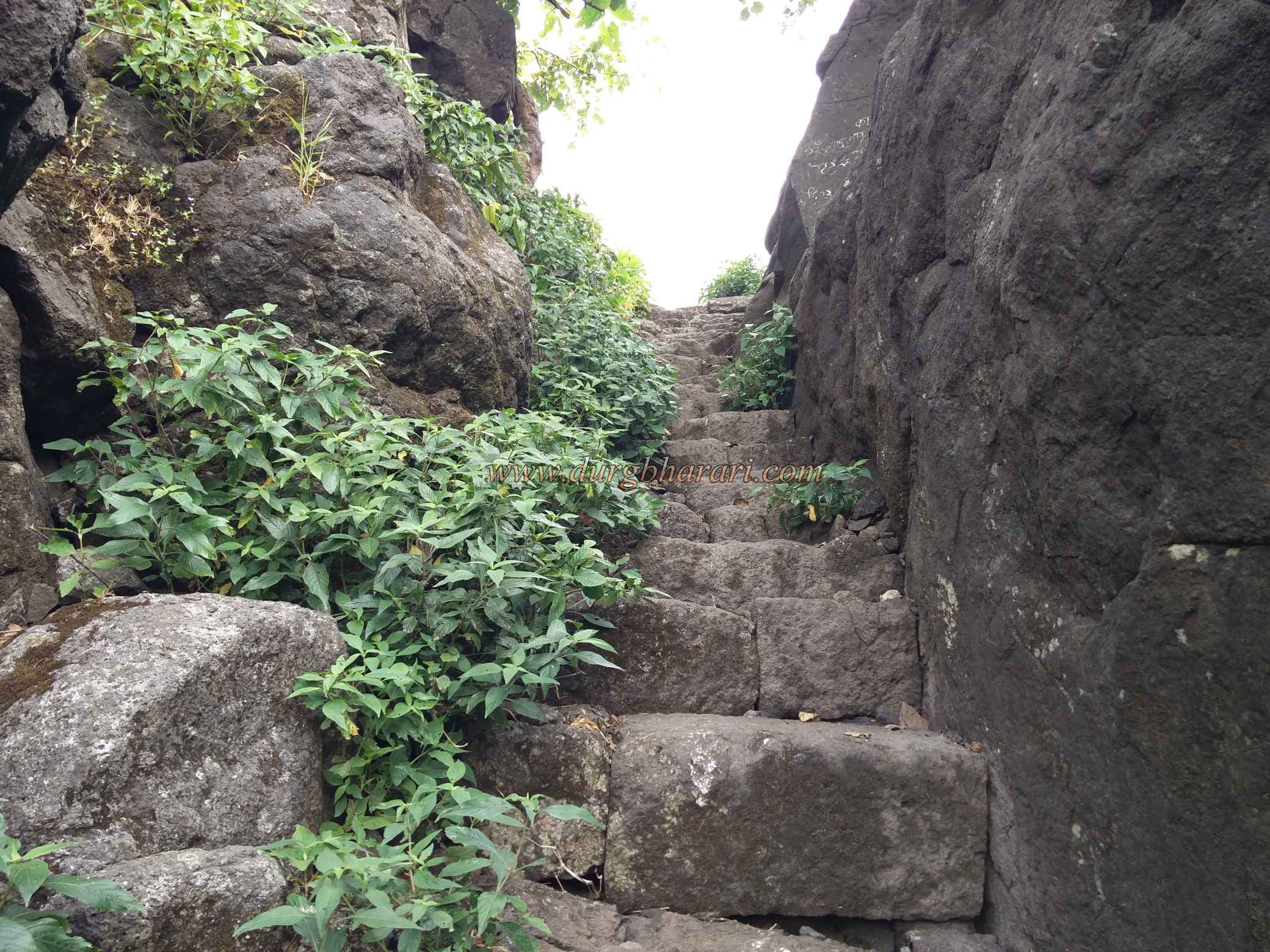
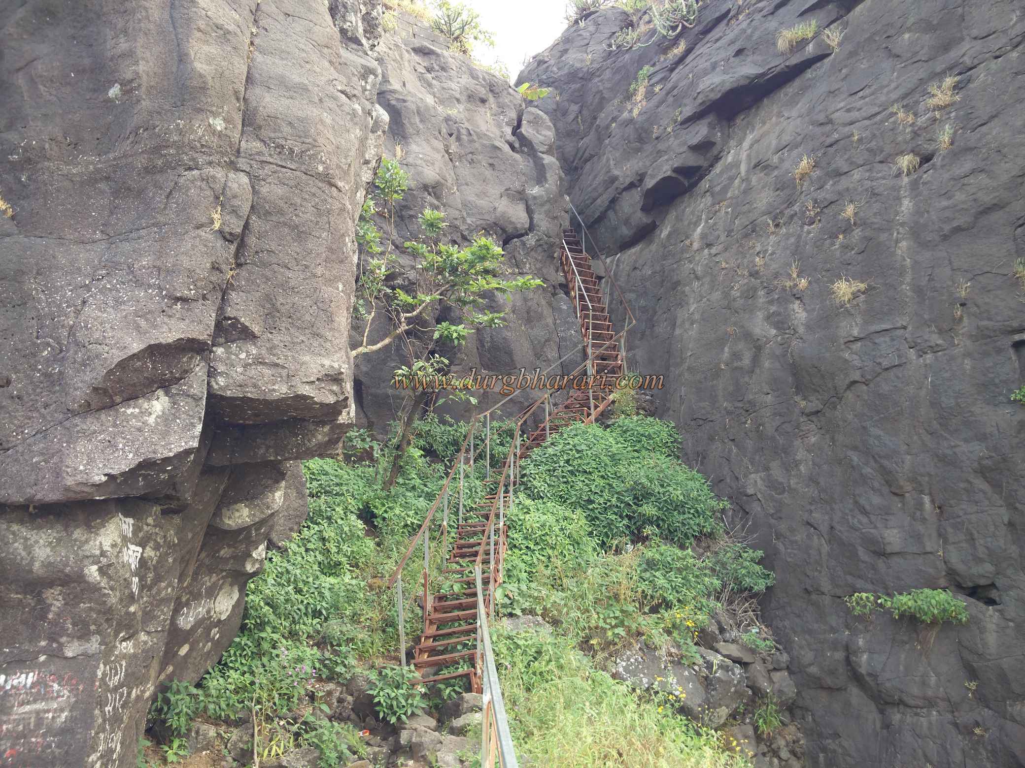
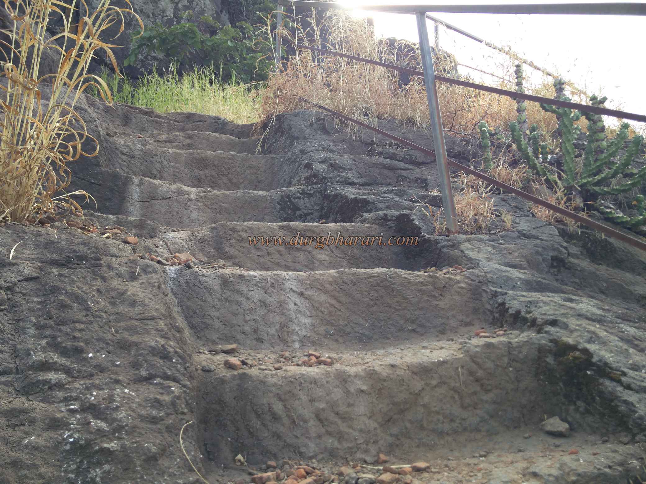
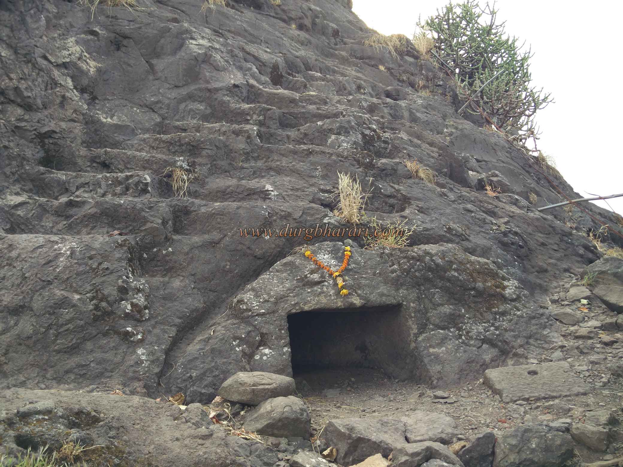
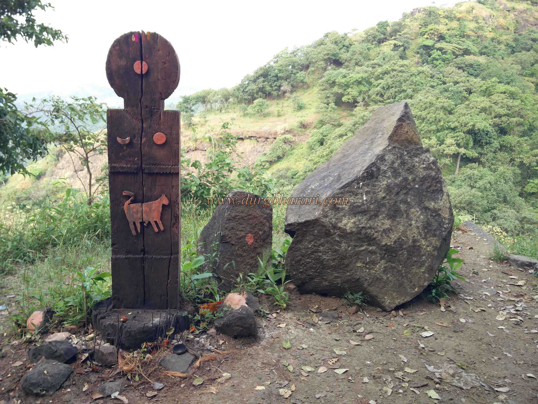
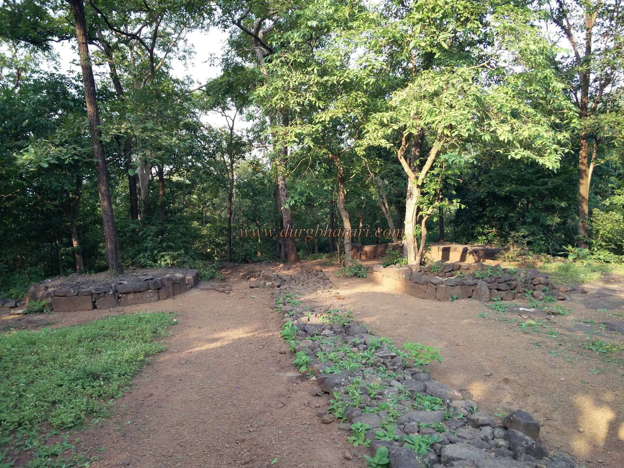
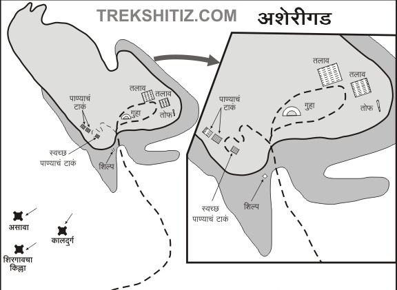
On the left side of the highway, on the fork leading to Khodkona village, the forest department has put up a sign of Asherigad. If you don't have your vehicle, you have to walk 1 km from this fork to Khodkona village. There is a small temple of Waghdeva at the entrance of the village and there are tiger carved on wood in this temple as well as some goddess stone. When we reached Khodkona village, we see Asherigad in front of us. The only way to reach Asheri fort is through Khodkona village. The path starts from the forest at the end of the village and climbs to the left of the fort in the valley between the fort and the adjoining hill. As there is no potable water on the way, take enough water from the village’s well and start climbing the fort. At the foot of the fort, at the beginning of the road, you can see the remains of a structure. Although there is a large amount of forest on the way to the fort, the humid climate here makes it difficult to climb the fort. In about 1.30 hours from this village, we reach the gorge under the fort. After a 15-minute ascent to the right of the gorge, you can see tiger carvings and moon-sun carved in the open. Besides the footpath, the mouth of a small cave can be seen. The length of the cave is about 12 feet and the size of the cave is such that only one person can crawl inside at a time. The rock patch on the cave is a bastion designed to keep an eye on the path. Climbing on the steps adjacent to the cave, we reach the bottom of the ruined doorway between the two hills. Once upon a time, the door at the mouth of this gorge was demolished by the British by planting a mine. In the past, you had to climb the fort from here, but now the forest department has installed an iron ladder on this road, making it a lot easier to climb. After climbing the ladder, you enter the fort by climbing a few steps of the fort which remains in the gorge. To the left of the gate is the bastion of the fort and to the right are the remains of the ramparts. The bastion features a crown of stone carvings symbolizing the Portuguese. In front of the bastion, there are steps carved in the rock to go to the top of the fort and on the left side of these steps, there is a water tank carved in the rock with green water. When you reach the top of the steps, you can see the ruined entrance of the fort facing east. Only the stone frame of this door remains and the upper arch is destroyed. In the facade of the door, some carvings can be seen on the lower side. On the upper side of the gate, there is a long drain parallel to the cliff and actually, this drain is the foundation of the rampart on the hillside has remained intact due to incomplete construction of ramparts. After climbing up the hill there is a path to go to the middle of the fort through the bushes that grow up to your waist. On the left side of the path, there is a rainwater harvesting lake and in the next part, you can see the remains of a structure. While the lake is on the left, one can see a small path going to the right. After walking for about 5 minutes along this path, you can see two water cisterns and a quadrangle structure carved in the rock on the hill slope. Seeing this, we should return to the original path. As you approach this path, you see another path descending to the right. Some water cisterns can be seen at this time, but before going there, you should walk around the fort. As you walk along the sidewalk, you come across a four-way path. From this four-way path, the path to the right leads to the Sadar (fort office) or the fort keepers mansion, while the path to the left leads to the water cistern. The straight path leads to the center of the fort. First, turn right and see the Sadar (fort office) or the fort's keepers mansion. The walls on all four sides of the structure are still standing and when you enter the building through the ruined door, you can see some wrought and carved stones arranged according to a king’s chair in front of it. There is a large number of bushes inside and it is not possible to move. To the right of the place you entered is a large rainwater pond and the water in this pond is drinkable. After crossing this pond, you can see two tanks and a quadrangle structure carved in the rock on the surface in front of you. After seeing this, you should come back to the intersection of the footpath and take the path in front. On this path, first on the left, you can see the square of a structure and the pits and ditches carved in the stone around it. These pits are carved for planting bamboo in the yard of the house and this ditch on the rock is carved to lay the foundation of the wall. On the other side of the road is a half carve cave in the rock, with three medium-sized cannons lying around. Dr. Shridatta Raut's Vasai Mohim Parivar, a fort conservation organization, had brought the cannons lying in the ponds and bushes and arranged them on the fort with great diligence, but some of the over smart people who came to the fort have dispersed them. The exterior of the cave has recently been painted in oil and the medium-sized cave has been excavated in two halls. The interior of the cave is uneven and rough as the excavation work is incomplete.The wall on the inside of the cave has been given the form of God by applying Shendur on it. 5-6 people can easily stay in this cave, except in the rainy season. It takes about 3 hours to reach this cave from Khodkona village. There is a wide plateau at the top of the cave and a small stone wall has also been built here to prevent water from the plateau falling on the mouth of the cave. On the way to the right side of the plateau, you can see the long stretch of crack lying on the edge. On the right side of this crack, there is a gorge between two hills of Asherigad, and a rampart has been built at the mouth of this gorge. There is a possibility that another gate of the fort exists here as the way down from this gate leaves you on the Mumbai-Ahmedabad highway as well as in Khodkona village. This path is dangerous because no one uses it much. The top of Asherigad is 1660 feet high above sea level and the entire fort covers an area of more than 50 acres. Due to a large amount of forest growing at the top of the fort, many remains are hidden in the trees. Walking through the wide plateau of the fort, one can see a large number of architectural remains and structures of houses. There are a total of three large lakes on the plateau out of which two are man-made and the other one is a rainwater harvesting lake. There are large water reserves inside this man-made lake and one of these is carved in rock and the other one is also carved in rock but is built by wrought stones. The water of these lakes is potable and steps have been built to descend into the lake. The hummock near the lake is the highest point on the fort and the entire plateau of the fort can be seen from here. Due to the natural cliffs around the plateau, the fort does not have many fortifications. After completing the round on the top, coming to the main path and next to the four-way path. From here, take the path on the right (facing the top on the left) towards the gorge. There are five cisterns of water carved in the rock at the edge of the valley. Since the path leading to the tank is steep and runs along the edge of the valley, you have to take a little care and get down. The water in two of these tanks is potable and most of the people who visit the fort use this water for drinking. From this tank, a little further along the edge of the valley, you can see the protective iron wall built by the forest department. Next to this wall are two more tanks carved in the rock. After seeing these tanks, when you return to the four-way path, your journey is complete. It takes three hours to see the entire fort properly. From the plateau of the fort, the many other forts like Mahalakshmi Sulka, Segwah, Gambhirgad, Kohoj, Takmak, Kaldurg, Adsul as well as the river-bed of Surya, Pinjal and Vaitarna rivers can be seen. The fort is believed to have been built by the second Bhoj king in the 12th century when the Shilahars dominated the North Konkan. According to Mahikavati Bakhar, this region, which was initially under the control of King Pratap Bimba, but later on it came under the control of the Sultan of Gujarat in the 14th century. When Vasai was captured by the Portuguese in 1556, the fort also came under their control. When the fort was captured, the Portuguese rebuilt the fort and built various new buildings. According to Portuguese documents, a total of 800 people, including soldiers, women, men, children, and prisoners, lived on the fort at that time. The importance of this fort increased during the Portuguese period due to the large requirement of teakwood trees required for shipbuilding which were present in the vicinity of this fort. The fort was in the possession of the Portuguese for 130 years from 1556 to 1683. After the invasion of Kalyan Bhiwandi by the Marathas in 1657 AD, the Portuguese viceroy sent a letter to his king in 1658 saying that Shivaji Maharaj has disturbed their region. Later in 1683, during the reign of Sambhaji Maharaj, the Marathas attacked Tarapur, which was under the control of the Portuguese, and destroyed it. At the same time, the Marathas also conquered Asherigad, but in October 1687, the fort was recaptured by the Portuguese. Later, in Chimajiappa's Vasai campaign, the Marathas laid siege to the fort and conquered Asherigad from the Portuguese on 24th January 1738. The fort was captured in 1818 by Captain Dickinson, an English officer. As mentioned in the Thane District Gazette, the gate of the fort was in a dilapidated condition around 1881.
© Suresh Nimbalkar
Gallery