ASAWA
TYPE : HILL FORT
DISTRICR : PALGHAR
HEIGHT : 1056 FEET
GRADE : MEDIUM
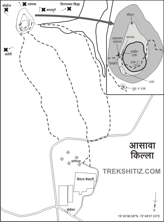
Due to Mumbai, the Konkan province is divided into North Konkan and South Konkan. The belt from Vasai to Daman is known as North Konkan and the belt from Alibag to Karwar is known as South Konkan. In the former Thane district of North Konkan and now in the newly formed Palghar district, Asava fort, a watchtower where dense bushes have grown still stands, holding its remnants. To visit the fort, Boisar on the Western Railway and Chilhar on the Mumbai-Ahmedabad route is nearest to the fort. To reach the fort, Baripada in the village of Wargande on the Boisar-Chilhar road is 7 km from the Boisar railway station and is 14 km from Chilhar on Mumbai-Ahmedabad route. Adjacent to the wall of the Viraj Profile factory in Wargande village, a road leads to Baripada village at a distance of 1 km.
...
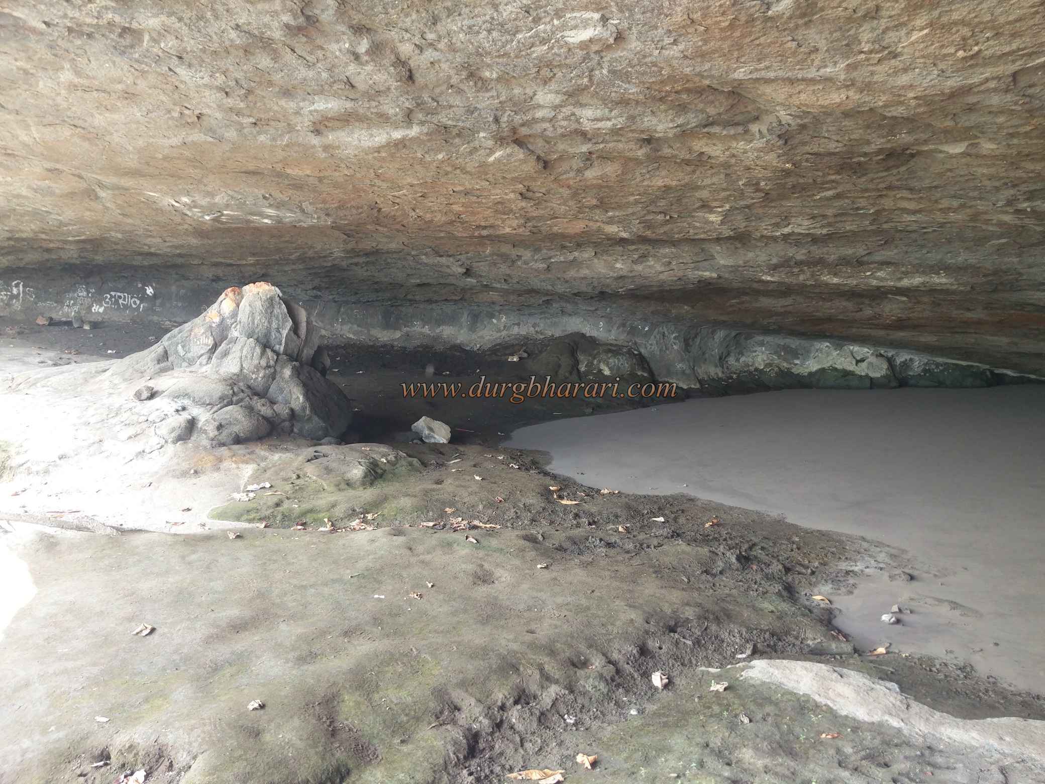
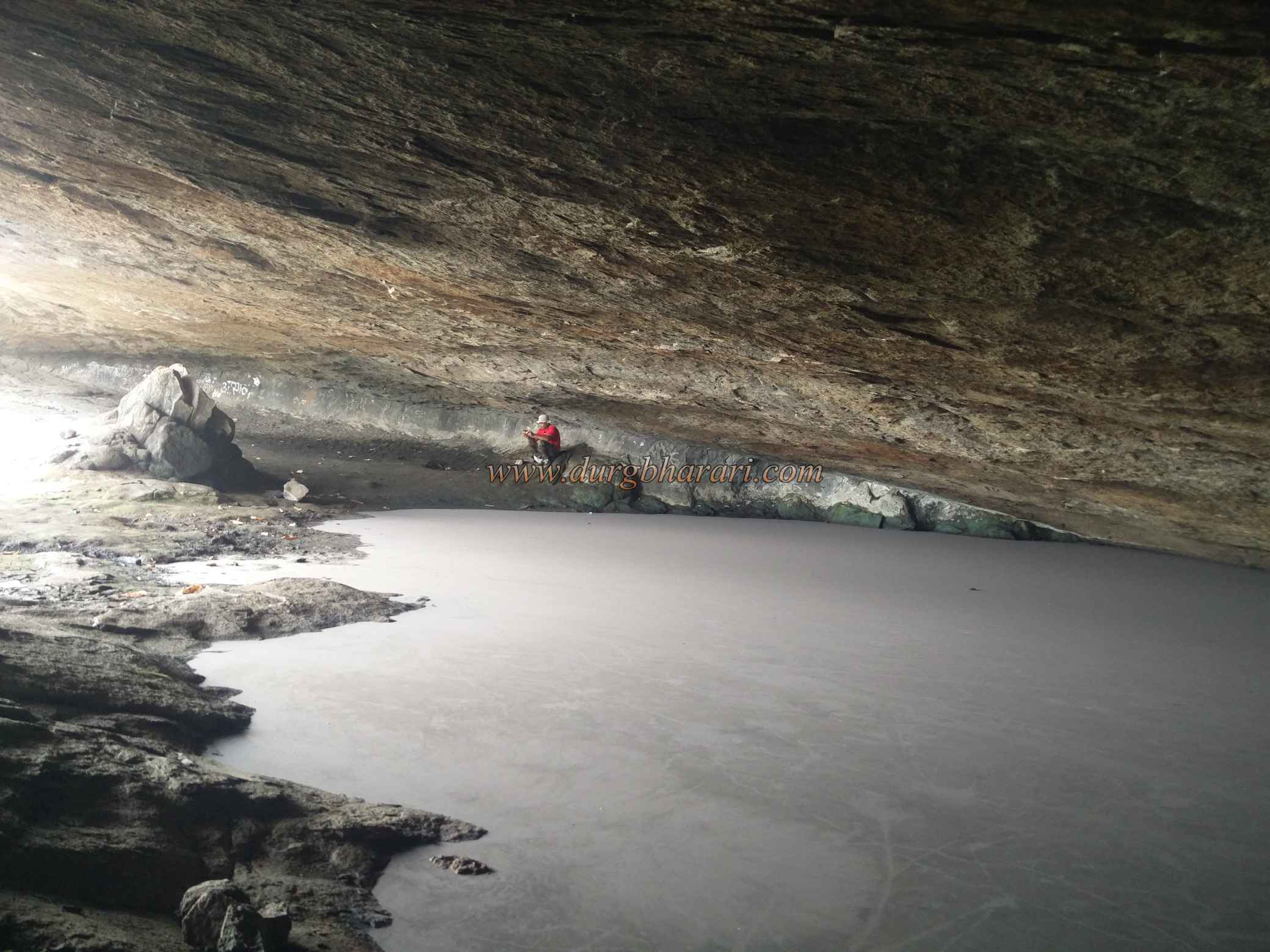
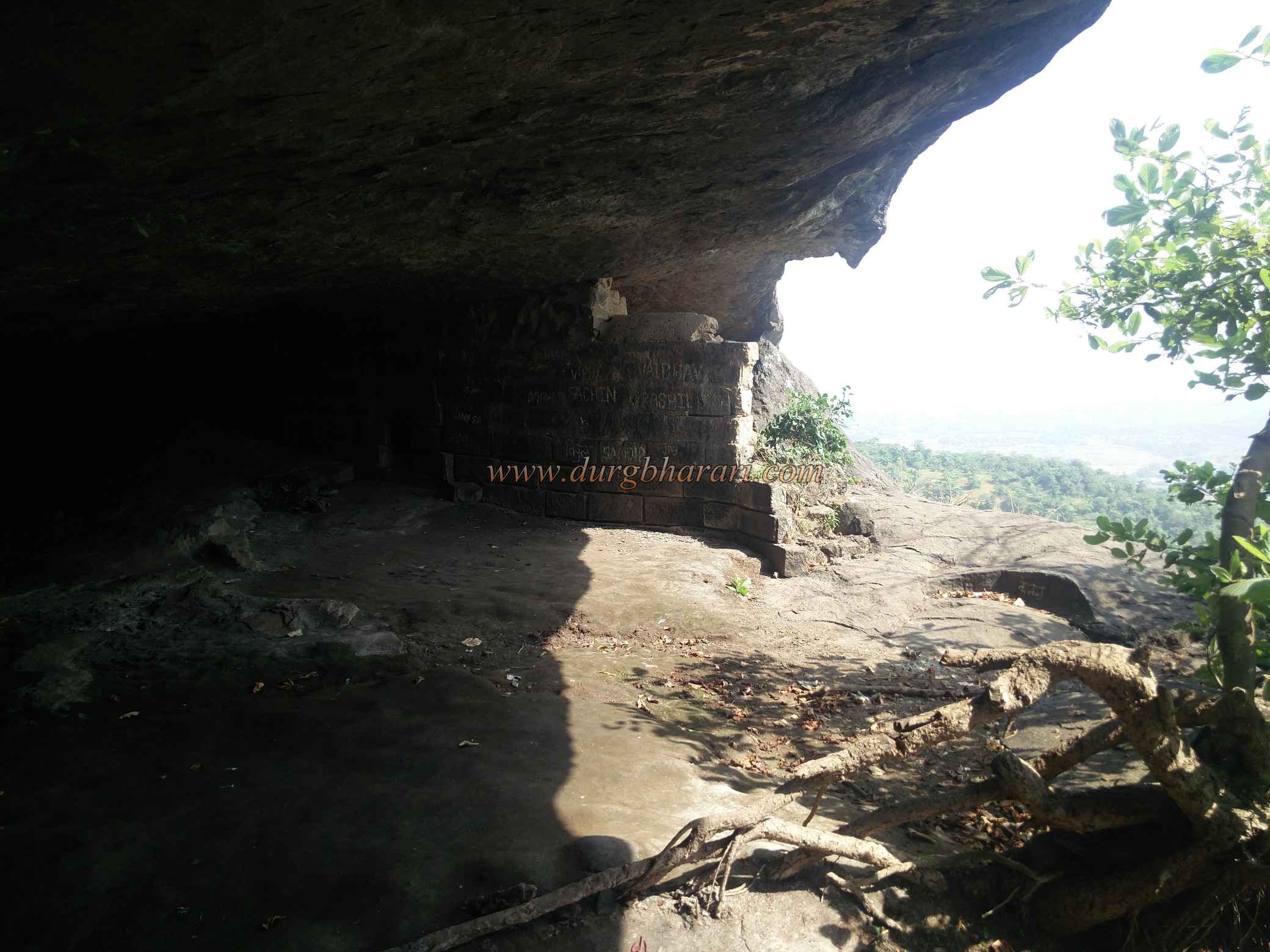
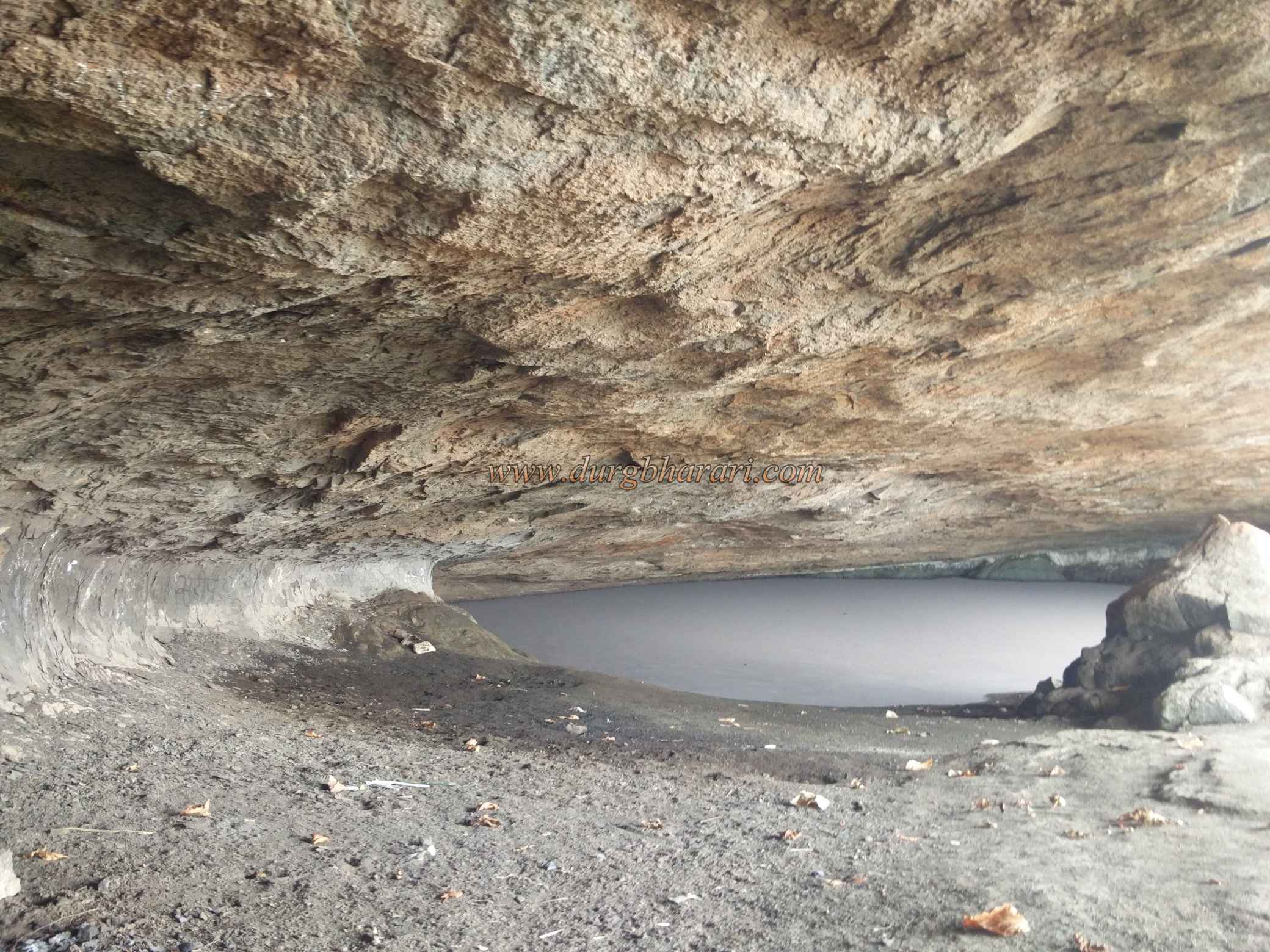
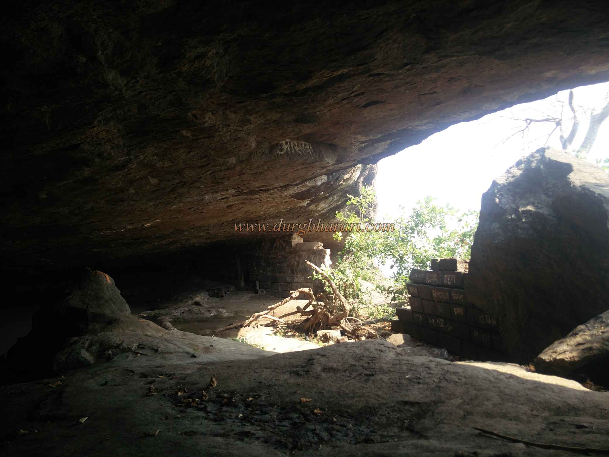
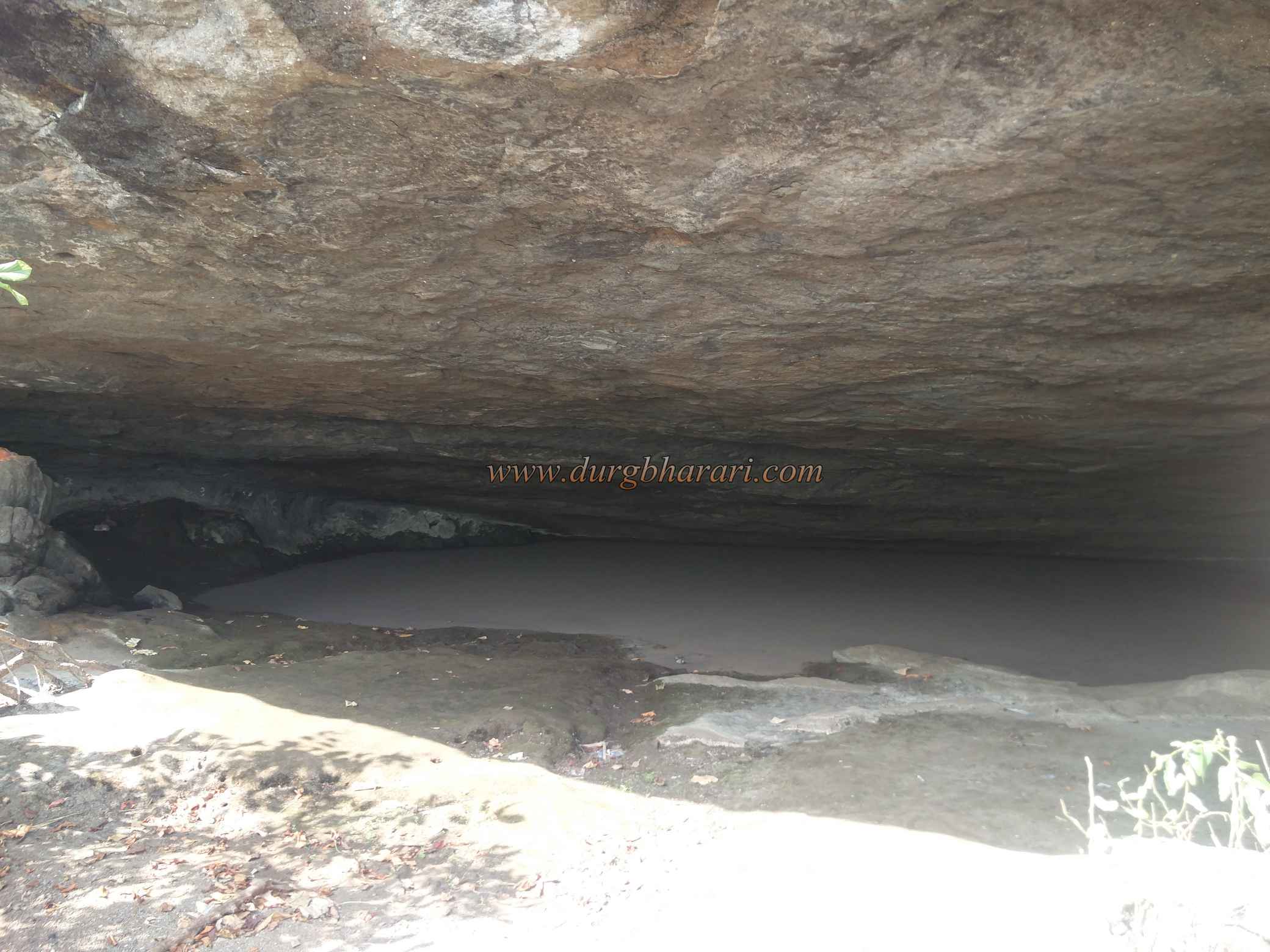
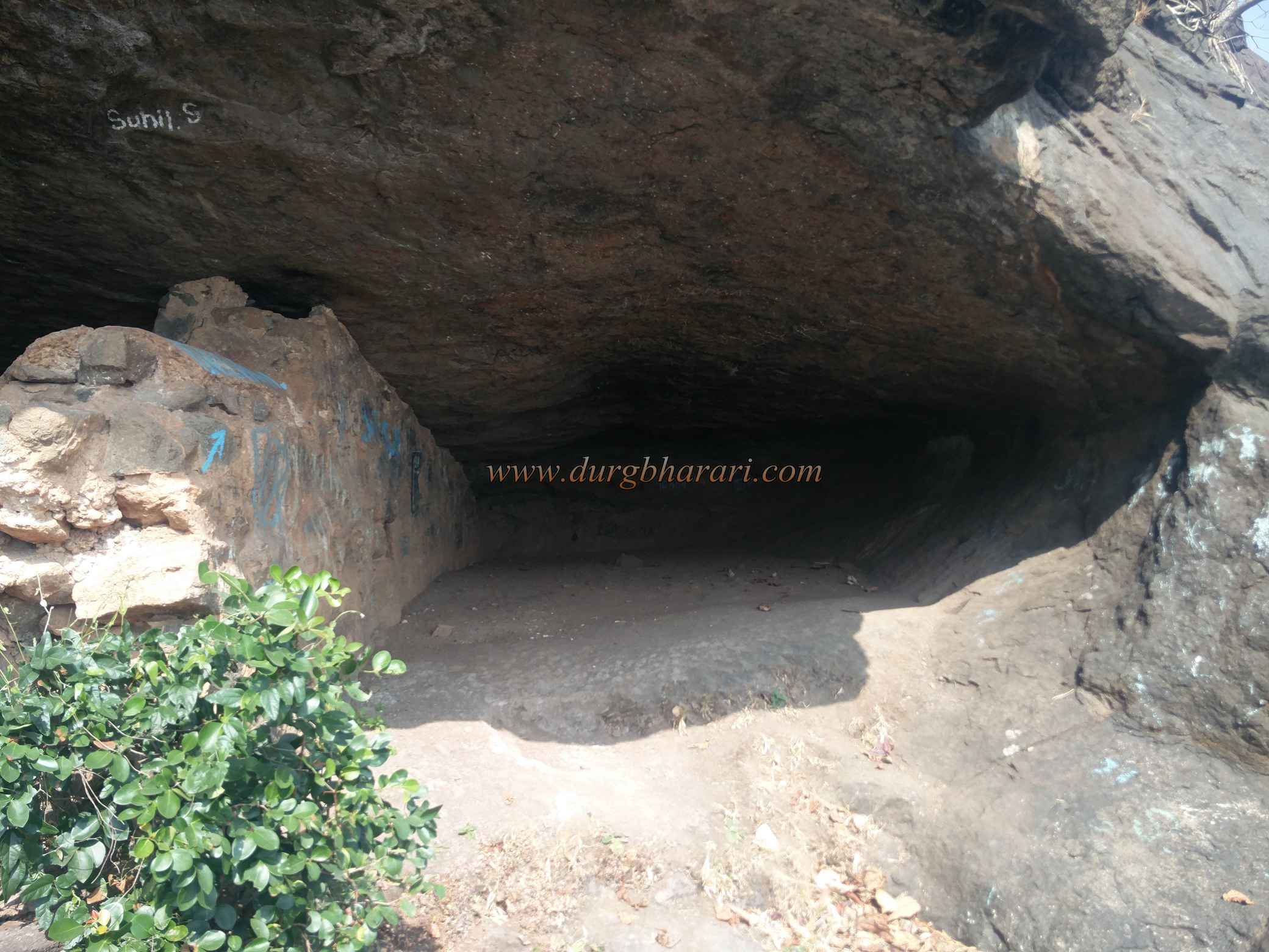
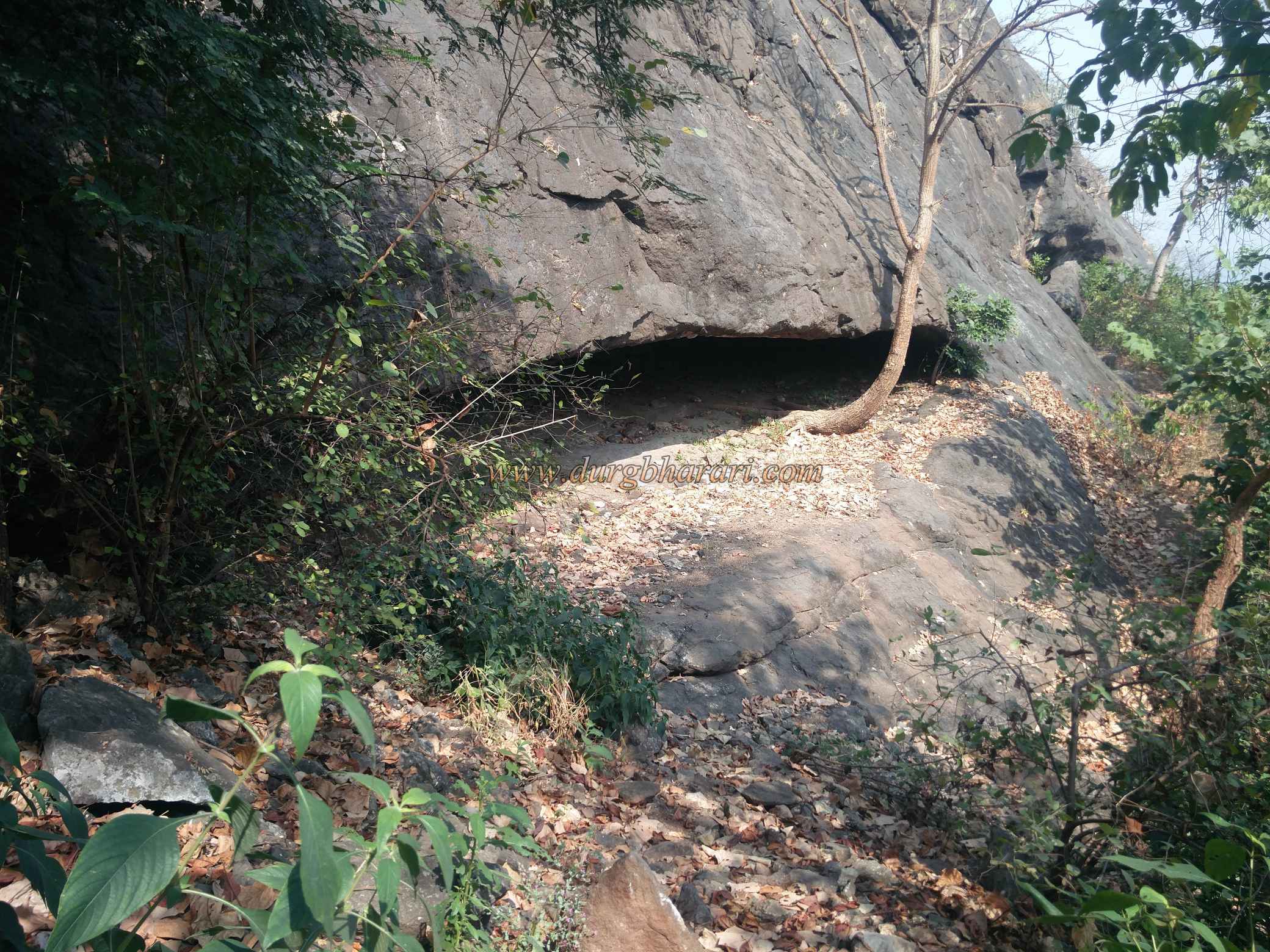
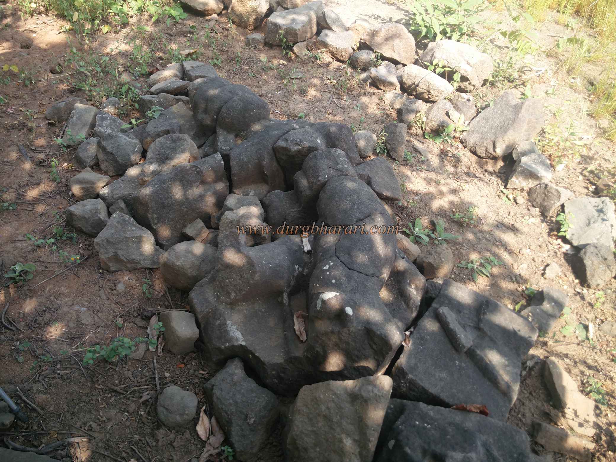
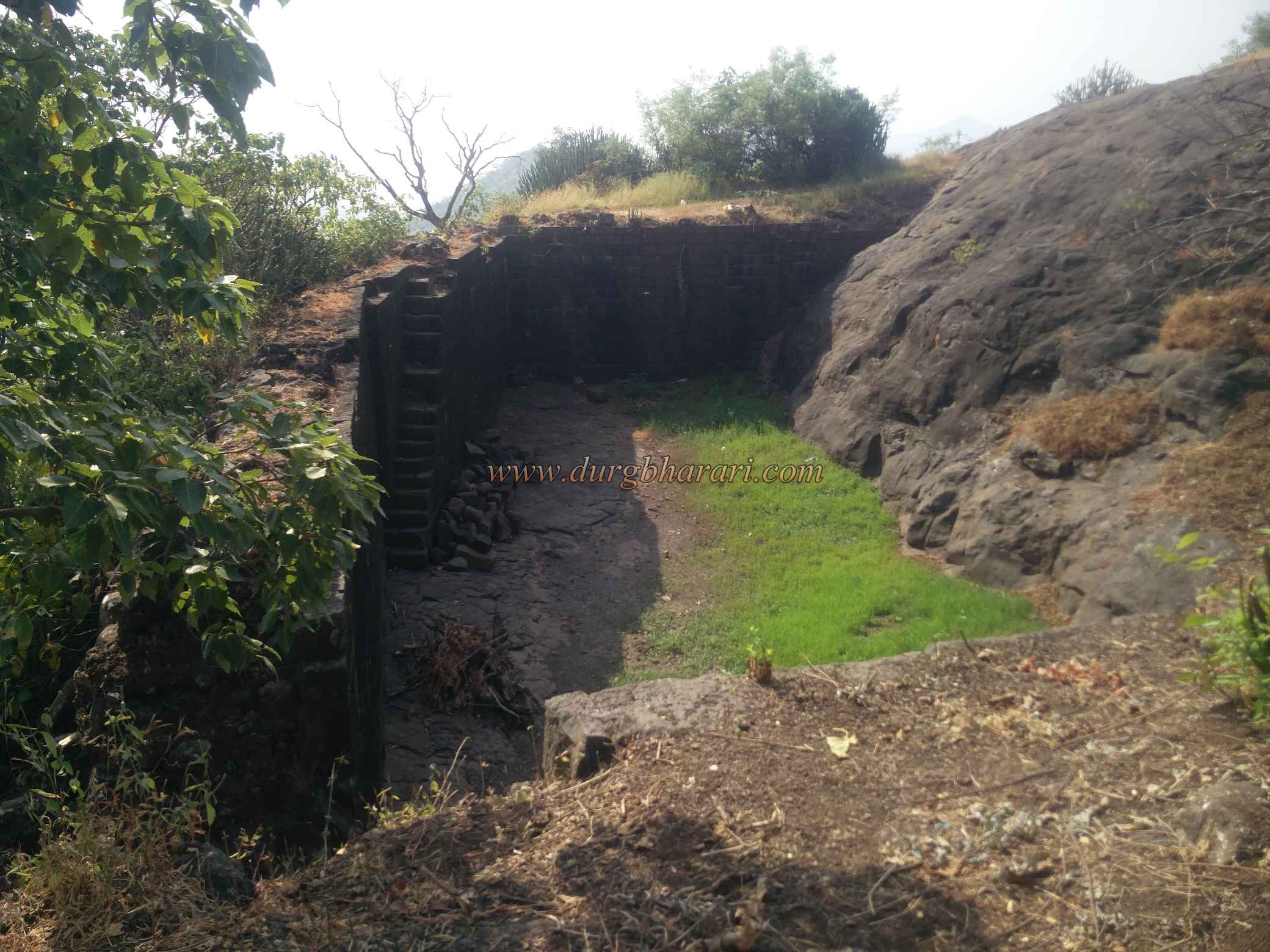
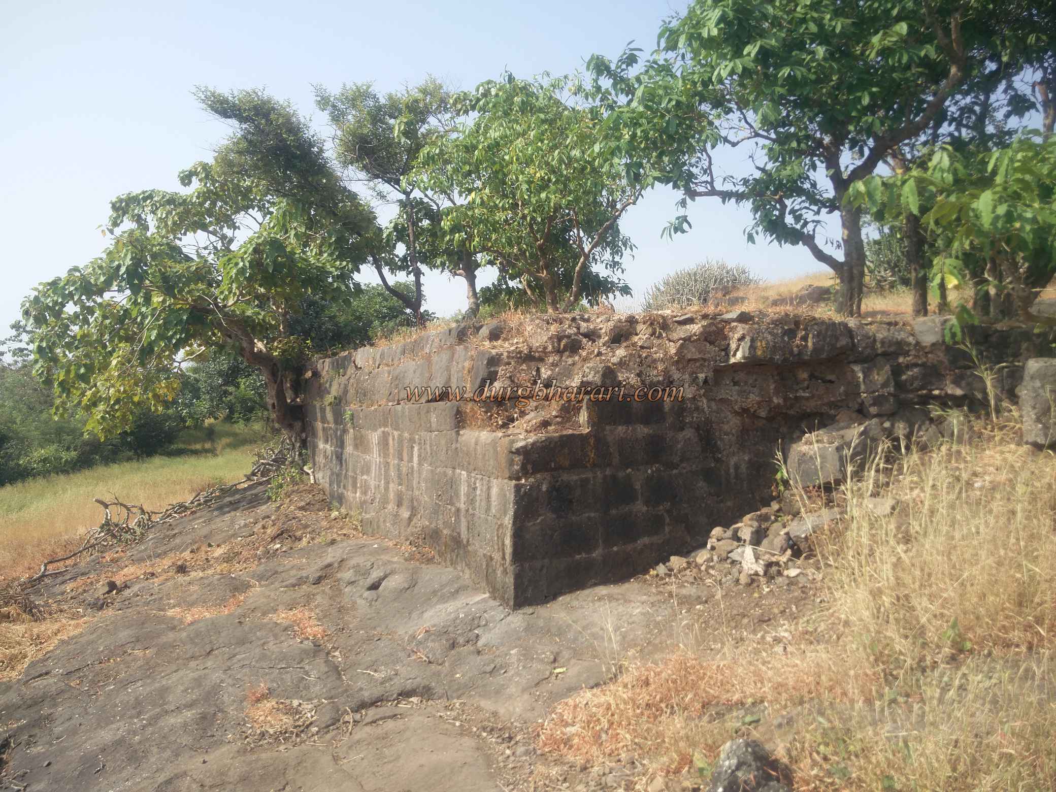
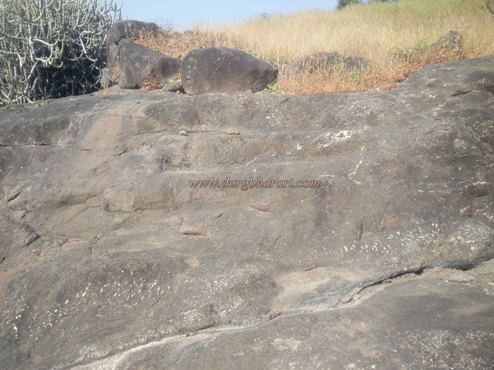
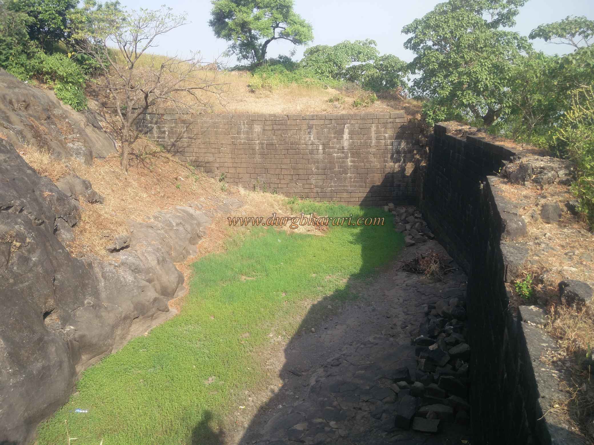
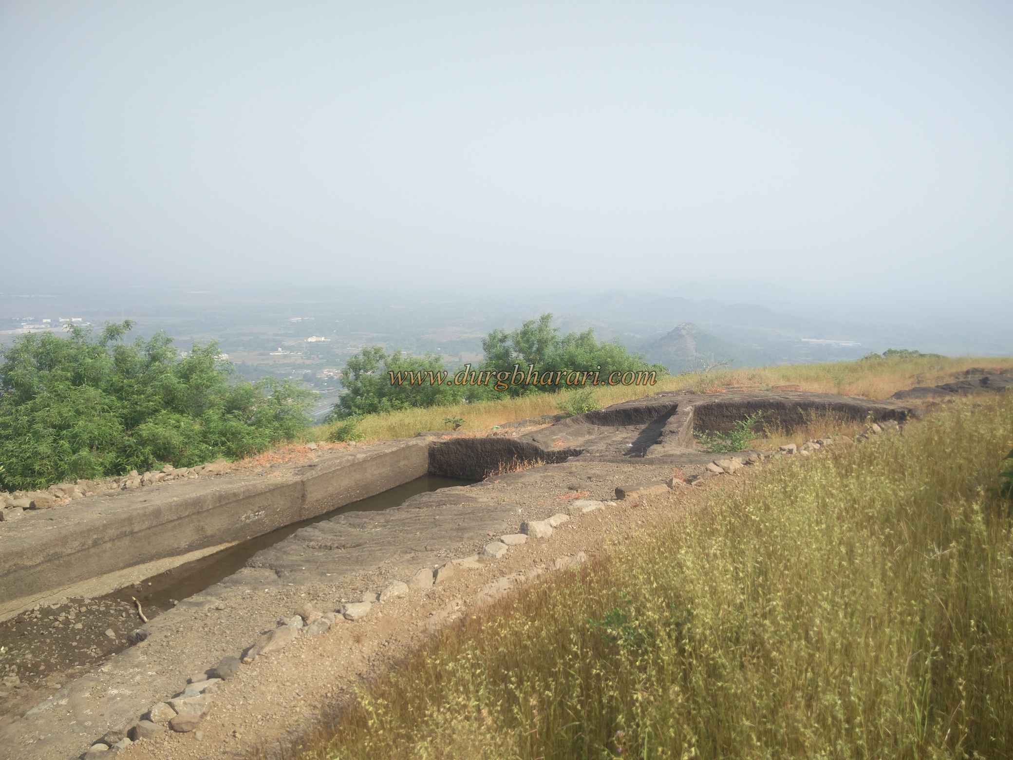
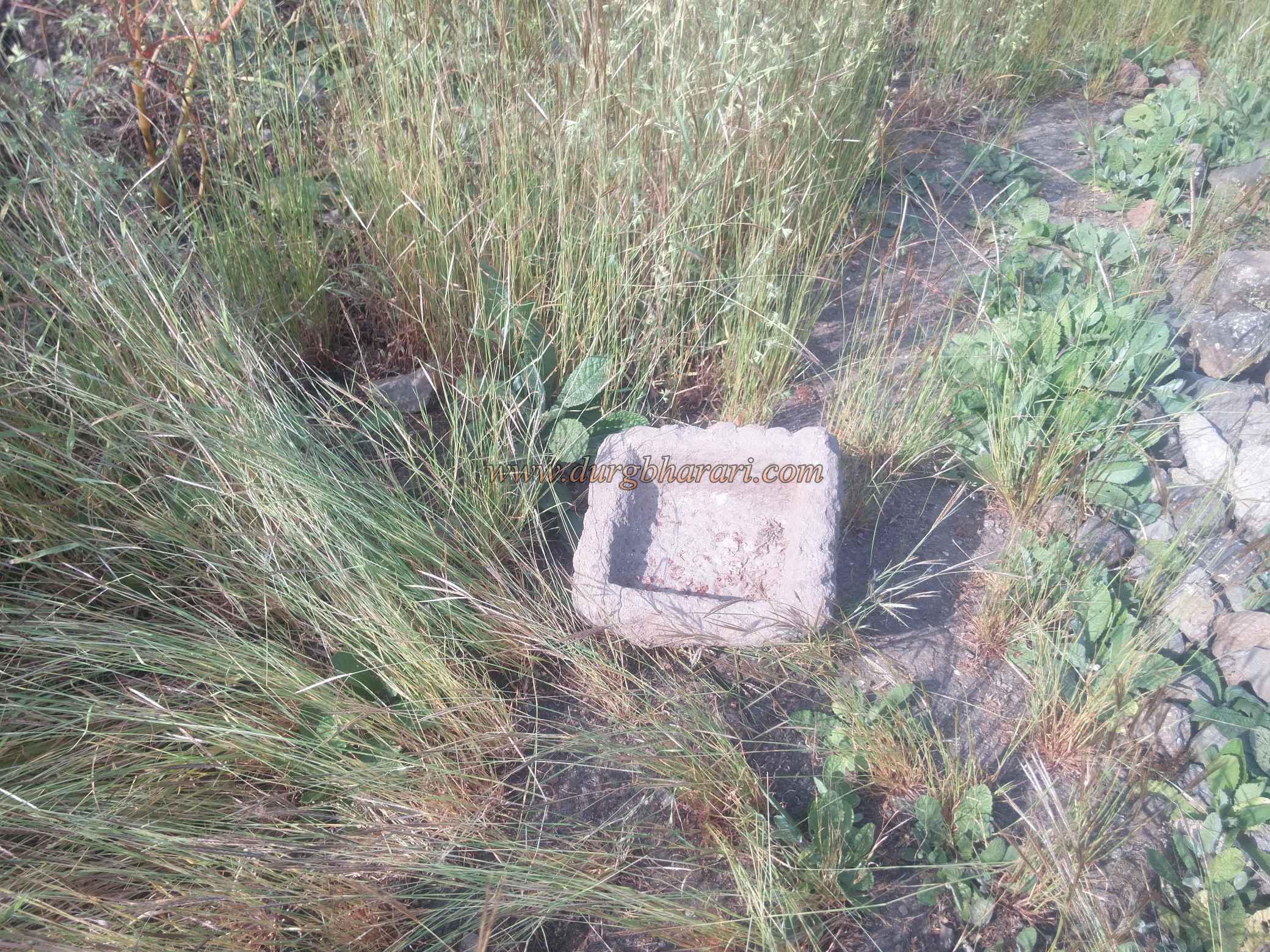
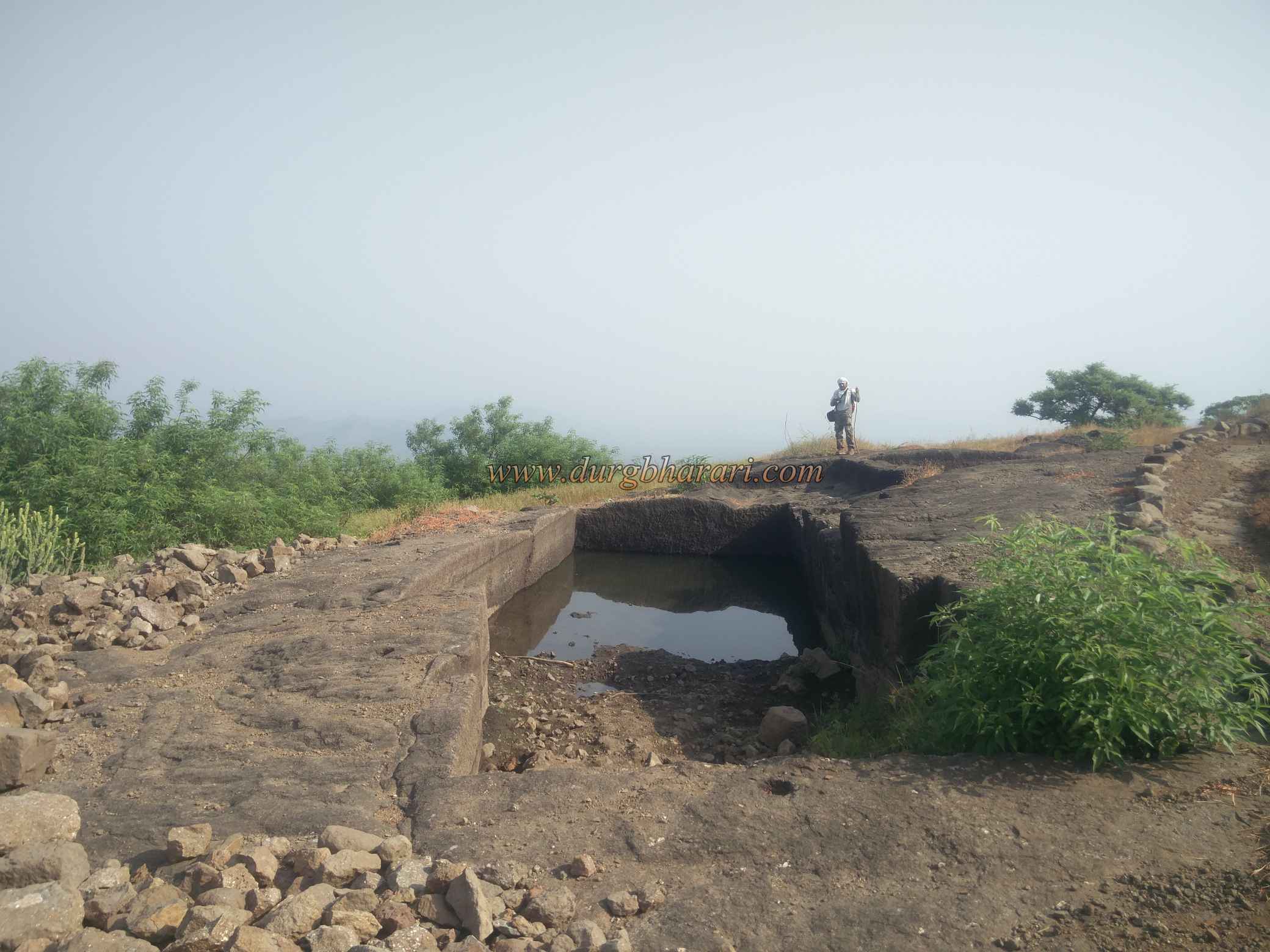
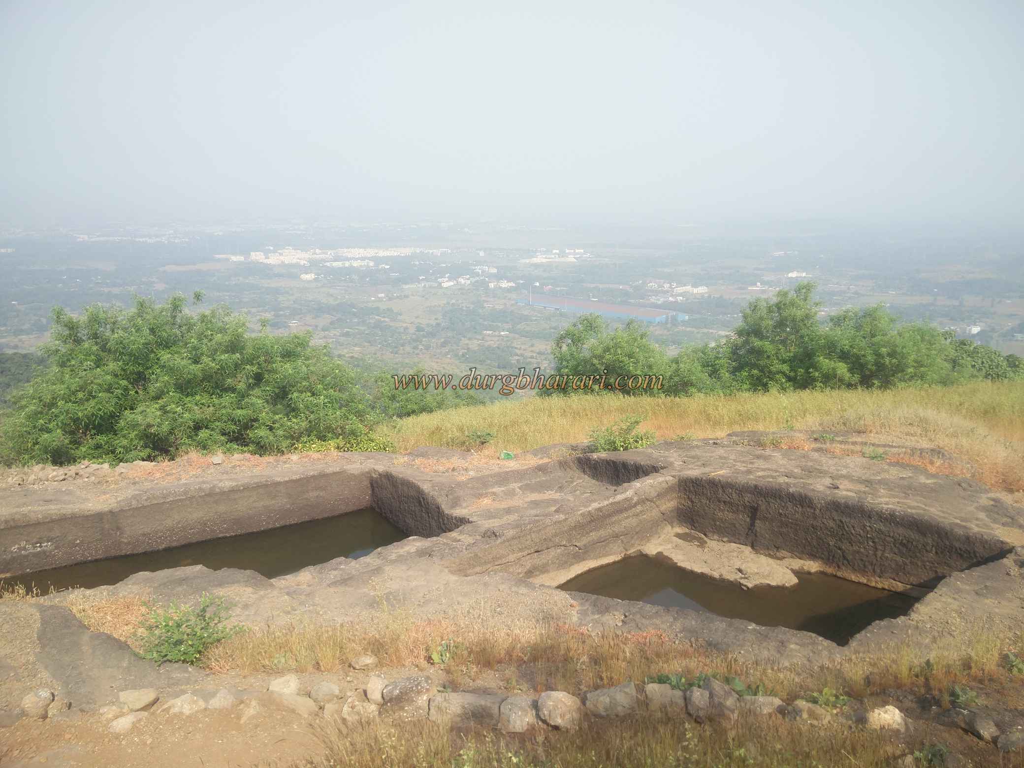
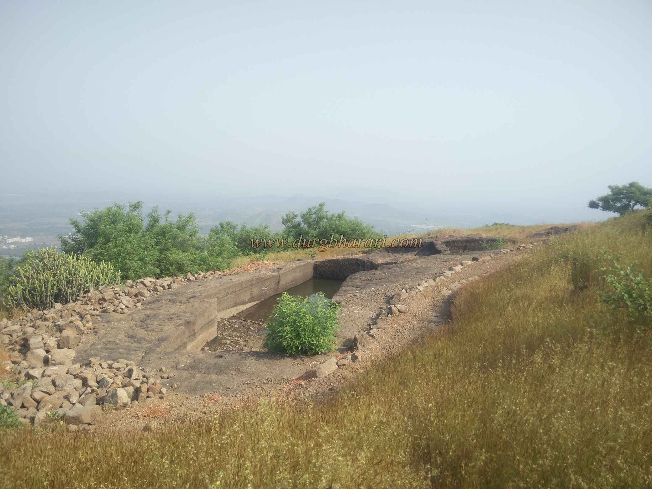
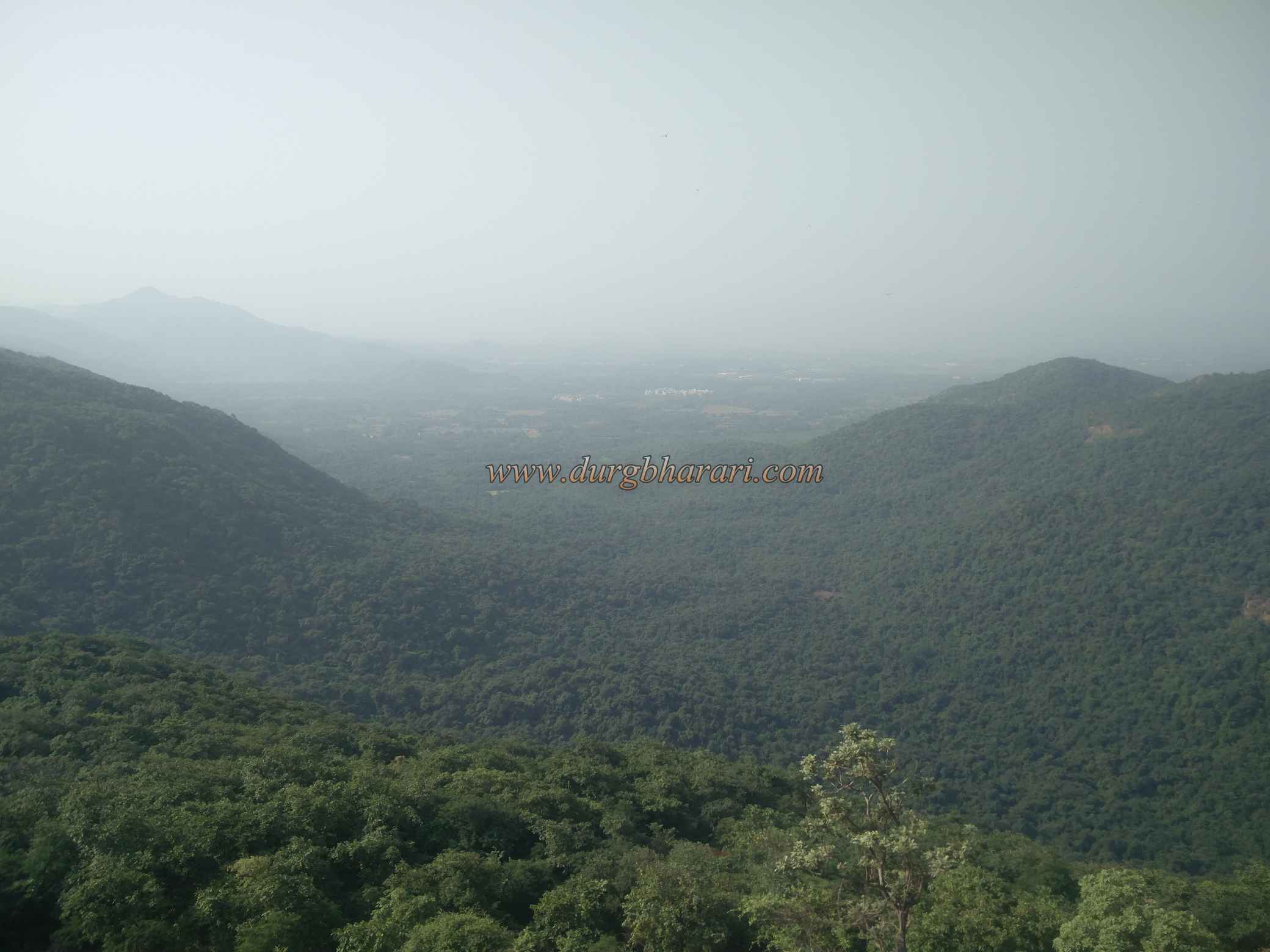
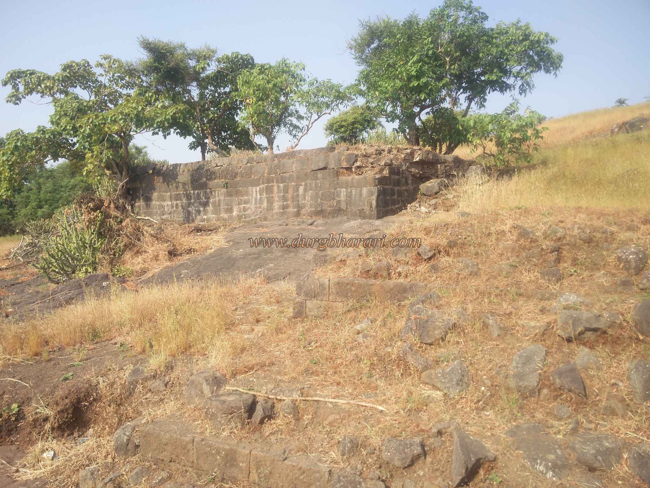
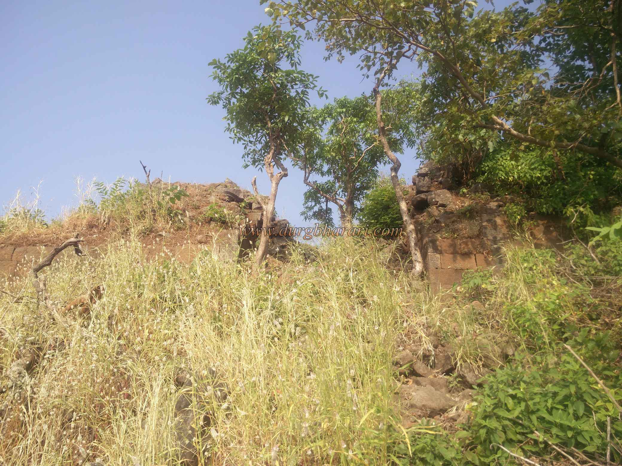
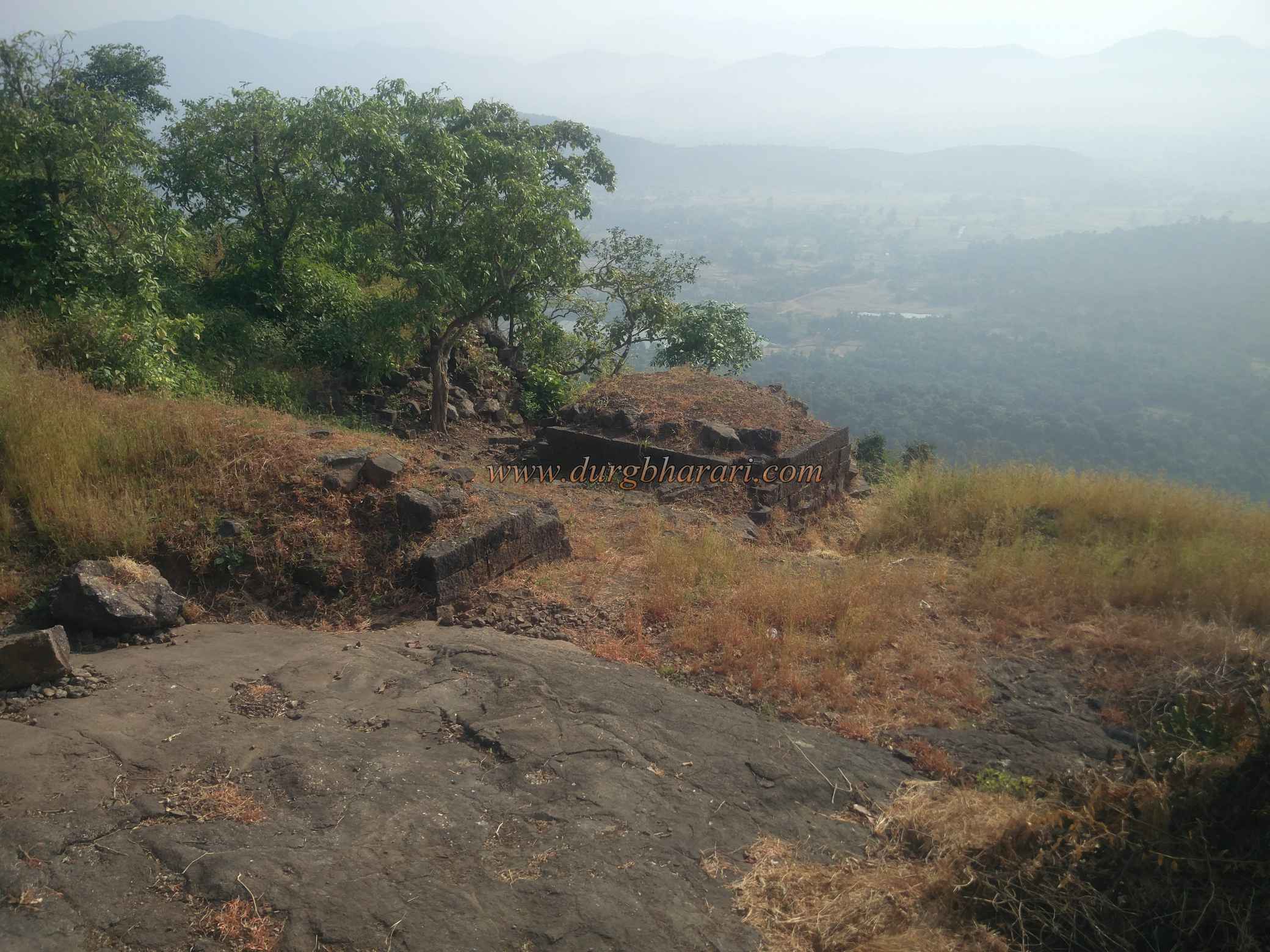
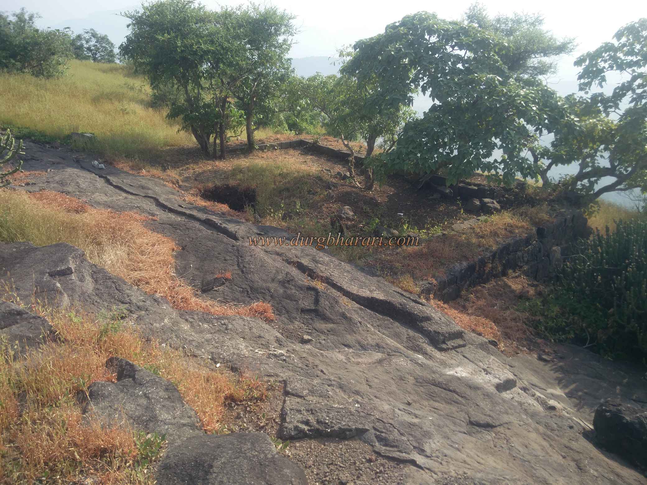
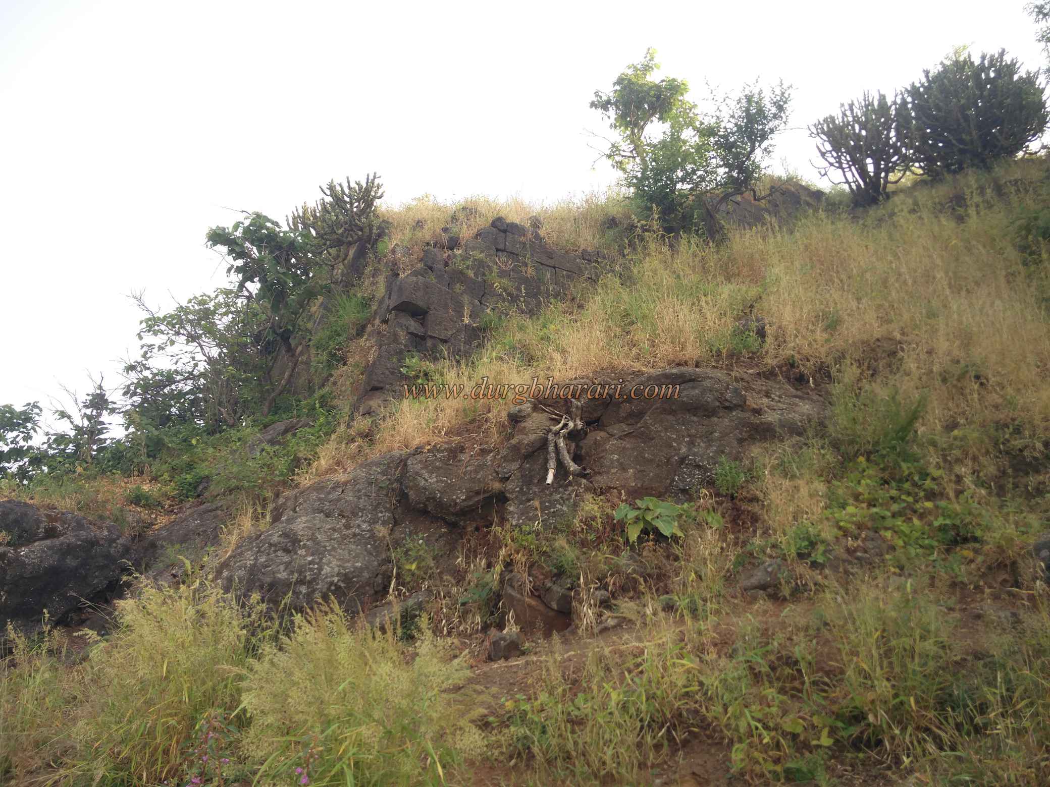
At the beginning of the village, an unpaved road is seen on the right leading to the fort. At the beginning of this road, after crossing a small stream and walking for 5 minutes, the canal of the Surya river comes to a standstill. From the bridge where you reach the canal by road, you can see a steep path leading to the hill of the fort, but this is not the path leading to the fort, but a muddy path leading to a house. Turn right without crossing the bridge. You will come across another bridge here, cross this bridge and start climbing the hill in front. Turning to the hill on the side of the fort, this path slowly climbs two small hills to reach the mountain of the fort. This path passes through thick bushes so you don't feel tired. Although once you reach the mountain of the fort, the path is steep and may tire you. This is the main route leading to the fort and this path directly takes you to the top without getting you lost. In about 1 hour you enter the fort from the ruined ramparts. The ramparts of the fort are built on the lower part of the plateau and from here you enter the citadel. You can see a ruined bastion on the left side. The ramparts of the fort should be in most parts of the plateau but it is not possible to walk in this area due to the trees growing on a large scale in the plateau. On entering the citadel, on the left side of the road, one sees a square bastion and the ramparts of the fort built by placing stones on the other. Neither cement nor any other mixture is used to withstand this construction. The head of the fort is spread over two and a half acres from south to north and the height of the fort is 970 feet above the sea level. Once you reach the top, turn left and start walking around the fort. At the beginning of the road, there are two water tanks carved in the rock. The water in this large tank is potable after filtered. On the side of this tank, there are some holes constructed for planting bamboo. Since the tank was open, bamboo was planted and a thatched roof was placed over it to prevent water from evaporating. Besides the tank, you can see a mortar and a stone basin. From here, on reaching the south end of the fort, one can see a 50 x 20 feet long and 20 feet deep water cisterns. There is a rock wall on one side of the tank and the other three walls are made of wrought stone. Since one of these walls is at the edge of the ridge, there is no need to build a separate rampart. Stairs have been built to get down to the tank from this fortified wall. The bottom of the wall has collapsed to some extent and water doesn’t get stored in the tank. To collect water in the tank, gutter carved in the rocks. Going further, you can see the ruined west-facing entrance of the citadel on the left side. Inside the doorway are ruined porches and adjacent square bastion testify to Portuguese construction. You can see a path descending through this door, but before going there, you should see the northern part of the fort. At the top of the door, you can see a small replica of the big tank we saw earlier but these tanks are filled with mud. The path that goes straight under the tank leads to the north bastion. Remains of construction can be seen on this square-shaped bastion. In this part of the fort, the remaining 80-90 feet ramparts can be seen. After taking a look at the ramparts, you should come to the hummock of the fort. There are some ramparts on both sides of this hummock and you can see some of the building structures here. From the citadel, you can see Asheri, Kaldurg Fort, and Dahanu-Boisar Palghar area. As the head of the fort is small, it can be completed in half an hour, but the view of the fort is not over yet. To the east of the fort are two large caves facing Baripada village. To see it, you have to go down half a mountain through the gate of the fort. As you begin to descend the path of the ruined door you saw earlier, you can see the steps carved into the rock on the way and the ramparts on either side of the door. After a short descent, a path goes to the plateau on the right, while the path goes straight descends. After crossing some distance on the right-hand side, you can see a six feet high broken idol of Hanuman lying on the ground. This idol is a little different from the usual Hanuman idols. After seeing the idol, come to the main path under the door and start descending the fort. On the way down, you can see the remnants of the ramparts in this part of the plateau. The way to the cave is indicated by an arrow, so the chances of missing are very low. There are many steps carved on this path and after half an hour of descending the mountain, we reach the front of the cave. There are a total of three caves in this place, the first cave is completely natural and the remaining two caves are also natural but are built up to some extent. The second cave is 70 x 50 feet long and 8-10 feet high. The cave is stocked with water and has a gray tinge. The bottom of the water is visible when the tinge is set aside. Adjacent to this large cave is another small cave. If necessary, 5-6 people can stay in this cave. The facade of both these caves is built of wrought stone and is now somewhat dilapidated. When you see the cave, your fort round ends. There is a footpath to get down from the cave, but since it is not used much, it is better to go down this path only if there is a guide with you, otherwise, it is better to go back. In history, Asava fort is known by many names, Visavagad, Visama, and Asavagad. Since the fort has been under Portuguese rule for a long time, the influence of Portuguese construction on the fort's structures is felt. In ancient times Sopara, Dahanu, Tarapur, Kalyan, and other ports were used for large scale trade with foreign countries. The cargo that landed at this port used to go to the Wharf. The Asava fort is believed to have been built by the Bimba king of Mahikavati to protect the routes connecting Dahanu and Tarapur ports to the Wharves, but later the fort passed to the Sultan of Gujarat and then to the Portuguese. During Shivaji Maharaj’s period, this fort was under the control of the Portuguese. In 1683, during the reign of Sambhaji Maharaj, the Marathas took possession of this fort but it did not last long. The Portuguese immediately took possession of it. Later, in the Vasai campaign of 1727, Chimaji Appa took possession of this fort and removed the Portuguese from this area permanently. The fort was captured by Captain Dickinson in 1818 and, like other forts in Maharashtra, this fort too fell into the hands of the British.
© Suresh Nimbalkar
Gallery