ANTUR
TYPE : HILL FORT
DISTRICT : AURANGABAD
HEIGHT : 2644 FEET
GRADE : MEDIUM
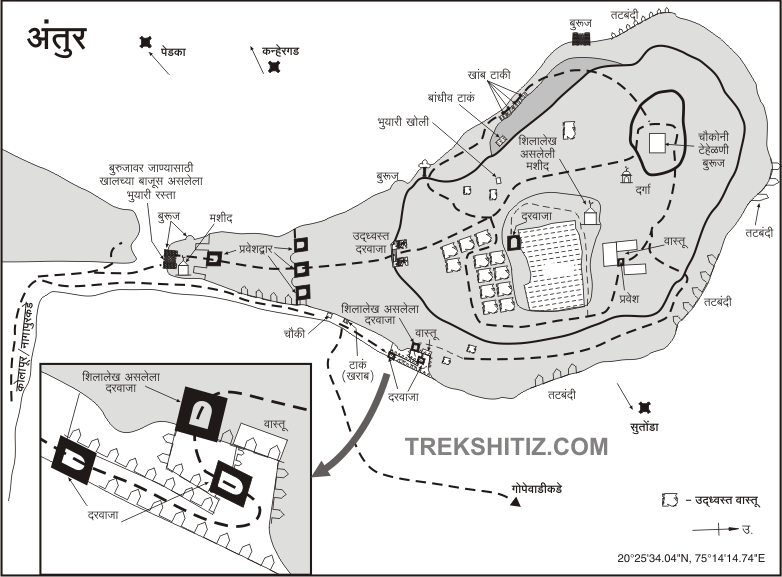
There are many unfamiliar forts in the Satmal mountain range stretching east-west from Pitalkhora to Ajanta in Aurangabad district. Known as the tourist district of Maharashtra, the district is in a dire condition of roads except for the main tourist destinations and some of the highways connecting them. So no one turns to these forts. Antur fort in Kannada taluka is a beautiful fort with many such architectural remains like ramparts, bastions, gates, barn, water cisterns on its shoulders. The fort is divided into both ground fort and hill fort. If you take the Nagapur-Kholapur road, you can enter the fort directly. To visit Antur Fort directly from the ground level, you have to reach Nagapur, a village near the fort. Given the dire condition of the roads here, going from Mumbai to Pune via Chalisgaon is a good option.
...
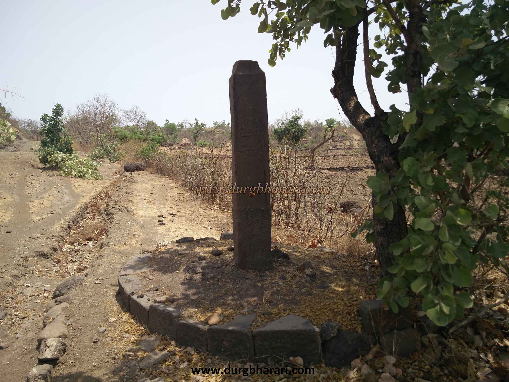
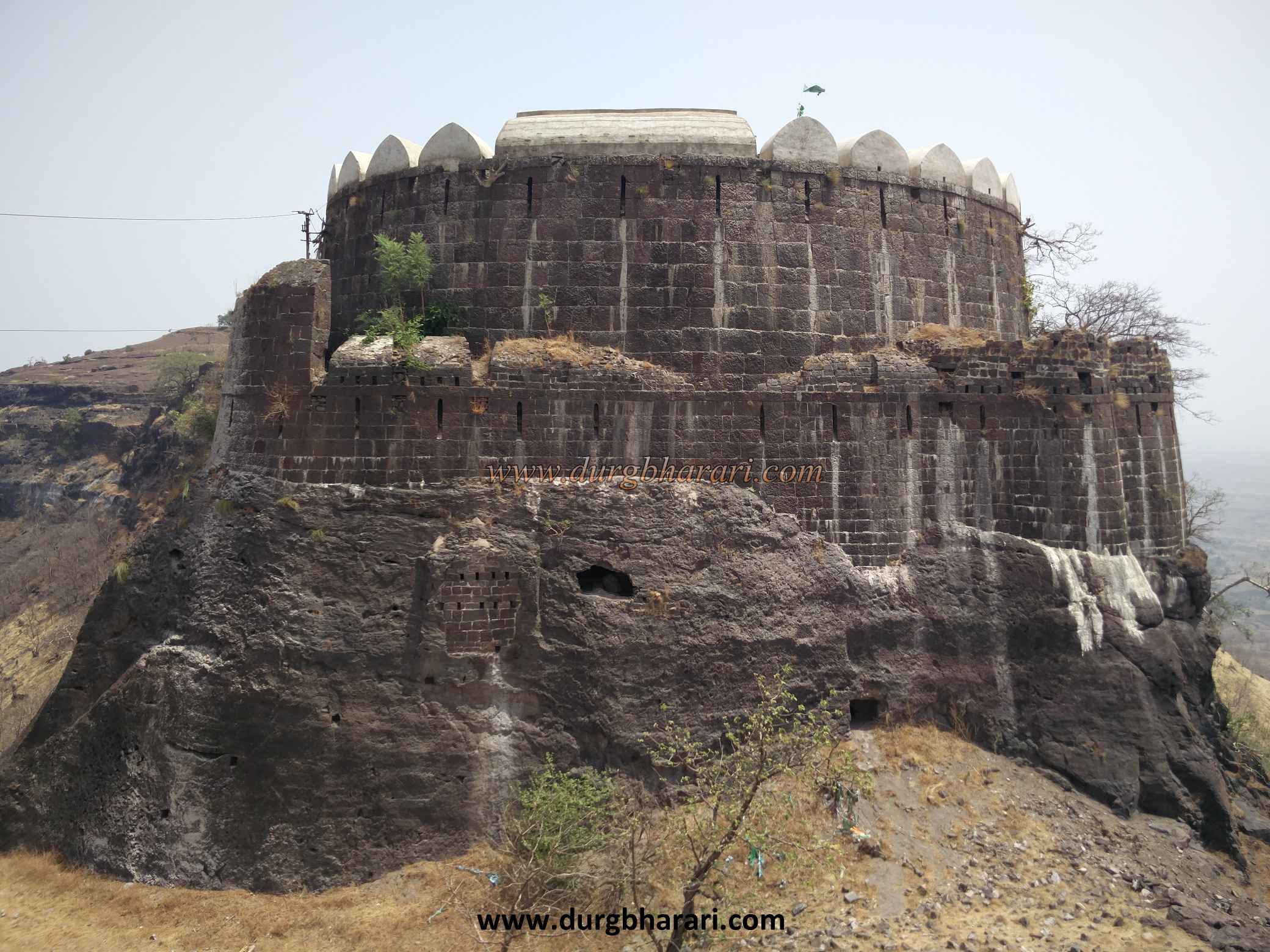
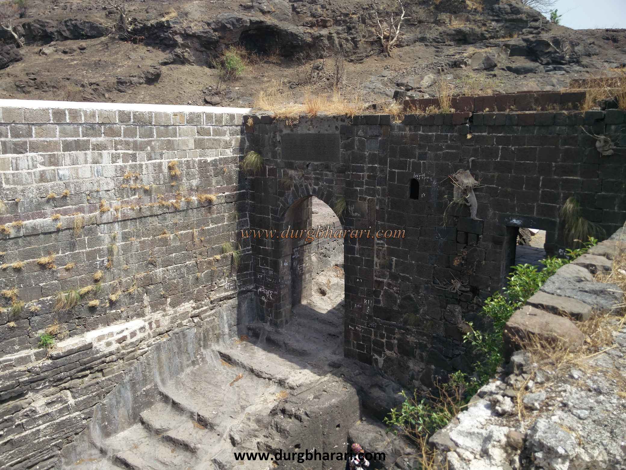
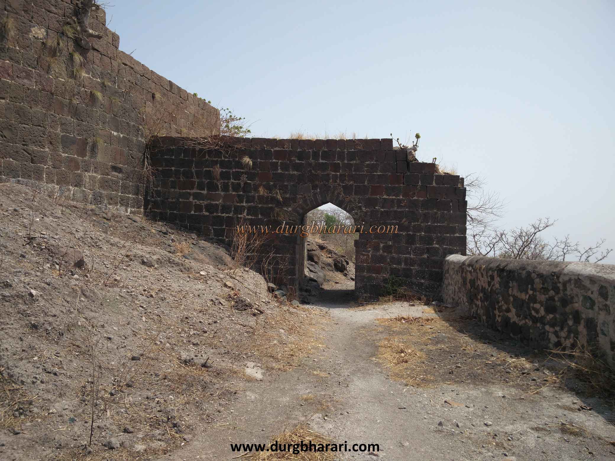
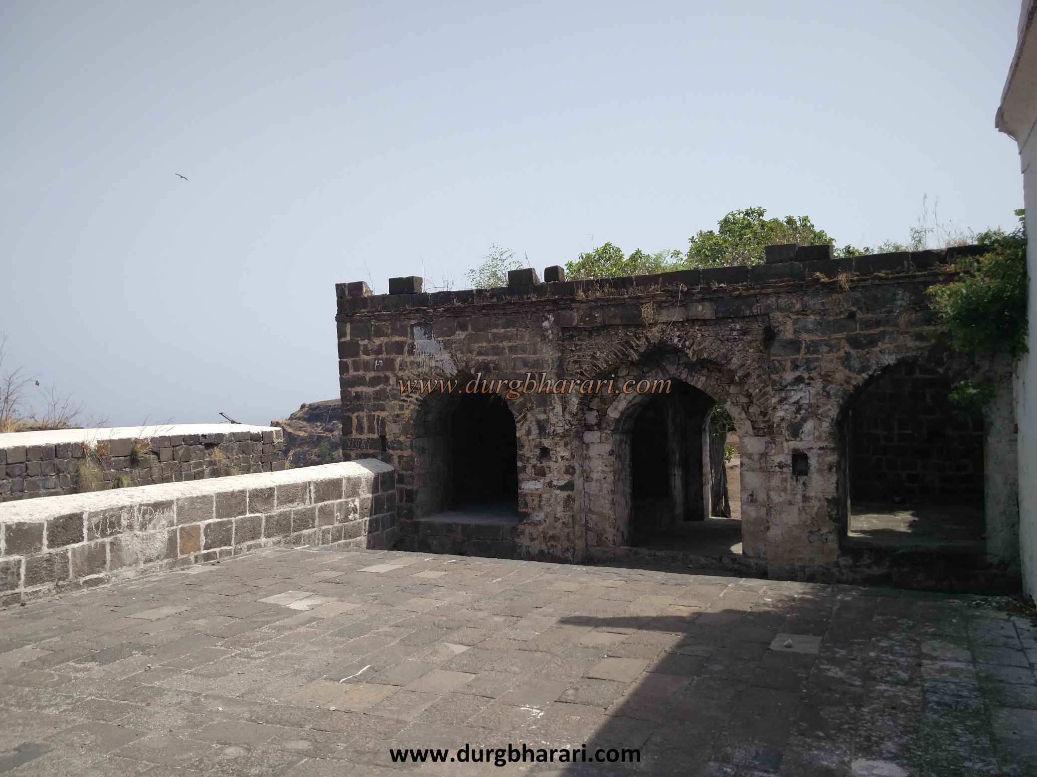
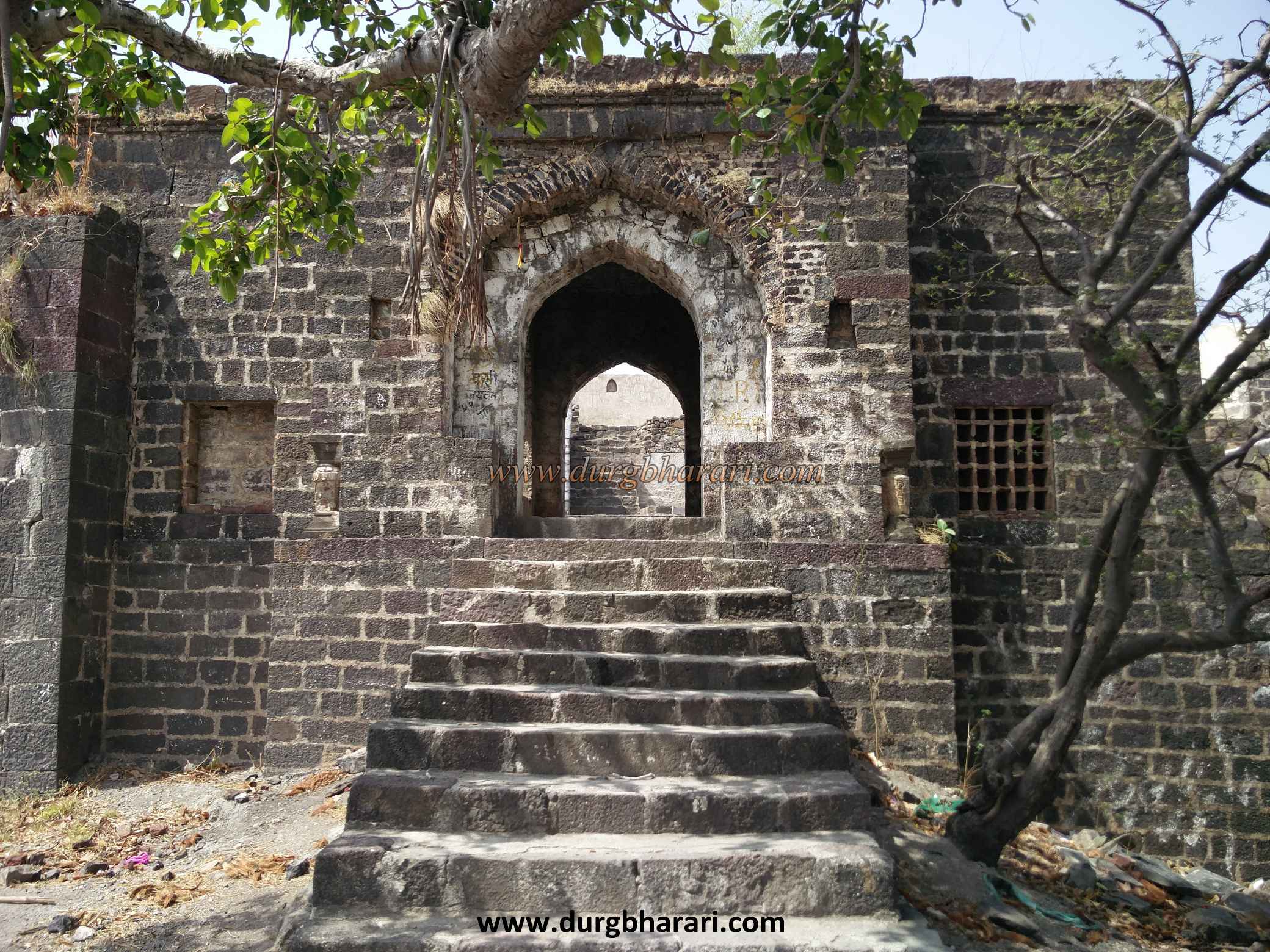
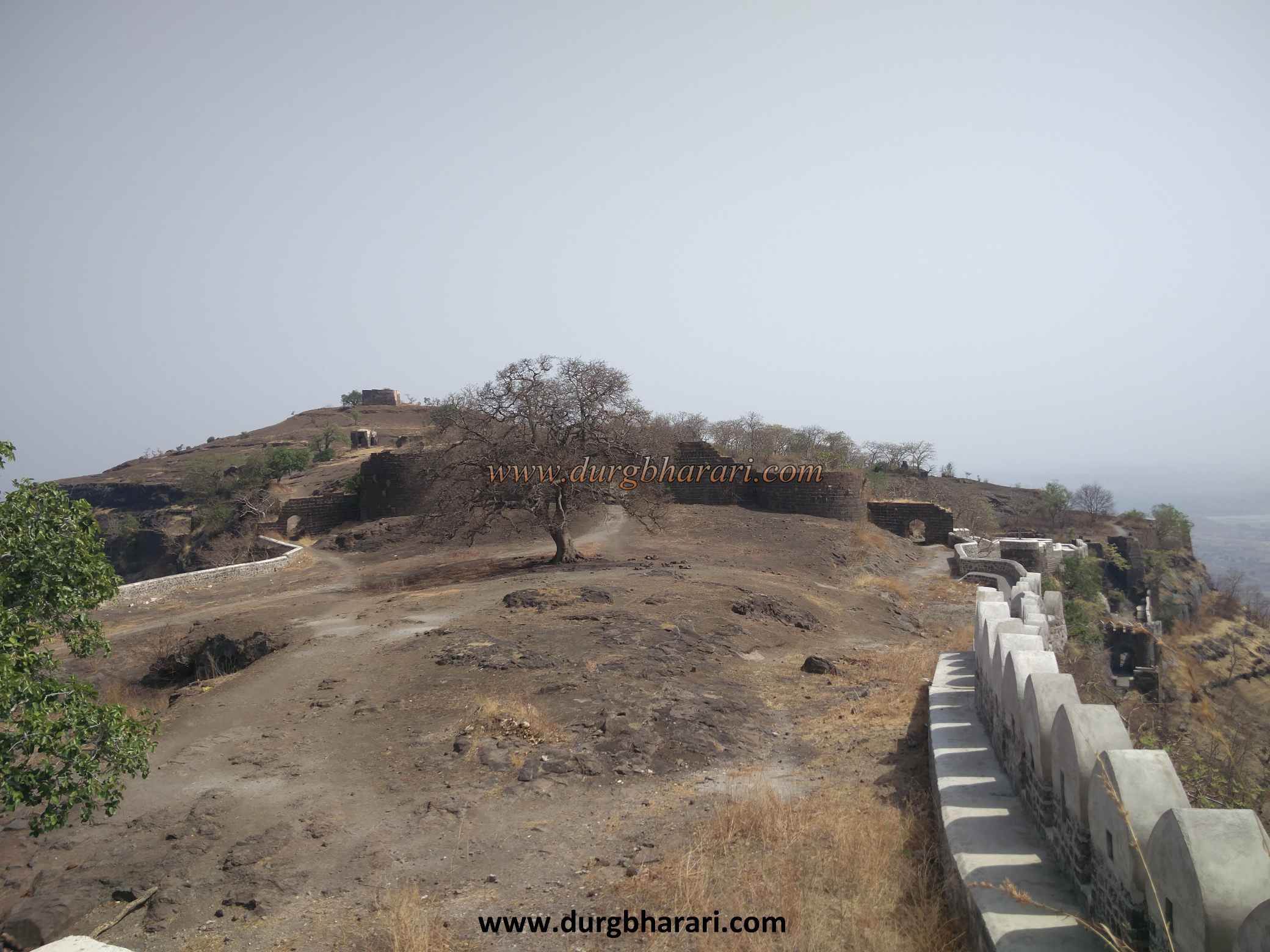
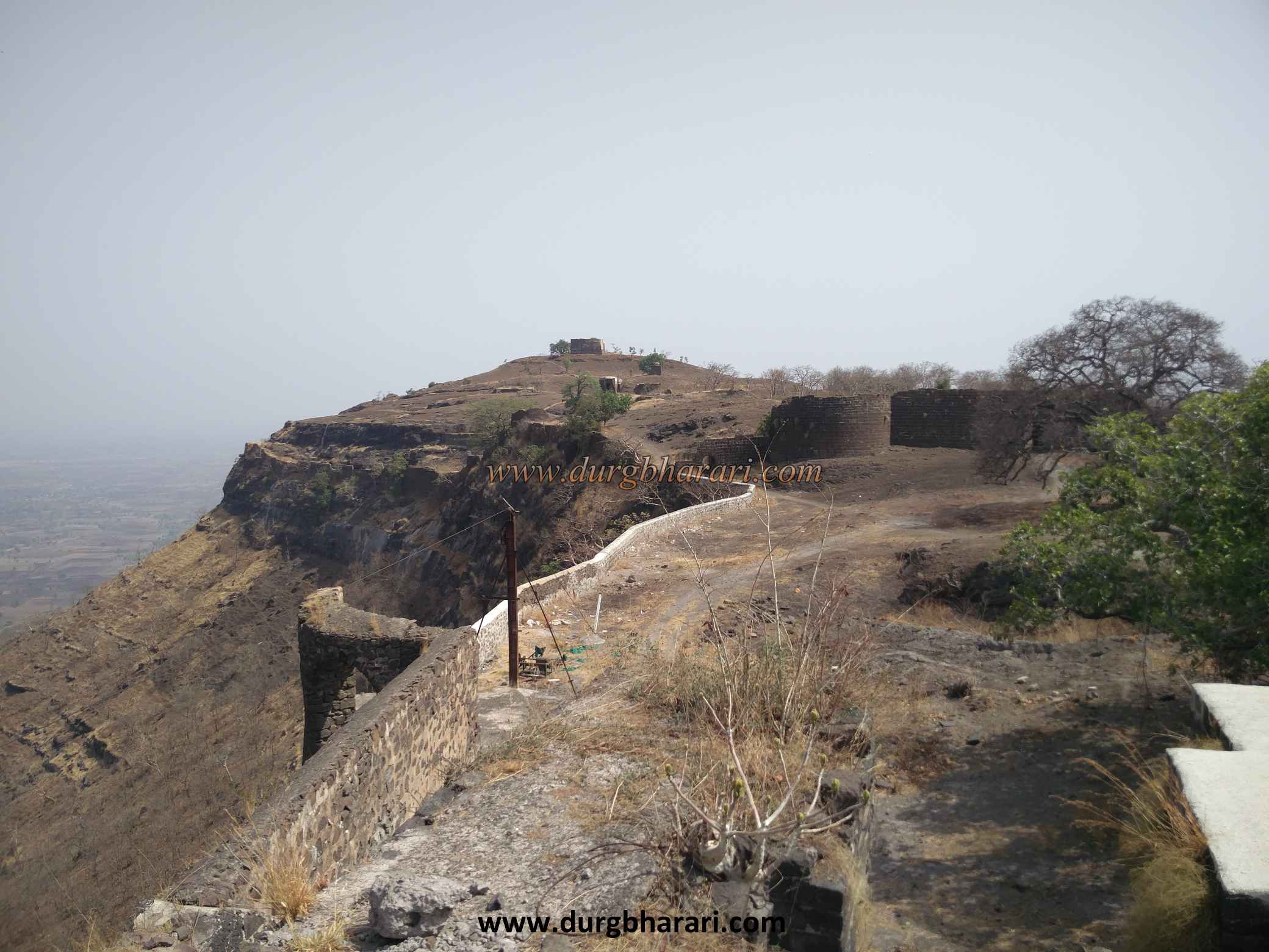
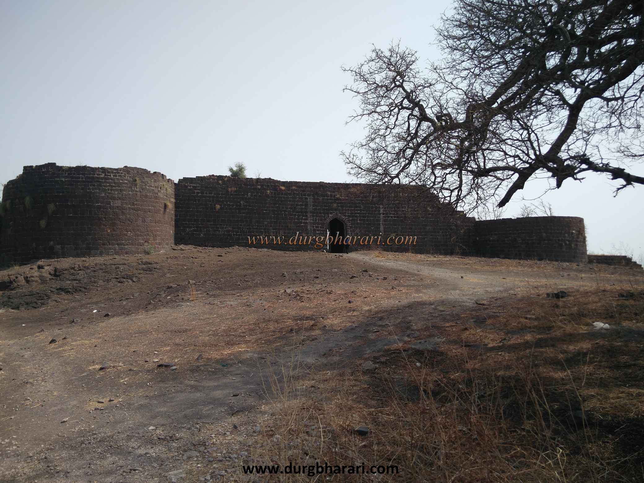
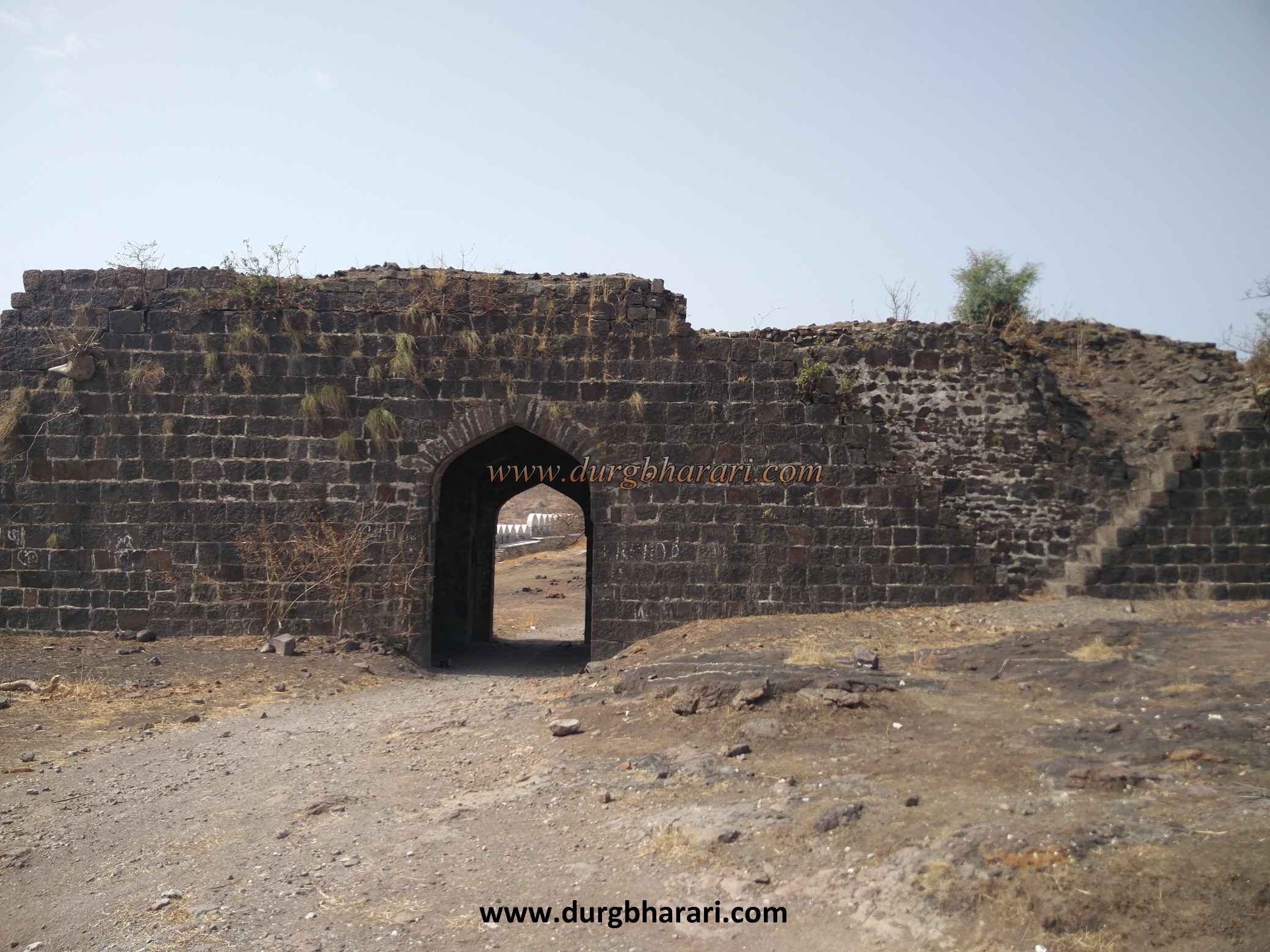
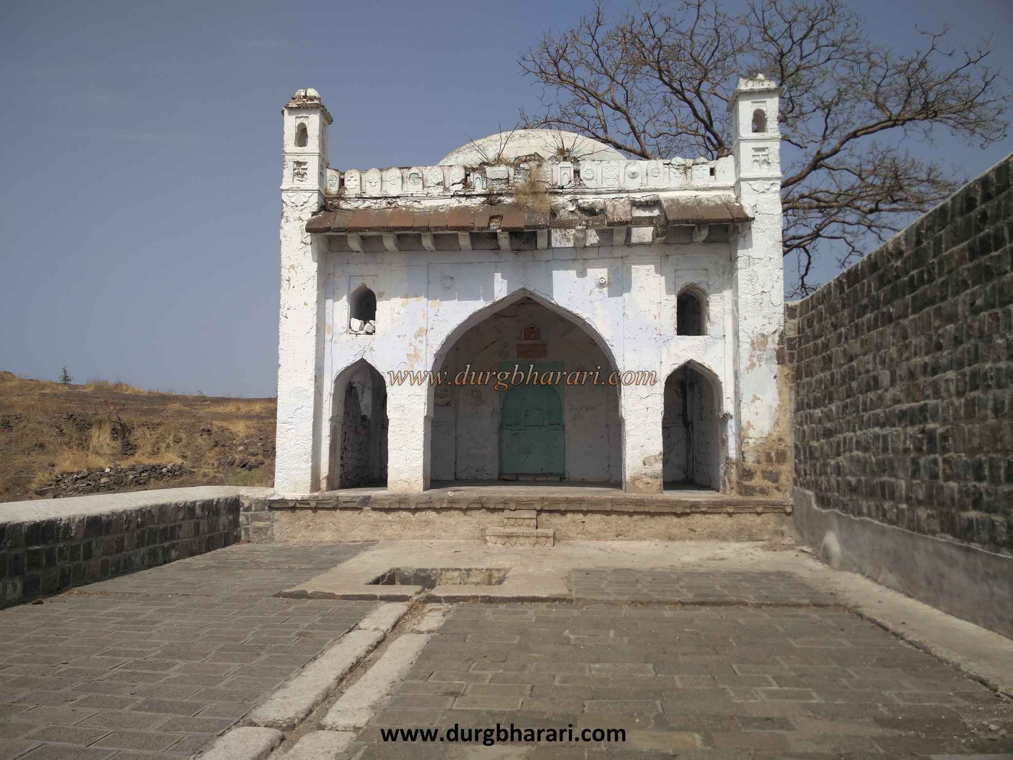
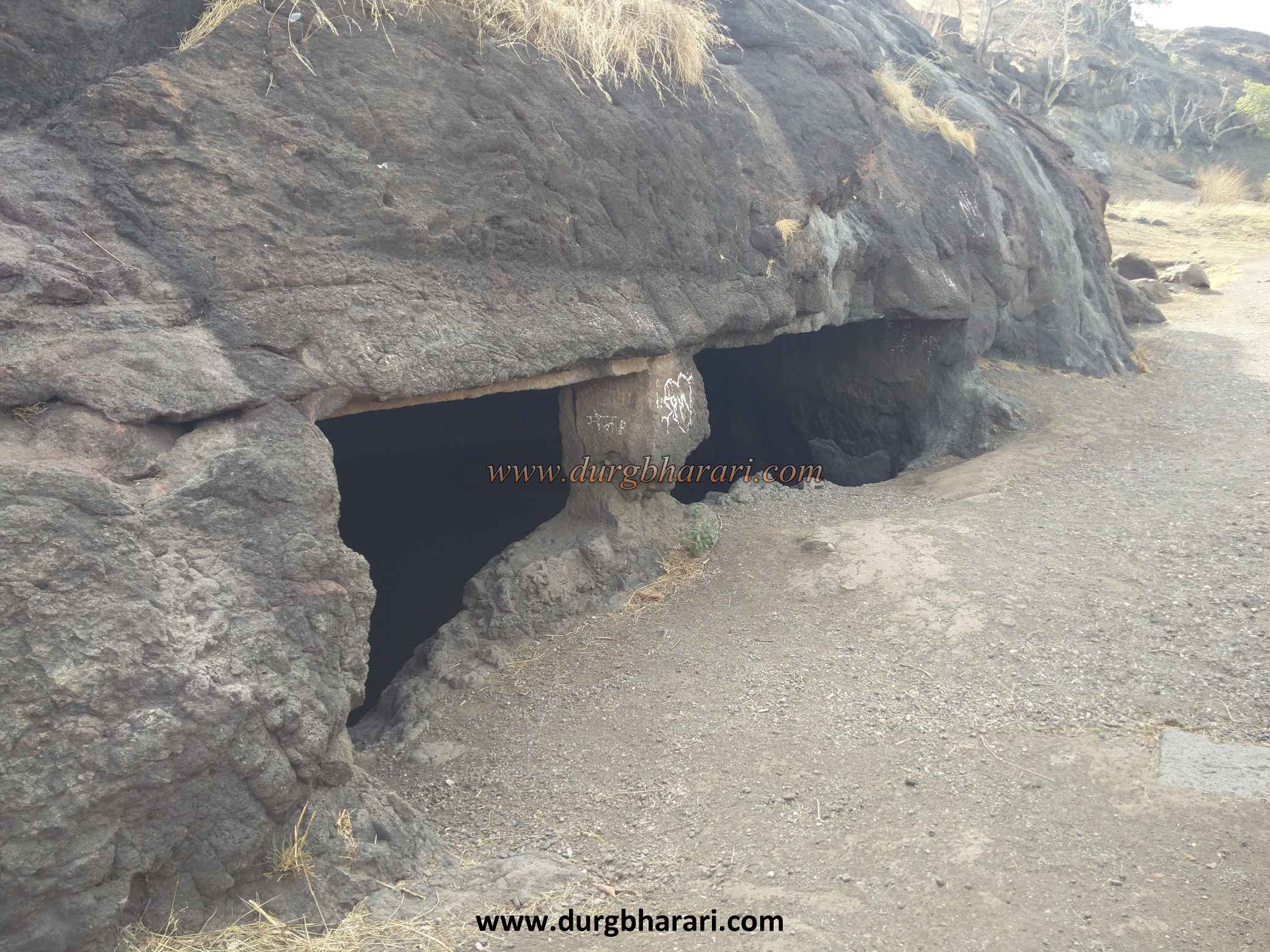
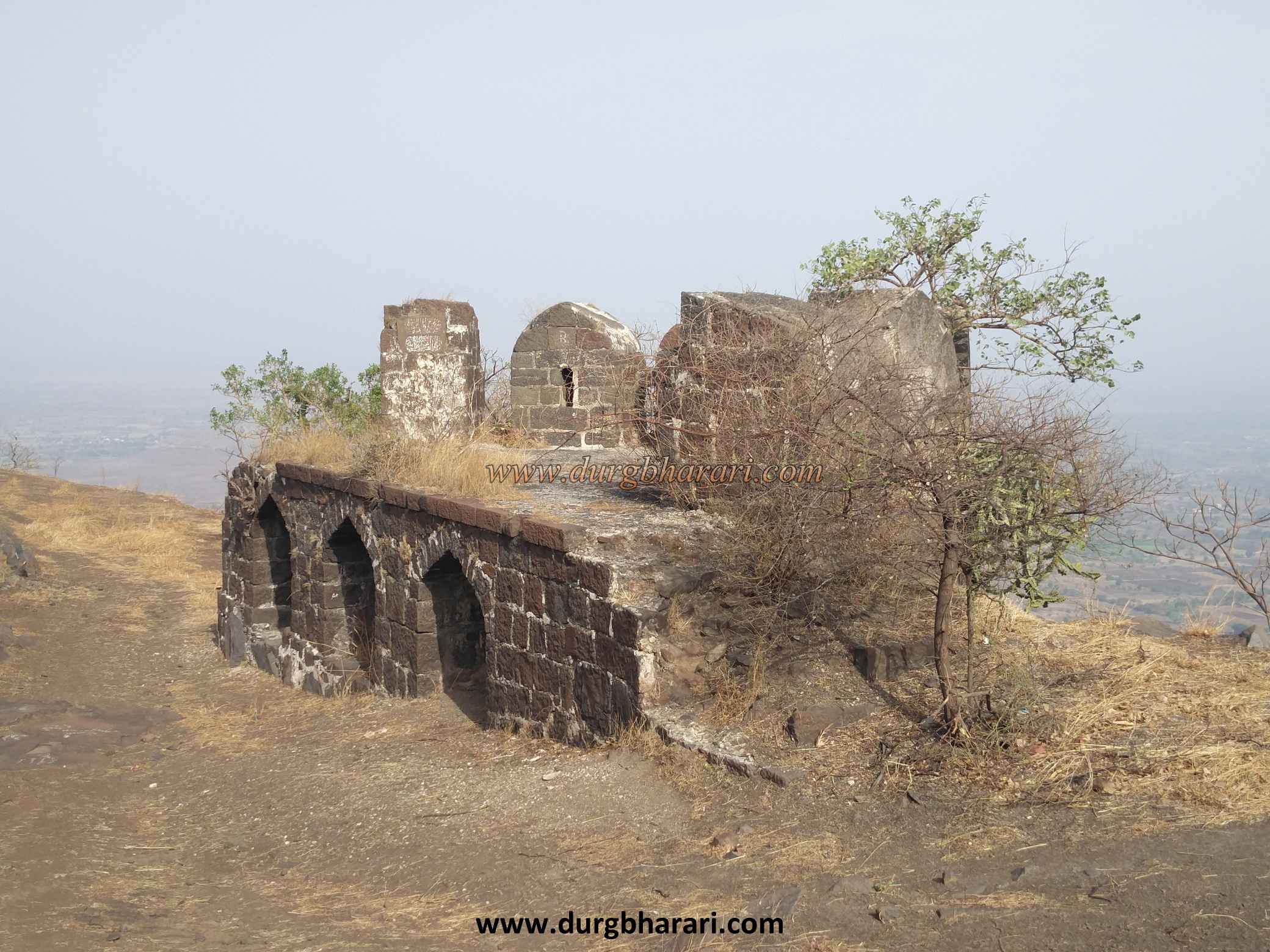
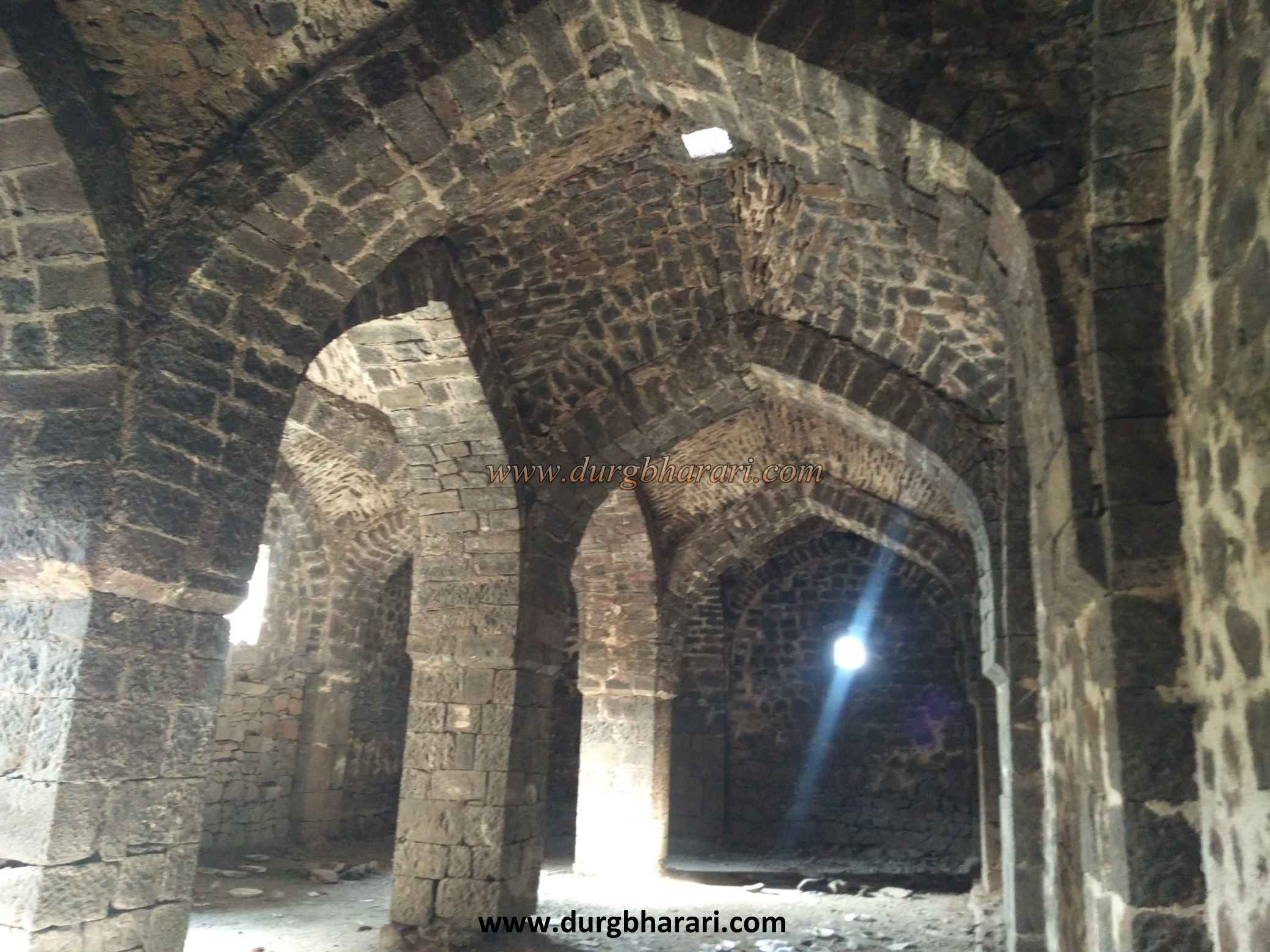
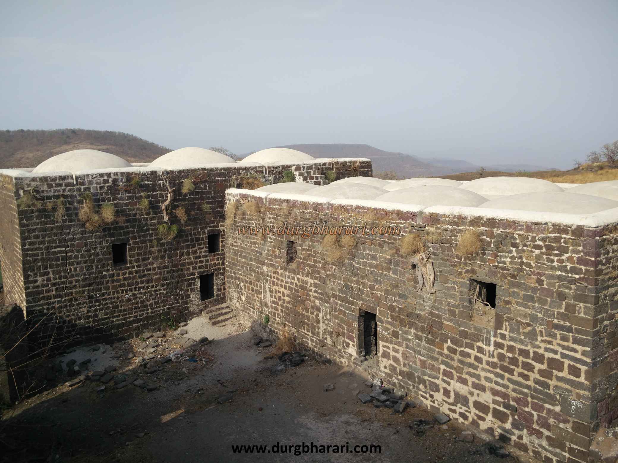
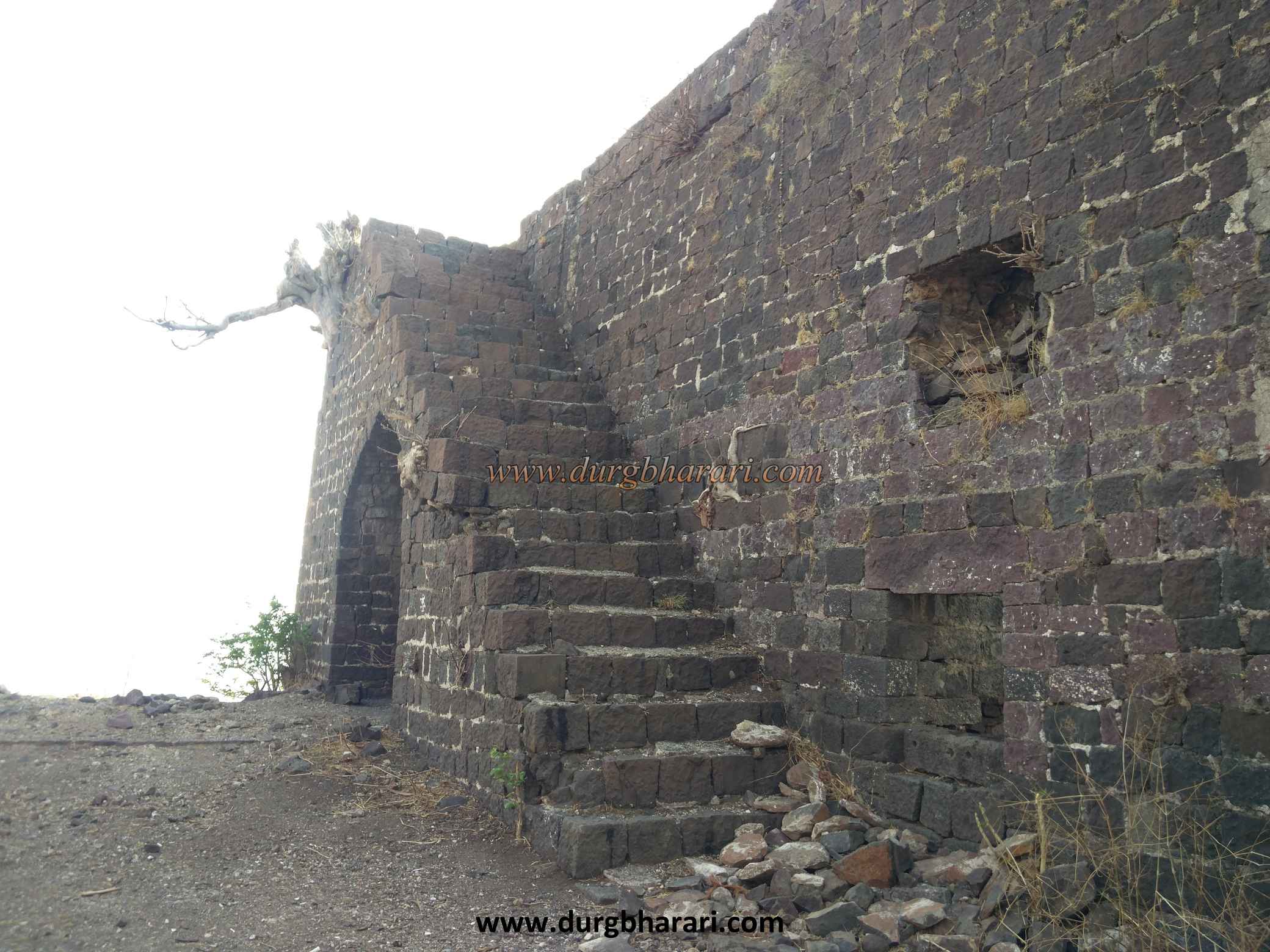
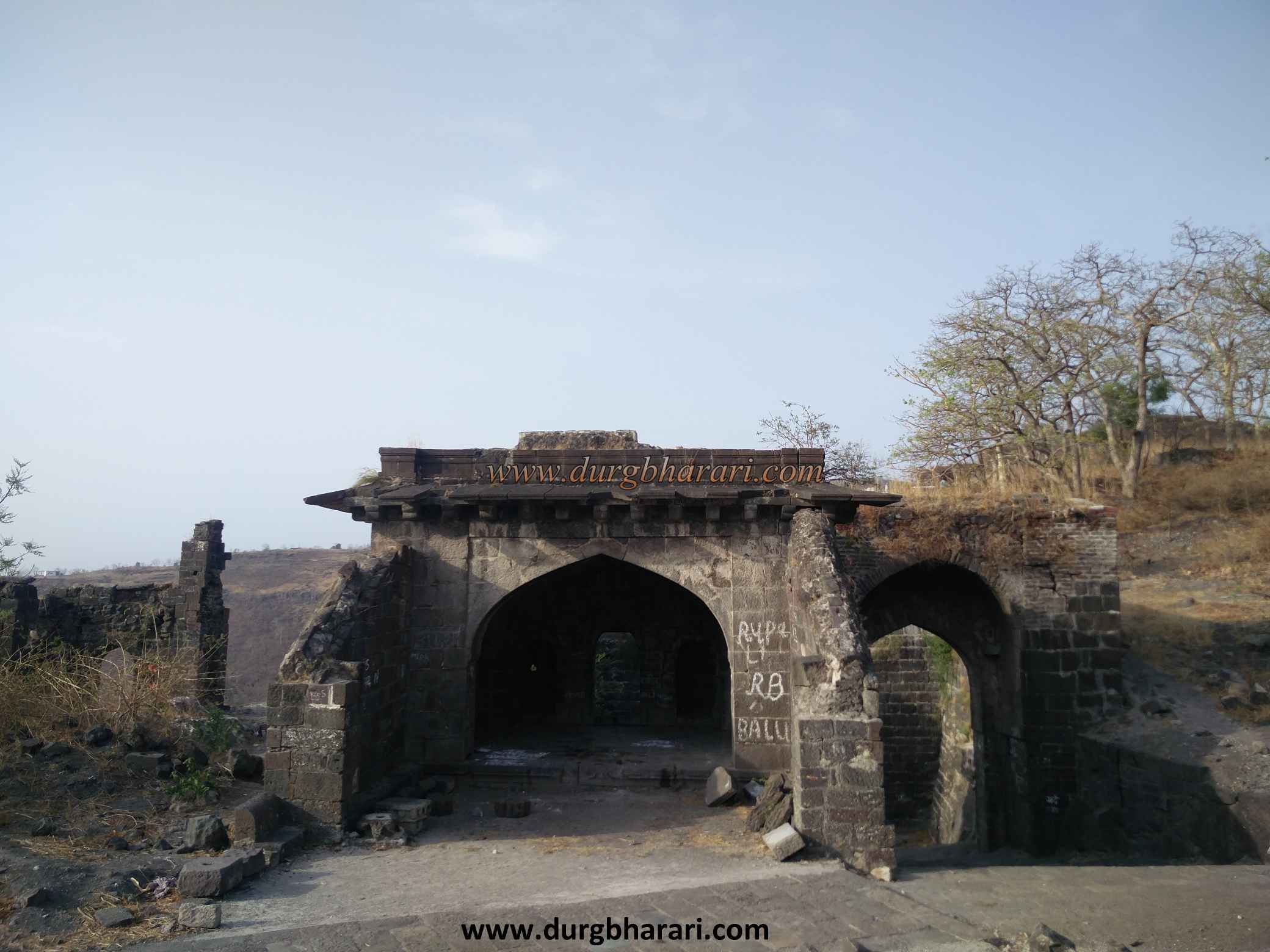
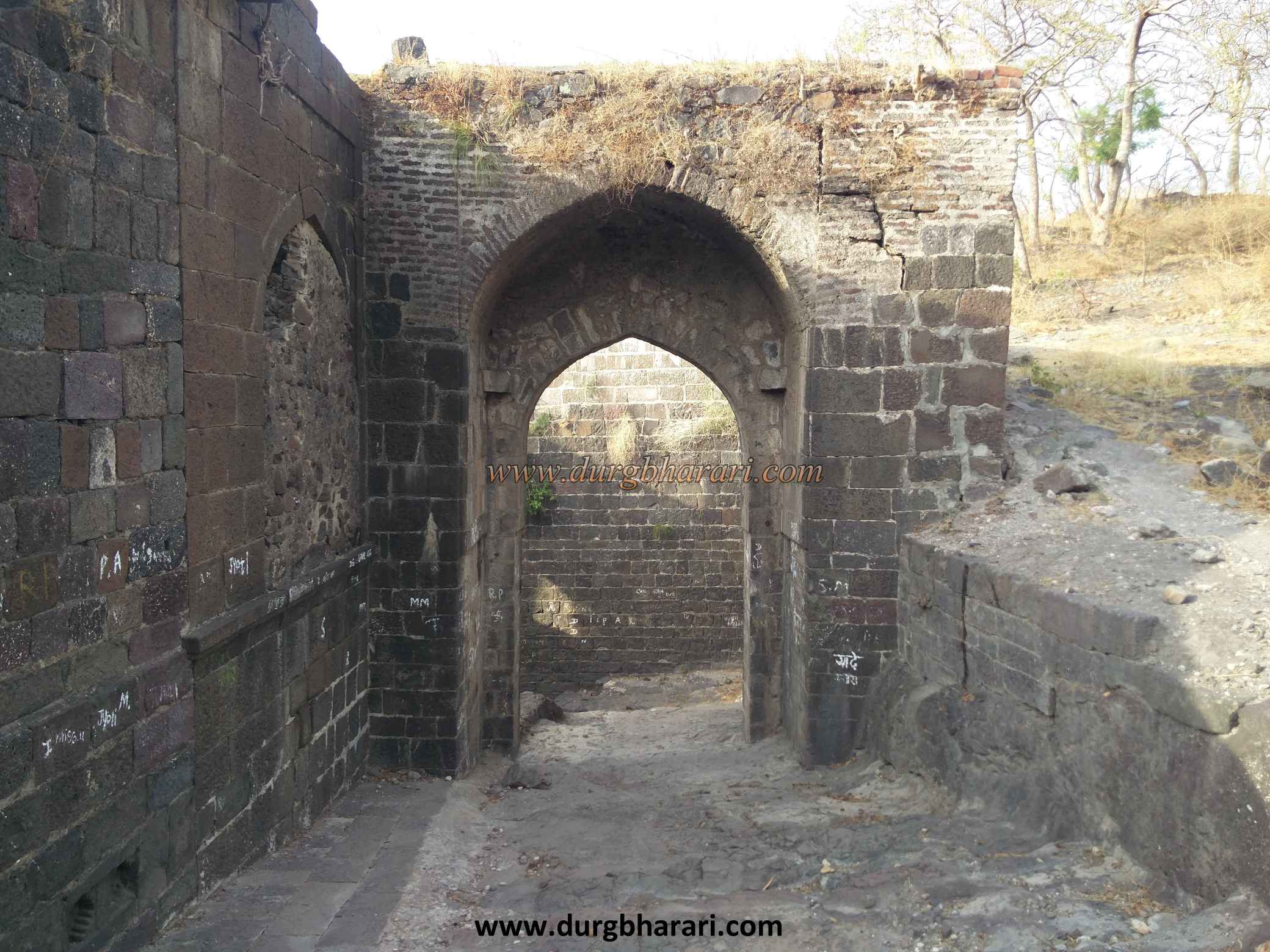
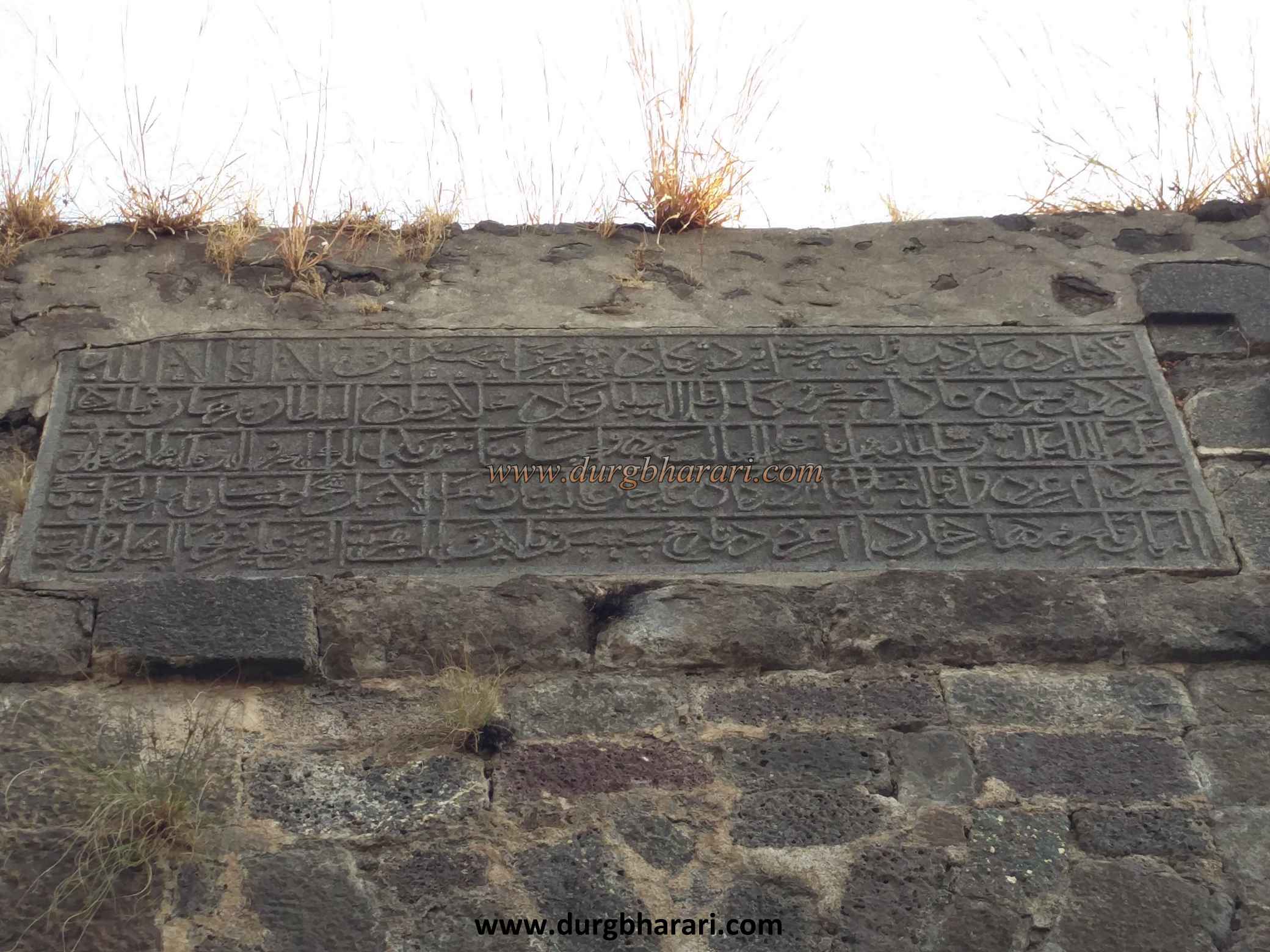
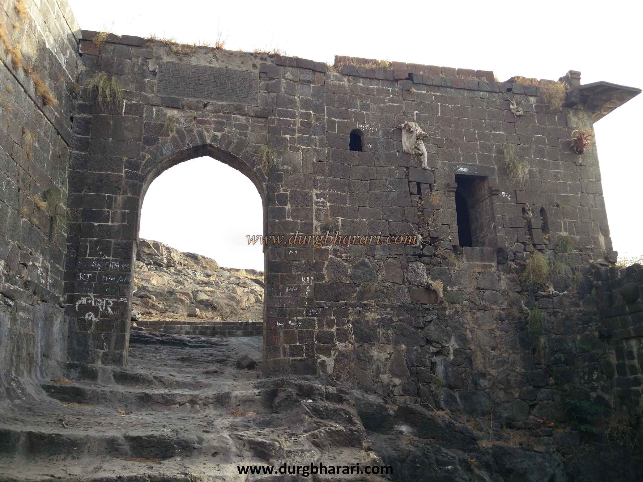
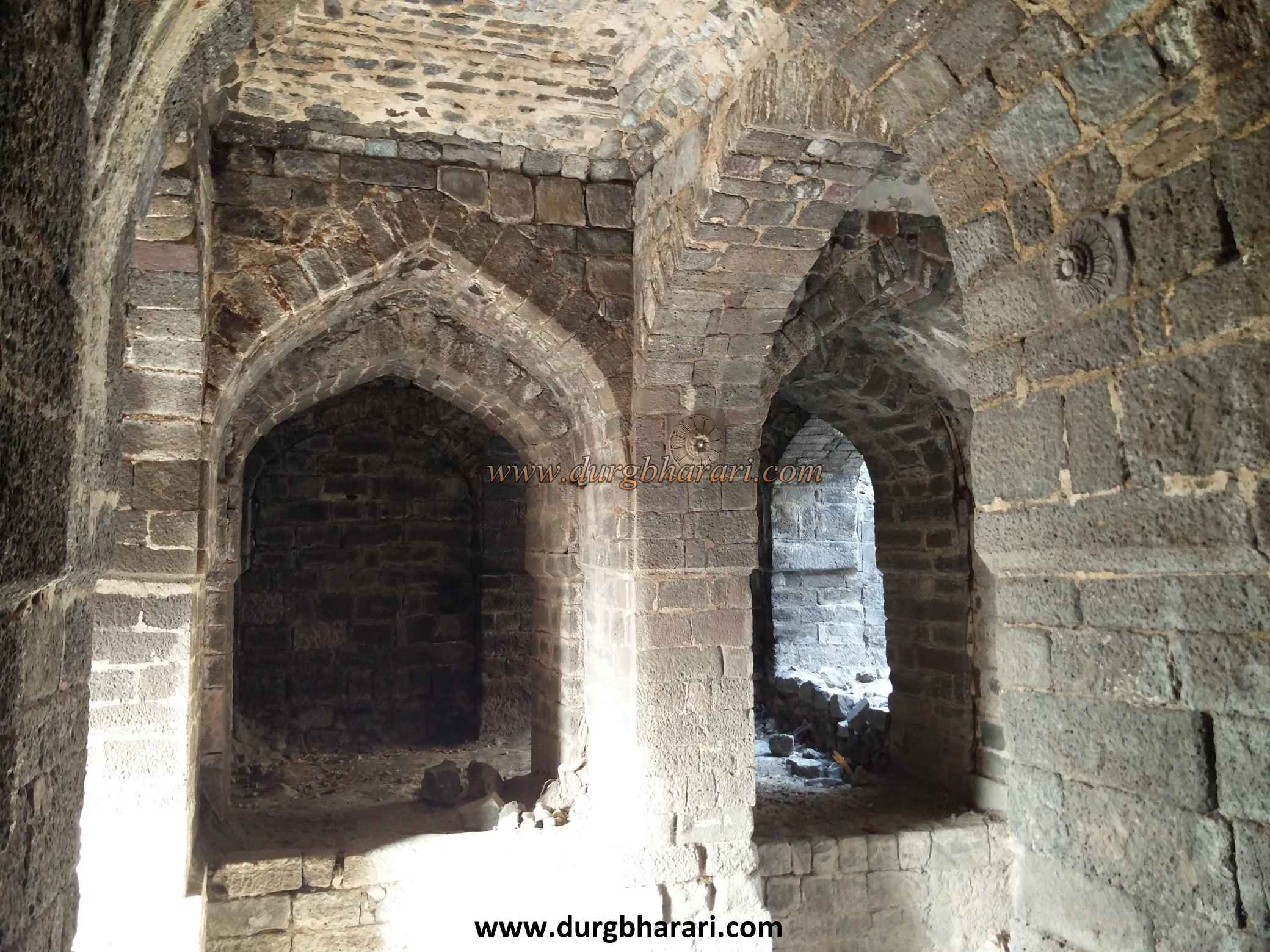
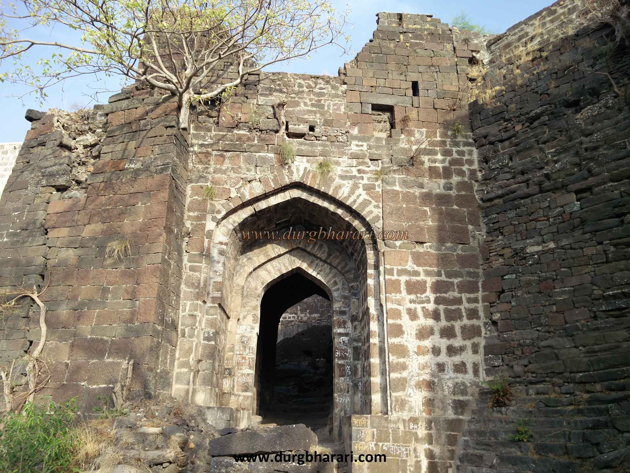
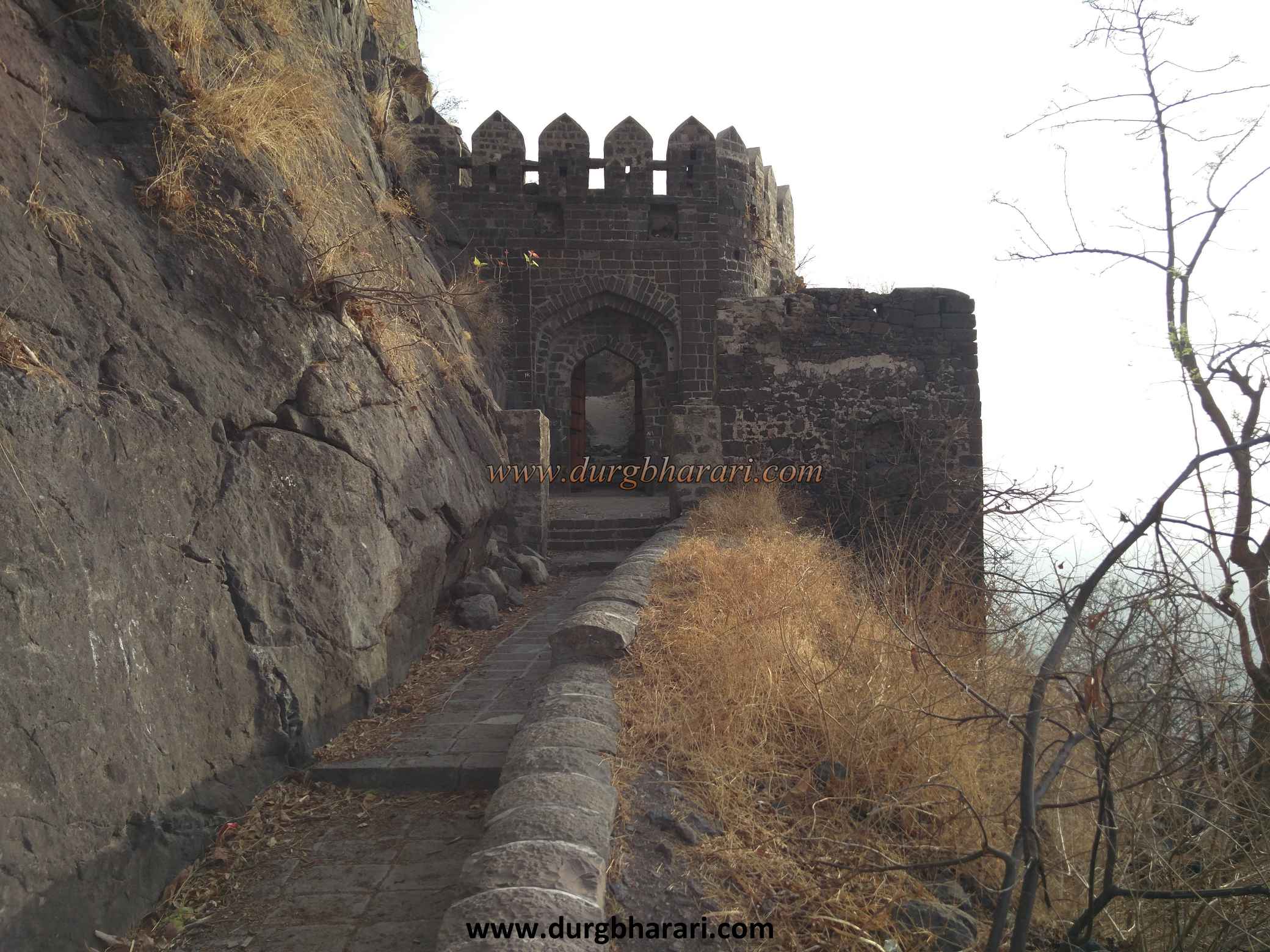
The distance from Chalisgaon to Nagapur is 42 km and the Chalisgaon-Nagapur-Kholapur route leads to the base of the fort. The distance from Aurangabad is 92 km and it takes 2.5 hours to reach Nagapur via Aurangabad-Verul-Kannada. The public transport service is only up to Nagapur and the road to the base of the next fort is unpaved, so if you don’t have a private vehicle, you have to cover a distance of 6 km from Nagapur-Kholapur to Antur fort walking but you can reach the fort in less time by climbing the fort. You can't see the fort until you get very close to it. On the way from Kholapur to the fort, we can see a square pillar at a height of 6 feet carved in Persian language showing the directions and distances of four cities. It mentions that this column was erected in 1608 AD. This is one of the most important landmarks in India and should be preserved. On the other side of the road, on a hill, you can see a Maruti idol in the open on the right side. If you keep calm while walking along this path, you will notice the wild animals around you. On the way, the forest department has built cement shelters in some places and 3 rooms have been built in the last phase of the road but they are useless due to lack of water and other facilities. From here we get our first view of Antur fort. On the hill to the left of the road is an ancient structure with a round dome. At some distance from here, the road leading to the fort ends and the footpath begins. As the fort is under the jurisdiction of the Archaeological Department, a large amount of conservation work has been done on the fort and the steps leading to the fort have been paved with stones. At the beginning of the road, on the left side, you can see the magnificent armored bastion of the fort. To separate this part from the fort in terms of protection, a moat 150x50x25 feet wide has been dug in front of the bastion. Remains of a water cistern and outpost can be seen in this part of the moat. In the vicinity of the fort, a bastion has been built on a 50-60 feet high cliff. On the upper side of this road, a cracked wall has been built and it has been covered with climbers and creepers. Upon entering the basement, there is a cave on the upper side that can accommodate 5-6 people. Inside the cave, steps are leading to the bastion but the path is closed due to falling stones. On the left side of the road, you will see an inn and a bastion on the ramparts of the fort. At some distance along this road, the first gate of the fort is located on the east side of the fort. Currently, the Archaeological Department has installed new wooden doors for this gate which faces the south. Outside the door is a guard's seat, and in one of the two corners above the arch is a broken sculpture. On the upper side of the gate, there is a barrage built in the arch to hit the enemy outside the door, and on the inside, there are signs of the gate of the previous construction of the fort. Inside the door is a guard's porch and the passage is blocked by a rampart. The ramparts have overpasses and steps to reach the ramparts and gates. At the end of the road, at the right corner of the first door, is the second-largest east-facing gate of the fort. The bastions on either side of the gate are square. Considering the size of the porch on the inside of this door, it has domes, arches, and other carvings, it seems that this place should be the courtyard of the fort and not the porch of the guard. The arch on the inside of the door is decorated with carvings and lotus flowers, along with four cannonballs. This type of decoration is not seen on any other fort. This is the third south-facing gate of the fort built at right angles to the second gate as you pass through it. In the upper part of the arch of this door, there is a Persian inscription of Malik Amber, 5x2 feet in size, from the time of Burhan Nizam Shah. The area between the second and third gates has a battlefield structure and is enclosed on all four sides. The three gates built at right angles to each other and the detour path passing through them are part of the fort's defense structure. Upon entering through the third door, you enter the fort. This fort is at an altitude of 2651 feet above sea level. This oval-shaped fort is spread over an area of 32 acres from north to south and is surrounded by ramparts. Upon entering through the door, there is a ruined structure on the right side with some carved stones. The building has a basement facing the second door and steps leading up to the third door. From here we come to the upper part of the fort by looking at the bastion of the fort and the surrounding area on the right side. At the top of the road, on the right side, you can see the remnants of some houses. From here you can see many structures spread on the top of the fort. There is a hill on the right side and on the left side of the hill, there is a big lake filled with green water. Water is blocked by a wall on one side of the lake. To the left of the lake are the remains of some buildings and a door, while to the right is a mosque. There is a complex of three magnificent buildings on the slope of the hill and there is a small door to enter the premises of these buildings. Two of these buildings are connected but one building is separate. The roof of the building has collapsed and there are steps to reach the roof of the building. These buildings should be a barn for storing grains. The building has large halls and many arches and windows. At the top of the hill is a large square watchtower, with steps at the rear. The bastion has beautiful corners on all four sides and two circular walls to hold the cannon at the top. The entire fort can be seen from this bastion and a very remote area in the Anjatha-Satmala range can also be seen. At the bottom of the bastion, on the slope of the hill, there is a carved Dargah-like structure. On the backside of the building is a large stone structure with seven to eight tombs, while on the lower side of the lake is a mosque built during the reign of Burhan Nizamshah. There is a small basement at the back of the mosque and in this area, you can see the underground stone drains built for rainwater to enter the lake. In front of the mosque, on the side of the lake, there is a magnificent arched door and at the back of this door are the remains of a ruined mansion. There is a facility to draw water from the lake at the top of the door and from there the water is diverted to the fort with the help of mud pipes. On the way, you see a door on the ground. This door is an underground basement in the mansion and it has fallen open due to the collapse of the mansion. The structure next to the basement is known as Godi Dargah. At the back of this structure is a dry pond. As you approach the lake, you see a large bastion with stairs descending to the ground. This way you can walk around the entire fort. A total of six water cisterns carved into the rock can be seen at the beginning of the road. Two of these tanks are extinguished and four tanks have water out of which only one tank has potable water. If you walk around the entire fort on this side of the ramparts, you can count 22 bastions in the ramparts. One of the bastions has a dome at the top and the other has a porch for the guards. There is a secret door at one place in this rampant and from there you can go down with a rope. In some places, trenches have been dug on the lower side of the ramparts. All this can be seen by walking around the fort, otherwise, you should see the water cistern and turn back and go towards the armored bastion on the south side. The southern part of the fort is separated from the main fort by a rampart like a citadel. The ramparts have three gates, with a large gate in the middle with stairs leading to the wall on the outside and two large bastions on the inside. Since this part of the fort is connected to the mountain range, the large moat we saw at the beginning is carved here. On this side, there is a strong rampart at the top of the moat and they are armored. There are two doors on either side of the bastion to get inside it. There is a secret door to get out of the fort from a room under the bastion but the building below it has collapsed which you can see when you enter from the outside. On the lower side of the bastion is the barrack for soldiers. The bastion is enclosed on all four sides and the opposite side there are steps and a door to go up to the bastion. There is a porch on the inside of this door and a tomb of the Sufi saint Gabinshah. The plateau in front and a distant terrain is visible from the bastion. This is where your exploration ends. Due to a large number of ruins at Antur fort, it takes four hours to see the entire fort properly. Looking at the history of the fort, it must have been built during the Yadav period in the 15th century. During the Yadav period, Kanha was the fort keeper of Antur when Allauddin Khilji attacked the fort. In this attack, the fort keeper was killed along with his family. Historians believe that the village got its Kannada name because of their sacrifice. Later this fort came under the control of Nizamshah of Ahmednagar. During the reign of Nizamshah Wazir Malik amber in the 16th and early 17th centuries, a large number of constructions took place on the fort. The Persian inscriptions on the stone pillars on the way from Nagapur, the inscriptions on the gates of the fort, and the mosque indicate the period of construction. Near Antur, there is a mention of a great battle between the Marathas and the Mughal chief Dilerkhan. According to the records in the Aurangabad District Gazetteer of 1884, the Antur fort conquered by the British-Nizam forces around 1818, and the fort came under the control of the British.
© Suresh Nimbalkar
Gallery