ALANG
TYPE : HILL FORT
DISTRICT : AHMEDNAGAR
HEIGHT : 3915 FEET
GRADE : VERY HARD
If you want to experience why Maharashtra is called a rock country, a solid country, a land of stones, then you must have to complete a wonderful trek of AMK in Sahyadri i.e. Alang-Madan-Kulang. (It is sad to mention here that some of the nomadic organizations are making trekking a business of this trek.) It is necessary to know the techniques and materials of rock climbing to feel the thrill of climbing these forts. In the field of mountaineering, this trek is considered as one of the most difficult treks in Maharashtra. Although this trek is considered as three forts, our wandering today is limited to Alang fort. Although there are two ways to reach Alang fort, Ambewadi, and Udhavane, the way from Ambewadi village to both Alang and Madan is relatively less time consuming, but you need to be aware of mountaineering equipment and rock climbing techniques.
...
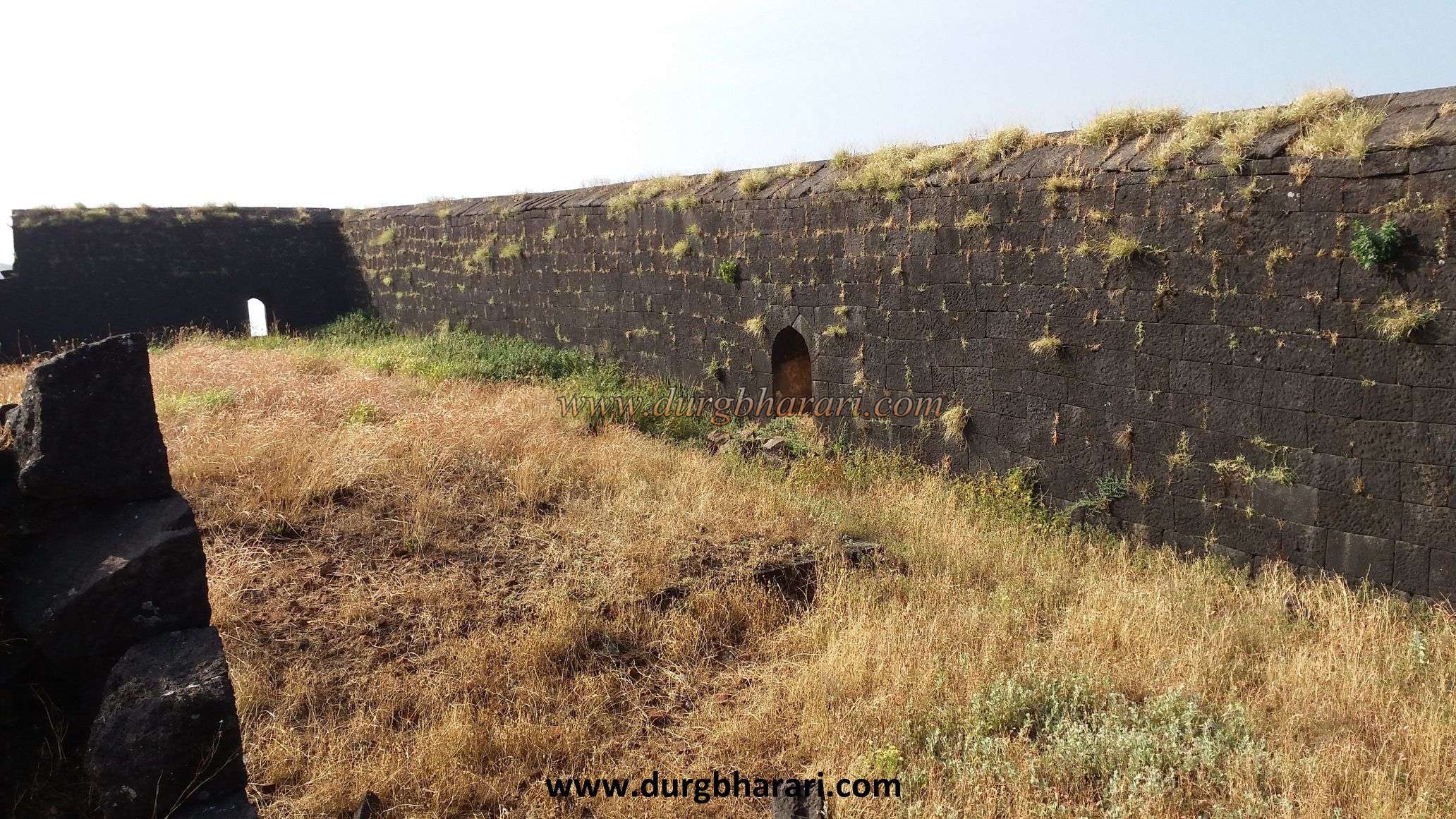
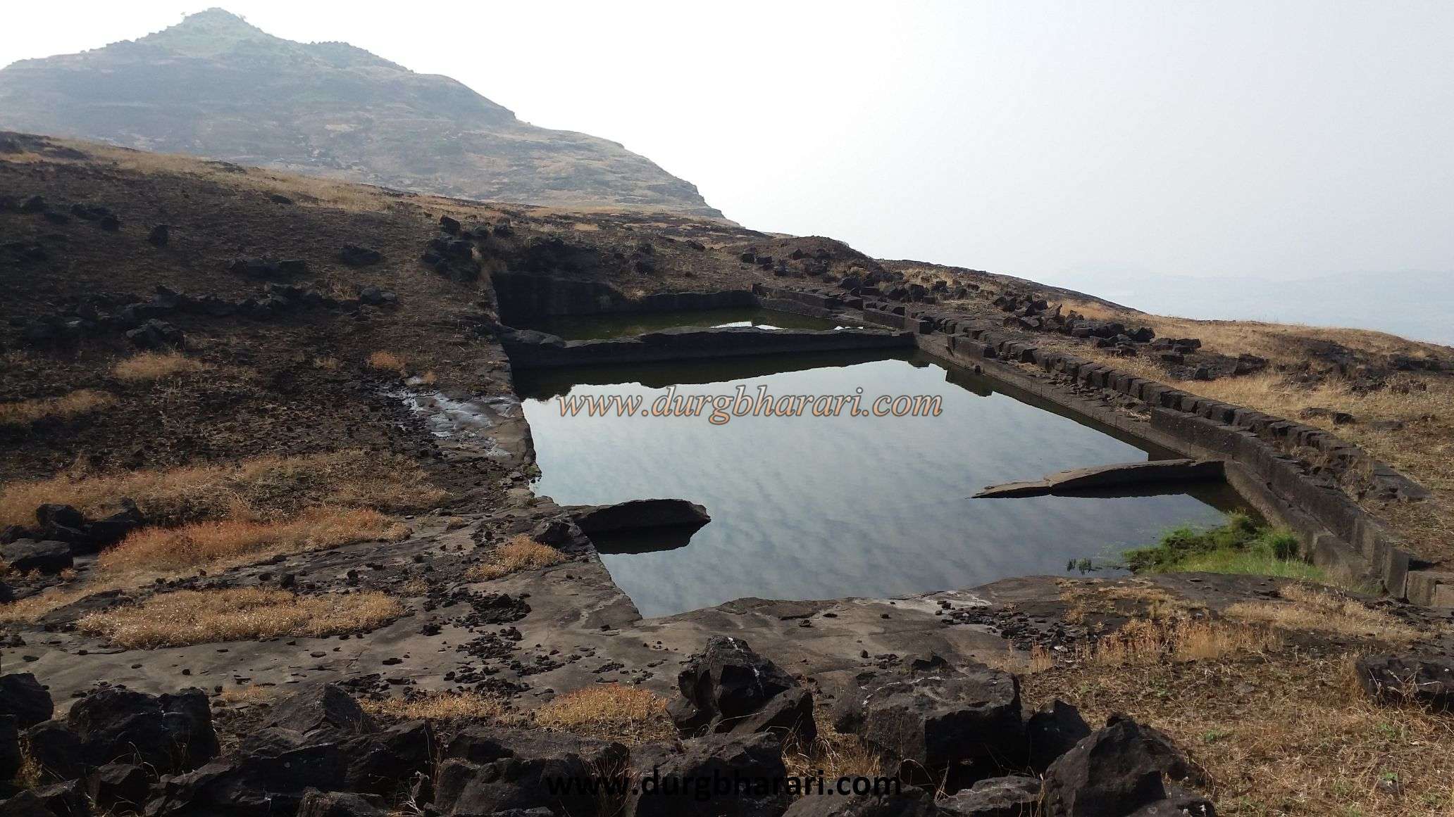
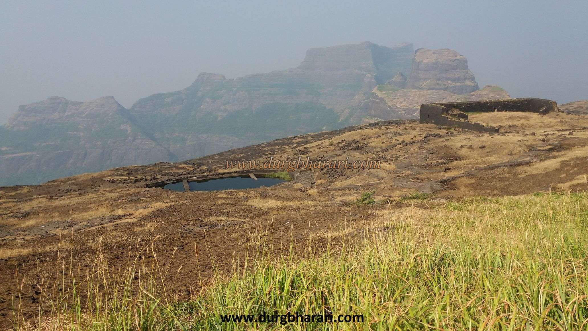
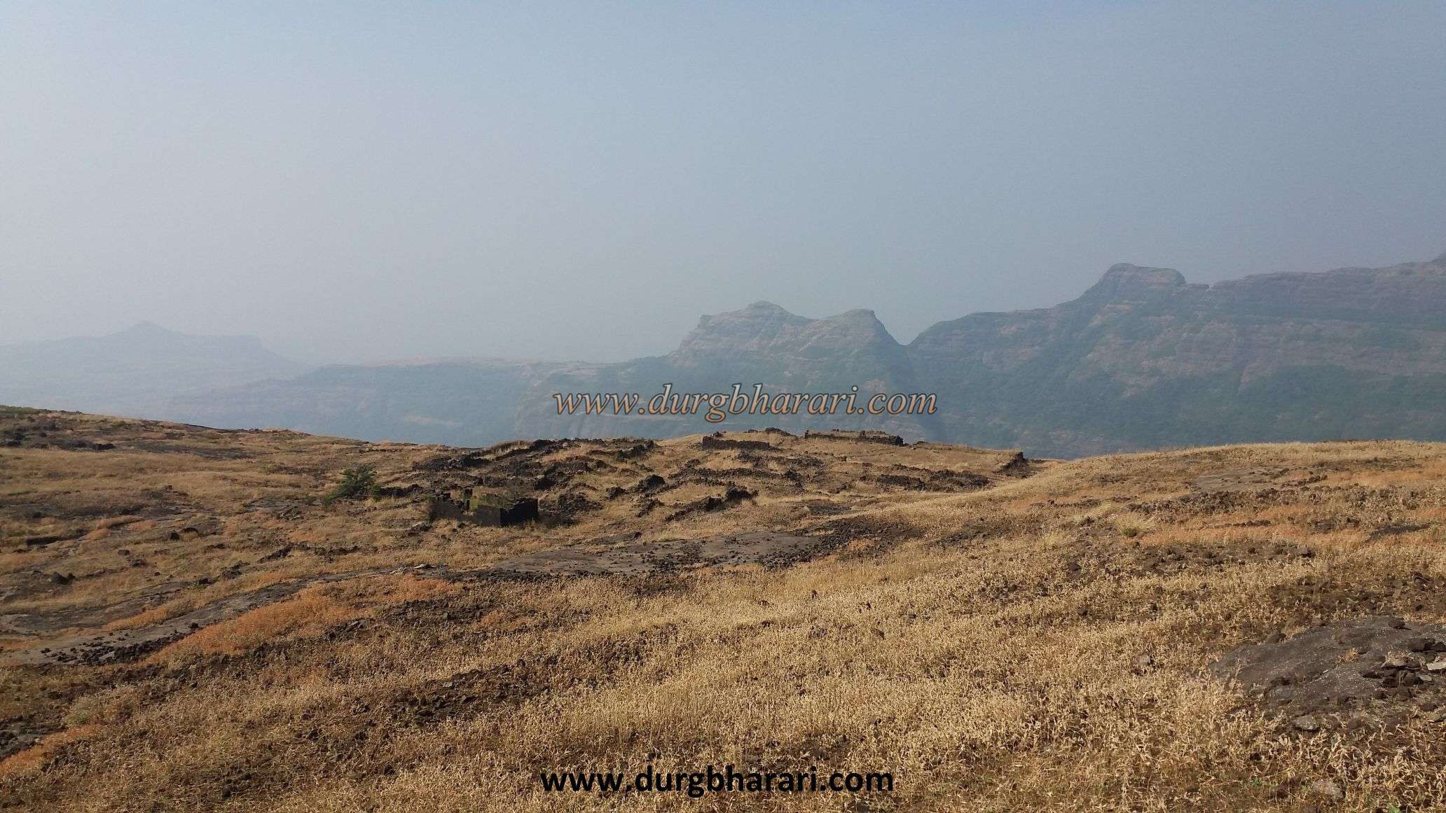
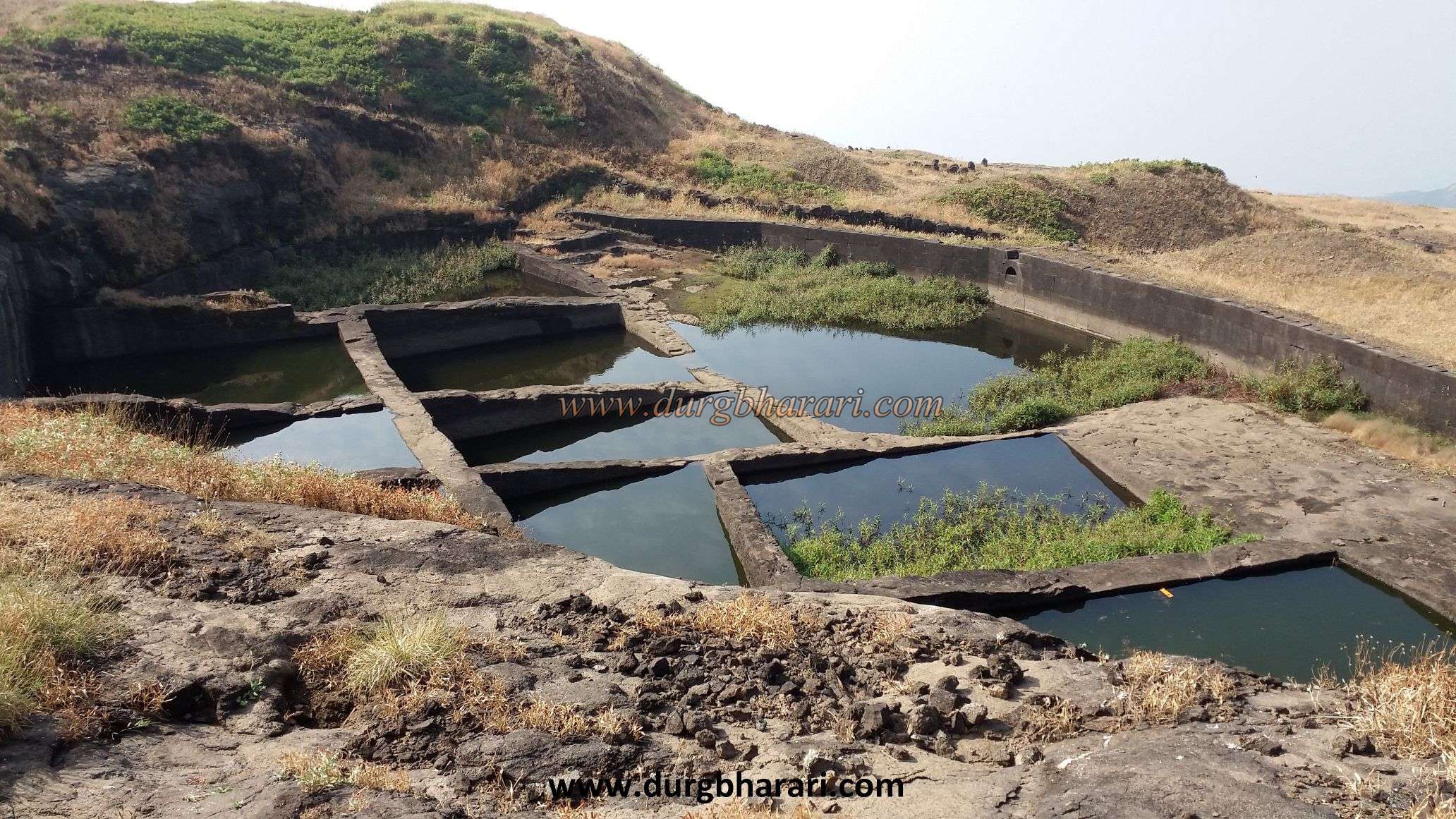
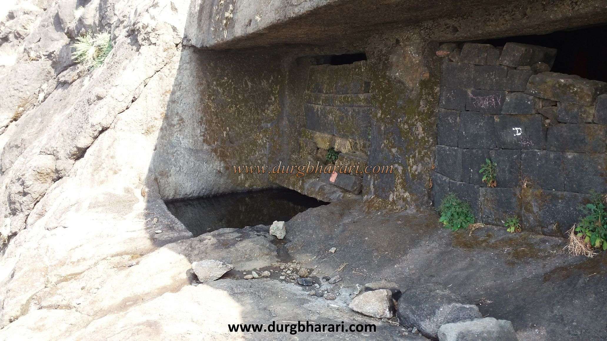
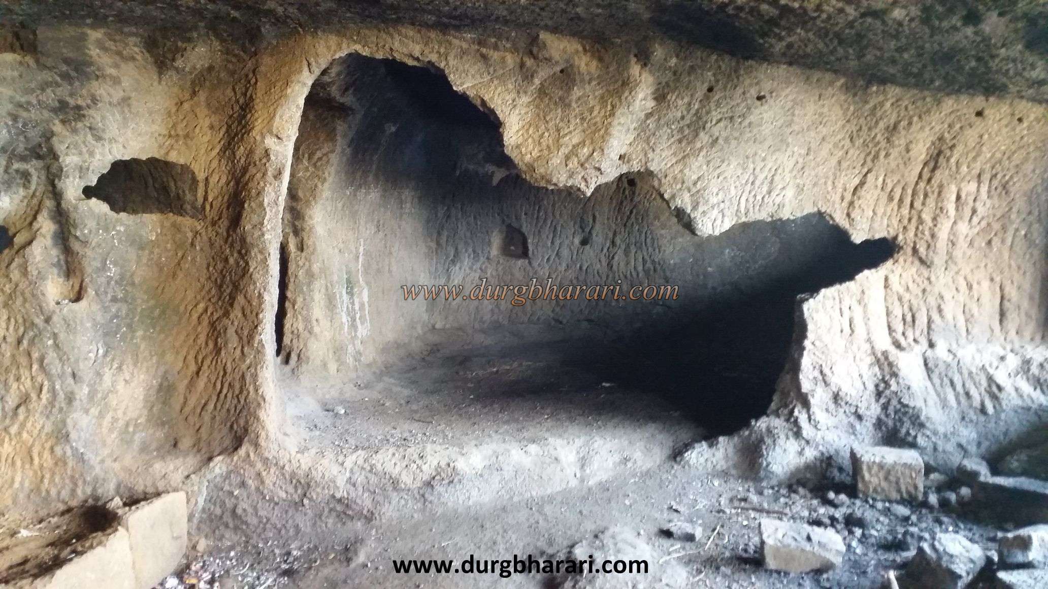
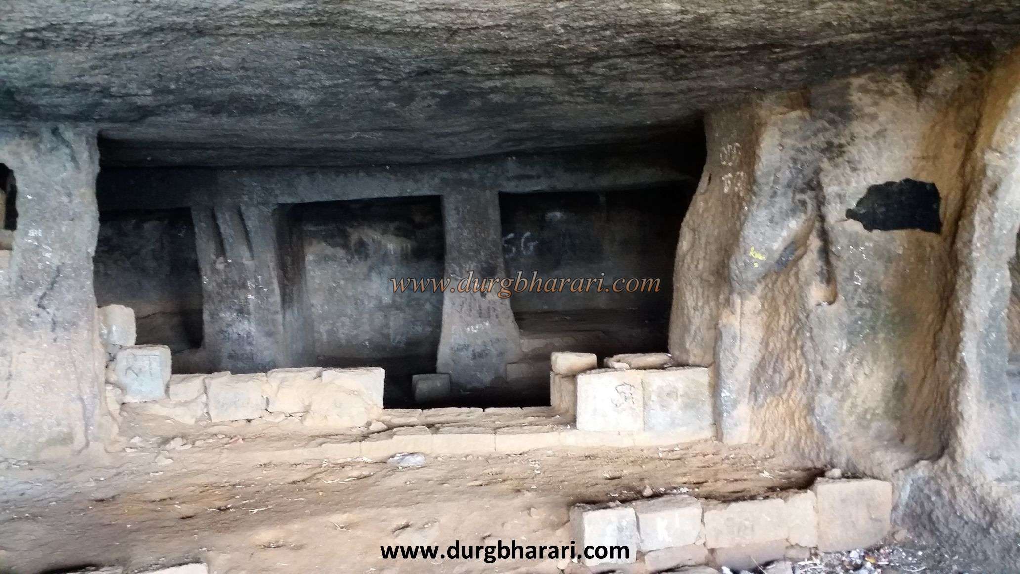
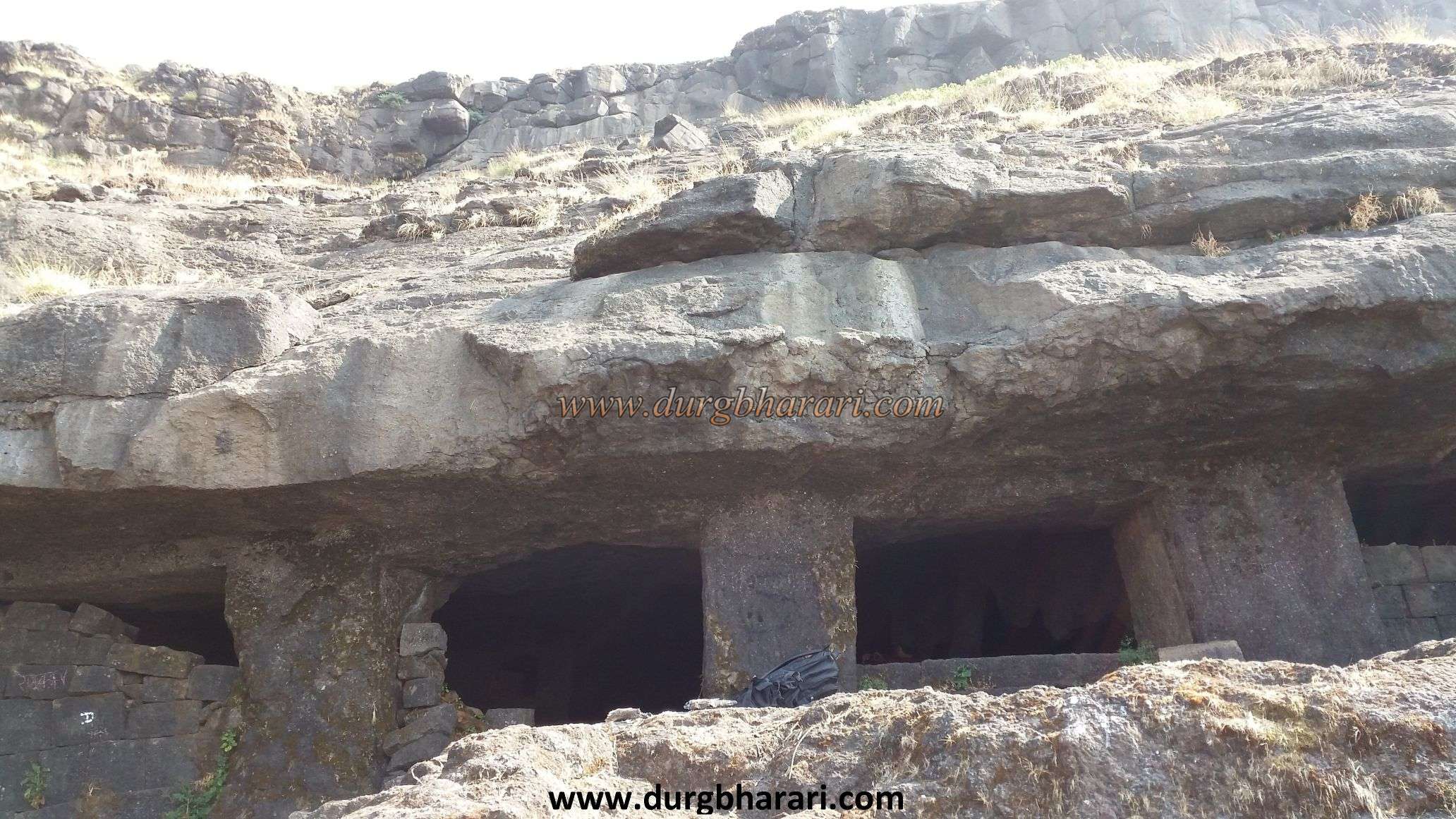
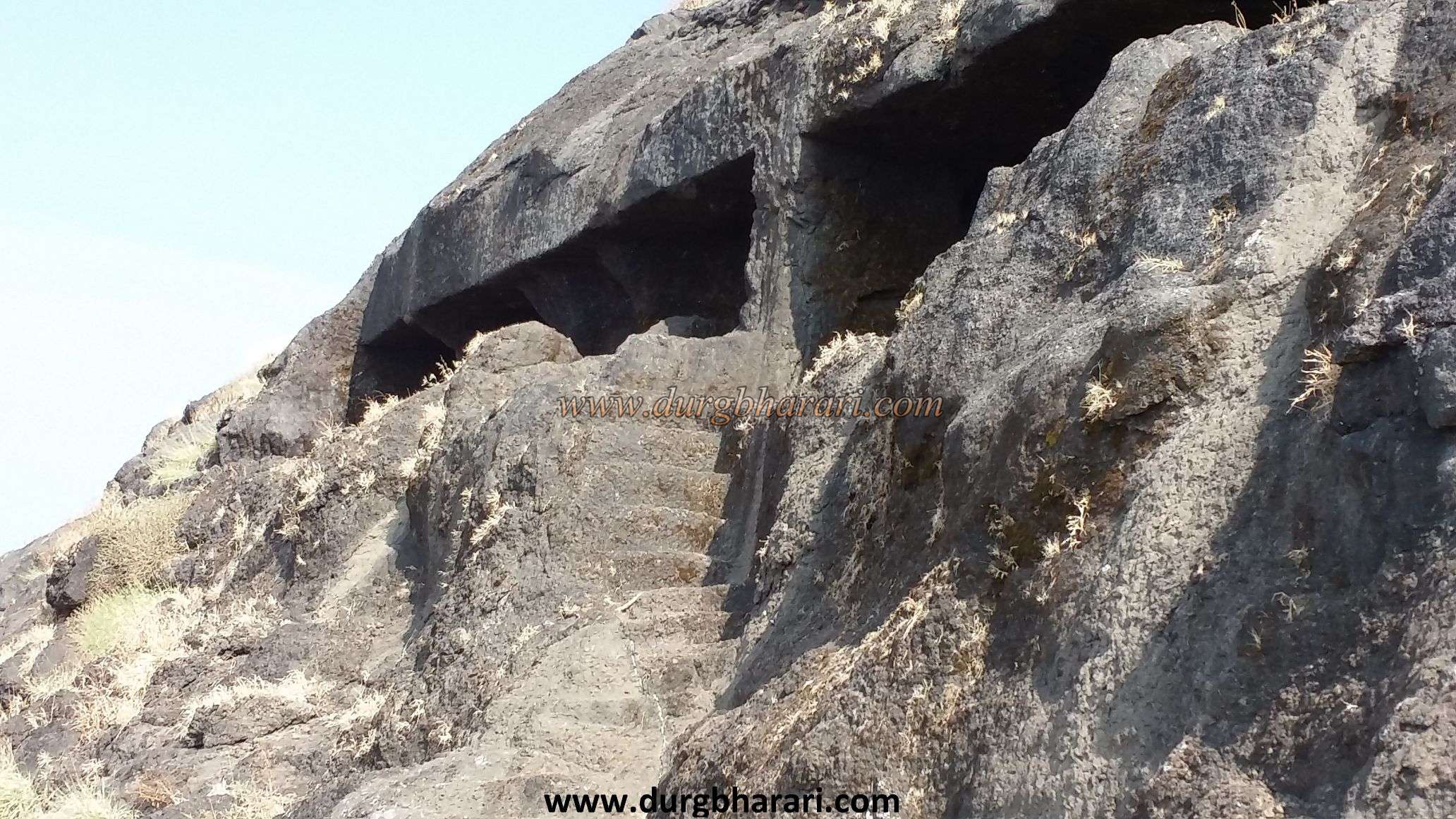
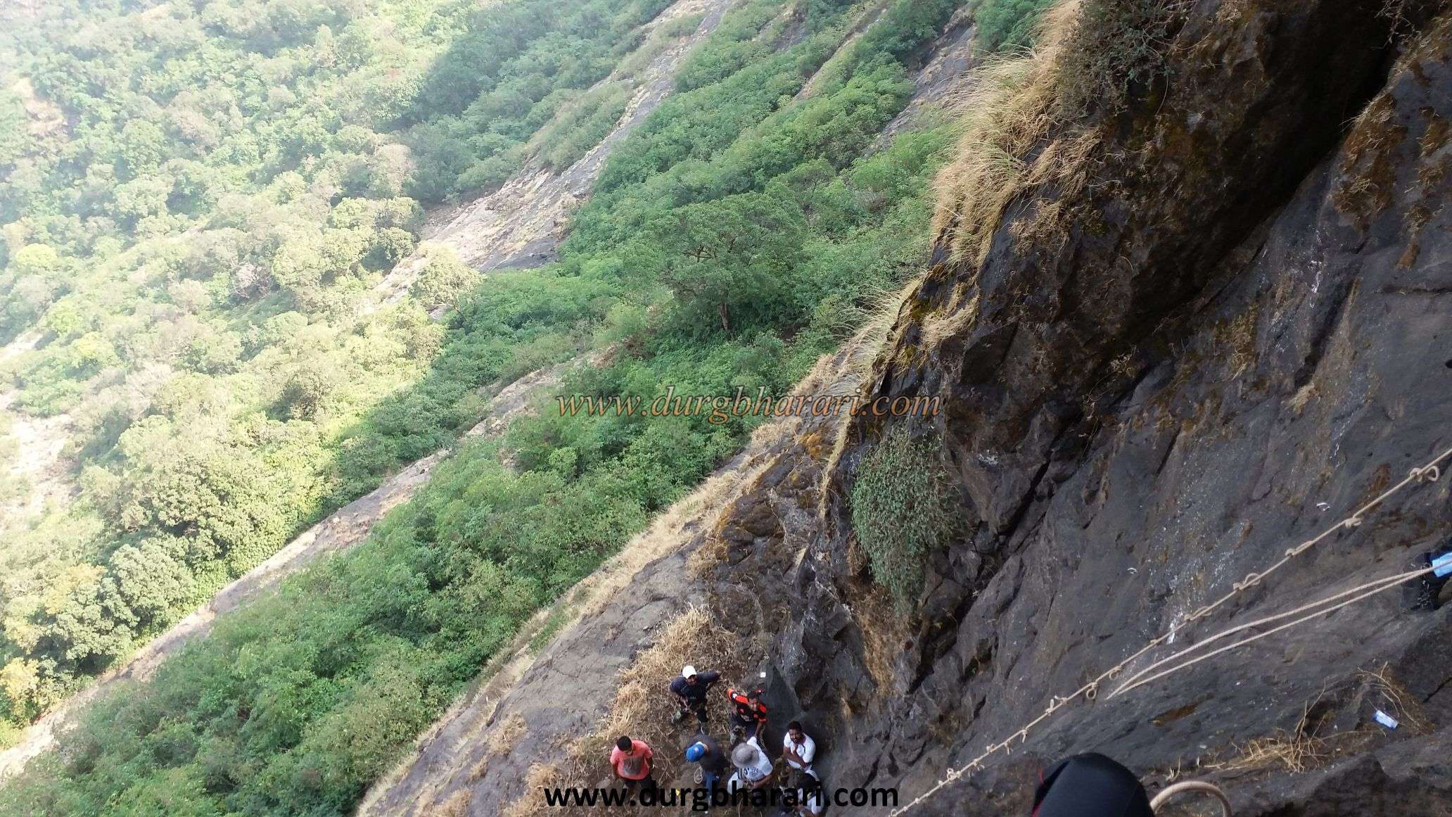
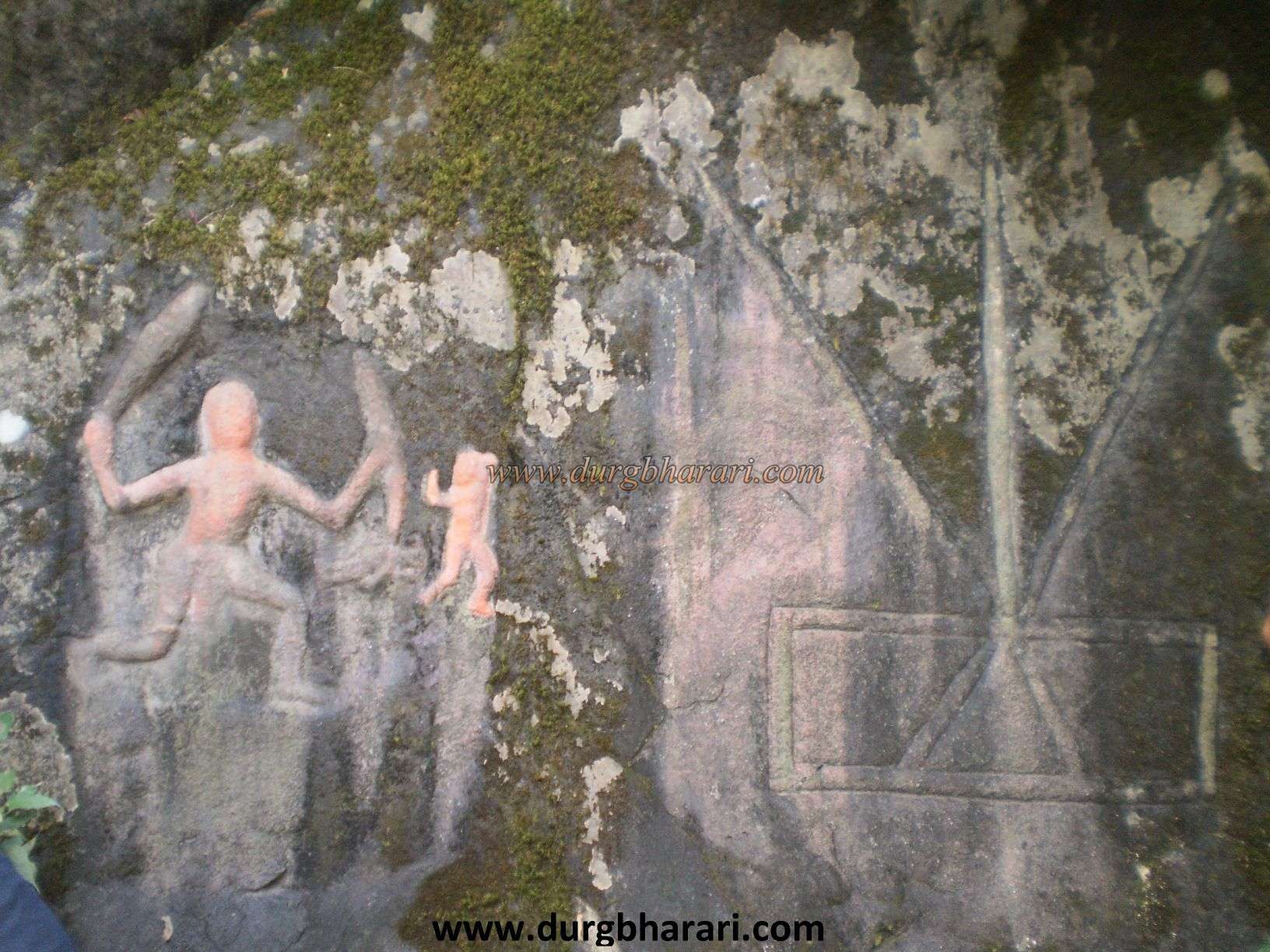
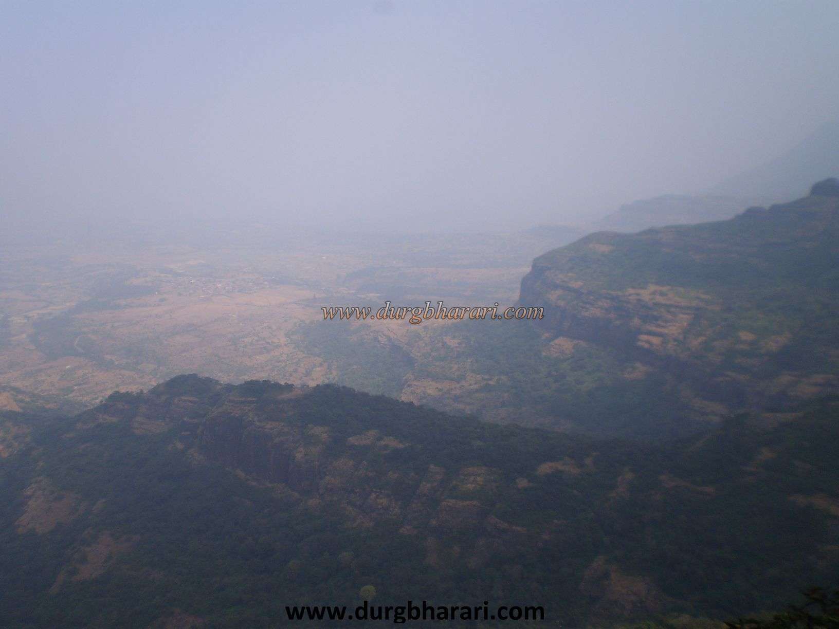
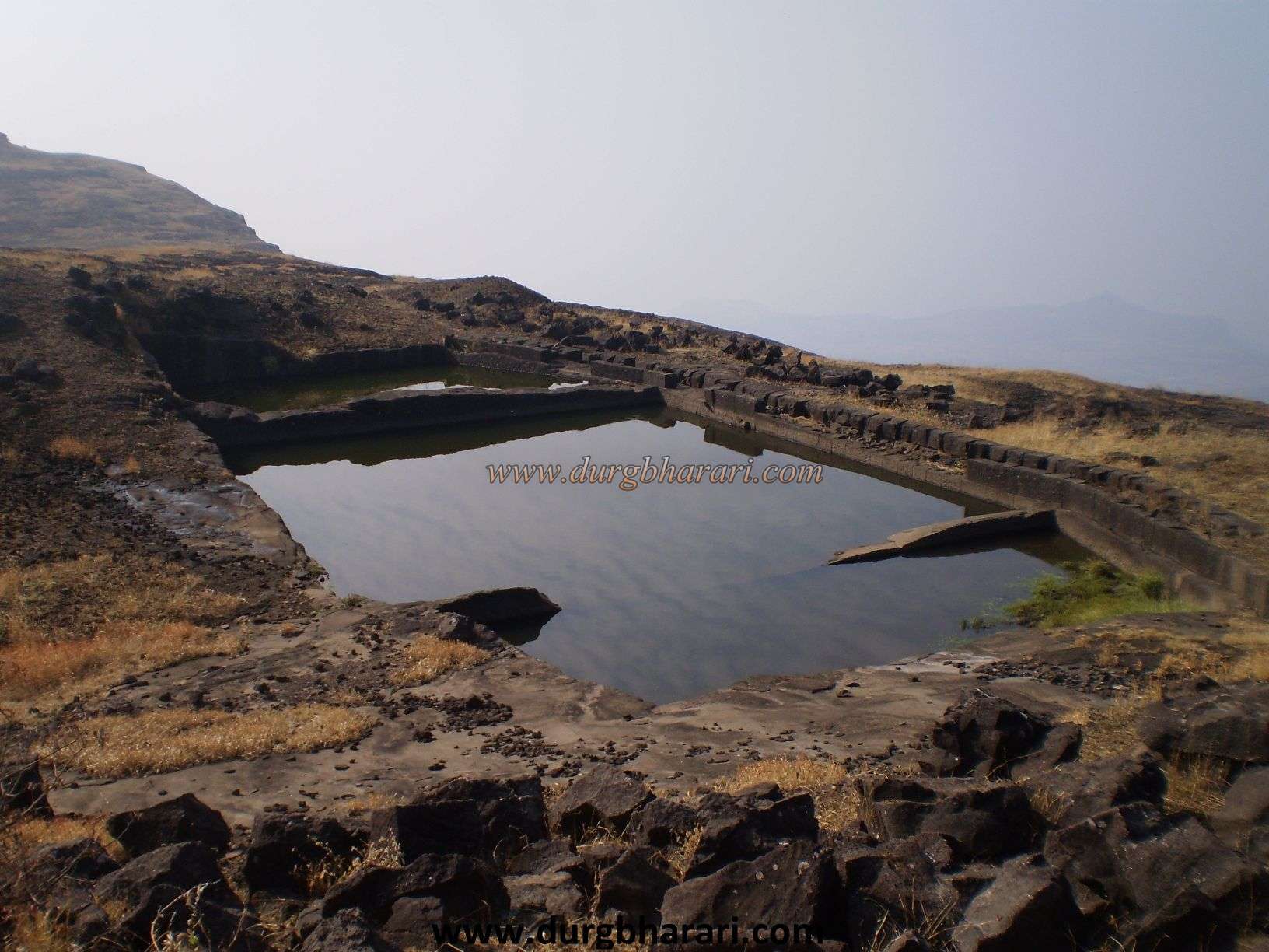
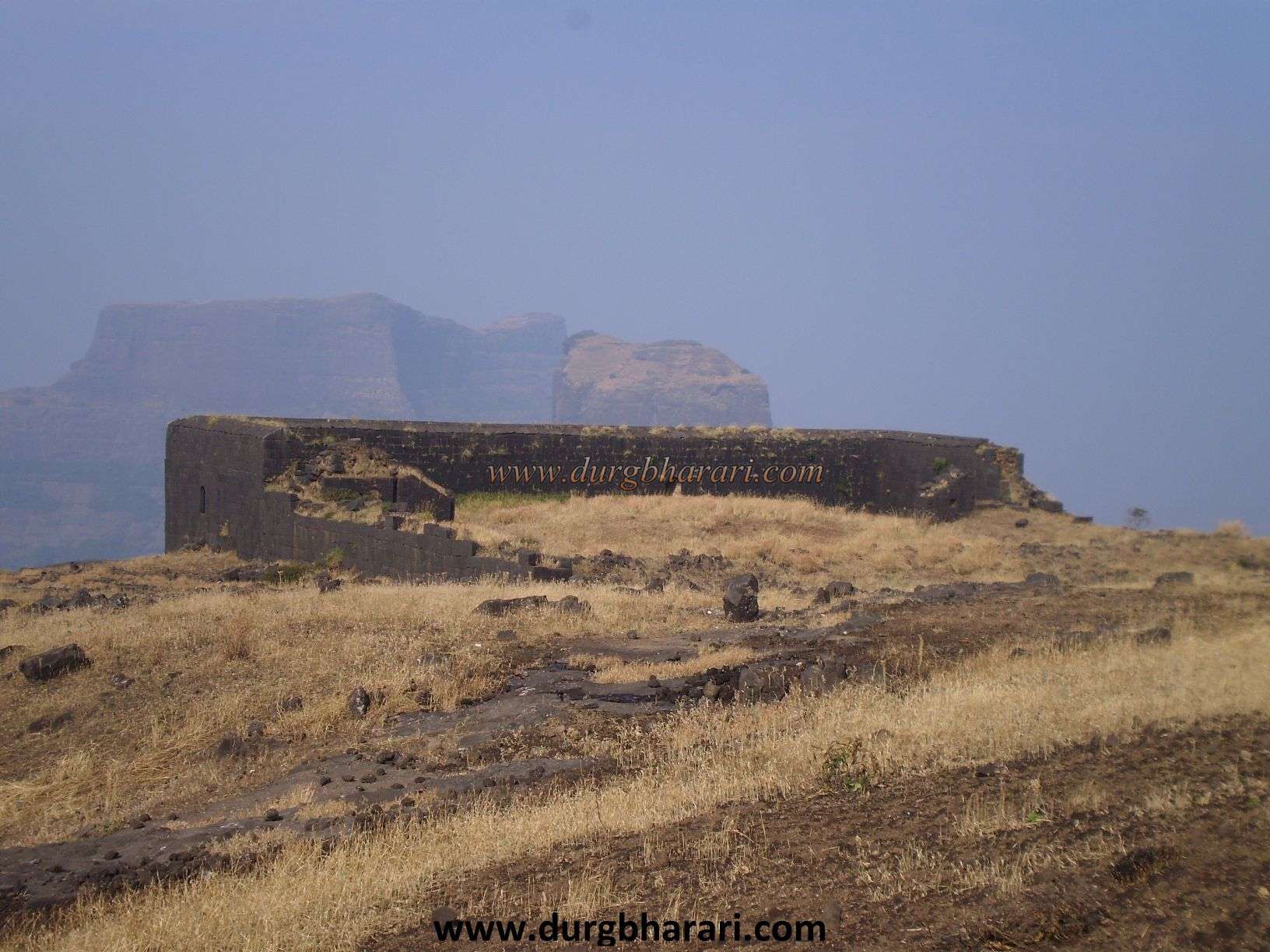
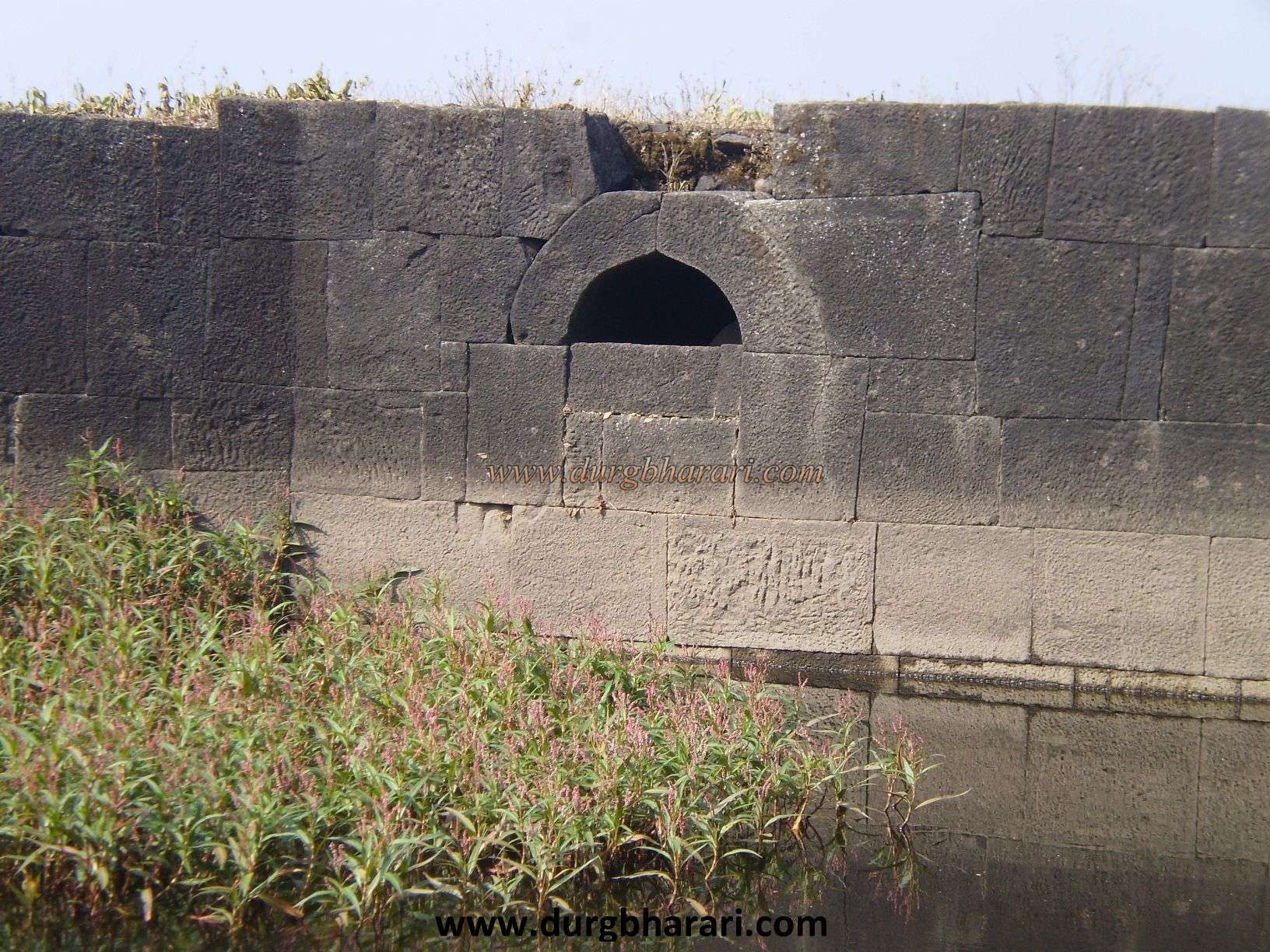
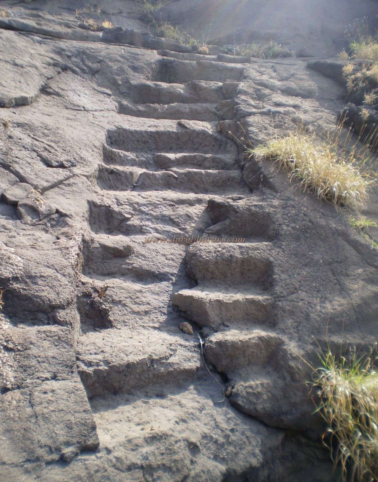
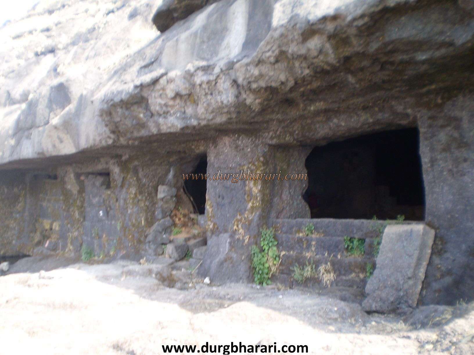
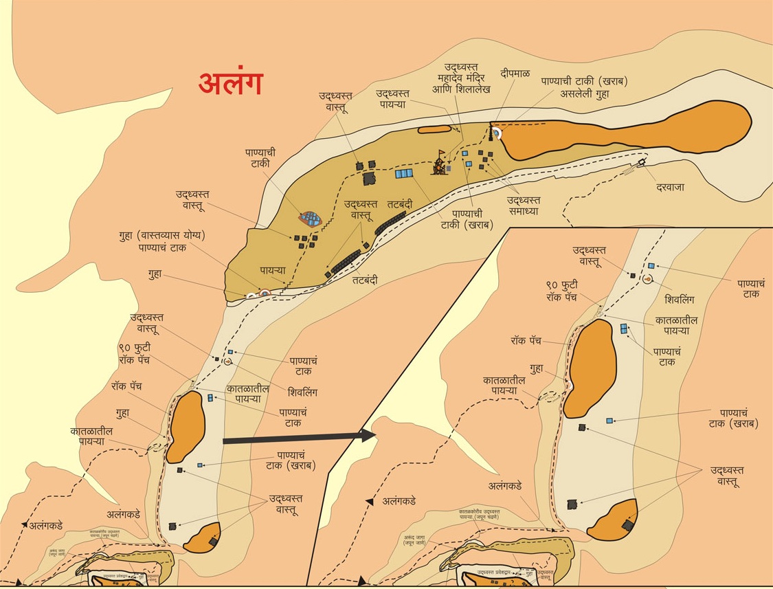
To reach Alang fort, first reach Ambewadi via Kasara-Igatpuri-Ghoti-Pimpalner. To reach from Ghoti to Ambewadi S.T. bus service is available. The distance from Ghoti to Ambewadi is about 32 km. There is a bus from Ghoti to Ambewadi at 6.00 am. The view of the three forts Alang, Madan, and Kulang opposite Ambewadi is shocking. It takes 3 hours to reach the gorge between Alang and Madan fort pass from the village. There are steps carved in the rock in some places along the way, in one place there is a sculpture of a forest deity and a trident next to it. On reaching the gorge, Alang fort is on the left and Madan fort is on the right. To reach the fort via Udhavane, go to Ghatghar via Ghoti-Bhandardara. From there we reach the plateau below the fort in 1 hour via Udhavane. From here, keeping the edge of Alang on the left, in 1 hour we come to the broken wooden ladder. Climbing a little further this ladder you have to do easy rock climbing. After crossing the surface a little further, the main gate of the fort, which was closed due to falling of stones, comes in front. You have to go up from the path next to this door. From here, take the road to the left. Within an hour we reach the cave on the fort. It takes 6 hours to reach the cave from the base. On the way to Ambewadi, after going a little further through the gorge on the left, we first come across a cave. Next to this cave is a potable water tank carved into the rock. The next part of the cave is a simple 25-foot rock climb and after it, there are a few steps. After climbing these steps, you come across a straight broken edge of 50 to 60 feet. This part of the fort can be reached using rock climbing equipment. Don't dare to go this route unless you know the technique and equipment of rock climbing. It takes 5 hours to reach the fort by this route. Climb up the cliff and enter the cave on the cliff. From here, we cross the dangerous steps carved in the rock and reach the top of the fort. The top of the fort is a vast plateau. When you reach the top, you can see two caves carved in the belly of the fort in front and Madan and Kulang fort on the right. On the plateau facing Madan on the right, you can see some rare relics and a large structure. On the way to the cave from here, there is a Shivling placed against the fallen wall and two water tanks next to it. After crossing these tanks, we reach the caves. These two caves can accommodate 30 to 40 people. There are water tanks next to the caves but the water in them is mossy. We reach the fort at the top of the cave by climbing the steps carved in the rock to the left of the cave. When you come up, first look at the left side of the fort. At this place, there is a group of 11 tanks carved in the rock on the slope. One of the tanks has a torn inscription on it. To the right of the fort, a large stone building still stands along its walls. This should probably be the headquarter of the fort or mansion for the fort keeper. About 20 feet high and 50 feet long, this building can be easily seen from Madan and Alang forts. In front of this building, you can see some tanks filled with water. Remains of some structures are scattered around these tanks. If you go further towards Kalsubai, there is a fallen Shiv temple on the slope and an inscription in Marathi script nearby. From here, on the way to the edge of the fort, there are the remains of some houses and a water tank carved in the rock but is soil eroded. At the end of the fort is a small ruined temple. From the fort, Kalsubai, Aundha, Patta, Bitangad to the east, Harihar, Trimbakgad, Anjaneri to the north, and Harishchandragad, Ajoba, Khutta Sulka, Ratangad, Katrabai hill to the south can be seen. Since it takes a whole day to visit the fort, it is convenient to stay at the fort and descend the next day. From the caves and water tanks on the fort, these forts must have been very ancient, dating back to the Satvahana period, but they are mentioned around in the year 1670. Alang-Kulang-Tringalwadi is mentioned in the forts captured by the Marathas after the battle of Kanchanbari. In 1818, during the last English-Maratha war, Colonel McDowell destroyed the path of the steps carved in a vertical ridge by planting a mine on these steps and firing a gun.
© Suresh Nimbalkar
Gallery