AKRANI MAHAL
TYPE : HILL FORT
DISTRICT : NANDURBAR
HEIGHT : 2230 FEET
GRADE : EASY
Nandurbar, which was once part of Khandesh, came into existence as an independent district after the partition of Khandesh. Nandurbar district borders Madhya Pradesh and Gujarat directly. In this tribal-dominated Nandurbar district, there were not one or two forts but 15 forts in the form of Hillfort, Ground fort and fortress. 7 forts are mentioned in the book “Gadkille Maharashtrache” by DurgMaharshi Pramod Mande. Except for this, these forts are not mentioned elsewhere. In today's computer age, except for Akrani fort, information about other forts is not available on the internet. I have present you the information about these forts I collected with my team on a study tour. Of these, two forts, Hatmoida and Ashte, have been destroyed and the remaining 13 forts are still standing.
...
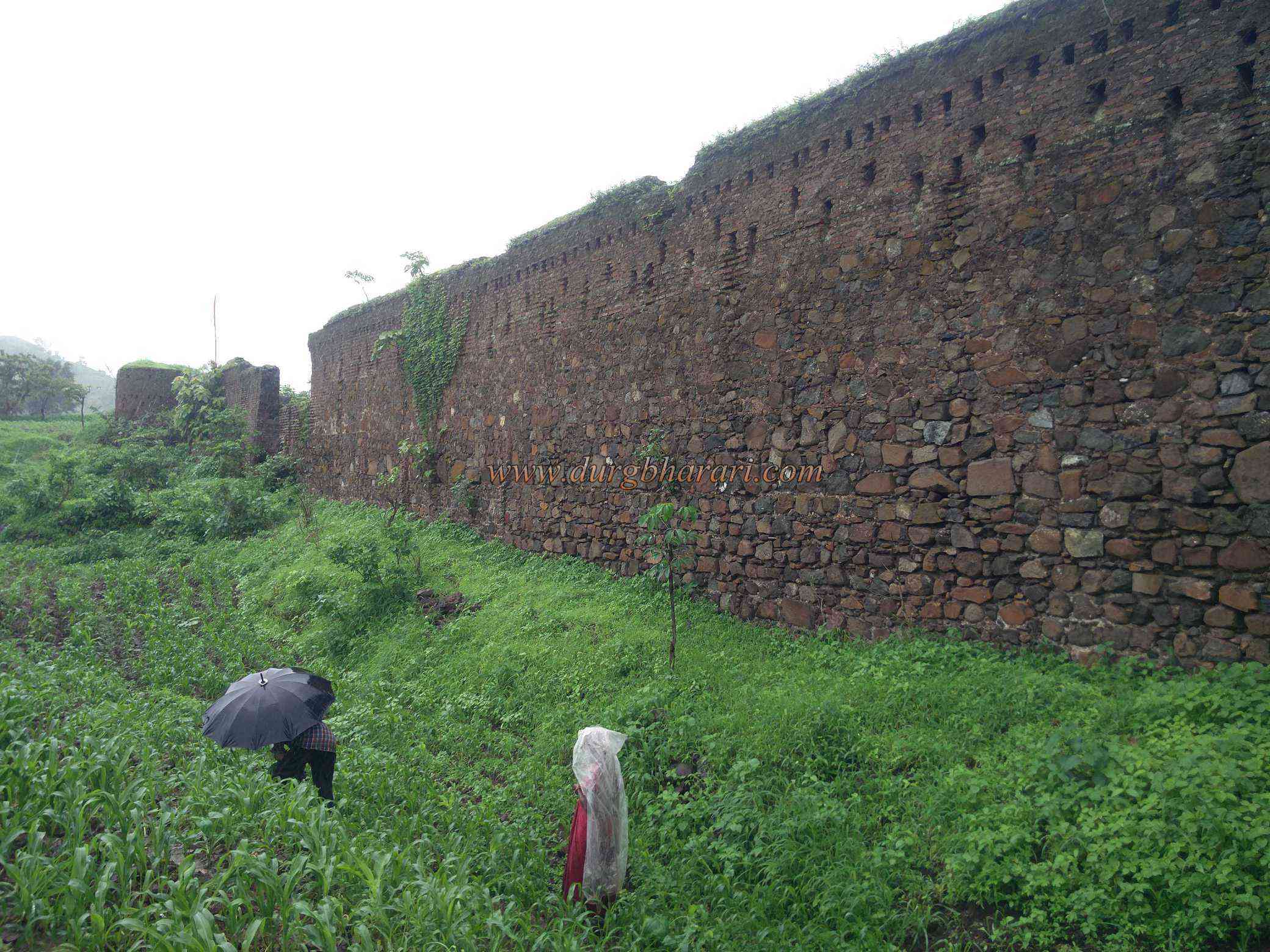
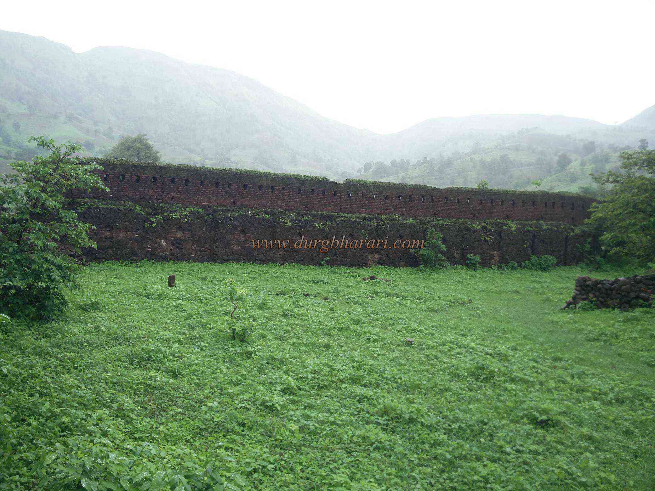
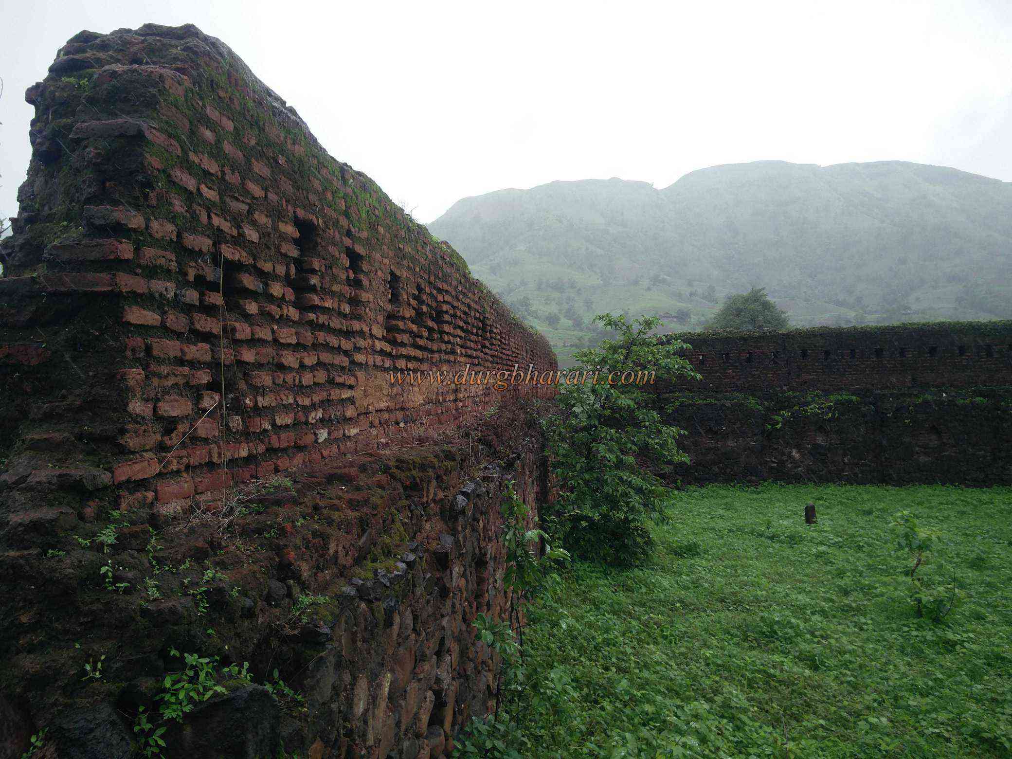
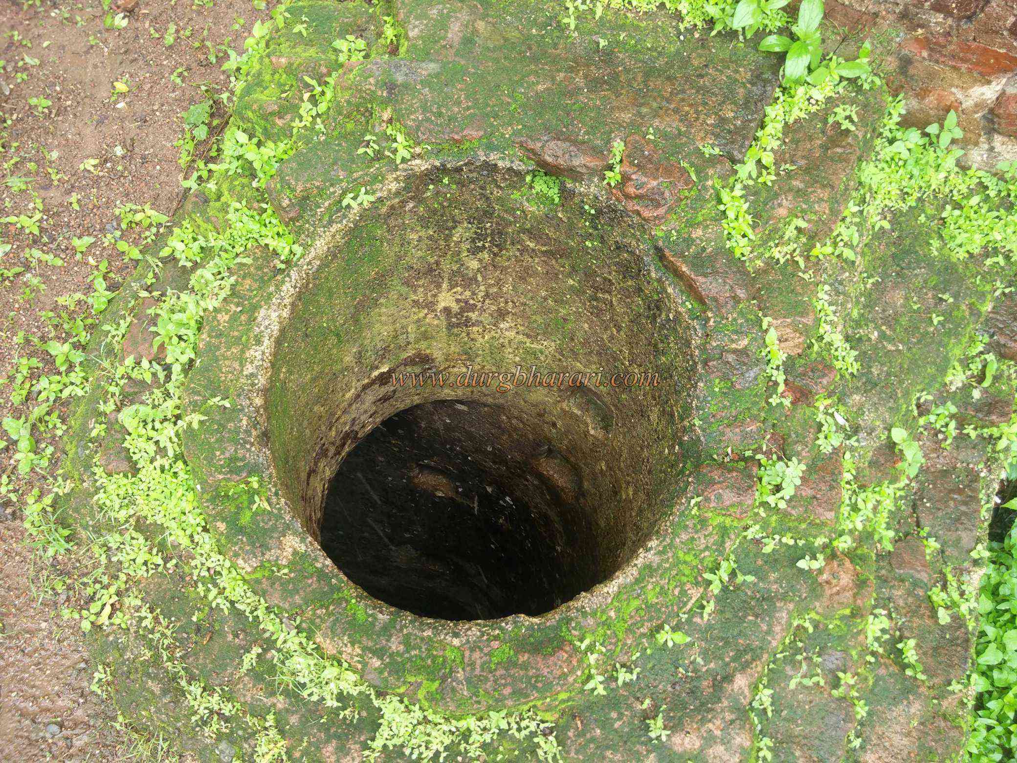
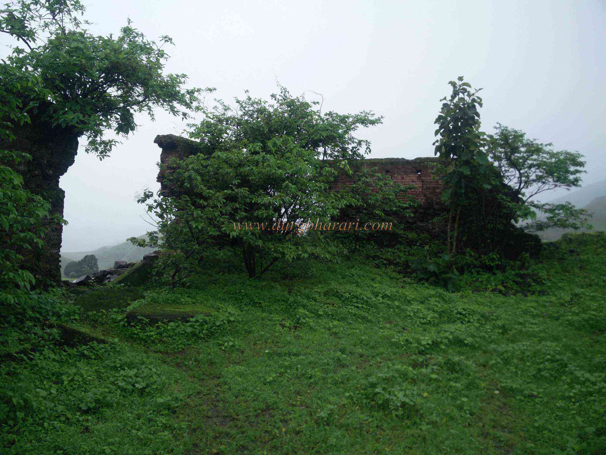
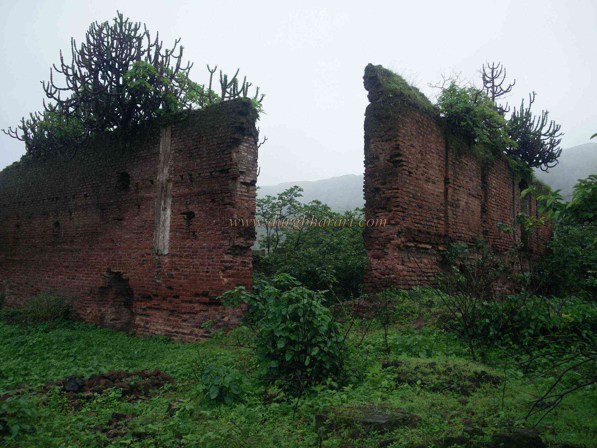
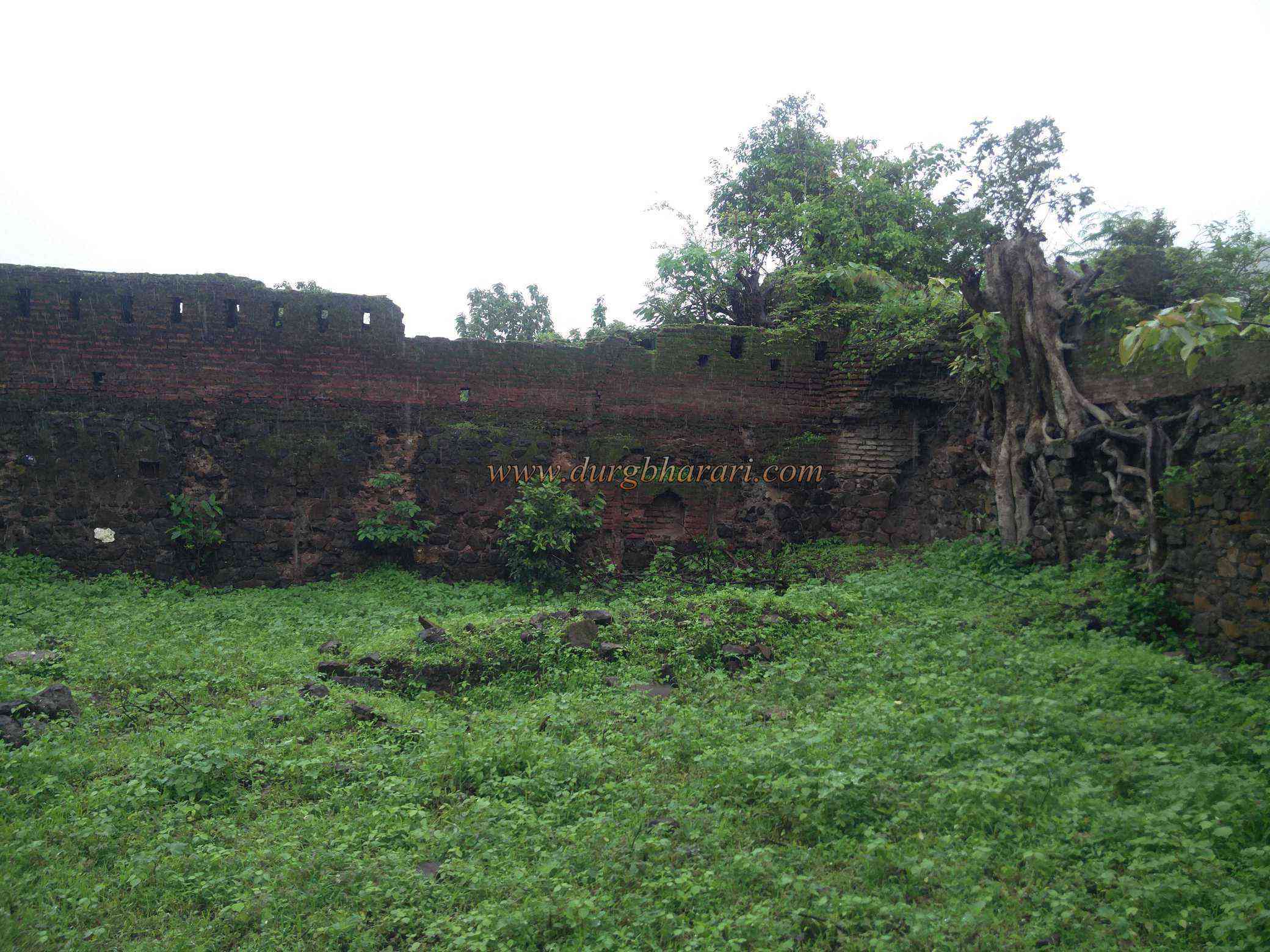
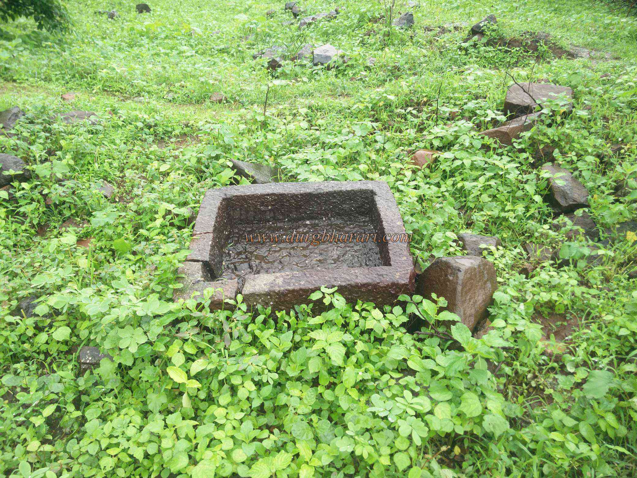
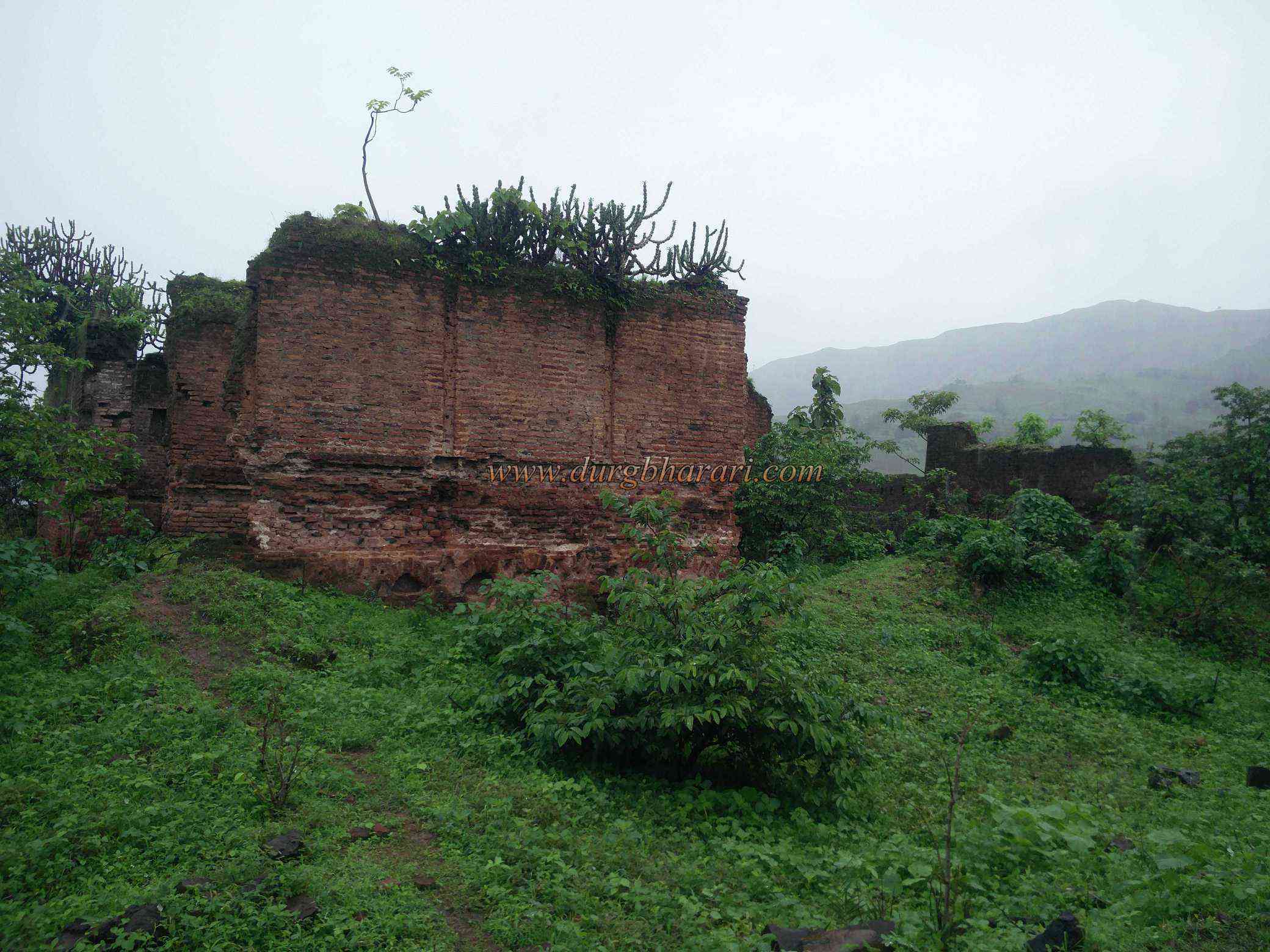
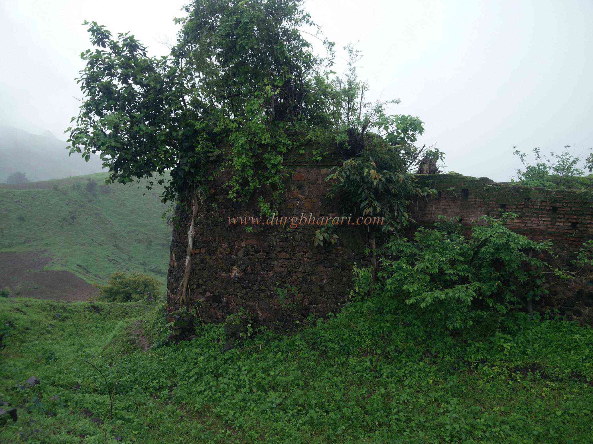
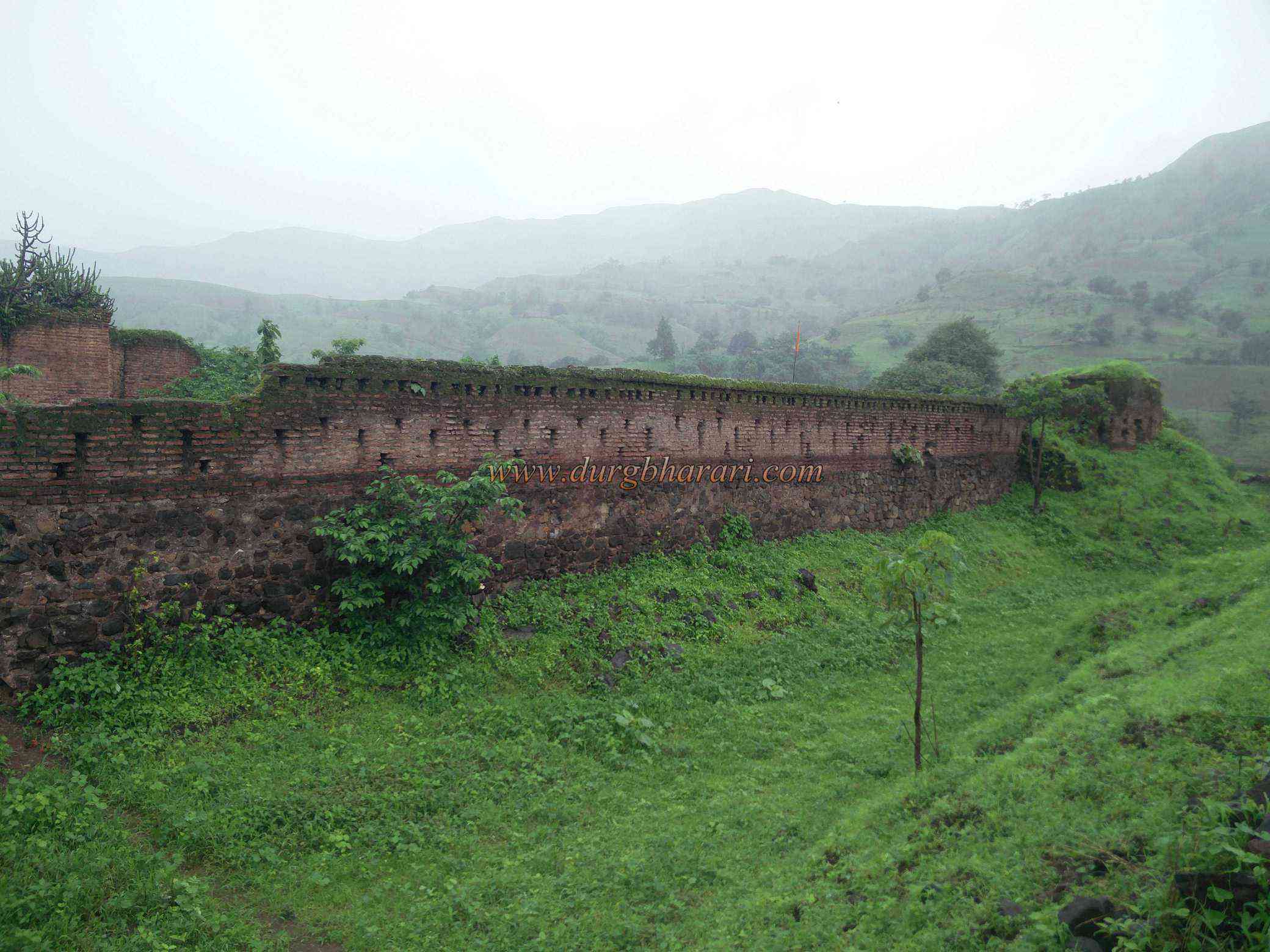
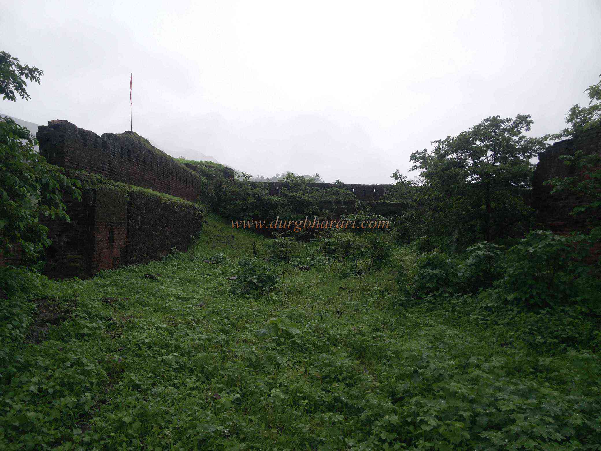
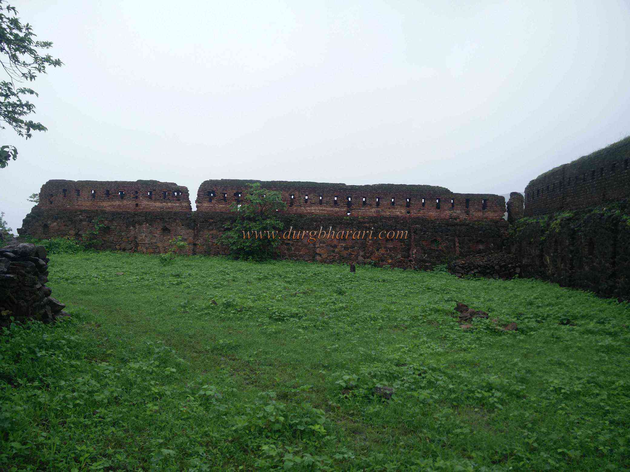
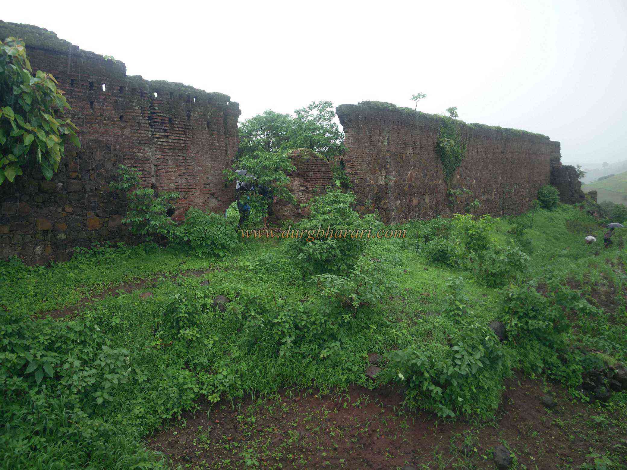
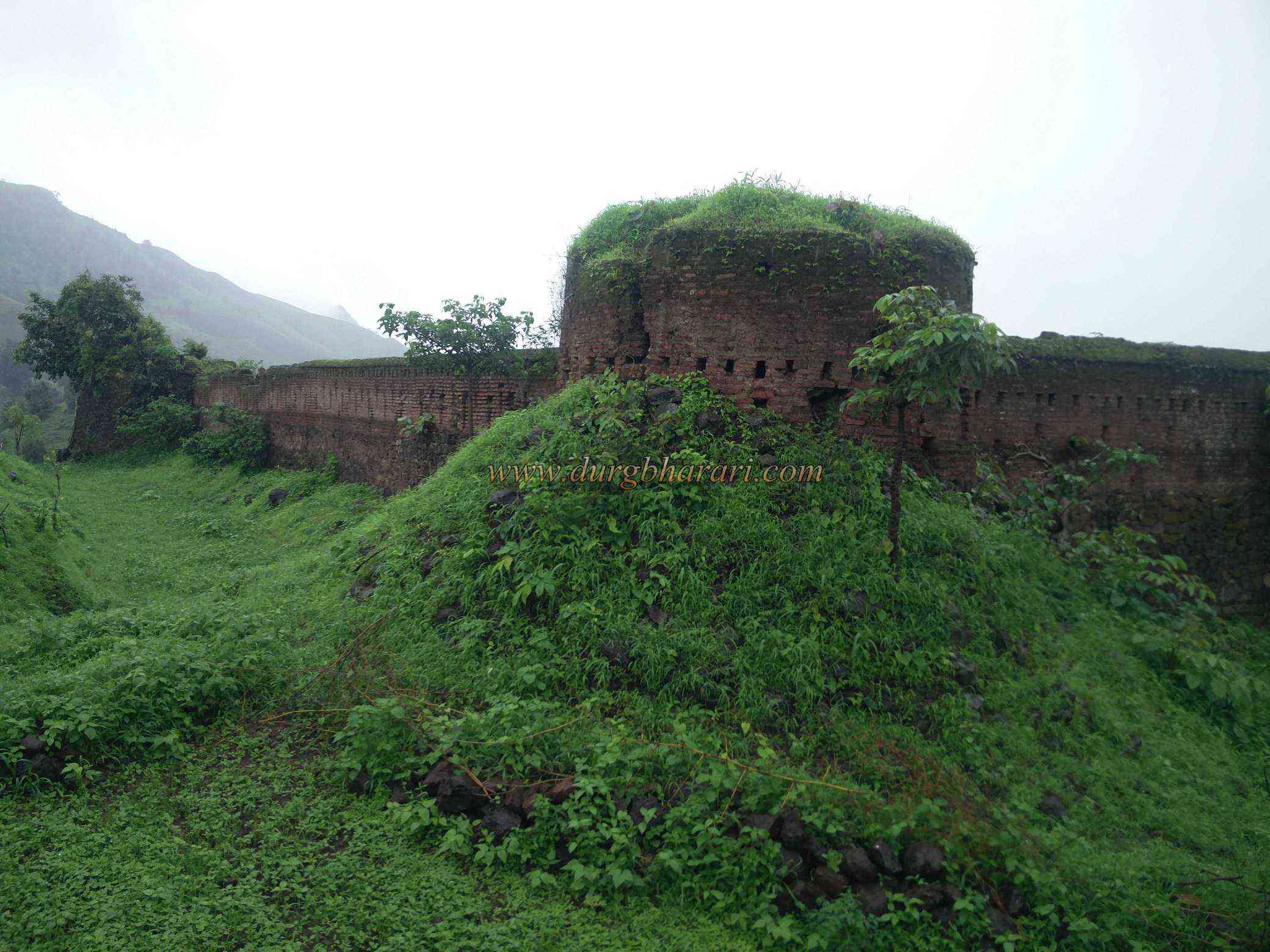
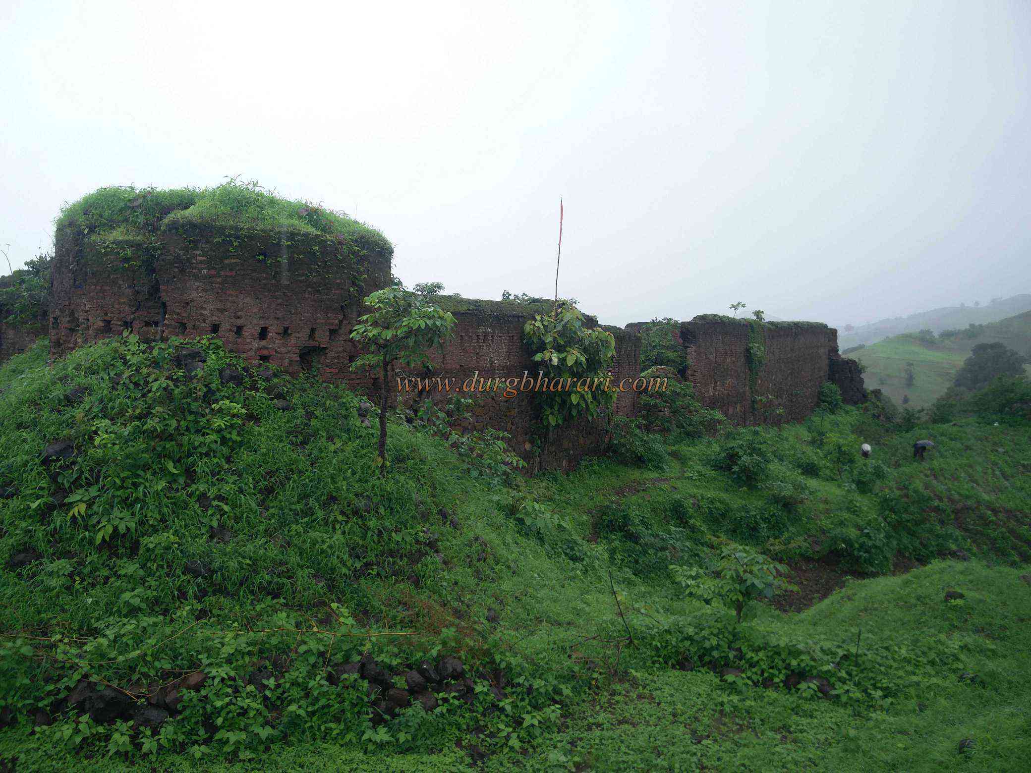
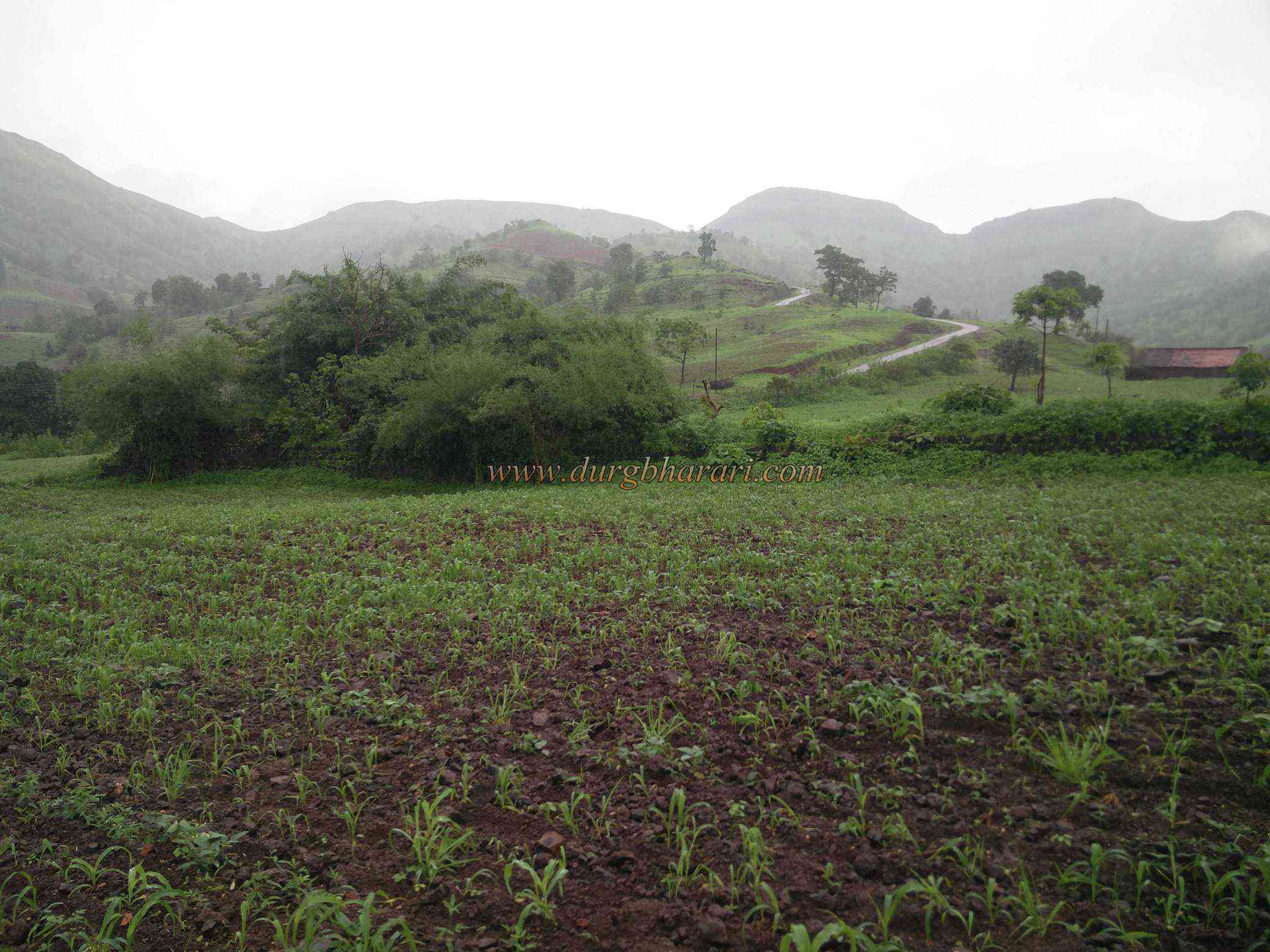
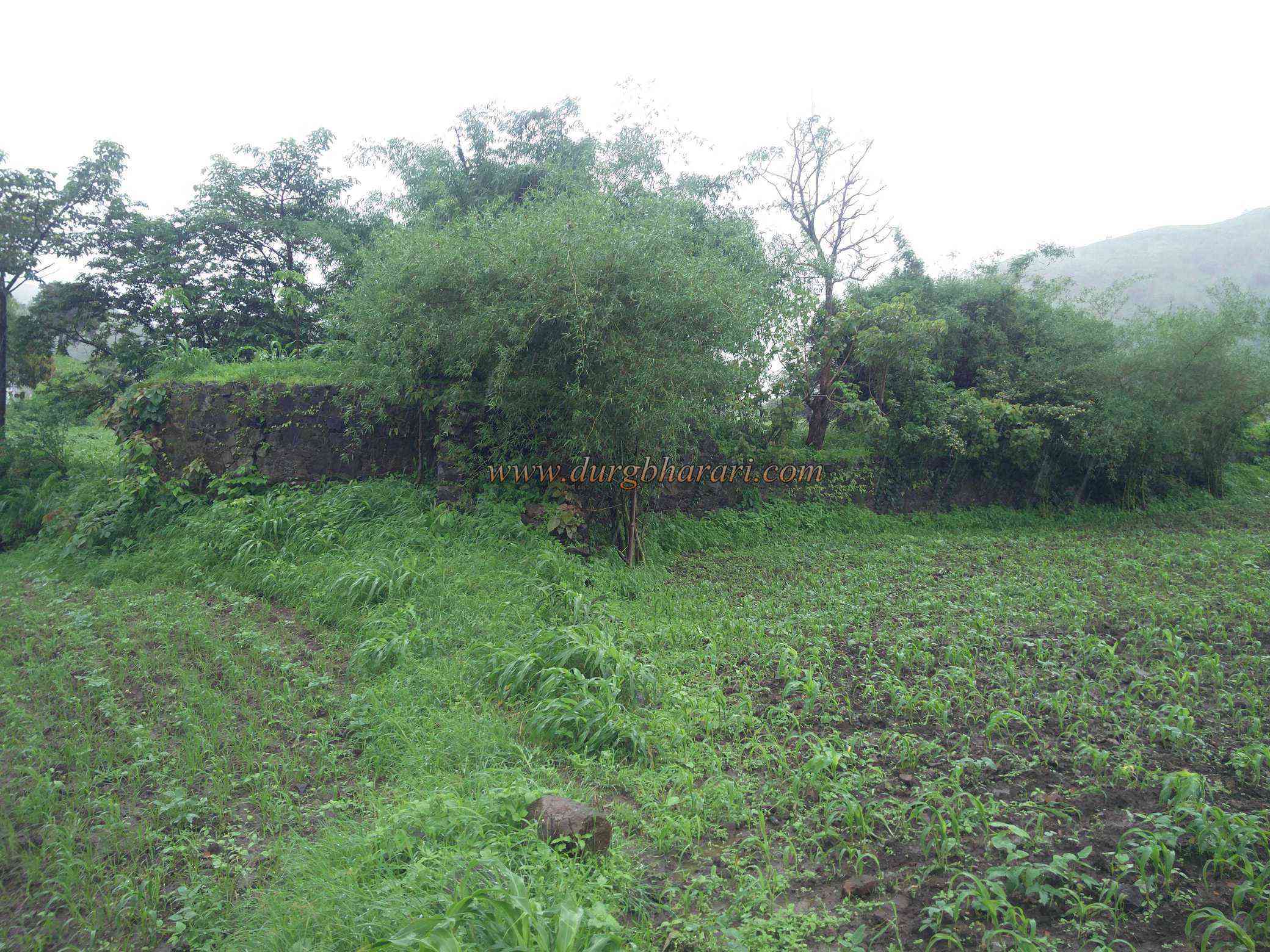
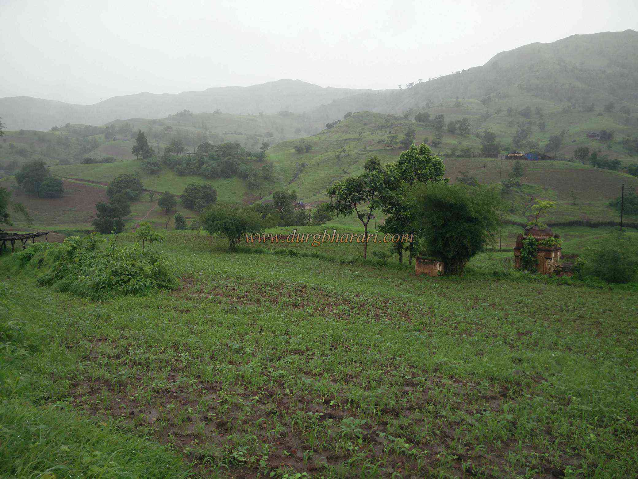
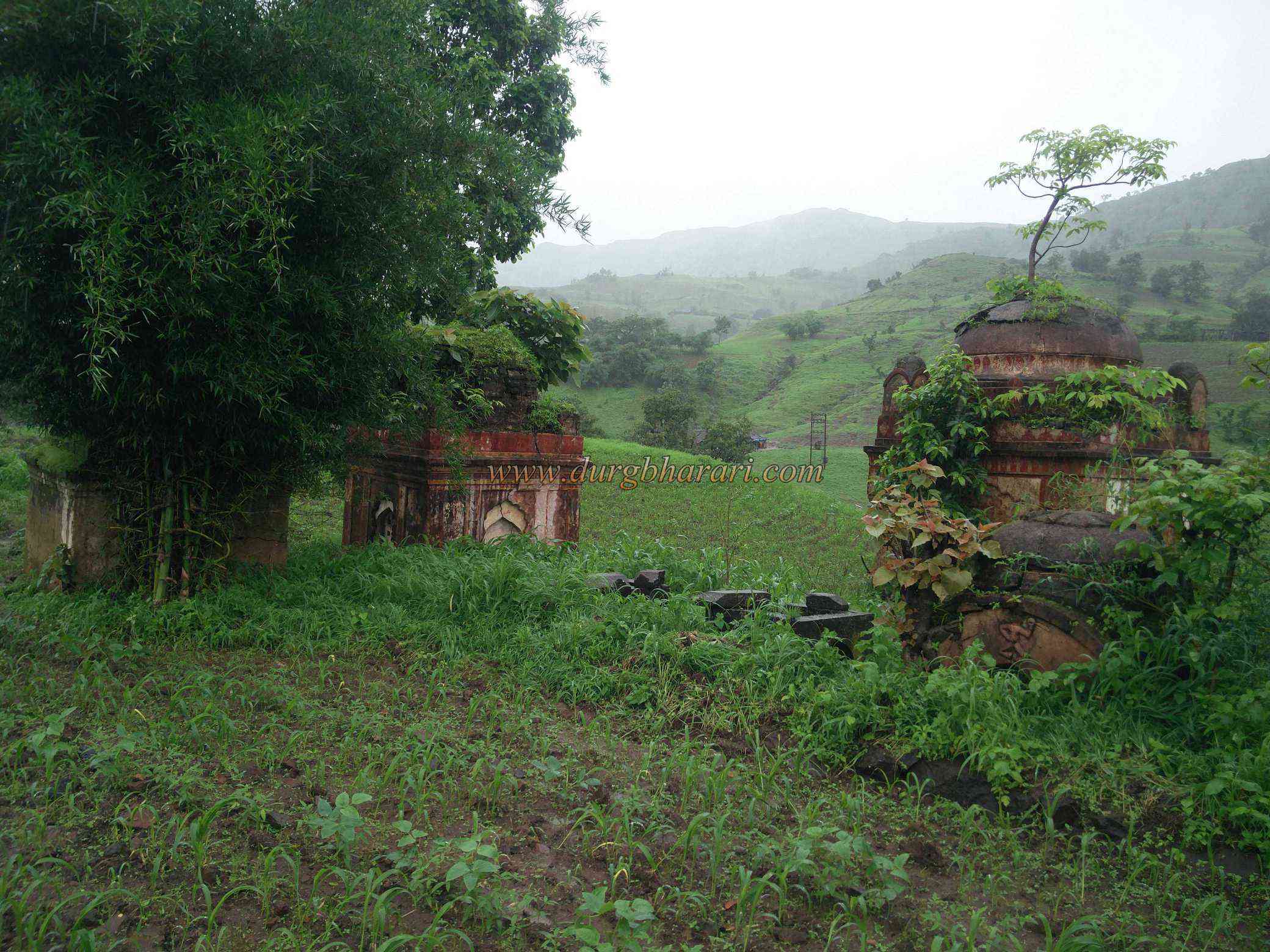
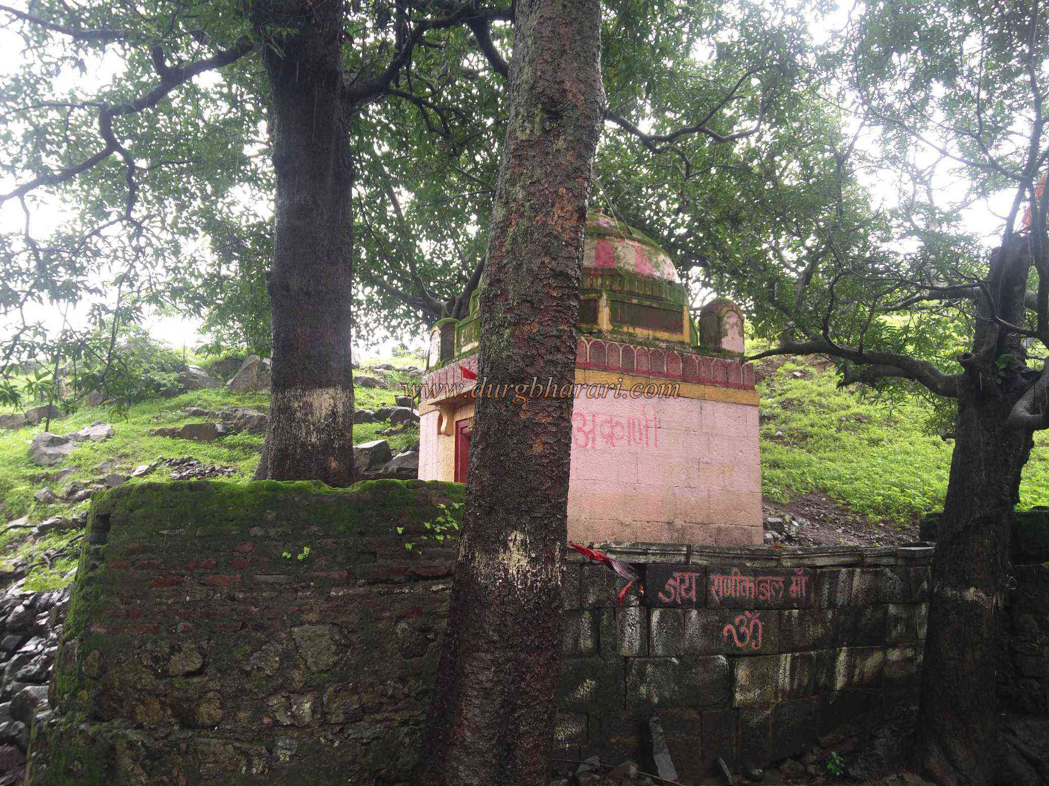
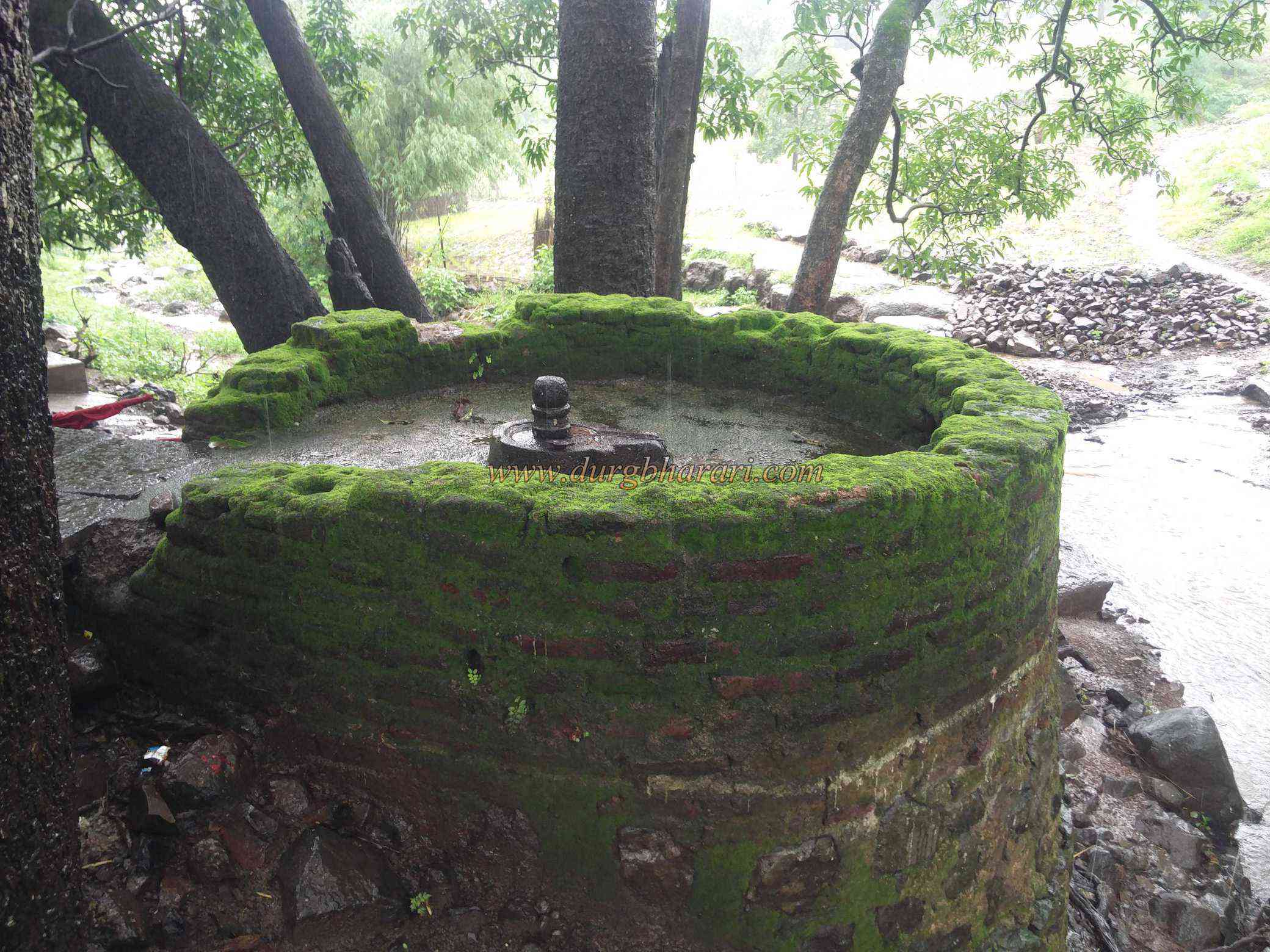
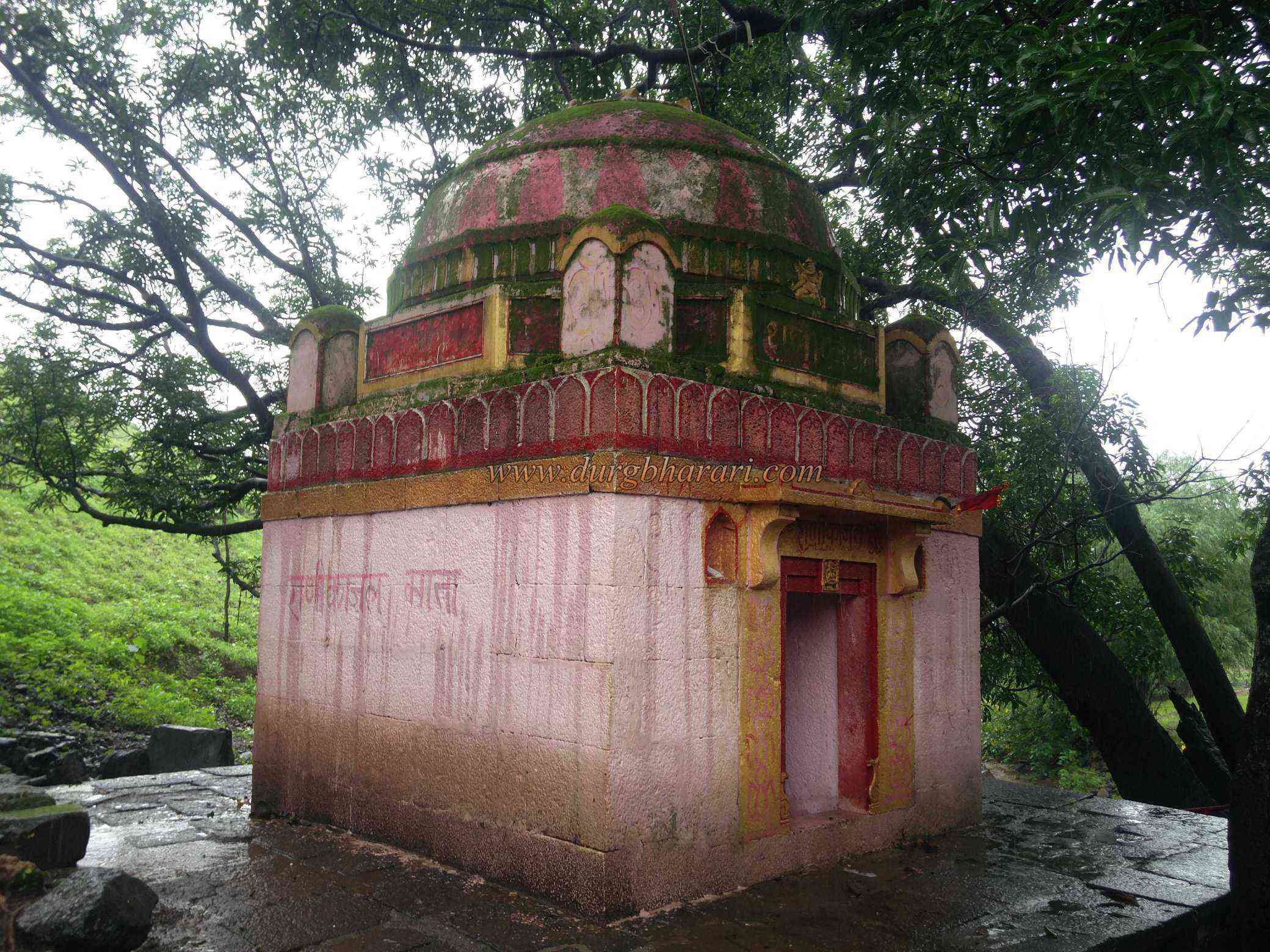
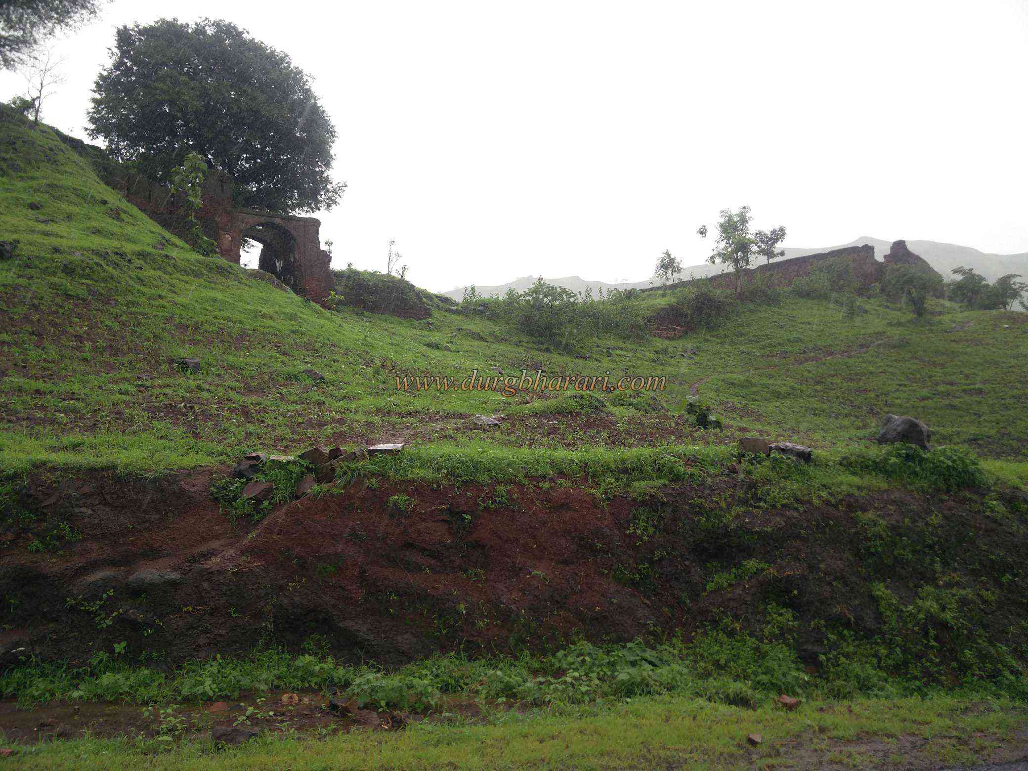
These 13 forts have 1 hill fort, 3 Ground fort, 2 city fort, and the remaining 7 fortresses. Due to the river Tapi flowing through Nandurbar district, the district is divided into two parts namely North and South. Akrani is an institution and Mahal means county or Province of this institution. Akrani Mahal is a fort located in North of Nandurbar in Talode taluka is at a distance of 28 km from Dhadgaon. Nandurbar Akrani Mahal is 83 km away and can be reached via Prakasha-Mhaswad-Khamla. Akrani village is 7 km south of Khamla village. Akrani Fort is also known as Dhadgaon Fort. According to the locals, after the defeat of Rana Pratap in the battle of HaldiGhat, some Rajputs, including Maharana Pratap's sister Akrani, took refuge in this part of Satpuda. Akrani fort was built by Maharana Pratap's sister Akrani and the fort and Dhadgaon taluka got its name Akrani Mahal after her. On the way from Khamla village to Akrani village, the remains of this fort and palace can be seen on the hill slope. The Mahal is protected by the main fort on the outside. The rectangular fort is spread over an area of 2.5 acres and the inner palace is 150 x 175 feet in size. On the left side of the road, outside the fort, you can see 5 tombs of the royal family. After visiting this tomb, you can see the west-facing main gate and bastion at a height of about 50 feet on the left side of the road. Built-in stone, the bastion, and door of this fort are still in good condition. The ramparts up to curtain wall are built of stone and the upper part is built of bricks. The ramparts of the fort have been severely damaged, but the ramparts of the inner palace are still standing. There are four bastions at the four ends of the palace and only three bastions remain as the outer ramparts have collapsed. Looking at the overall construction of the palace and the grooves in it, it seems that the palace has three floors. The inner wall of the palace has a place for storage in some places and all the walls are standing today but they have fallen in some places. The main entrance of the palace faces north and no remnants of it remain today. The inner hall of the palace has a deep basement with a rounded face from above and its size cannot be estimated as there is no access to it. Apart from this, there is a small built tank in the palace and next to it there is broken water storage made up of stone. This is where your fort round ends. Half an hour is enough to see the fort. Apart from this, on the opposite side of the road, on a slope with three or four trees, there is a small dome-shaped temple built on a quadrangle of stone and some sculptures are kept in this temple. There is a perennial spring under this temple and it flows even in summer. The temple is inscribed in bold letters as Rani Kajal Mata Mandir, but the locals know this temple as Rani Ka Jal Mandir. The first Sultan of Khandesh, Farooqi Malikraj, captured the cities of Sultanpur and Nandurbar and its environs in 1530 AD, but the invasion of Gujarat Sultan Muzaffar forced Farooqi Malikraj to return to Thalner. When Mahamadshah Begda became the king of Gujarat in 1536, Sultanpur and Nandurbar places were handed over to Mubarak Khan Farooqi. When Farooqi was in power in Khandesh, it also included Dhadgaon. After the end of the Farooqi dynasty in the 15th century, there was no heir to the parish and the Sansthan was taken over by Chhaviji Rana of Kathi Sansthan. After the death of Chhawji Rana, Akrani county came to his son Rana Gumansingh and built the fort. In Maharashtra Encyclopaedia Volume-6, it is mentioned that Rana Gumansingh, the founder of Kathi, built the fort of Akrani in the late fifteenth century. He was succeeded by his son Himmat Singh who ruled Akrani for 28 years. Himmatsingh had two sons, Ranababu and Gumansingh. As Ranababu had already died, his son GumanSingh ruled over Akrani for 12 years. Since there was no heir after Guman Singh, there was chaos and the army and relatives left for Udaipur. The tombs at this place belong to Rana's ancestors. According to the Dhule District Gazette, in 1634, Shahjahan had annexed the provinces of Sultanpur and Nandurbar in Khandesh to the province of Malwa, with Barhanpur as his headquarters. Taloda from the invasion of the then Bhil people. The gazette suggests that Aurangzeb may have given the Akrani Mahal Pargana to Pratap Singh, the founder of the Rana family, on the condition of protecting Sultanpur and other areas.
© Suresh Nimbalkar
Gallery