AAMNER
TYPE : HILL FORT
DISTRICT : AMRAVATI
HEIGHT : 958 FEET
GRADE : MEDIUM
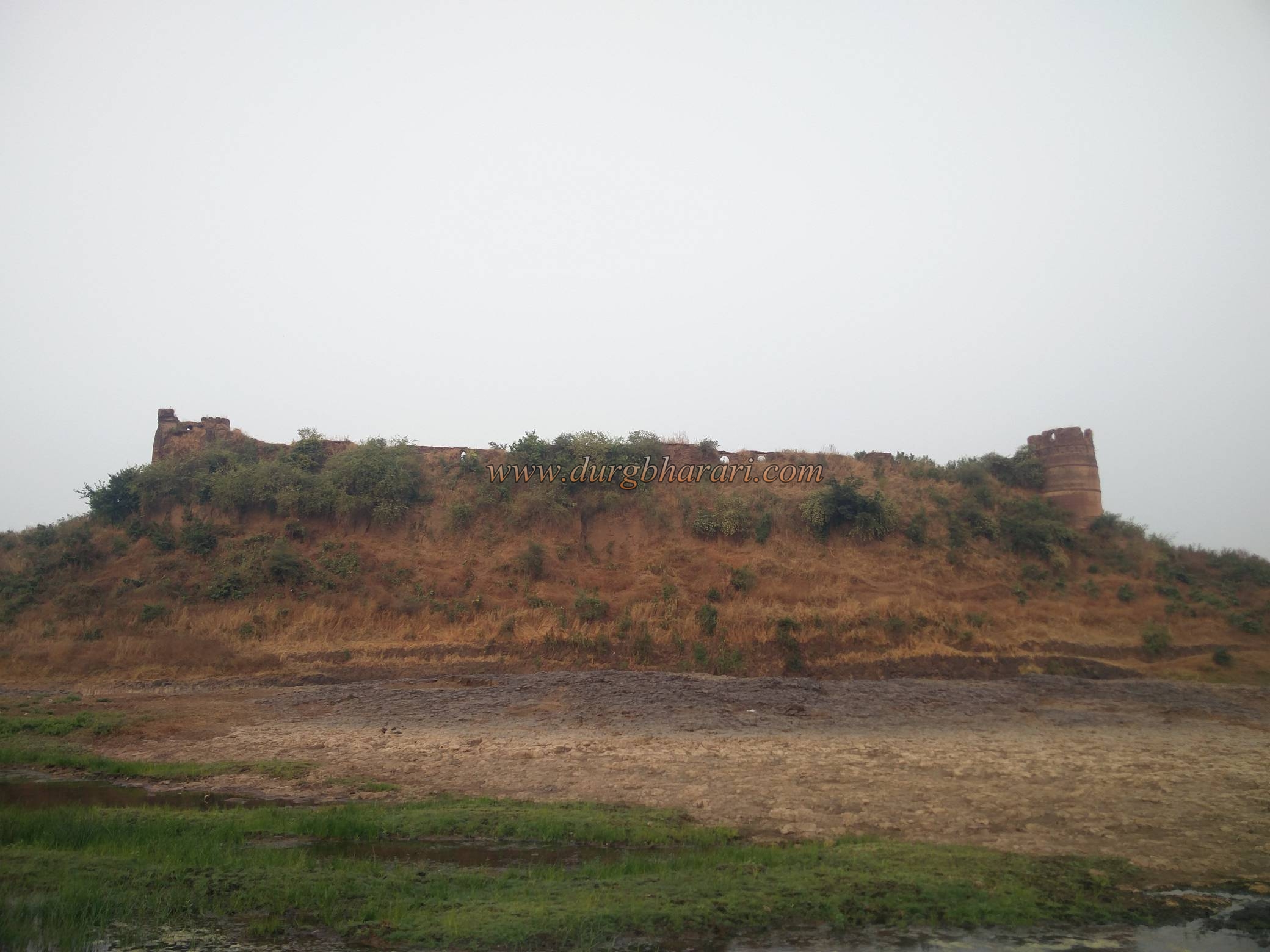
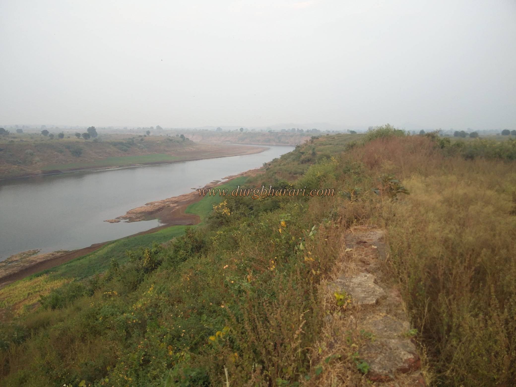
Apart from the mighty forts Narnala and Gavigad in Melghat, other small forts are unknown to people today. No one knows the information about these forts. In Dharani taluka of Amravati in Vidarbha, there is a similar unknown fort known as Aamner fort or Zilpi Aamner. The locals call this fort as Hasir Fort. Situated on a small triangular hill at the confluence of River Tapi and Gadga, this fort was a watchtower for the way coming from the north to Vidarbha. The fort has a river bed on two sides and a ditch the other side was the security pattern of the fort. As the Aamner village near the fort was uprooted during the British rule so now the village close to the fort is Bhokarbardi. To visit the Amaner fort, you have to reach Dharani from Amravati via Paratwada-Semadoh-Harisal. This distance is about 145 km.
...
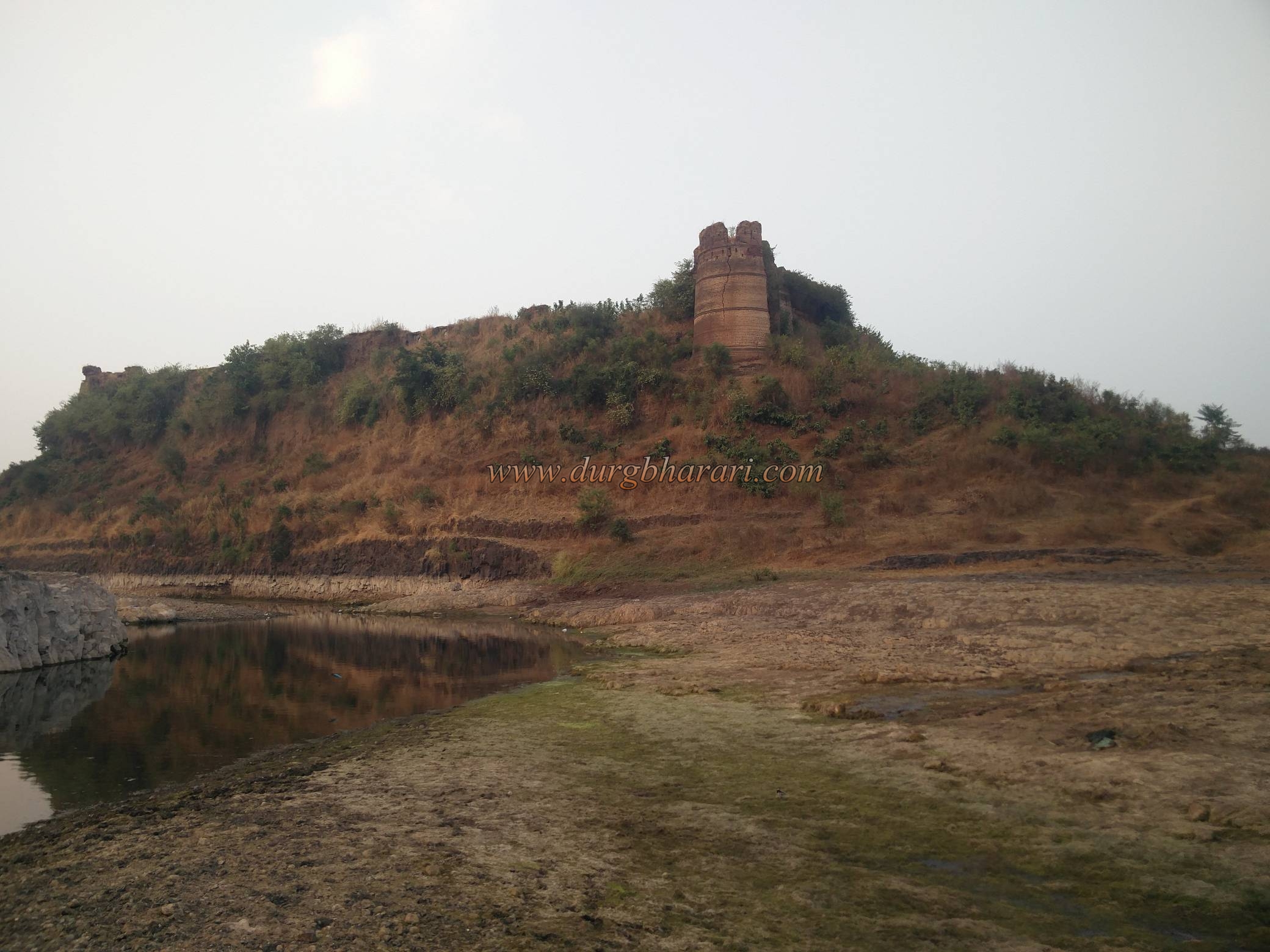
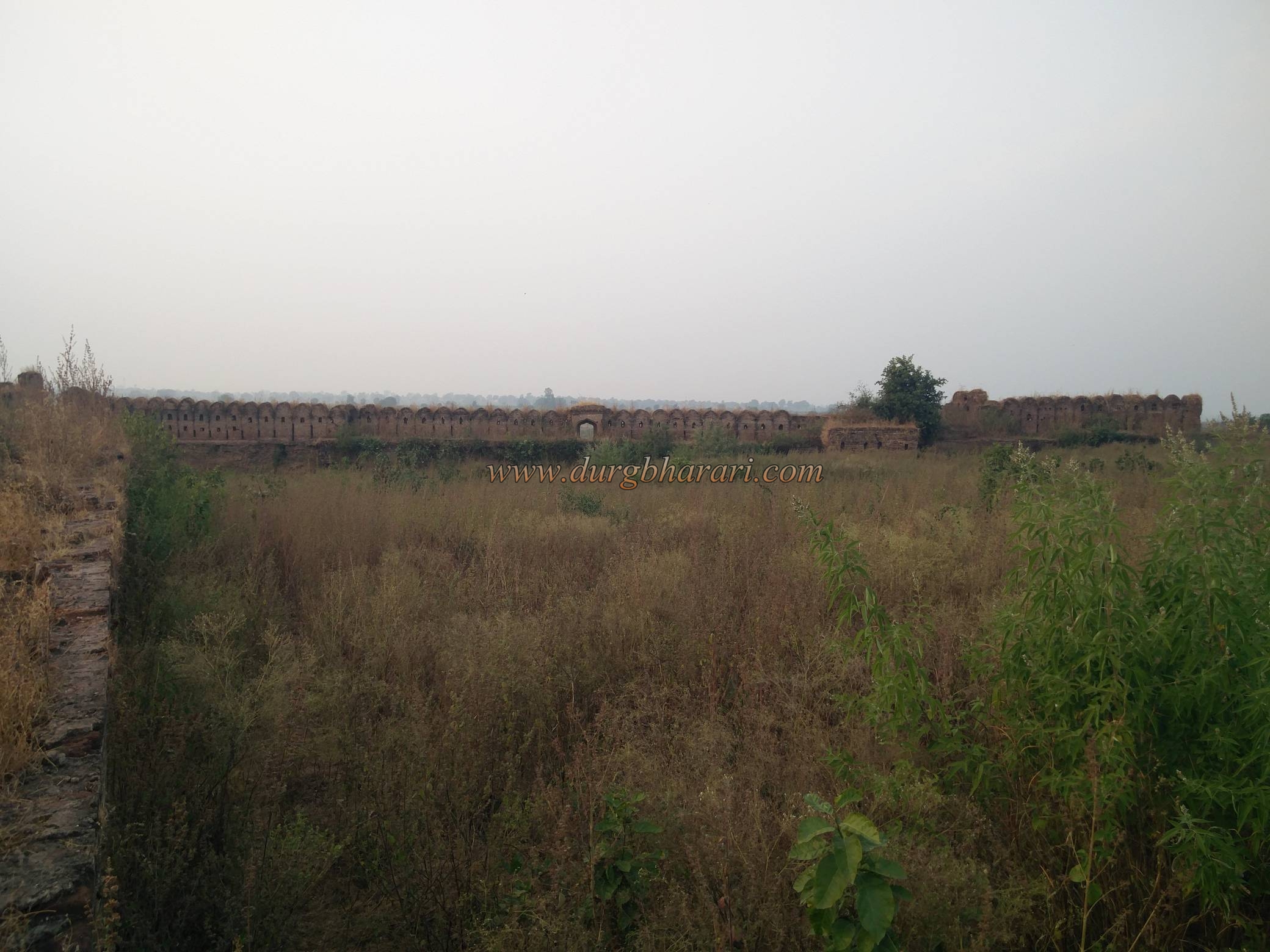
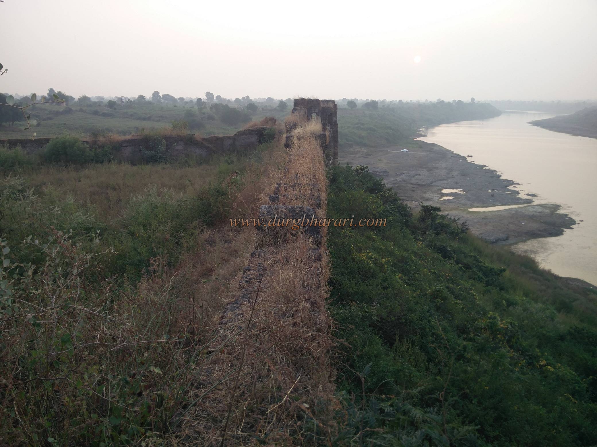
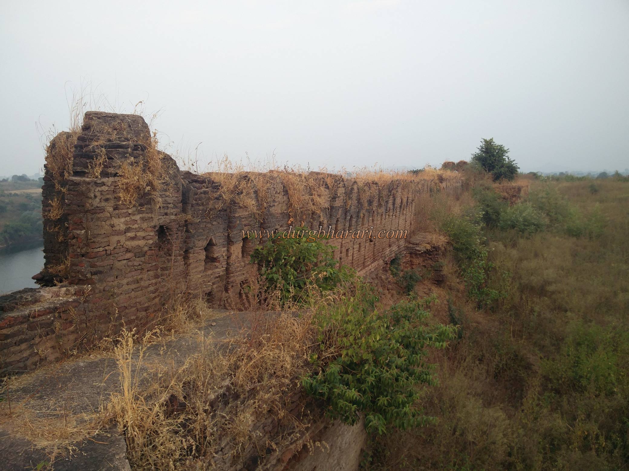
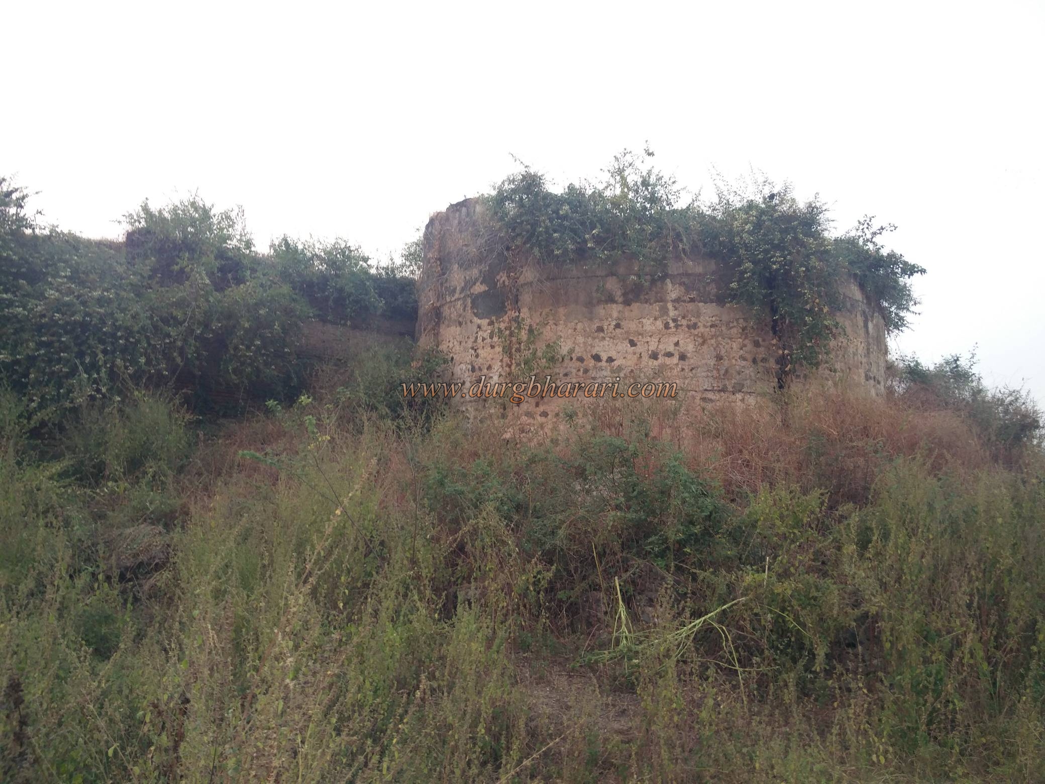
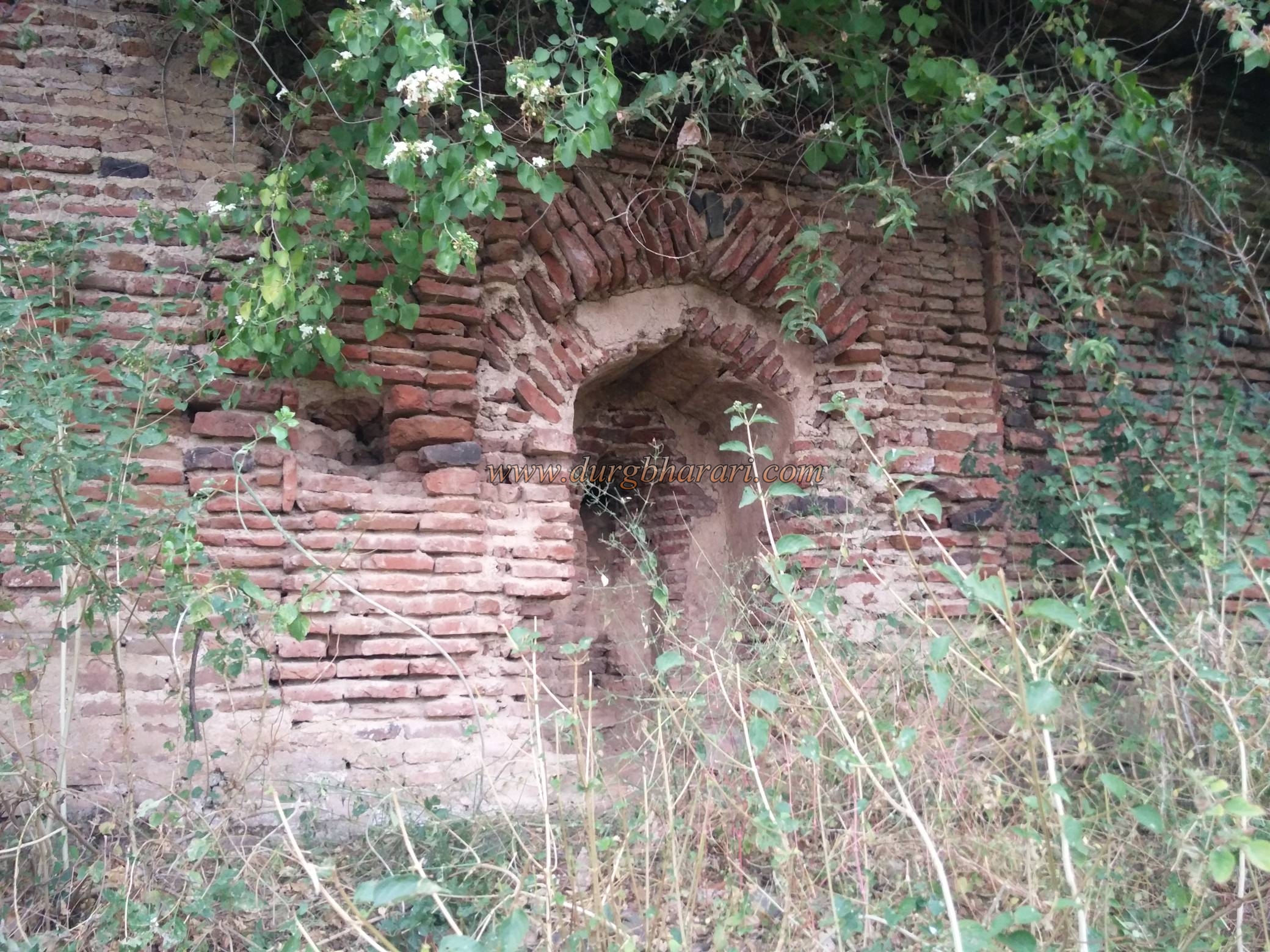
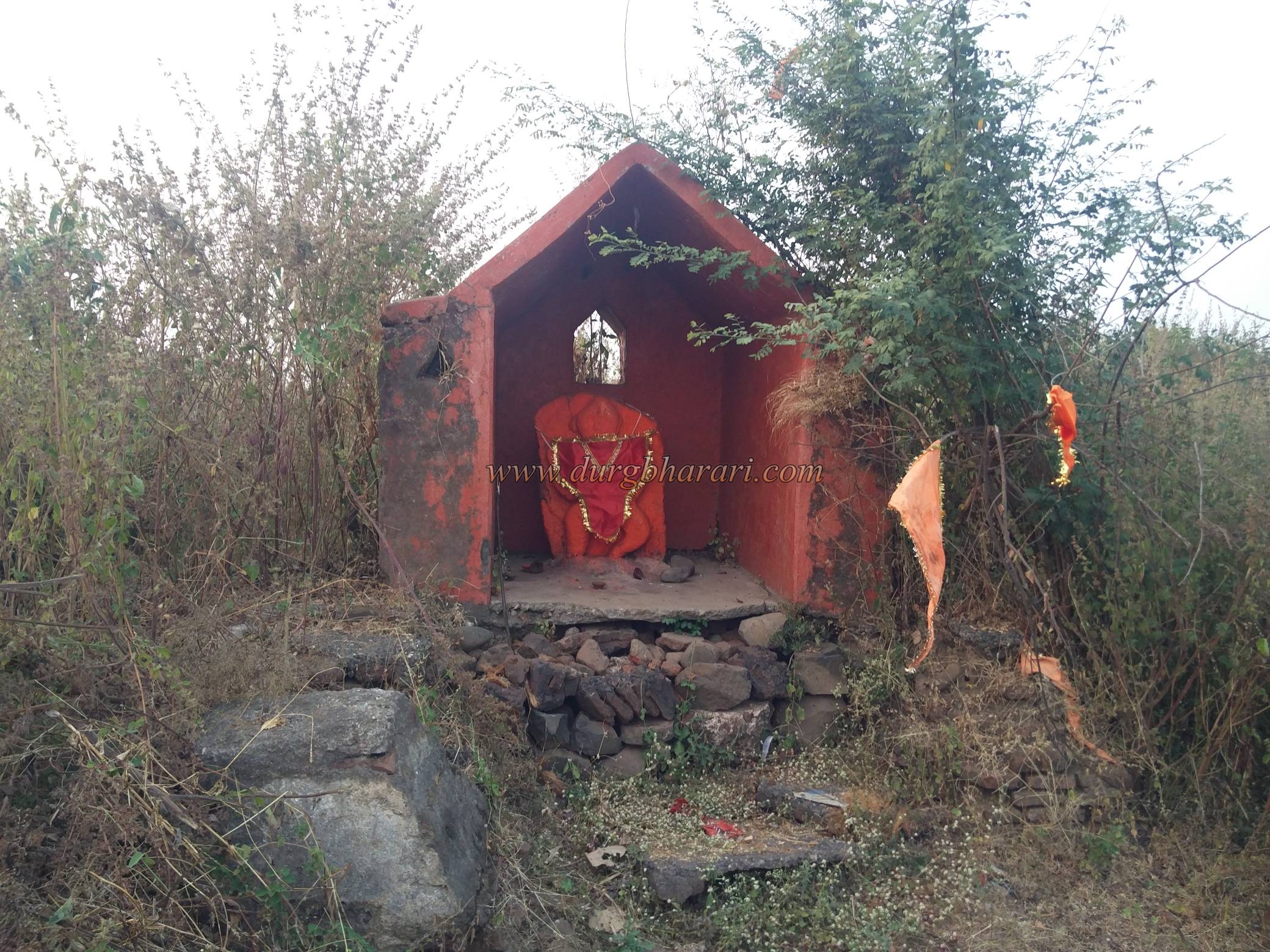
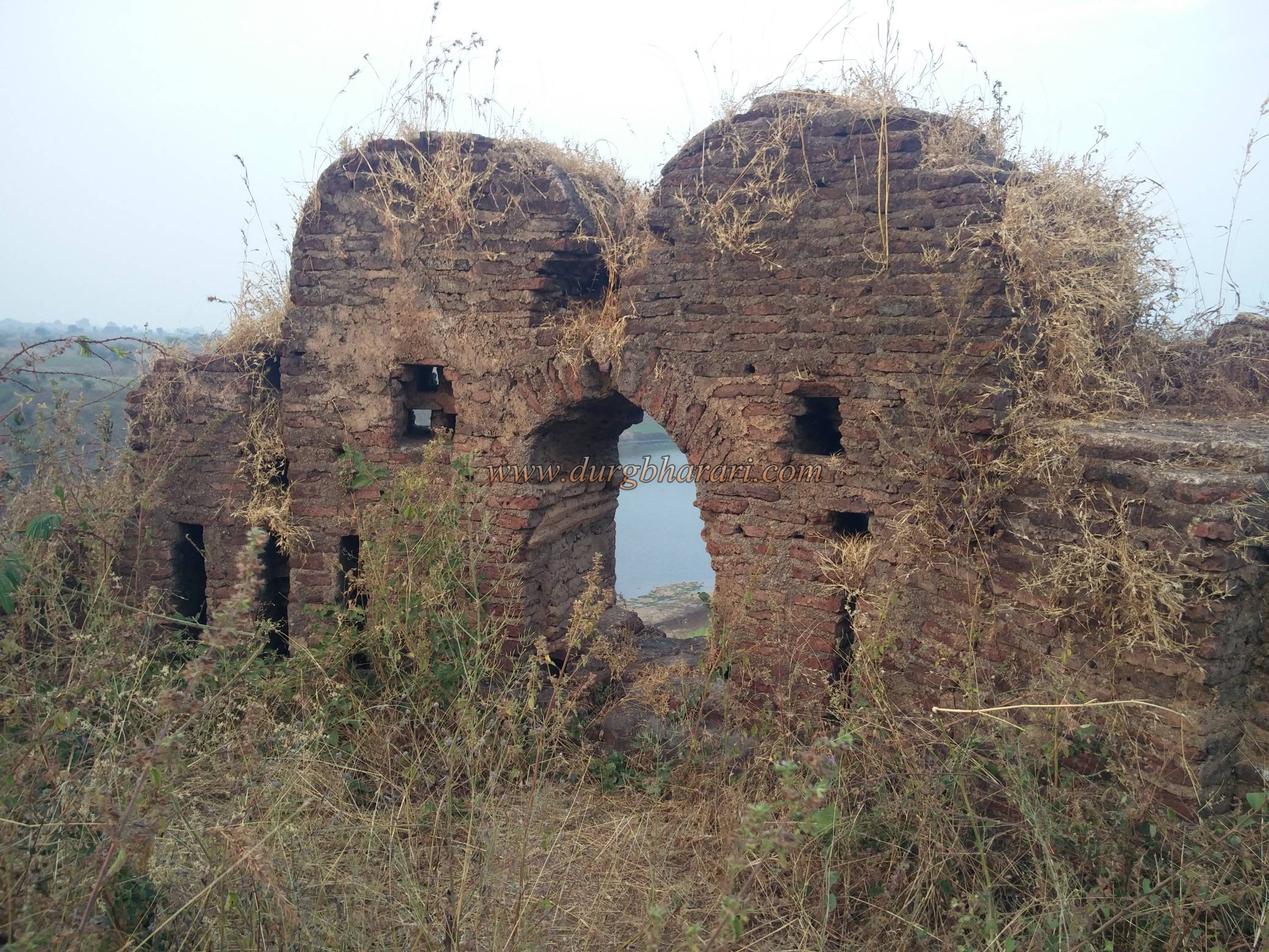
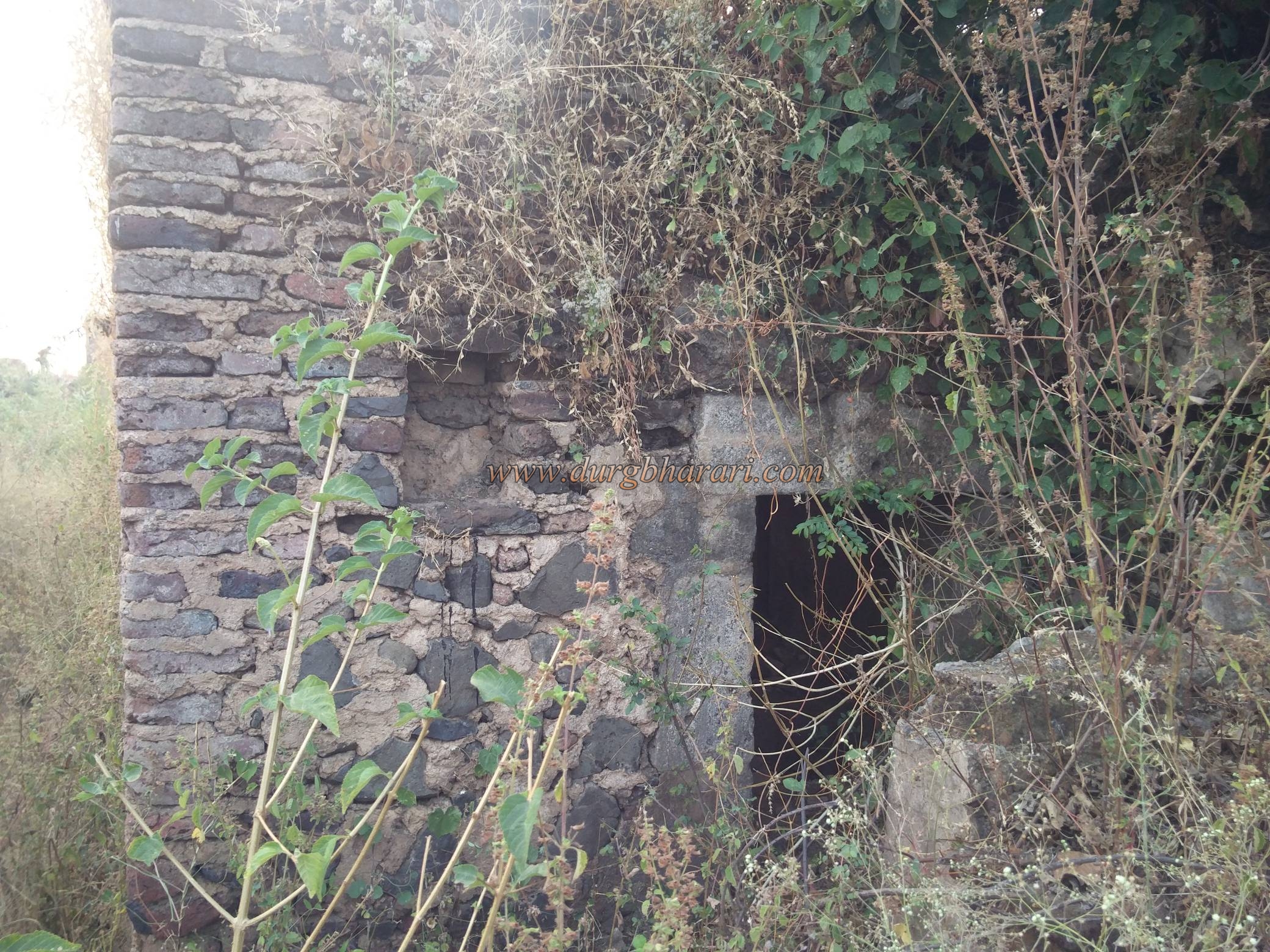
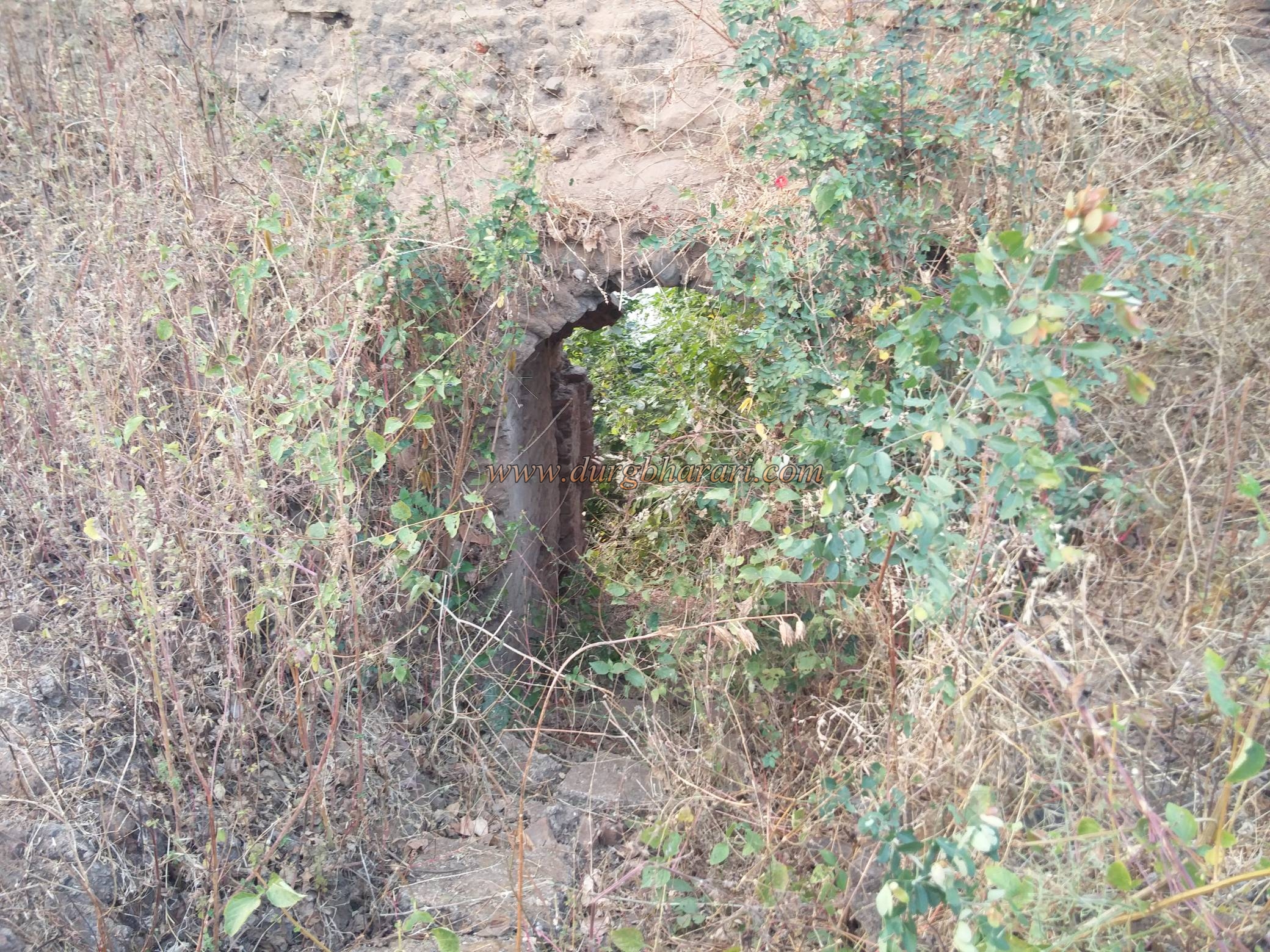
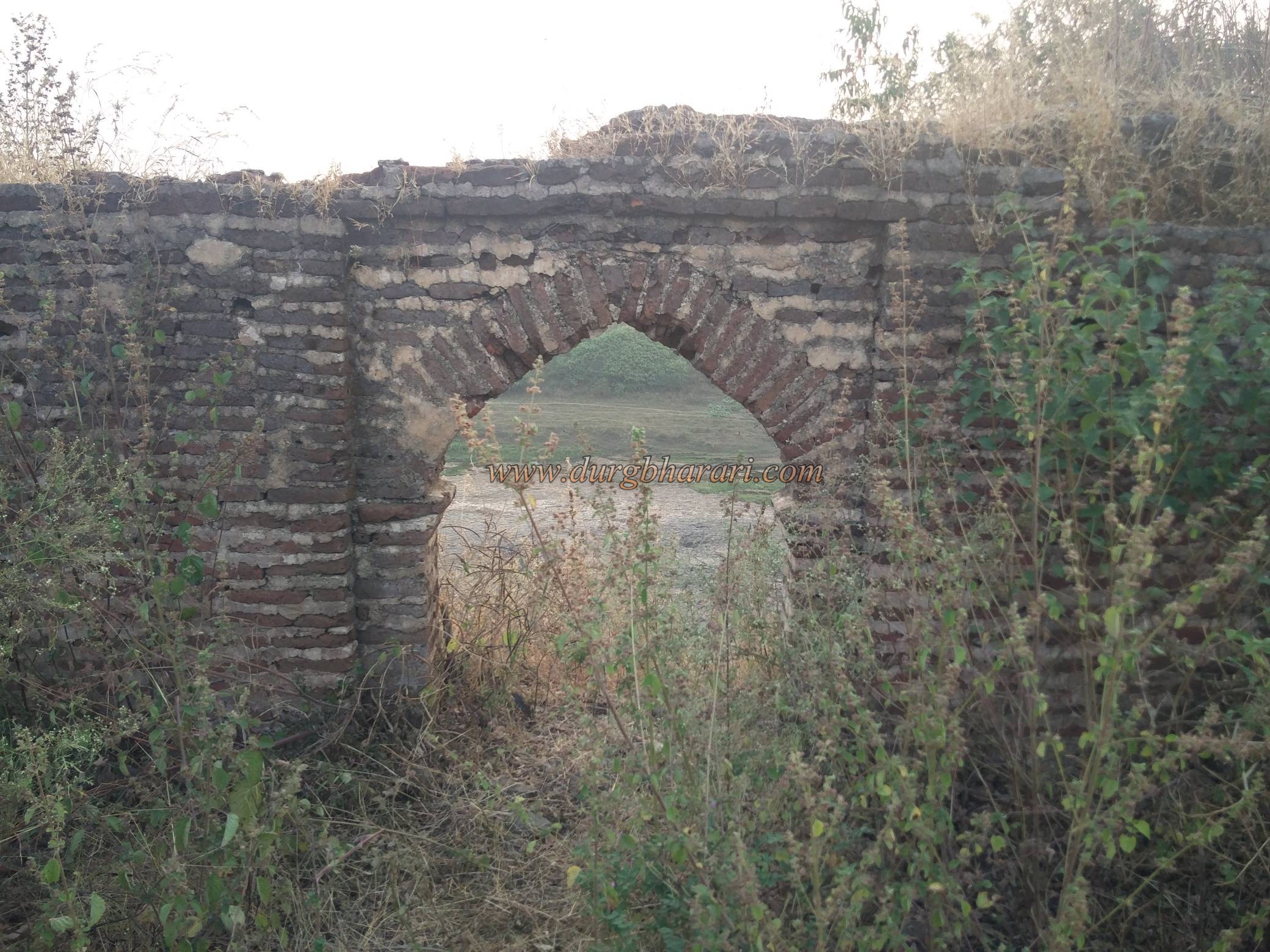
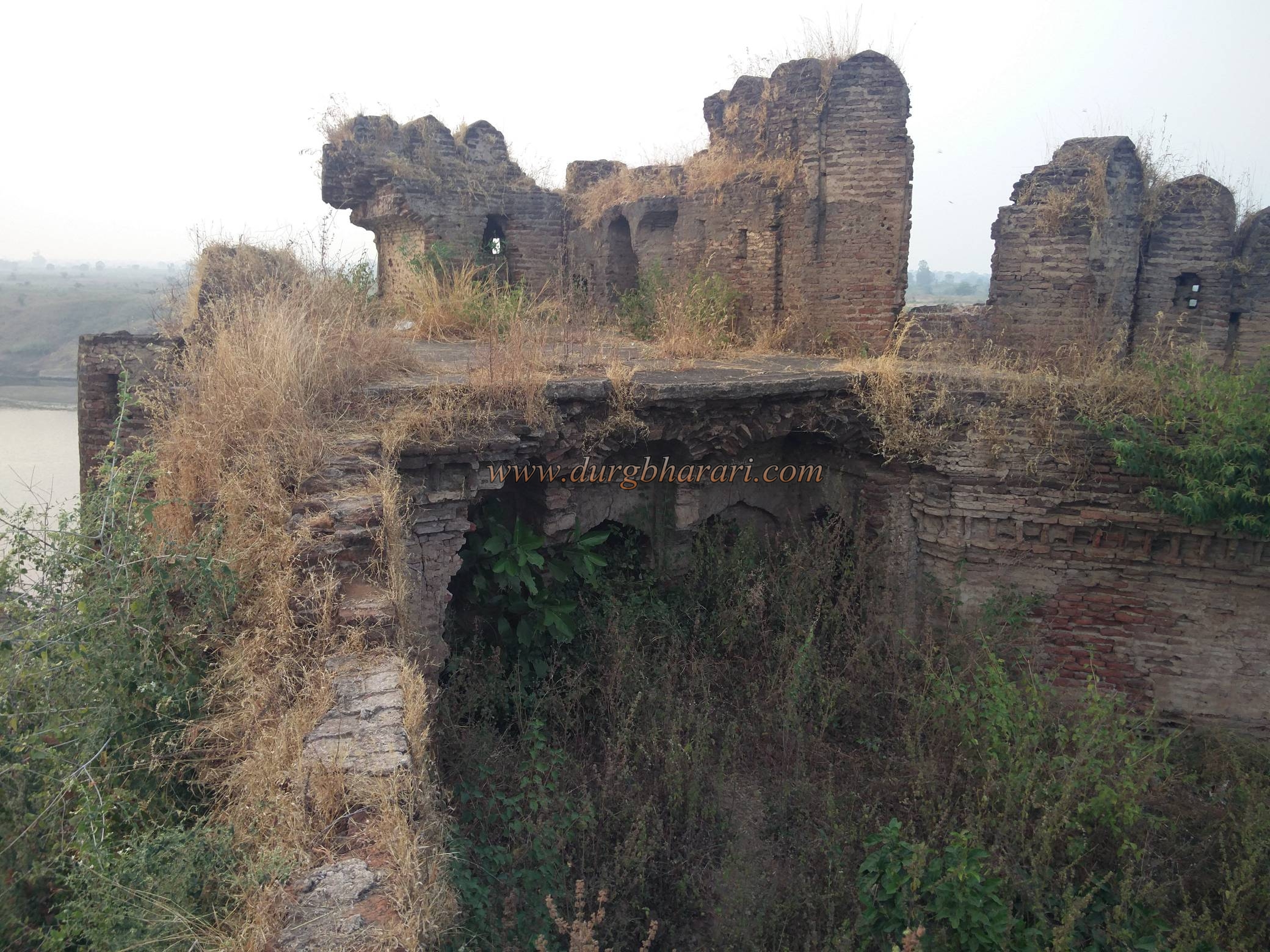
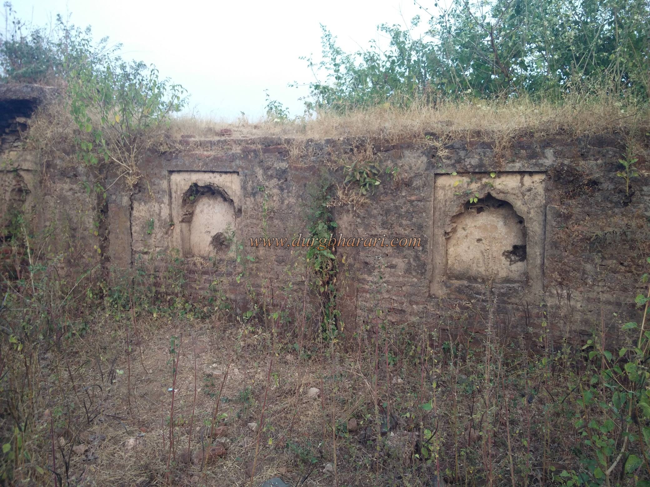
Bhokarbardi village is 11 km away from Dharani Burhanpur road. There is an ashram school on the left before entering Bhokarbardi village by this road. In front of this ashram school, a small road leads to the river Tapi on the right. This road takes you to the confluence of the Tapi-Gadga river in front of the fort. From here you can see a beautiful view of Amaner fort. To reach the fort, you have to cross the river Gadga. The river can be easily crossed after November as the river recedes but it is dangerous to cross the river during monsoon and later when the river is flooded. Therefore, December to June is the best time to visit this fort. On the way to the fort across the river Gadga, on the left side, you can see the east-west ramparts of the fort and the crumbling bastion between these ramparts. After a short climb along the path to the bastion, we reach the north end of the bastion, leaving the bastion and the ramparts on the left. The ramparts in the northern part of the fort and the gate of the fort in this area have been destroyed. Due to a large number of itchy creepers in this area, little care has to be taken. Upon entering the fort, a statue of Maruti can be seen in the newly built dome in front. The height of the fort is 955 feet above the sea level and this triangular-shaped fort is spread over an area of two acres from south to north. There are four bastions at each end of the fort and one at the center of the fort. One of the bastions at the northern end of it has been destroyed and the rest of the bastions have fallen, but they are still recognizable. Most of the construction of the fort is done with bricks and sand mixed lime is used in this construction. The walls of the ramparts are lined with barrels for guns and cannons. The walls are built of bricks and have beautiful arches. One of the bastions on the north side is made of stone and lime. As there is a large number of bushes growing inside the fort, one has to find a way through it. It is not possible to go round the bank continuously as the ramparts of the wall have collapsed in some places. Inside the fort, there is a quadrangle of a palace with a basement. All other structures, however, have been destroyed with time. A bastion at the confluence of the Tapi-Gadga rivers is in the shape of a petal and from this bastion, the character of both the rivers spread far and wide can be seen. On the inside of both the bastions, there are a guard quarters and on one bastion there is a small water tank for cannon. There is a small gate facing the river in the ramparts of the Tapi river and some construction can be seen in the river basin below this gate. Water supply to the fort was probably provided from here. This road is worn out and difficult to use. Adjacent to this rampart is a barn. Although no information is available as to when the fort of Amaner was built, the existing structure of the fort suggests that it may have been built in the late seventeenth century. Located in Melghat county, this fort was strategically located at that time. Around 1572 in the rule of nijamshahi Feroze Shah revolted against the Nizamshah, the Nizamshah sent Sayaad Murtaza against him. It is recorded in Burhane Masir that Feroze Shah fled from Elichpur at that time and took refuge at Amaner Charvi. The fort seems to have been built during the same period as the importance of Burhanpur increased after Akbar invaded the south in 1599 AD. Then in 1727, it is mentioned that the first Bajirao Peshwa had a base near Tapi. It is also mentioned that in 1818, second Bajirao Peshwa came near Jilpi Amaner fort and in 1819 there was a battle between Apasaheb Bhosale of Nagpur and the British on this fort. In 1858, the British demolished the entrance and ramparts of Amaner fort and removed four cannons from the fort. Later, Vijaysingh and Jaisingh, descendants of the Poddar family who came to Melghat from Rajasthan, conquered Vairat, Makhla, Kot, etc. in Melghat was taken into custody. Khuman Singh was on the throne of Melghat till 1905 when he lived on Amaner fort for some time. Khuman Singh used this fort to take action against Tantya Bhil in the Bhil movement.
© Suresh Nimbalkar
Gallery