AAGARKOT (CHAUL-RAJKOT)
TYPE : COASTAL FORT
DISTRICT : RAIGAD
HEIGHT : 0
GRADE : EASY
Ashtagar is a part of Alibag taluka in Raigad district, from Rewas to Kundalika creek. There are some important things to keep in mind before visiting Chaul Fort. Revdanda fort is also known as Chaul fort as well as Agarkot. The name of the fort of Chaul is Rajkot and as the ramparts of this fort are within the boundaries of Agrav village, some people refer to it as Agarkot but there is no mention of it anywhere in the documents. Revdanda is the last village on the Kundalika creek to the south-east. As the town of Revdanda was previously a part of Chaul, the area is referred to as Chaul-Revdanda. Revdanda fort is considered to be the fort of Chaul but this fort of Chaul Rajkot is completely different from Revdanda fort. It is said that the history of Revdanda is linked to the history of Chaul but the history of Chaul is completely different.
...
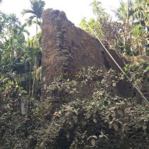
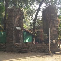
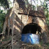
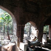
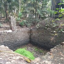
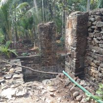
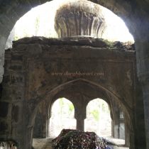
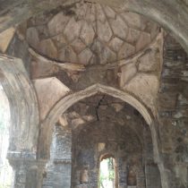
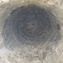
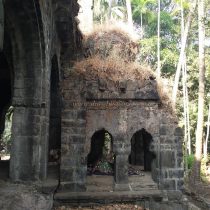
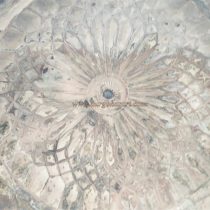
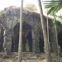
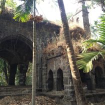
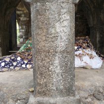
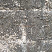
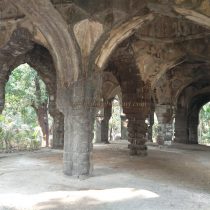
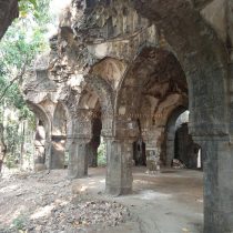
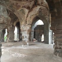
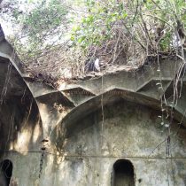
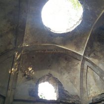
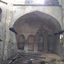
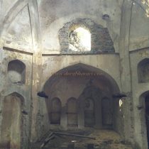
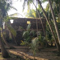
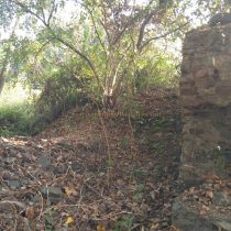
Chaul has been a safe and famous port since ancient times at the mouth of Kundalika Bay, where the Kundalika River originates in the Sahyadri and joins the Arabian Sea near Chaul-Revdanda. Many fort’s and other structures were built there during the Nizamshahi period to protect this port. Portuguese built a fort at Revdanda to settle there, but after this Chaul lost its importance. The Chaul fort here was in use till the seventeenth century. But nowadays tourists know the Revdanda fort which is on the beach but Chaul fort has been completely forgotten. Not only this, but the fort does not appear in the list of fort lovers as there is no information or mention of this fort in the history. To see Rajkot Fort, you must first reach Alibag. The distance between Mumbai and Alibag is 100 km and the distance from Pune to Alibag is about 140 km. Rajkot fort is at a distance of 16 km from Alibag. To reach there, you have to get off at Chaulnaka by bus or rickshaw. Nearby is the temple of Rameshwar, the deity of Chaul. There is Nandimandap, Deepmal, and Pushkarani in the temple premises. Although it is not known who built the original temple and when it is often mentioned that the temple was restored. In the mansion behind the temple, there is a samadhi of a man from the Angre family. You should start your fort round by visiting the temple of Rameshwar. The fortification wall of the Rajkot fort at the ground side is almost destroyed. All these stones are used for private work and also the architecture of the fort is also being misused. If you ask about the fort, since no one knows, you should ask about the name of the remains. As Rajkot fort is 90% privately owned, one should look at the fort with due respect to these owners. To reach Rajkot fort, take the road to Agrav village and reach the Dadara area. Remains of Rajkot fort start from the Dadara area. Here on the road leading to Shitladevi temple, turn right on the dirt road towards Katkar Ali. The first thing you see on this road is a large rampart. The Archaeological Department has put up a signboard here saying that its a protected monument. When you enter from here, turn right. This is the way we reach Katkar aali. Here you can see an arch in front. This arch should be of a magnificent structure. In front of the arch, on the left side of the road, is a two-storied arched structure. There is a large door to enter the building and there are three arches on each side. There is a staircase leading up to one of these arches. Only one side of the wall of this building remains. There are some other ruined buildings in this area too. Locals in Katkar aali know about the mosque present here. At the back of Katkarali is a stone masonry mosque on 15 arches facing the creek. Four arches of the mosque have collapsed and the stone in the arch has also been eroded. The inner dome of the mosque has various carvings. Adjacent to the mosque is a small stone dargah with two tombs. The shrine has an Arabic and a Persian inscription stating that the Asa / Arih Mosque was built by Burhan Nizam Shah in the 16th century. The ramparts near the creek close to this mosque extend for about 1.5 km towards Agrav village. The ramparts adjoining the creek are still very much in existence and two bastions can be seen in this area. I got to see a total of six bastions in this rampart. There are more bastions in the ramparts but you can't see them due to bushes and restricted areas. After seeing the mosque, come back to Shitladevi temple road and turn right from Gulbadevi temple on the dirt road. Along the way, you will see a building with seven arches in a row. There is a way to get inside through one of these arches. This place is known as the Hamamkhana, it is a bathhouse built by Muslim rulers. This very beautiful structure has been destroyed due to a lack of maintenance. The rooms in this building, the lime carvings on it, the water cistern and the hot and cold water supply in it, the facility for heating the water as well as the steam in the gallery, the fountain are all worth looking at from a scholarly point of view. But the carelessness of the owner of this building is destroying this building. There is well-supplying water to it and the water from this well is used for gardening today. On the way from Shitladevi temple to Agrav, you can see some remains as well as the ramparts of the fort and its two bastions on the right side of the road towards the creek. From here, you can see a small temple on the road. To the right of this temple is the ramparts of the fort towards the direction of mangroves. There are some architectural remains in this place and it has a two-story wall. The door of this building has two windows and five corners on the upper floor. At this place, a two-storied bastion remains in the ramparts. This is where your fort round ends. Since most of the fort is private property, some owners allow you to see it from inside, while others show no courtesy. Some people refuse to take pictures. There are three large lakes in the Shitaladevi temple area. Outside the fort, near the village of Sarai, one can see an inn known as Kalavantini's mansion. This inn is built only for the accommodation of the traders who come to Chaul. It takes about two hours to see the entire fort. It is said that in ancient times, Chaul was a village of Champawati and Revdanda was a village of Revatikshetra. Satavahana, Rashtrakuta, Maurya, Chalukya, Shilahar, Kadamba, Yadav, Nizamshahi, Adilshahi, Portuguese, Maratha, and Siddhi ruled over Chaul. The Archaeological Department has excavated the Chaul area and found the remains of the Satavahana period here. The four inscriptions at Kanheri records the donations made by the merchants of chaul. Inscriptions include the donation of a water cistern by Sulasadat who was the son of Suvarnakar Rohinimit, the path donated by Dhamna by, the second son of Suvarnakar Rohinimit, the donation of a cave at Kanheri by Sivaput, the son of Shrimu, and the donation made by Yash's son for the footpath to the crematorium. From the year 130 to 1583, ships were passing through this port to the corners of the world. In Ptolemy's travelogue Periplus of Erythrine Sea in 247, the port is referred to as Simul, while Huentsang calls it Chimlo. Later in the 12th century, the Arabs called it Seymour and Jaimur. Al-Masudi, an Arab merchant who came here in the tenth century, mentions that Zanz Shilahar ruled over the king. Afanasi Nikitin was the first Russian traveler to visit India between 1466 and 1472. He started his journey from the port of Chivil. Over time, the use of the port declined as sludge accumulated in the port. After the fall of the Yadav Empire, the city came under Muslim rule and at the same time, the Portuguese came here. In 1508, the Portuguese were defeated in a battle with Bijapurkar. In 1516, the Portuguese built a warehouse here. In 1521, Bijapukar's army set fire to the port of Chaul and defeated the Portuguese. Recognizing the importance of Revdanda village, the Portuguese built Revdanda fort at the mouth of the creek between 1521 and 1524, and the importance of Chaul diminished. In 1528, Turkish ships attacked Chaul, but the Portuguese and Nizamshah's forces defeated Turkey. It is mentioned that in 1583, the port of Chaul was fortified. This means that the fort existed during this period. After the fall of Nizamshahi in the 16th century, this part came under the control of the Mughals but they handed it over to Adilshah. It is mentioned in some places that Adilshah built Rajkot in 1636 when he had the control of Chaul, but the mosque in the fort and the fortifications of Chaul port in 1583 show that the fort has existed since Nizamshahi. Around 1657-58, Shivaji Maharaj won Chaul but Revdanda remained with the Portuguese. When Dr. Fryer visited Chaul in 1672, it is said that the Chaul market was under the control of Shivaji Maharaj and it was decimated due to constant fighting with the Mughals. In some places, it is said that Sambhaji Maharaj built Rajkot fort in 1683 in the ancient village of Chaul but it does not have a strong base. On the night of July 22, 1683, under the leadership of Sambhaji Raja, the Marathas attacked Revdanda fort with 6,000 soldiers and 2,000 cavalries, but the Portuguese, with the help of Siddi, defended it. When the Marathas laid siege to Revdanda, the Portuguese attacked Fonda fort to divert their attention. Therefore, the Marathas had to leave the siege. During the reign of Kanhoji Angre, the Portuguese suddenly attacked Bramhangaon near Sagargad, which was built by Angre one night, but cautious Kanhoji Angre slaughtered the Portuguese in such a way that it was difficult for them to reach Revdanda fort. Hakim Motmankhan, the subedar of Chaul, gave shelter to the fleeing Portuguese in Rajkot and saved some Portuguese. According to the Shahu-Mughal treaty of 1733-34, Rajkot came under the control of the Mughals but it was ruled by Sambhaji Angre. Later, Manaji took possession of the fort by capturing it. But in December 1734, Sambhaji Angre recaptured the fort with the help of the Portuguese. At this time the fort keeper Rayaji Uttekar was removed and a new fort keeper was appointed. After the conquest of Vasai in 1739, Rajkot came under the control of Chimajiappa, and later on, he handed it over back to Angre. As Rajkot was an obstruction infrequently used routes, Nanasaheb Peshwa decided to demolish Rajkot and in January 1748, Sardar Bajirao Belose laid a mine and demolished the bastion towards the landside.
© Suresh Nimbalkar

